- Washington State Route 529
Infobox WA State Route
type=State
route=529
sec=752
parent_type=Interstate
parent=5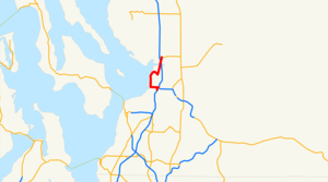
length_mi=7.87
length_ref=
length_round=2
formed=1971
dir1=South
dir2=North
from=
to=
previous_type=WA
previous_route=528
next_type=WA
next_route=530State Route 529, commonly known as SR 529, Highway 529, or the Marine View Drive, is a state highway in the
U.S. state ofWashington . It extends almost 9 miles from Everett in the south to an area near Marysville in the north.Route description
SR 529 starts going south from SR 528 (4th Street)as State Avenue/Old 99. After intersecting with I-5, it turns into a freeway of 4 lanes until an interchange with Marine View Dr in Everett. The roadway continues into downtown Everett as Broadawy Ave (old US 99), while SR 529 exits, then goes west to the Naval Base. Then, it goes south and then east at Everett Avenue towards Exit 194 (US 2. It then turns south on Maple St. to Exit 193 (Pacific Avenue).
The southern terminus of mainline SR 529 on Pacific Avenue only provides access to I-5 southbound and from I-5 northbound. A spur route, State Route 529 Spur, is designated along Everett Avenue to connect with I-5 at Exit 194, completing the missing movements.
SR 529 formerly continued south of Marine View Dr along Broadway Ave through Everett to meet Interstate 5 at exit 192. The routing was changed in 1992 to service the Port of Everett and Naval Station more directly. Marine View Dr between the Port of Everett and Broadway Ave has been improved in phases in order to meet state highway standards.
Major intersections
The entire route is in Snohomish County.
Related routes
References
External links
* [http://www.angelfire.com/wa2/hwysofwastate/sr529.html Highways of Washington State]

Wikimedia Foundation. 2010.