- Oak Harbor, Washington
-
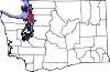
Oak Harbor, Washington — City — Location of Oak Harbor, Washington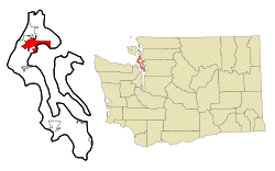
Coordinates: 48°17′42″N 122°39′31″W / 48.295°N 122.65861°WCoordinates: 48°17′42″N 122°39′31″W / 48.295°N 122.65861°W Country United States State Washington County Island City May 14, 1915 Government – Mayor Jim Slowik Area – Total 9.1 sq mi (23.7 km2) – Land 9.1 sq mi (23.6 km2) – Water 0.0 sq mi (0.1 km2) Elevation 92 ft (28 m) Population (2010) – Total 22,075 – Density 2,175.0/sq mi (839.8/km2) Time zone Pacific (PST) (UTC-8) – Summer (DST) PDT (UTC-7) ZIP codes 98277-98278 Area code(s) 360 Telephone exchanges 240, 257, 279, 395, 675, 678, 679 FIPS code 53-50360[1] GNIS feature ID 1512518[2] Website http://www.oakharbor.org/ Oak Harbor is a city located on Whidbey Island in Island County, Washington. The population was 22,075 at the 2010 census.
Oak Harbor was incorporated on May 14, 1915.
Contents
History
Oak Harbor is Whidbey Island's largest incorporated city. Named for the Garry Oak trees which grace its skyline, the city's growth coincided with two major events: the building of Deception Pass Bridge on July 31, 1935, and the completion of Naval Air Station Whidbey Island on September 21, 1942.
Oak Harbor's history goes back to the early 1850s, when three settlers staked claims where the city now stands — Zakarias Martin Taftezon, a shoemaker from Norway; C.W. Sumner from New England, and Ulrich Freund, a Swiss Army officer. Freund retained part of his claim, which today is home to his descendants. Houses and businesses sprouted up along the shores of Oak Harbor as the pioneers relied entirely on water transportation until the 1900s. For the next thirty years, steamers and freighters carried passengers and freight from the Island to the mainland and back as well as Fidalgo Island to the north.
The Irish came in the late 1850s, making Oak Harbor grow and prosper as they fished and farmed the area. The city's Dutch heritage arrived in the 1890s when Hollanders became disillusioned with the northern Midwest region of the United States and came to Whidbey Island. Churches, schools, and more businesses followed the arrival of the Hollanders. A high school was built in 1906. Oak Harbor flourished as a small country town until Deception Pass Bridge and the U.S. Navy Base connected the city to the rest of the region and the world.
Deception Pass Bridge, a National Historic Monument since 1982, is actually two spans that link Whidbey Island to Fidalgo Island over Canoe Pass and Deception Pass. The bridge, one of the scenic wonders and destinations of the Pacific Northwest, was a Public Works Administration project built by the Civilian Conservation Corps. Deception Pass State Park, Washington's second most popular state park[1], has over 4,100 acres (17 km2) of forest, campsites, trails, and scenic vistas of the San Juan Islands, Victoria (British Columbia, Canada), Mount Baker, and Fidalgo Island.
Geography
Oak Harbor is located at 48°17′42″N 122°39′31″W / 48.295°N 122.65861°W (48.295136, -122.658553).[3]
According to the United States Census Bureau, the city has a total area of 9.15 square miles (23.7 km2), of which, 9.10 square miles (23.57 km2) of it is land and 0.4 square miles (1.04 km2) is water.
Demographics
As of the census[1] of 2000, there were 19,795 people, 7,333 households, and 5,265 families residing in the city. The population density was 2,175.0 people per square mile (839.9/km²). There were 7,772 housing units at an average density of 854.0 per square mile (329.8/km²). The racial makeup of the city was 74.93% White, 5.45% African American, 9.62% Asian, 1.22% Native American, 0.77% Pacific Islander, 2.42% from other races, and 5.58% from two or more races. Hispanic or Latino of any race were 6.61% of the population.
There were 7,333 households out of which 43.4% had children under the age of 18 living with them, 59.0% were married couples living together, 9.7% had a female householder with no husband present, and 28.2% were non-families. 22.2% of all households were made up of individuals and 7.2% had someone living alone who was 65 years of age or older. The average household size was 2.68 and the average family size was 3.18.
In the city the population was spread out with 31.6% under the age of 18, 11.6% from 18 to 24, 34.4% from 25 to 44, 13.4% from 45 to 64, and 9.0% who were 65 years of age or older. The median age was 28 years. For every 100 females there were 98.7 males. For every 100 females age 18 and over, there were 95.2 males.
The median income for a household in the city was $36,641, and the median income for a family was $41,579. Males had a median income of $29,498 versus $21,633 for females. The per capita income for the city was $16,830. About 8.1% of families and 9.3% of the population were below the poverty line, including 11.2% of those under age 18 and 5.4% of those age 65 or over.
Politics
Oak Harbor is the nearest city to Naval Air Station Whidbey Island. Its influence on the area has established Oak Harbor as a stronghold for American conservatism and the Republican Party. Jim Slowik was sworn in as mayor on January 2, 2008. He oversees city government with a 7-person City Council and a city administrator.
-
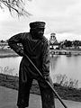
A monument of City Beach Park, now Windjammer Park.
-
The little Dutch boy with a brush at Windjammer Park.
-
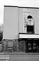
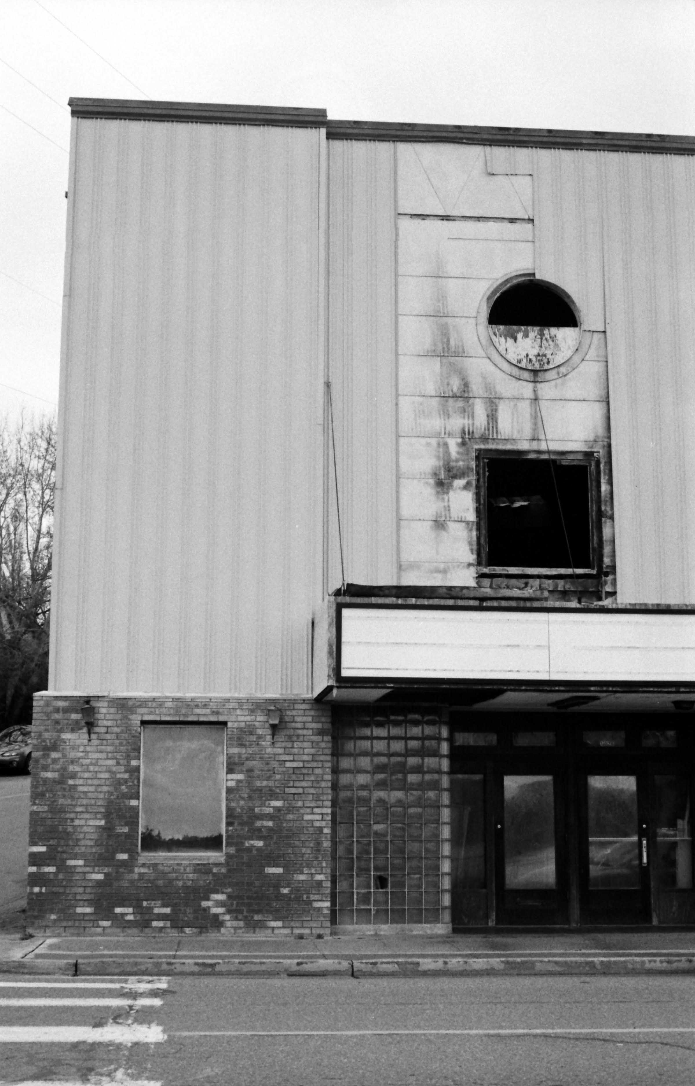
The old, downtown cinema that burned inside one night in 2005, and has since been demolished.
-
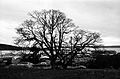
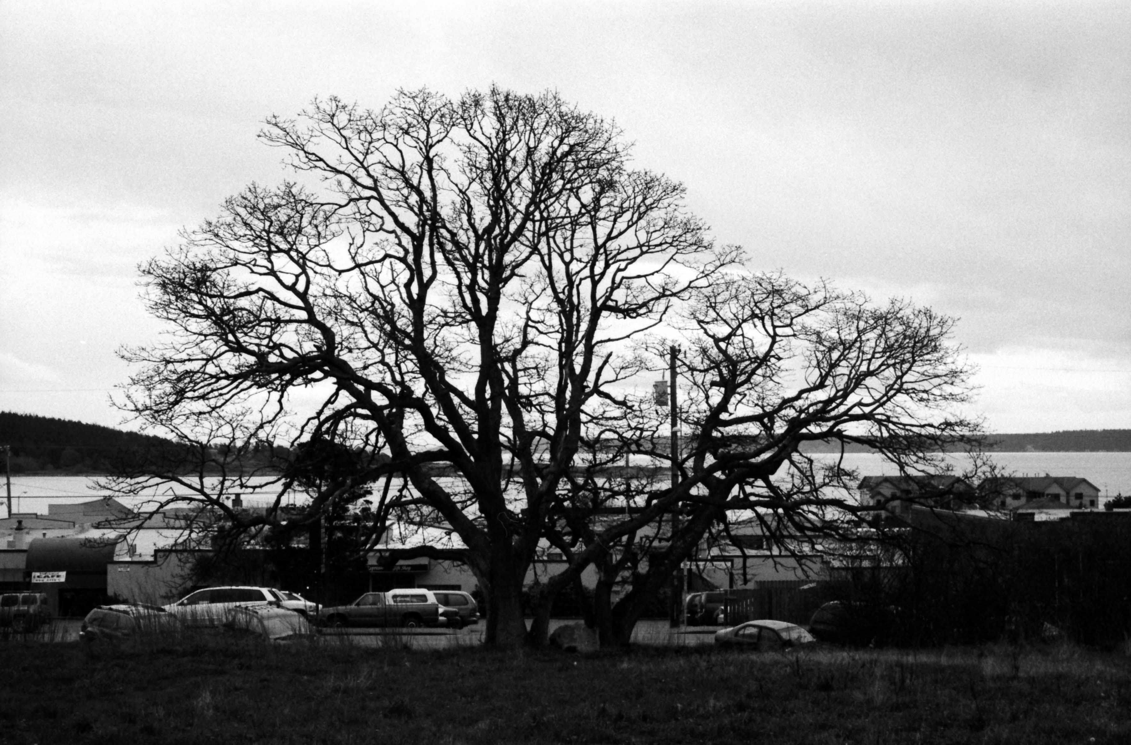
One of the symbolic oak trees that give Oak Harbor its name.
References
- ^ a b "American FactFinder". United States Census Bureau. http://factfinder.census.gov. Retrieved 2008-01-31.
- ^ "US Board on Geographic Names". United States Geological Survey. 2007-10-25. http://geonames.usgs.gov. Retrieved 2008-01-31.
- ^ "US Gazetteer files: 2010, 2000, and 1990". United States Census Bureau. 2011-02-12. http://www.census.gov/geo/www/gazetteer/gazette.html. Retrieved 2011-04-23.
External links
- Oak Harbor Tourism and Visitor Service
- Whidbey News Times- Closest Major Newspaper
- City of Oak Harbor official website
- Deception Pass Park Foundation
- About Oak Harbor from the city's chamber of commerce
Municipalities and communities of Island County, Washington Cities Langley | Oak Harbor
Town CDPs Ault Field | Camano | Clinton | Freeland
Unincorporated
communitiesBaby Island Heights | Bayview | Keystone | Greenbank | Maxwelton | San de Fuca | Utsalady
Seattle metropolitan area Central cities Outer cities Central counties Outer counties Categories:- Cities in Washington (state)
- Populated places in Island County, Washington
-


Wikimedia Foundation. 2010.