- Maxwelton, Washington
-
Maxwelton is a mostly summer community located on the south end of Whidbey Island, Washington.
 Maxwelton Beach
It was first settled in 1905 by the Mackie family and named after a place in Dumfries and Galloway, Scotland, made famous in the song "Annie Laurie." The beach at Dave Mackie Park on Useless Bay is a favorite spot to watch the sunsets over the Olympic Mountains and is near the outflow of Maxwelton Creek. The creek and its tributaries have formed Maxwelton Valley, an area that remains predominantly farm-like.
Whidbey Watersheds, formerly known as The Maxwelton Salmon Adventure, is a non-profit group that has been working to restore salmon runs on Maxwelton and Quade Creeks.
Maxwelton hosts a 4th of July parade with an old-fashioned hometown feeling.
Municipalities and communities of Island County, Washington Cities 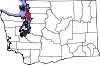
Town CDPs Ault Field | Camano | Clinton | Freeland
Unincorporated
communitiesBaby Island Heights | Bayview | Keystone | Greenbank | Maxwelton | San de Fuca | Utsalady
Coordinates: 47°56′14″N 122°26′40″W / 47.93722°N 122.44444°W
Categories:- Populated places in Island County, Washington
- Unincorporated communities in Washington (state)
- Washington (state) geography stubs


Wikimedia Foundation. 2010.