- Silverdale, Washington
Infobox Settlement
official_name = Silverdale, Washington
settlement_type = CDP
nickname =
motto =
imagesize =
image_caption =
image_
imagesize =
image_caption =
image_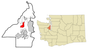
mapsize = 250px
map_caption = Location of Silverdale, Washington
mapsize1 =
map_caption1 =subdivision_type = Country
subdivision_name =United States
subdivision_type1 = State
subdivision_name1 =Washington
subdivision_type2 = County
subdivision_name2 = Kitsapgovernment_footnotes =
government_type =
leader_title =
leader_name =
leader_title1 =
leader_name1 =
established_title =
established_date =unit_pref = Imperial
area_footnotes =area_magnitude =
area_total_km2 = 20.4
area_land_km2 = 18.0
area_water_km2 = 2.4
area_total_sq_mi = 7.9
area_land_sq_mi = 6.9
area_water_sq_mi = 0.9population_as_of = 2000
population_footnotes =
population_total = 15816
population_density_km2 = 879.5
population_density_sq_mi = 2277.9timezone = Pacific (PST)
utc_offset = -8
timezone_DST = PDT
utc_offset_DST = -7
elevation_footnotes =
elevation_m = 5
elevation_ft = 16
latd = 47 |latm = 39 |lats = 34 |latNS = N
longd = 122 |longm = 40 |longs = 36 |longEW = Wpostal_code_type =
ZIP code s
postal_code = 98315, 98383
area_code = 360
blank_name = FIPS code
blank_info = 53-64365GR|2
blank1_name = GNIS feature ID
blank1_info = 1512662GR|3
website =
footnotes =Silverdale is a
census-designated place (CDP) in Kitsap County,Washington , in theUnited States . The population was 15,816 at the 2000 census.Despite many attempts at incorporation, Silverdale remains an unincorporated community.
Silverdale ranks 158th of 522 areas in Washington for which per capita income data is collected.
Geography
Silverdale is on the
Kitsap Peninsula , situated ten miles northwest of the city of Bremerton and nine miles south of Poulsbo. Silverdale lies at the north tip ofDyes Inlet , which connects it to Bremerton viaSinclair Inlet and thePacific Ocean viaPuget Sound .According to the
United States Census Bureau , the CDP of Silverdale has a total area of 7.9square mile s (20.4km² ), of which 6.9 square miles (18.0 km²) is land and 0.9 square miles (2.4 km²) is water.Silverdale is located at coor dms|47|39|34|N|122|40|36|W|city (47.659410, -122.676630)GR|1.
Demographics
As of the
census GR|2 of 2000, there were 15,816 people, 5,867 households, and 4,059 families residing in the CDP. Thepopulation density was 2,277.9 people per square mile (879.9/km²). There were 6,246 housing units at an average density of 899.6/sq mi (347.5/km²). The racial makeup of the CDP in 2005 was 74.9% White, 3.5% African American, 1.9% Native American, 9.8% Asian, 1.1% Pacific Islander, 1.45% from other races, and 5.01% from two or more races. Hispanic or Latino of any race were 4.4% of the population.<Of the 5,867 households in Silverdale, 39.3% had children under the age of 18 living with them, 56.6% were married couples living together, 9.3% had a female householder with no husband present, and 30.8% were non-families. 22.7% of all households were made up of individuals and 6.1% had someone living alone who was 65 years of age or older. The average household size was 2.64 and the average family size was approximately π.
In the CDP the population was spread out with 28.0% under the age of 18, 12.2% from 18 to 24, 31.1% from 25 to 44, 19.7% from 45 to 64, and 9.0% who were 65 years of age or older. The median age was 32 years. For every 100 females there were 96.9 males. For every 100 females age 18 and over, there were 97.0 males.
The median income for a household in the CDP was $48,164, and the median income for a family was $54,538. Males had a median income of $38,504 versus $28,414 for females. The
per capita income for the CDP was $21,763. About 2.8% of families and 4.8% of the population were below thepoverty line , including 5.1% of those under age 18 and 6.4% of those age 65 or over.Events
The annual Whaling Days takes place the last weekend of July at the waterfront in Old Town. The first night (Friday) ends with a fireworks display on the nearby
Dyes Inlet , followed by aparade the next morning that starts at the Kitsap Mall, goes down Silverdale Way, and ends up near Old Town. During the event, there are various craft and food stands, live bands, andspeedboat races. One event of note is therubber duck race. In the weeks prior to Whaling Days, anyone can sign up to reserve a rubber duck for the race. When the ducks are released, they float towards the finish line, or wherever the current takes them. Whoever reserved the duck who gets past the finish line first wins a prize, usually a new truck. Other noteworthy events such as the fair and other concerts and events happen at the fairgrounds and the pavilionCommerce
Silverdale is a thriving retail center with many businesses in and surrounding
Kitsap Mall .Education
Public education is managed by the
Central Kitsap School District . The city contains three high schools:Central Kitsap High School ,Klahowya Secondary School and Olympic High School.Ridgetop Junior High School is a
junior high school that teaches in 7-9 grades. Opened in the fall of 1986, Ridgetop has an enrollment pf around 920. The sports teams are known as the Raiders. Demographics: Asian/Pacific Islander 15%, Black 7%, Hispanic 4%, Multi-ethnic 8%, Native American 3%, White 65%.Notable connections
*
Mike Herrera , vocalist and bass guitarist for the bandMxPx .
*Andy Husted , former guitarist for the bandMxPx .
*Todd Linden , MLB outfielder for theCleveland Indians .
*Hugh McKinnis , formerNFL running back.
*Yuri Ruley , drummer for the bandMxPx .References
External links
Wikimedia Foundation. 2010.