- Tukwila, Washington
Infobox Settlement
official_name = Tukwila, Washington
imagesize =
image_caption =
image_
settlement_type =City
nickname = The Hazelnut City
mapsize = 250x200px
map_caption =
mapsize1 =
map_caption1 =
subdivision_type = Country
subdivision_type1 = State
subdivision_type2 = County
subdivision_name =United States
subdivision_name1 = Washington
subdivision_name2 = King
established_title = Incorporated
established_date = 1908
government_type =
leader_title =Mayor
leader_name =Jim Haggerton
area_magnitude =
area_total_km2 = 23.5
area_land_km2 = 23.1
area_water_km2 = 0.4
area_total_sq_mi = 9.1
area_land_sq_mi = 9.1
area_water_sq_mi = 0.2
elevation_m = 42
elevation_ft = 138
latd = 47 |latm = 28 |lats = 42 |latNS = N
longd = 122 |longm = 16 |longs = 32 |longEW = W
population_as_of = April 1, 2006
population_total = 17481
population_metro = 3166828
population_footnotes = [http://www.census.gov/population/www/estimates/metropop/table01.xls Annual Estimates of the Population of Metropolitan and Micropolitan Statistical Areas: April 1, 2000 to July 1, 2004 (CBSA-EST2004-01)] ]
timezone = PST
utc_offset = -8
timezone_DST = PDT
utc_offset_DST = -7
postal_code_type =ZIP code s
postal_code = 98100-98199
area_code = 206
blank_name = FIPS code
blank_info = 53-72625GR|2
blank1_name = GNIS feature ID
blank1_info = 1509106GR|3
footnotes =
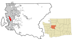
website = http://www.ci.tukwila.wa.us/Tukwila (pronEng|tʌkˈwɪlə) is a city in King County,
Washington , about 6 miles south ofSeattle . The population was 17,181 at the 2000 census.History
The earliest people in Tukwila were the Duwamish who made their homes along the Black and
Duwamish River s. They named Tukwila for the lush forests of hazelnut trees which grew around them. The Duwamish lived in cedar longhouses, hunted and fished, picked wild berries and used the river for trade with neighboring peoples.In 1853, the area was settled by
Joseph Foster , aCanadian pioneer who had traveled to the northwest fromWisconsin . Foster would become known as the "Father of Tukwila" and serve King County,Washington Territory in thelegislature for 22 years. Today, Foster's legendary home on the banks of the Duwammish River is preserved asFort Dent Park, as it also served as a military base during 1850s Indian Wars. Foster's name is also memorialized in the Foster neighborhood of Tukwila where Foster High School is located.In the early years of "Foster, Washington", the small village would grow into an agricultural center and a vital trading point in the upper-Duwammish River Valley. Population began to grow as well, and expanded industry would soon follow. Although with the largely farm-oriented commerce in Tukwila, other businesses found fertile land in which to grow from.
Early electric rail trains traveled along Interurban Avenue in Tukwila, connecting to Renton and a line to
Tacoma . The Interurban Railroad operated a commuter line from 1902 to 1928, making it possible to travel from Seattle to Tacoma in less than an hour. The firstMacadam paved road in Washington State was in Tukwila and bears the name of this new method of street paving. One of the earliest paved military roads is located in the city.Tukwila was incorporated as a city in 1908.
Geography
Tukwila is located at coor dms|47|28|42|N|122|16|32|W|city (47.478243, -122.275432)GR|1.
According to the
United States Census Bureau , the city has a total area of 9.1square mile s (23.5km² ), of which, 8.9 square miles (23.1 km²) of it is land and 0.2 square miles (0.4 km²) of it (1.65%) is water.Neighborhoods
*Cascade View (Upper West Side) Suburban, Lower Income
*McMicken (Lower West Side) Suburban, Middle Income
*Riverton (Central West Side) Urban, Lower Income
*Foster (Central/Mid-West) Suburban, Middle Income
*Ryan Hill (Upper End) Industrial, Middle Icome
*Allentown (Upper End) Industrial, Middle Income
*Duwamish (Upper East Side) Industrial, Lower Income
*Thorndyke (Central/Lower East Side), Suburban, Middle Income
*Southcenter (Central) Urban, Upper-Middle IncomeDemographics
Tukwila is one of King County's most diverse cities. As of the
census GR|2 of 2000, there were 17,181 people, 7,186 households, and 3,952 families residing in the city. Thepopulation density was 1,927.0 people per square mile (743.7/km²). There were 7,725 housing units at an average density of 866.4/sq mi (334.4/km²). The racial makeup of the city was 58.63% White, 12.79% African American, 1.30% Native American, 10.88% Asian, 1.82% Pacific Islander, 8.06% from other races, and 6.51% from two or more races. Hispanic or Latino of any race were 13.56% of the population.There were 7,186 households out of which 28.2% had children under the age of 18 living with them, 36.4% were married couples living together, 12.4% had a female householder with no husband present, and 45.0% were non-families. 34.3% of all households were made up of individuals and 5.6% had someone living alone who was 65 years of age or older. The average household size was 2.38 and the average family size was 3.09.
In the city the population was spread out with 24.0% under the age of 18, 10.4% from 18 to 24, 37.3% from 25 to 44, 20.5% from 45 to 64, and 7.8% who were 65 years of age or older. The median age was 33 years. For every 100 females there were 109.3 males. For every 100 females age 18 and over, there were 108.9 males.
Poverty has long been associated with Tukwila via media-fueled stereotypes and other means of publication.Homelessness has been (and continues to be) an issue in the last decades, with city leaders struggling to find good solutions for the vicious cycle that poverty and homelessness create. In recent years however, the city and local churches have taken a different approach to dealing with the matters of poverty. In 2003 and 2004, Riverton Park United Methodist Church located in northeast Cascade View, Tukwila and The Church by the Side of the Road located in south Cascade View hosted controversial homeless campTent City . And since 2003, city government has increased poverty-ending oriented legislation to further resolve issues.The city is not without its share of wealth in commerce and income, either. Tukwila is home to a median income for a household of $40,718, and the median income for a family of $42,442. Males had a median income of $35,525 versus $28,913 for females. The
per capita income for the city was $22,354. About 8.8% of families and 12.7% of the population were below thepoverty line , including 18.0% of those under age 18 and 7.7% of those age 65 or over. Southcenter Mall, shopping centers, trendy stores and nearby car dealerships glamorize a once farm-based economy.Industry
Tukwila’s location at the confluence of rivers, freeways and railroads has determined its destiny as a center of commerce.
Westfield Southcenter (formerly Southcenter Mall), Puget Sound's largest shopping complex, is located in Tukwila, as well as a number ofBoeing corporation facilities. Tukwila is also the location of several Internet and Corporate datacenters, including Microsoft, InterNAP, The University of Washington, Savvis, AboveNet, [http://www.forest.net] digital.forest, HopOne, and Fortress Colocation, these are mostly located in [http://www.sabey.com] Sabey Corporation's Intergate.Seattle campus near Boeing Field. It is only 5 minutes fromSeattle-Tacoma International Airport . Approximately 45,000 people work in Tukwila every day, while only about 17,000 live there.Culture
The
Museum of Flight is an air and space museum located in the extreme northern part of Tukwila cite web | title=Museum of Flight | url = http://travel.yahoo.com/p-travelguide-2747316-museum_of_flight_seattle-i | accessdate=2007-09-17] , adjacent toBoeing Field . Tukwila is also home to the Rainier Symphony who conduct several performances each year at the Foster Performing Arts Center in Tukwila.References
External links
* [http://www.ci.tukwila.wa.us/ City of Tukwila website]
* [http://www.tukwila100.com/ City of Tukwila Centennial website]
* [http://www.seattlesouthside.com/ City of Tukwila's Tourism website]
* [http://www.tukwilablog.com/ Local Tukwila Blog]
* [http://www.historylink.org/output.CFM?file_ID=2091 Tukwila -- Thumbnail History]
* [http://www.tukwila.wednet.edu/ Tukwila School District]

Wikimedia Foundation. 2010.