- Richland, Washington
Infobox Settlement
official_name = Richland, Washington
settlement_type =City
nickname =
motto =
imagesize =
image_caption =
image_
imagesize =
image_caption =
image_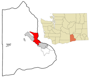
mapsize = 250px
map_caption = Location of Richland, Washington
mapsize1 =
map_caption1 =subdivision_type = Country
subdivision_name =United States
subdivision_type1 = State
subdivision_name1 =Washington
subdivision_type2 = County
subdivision_name2 = Bentongovernment_footnotes =
government_type =
leader_title =
leader_name =
leader_title1 =
leader_name1 =
established_title =
established_date =unit_pref = Imperial
area_footnotes =
area_magnitude =
area_total_km2 = 97.8
area_land_km2 = 90.2
area_water_km2 = 7.6
area_total_sq_mi = 37.8
area_land_sq_mi = 34.8
area_water_sq_mi = 2.9population_as_of = 2000
population_footnotes =
population_total = 38708
population_density_km2 = 429.3
population_density_sq_mi = 1111.8timezone = Pacific (PST)
utc_offset = -8
timezone_DST = PDT
utc_offset_DST = -7
elevation_footnotes =
elevation_m = 117
elevation_ft = 384
latd = 46 |latm = 16 |lats = 47 |latNS = N
longd = 119 |longm = 16 |longs = 53 |longEW = Wpostal_code_type =
ZIP code s
postal_code = 99352-99353-99354
area_code = 509
blank_name = FIPS code
blank_info = 53-58235GR|2
blank1_name = GNIS feature ID
blank1_info = 1513395GR|3
website =
footnotes =Richland is a city in Benton County in the southeastern part of the
U.S. state ofWashington , at the confluence of the Yakima and the Columbia Rivers. As of the 2000 census, the city population was 37,708. April 1, 2007 estimates from the Washington State Office of Financial Management put the city's population at 45,070. Along with the nearby cities of Pasco and Kennewick, Richland is one of theTri-Cities of Washington , home to the Hanford nuclear site.History
For centuries, the village of Chemna stood at the mouth of the current Yakima River. Today that village site is called Columbia Point. From this village the
Wanapum ,Yakama and Walla Walla Indians harvested thesalmon runs entering the Yakima River. Captain William Clark of theLewis and Clark Expedition visited the mouth of the Yakima River onOctober 17 ,1805 .Formative years
In 1904-1905, W.R. Amon and his son Howard purchased convert|2300|acre|km2|0 and proposed a town site on the north bank of the Yakima River. Postal authorities approved the designation of this town site as Richland in 1905. In 1906, the town was registered at the Benton County Courthouse. It was incorporated on
April 28 ,1910 as a Washington Fourth Class City.The war years
Richland was a small farm town until the US Army purchased 1660 km² (640 sq mi - half the size of
Rhode Island ) along the Columbia River for the war effort, evicting the 300 residents of Richland as well as those of the now vanished towns of White Bluffs and Hanford just upriver. The army turned it into a bedroom community for the workers on itsManhattan Project facility at the nearby Hanford Engineering Works (now the Hanford site). The population increased from 300 in July and August 1943 to 25,000 by the end ofWorld War II in August 1945. Richland became a closed city (federally controlled Atomic Energy community), with access restricted to residents and others authorized by the U.S. Army. Mail was postmarkedSeattle and many addresses were misleading. All land and buildings were owned by the government. Housing was assigned to residents and token rent was collected; families were assigned to houses or duplexes; single people were placed in apartments or barracks. Everything necessary was provided, from free bus service to light bulbs, and trees were planted in people's yards by the government.As much of the city was planned by the
Army Corps of Engineers many of the streets are named after famous engineers. For instance, the main street (George Washington Way) is named after the first president, who was a surveyor; Stevens Drive is named afterJohn Frank Stevens , chief engineer of thePanama Canal andStevens Pass ; Goethals Drive is named afterGeorge W. Goethals , designer of the Panama Canal; and Thayer Drive is named afterSylvanus Thayer , founder of the first professional school of engineering in the United States atDartmouth College . The rule is that ifalphabet house s reside on a given street, it is named either after an engineer or a type of tree.The end of the war
With the end of the war, that Hanford workers camp, originally located fifteen miles (24 km) north of Richland at the old Hanford town site, was closed down. Although many of them moved away as the war effort wound down, some of these workers moved to Richland, offsetting the depopulation that might otherwise have occurred.
The Cold War boom
Fears that the
Soviet Union 's intentions were aggressive set off theCold War in 1947. The capacity to produce plutonium was increased beginning in 1947. When the Soviet Union developed and tested their first nuclear weapon in 1949, the U.S. nuclear program was reinvigorated. A second post-WW II expansion began in 1950 as a result of the war in Korea. Richland's Cold War construction boom resulted in Richland's population growing to 27,000 people by 1952. Many of these people lived in a construction camp of trailers located in what is now north Richland. With time, these trailers were vacated and the core city grew.Transition to private property
The government got out of the landlord business in 1957 when the real estate was sold to the residents. Most of the people lived in duplexes; senior tenants were given the option to purchase the building; junior tenants were given the option to purchase lots in a newly platted area of north Richland. Richland was incorporated in 1958 as a chartered First Class City, an open self-governed city. As part of the transition, large areas of undeveloped land became city property. Richland's financial dependency on the federal Hanford facility changed little at this time because Hanford's mission as a weapons materials production site continued during the Cold War years.
After the production boom
With the shutdown of the last production reactor in 1987, the area transitioned to environmental cleanup and technology. Now, many Richland residents are employed at the Hanford site in its environmental cleanup mission.
Richland contains many reminders of its past. Richland High School's sports teams are called the Bombers - complete with a
mushroom cloud (at one point there was a campaign to change this to the more politically correct B-17 logo after the B-17G "Day's Pay" bought by Hanford workers in 1944 for theUnited States Army Air Forces , but the cloud still prevails). Less controversially, Hanford, the other High School in town has a Falcon mascot.Some of the streets platted after 1958 are named after generals in the U.S. Army (Patton Street, MacArthur Street, Sherman Street, Pershing Avenue, and after various nuclear themes, (Einstein Avenue,Curie Street,Proton Lane, Log lane, and Nuclear Lane). A local museum (Columbia River Exhibition of History, Science, and Technology (CREHST)) features exhibits of nuclear technology.Washington State University Tri-Cities was founded in northern Richland in 1989, growing out of a former Joint Graduate Center which had been affiliated with the
University of Washington ,Oregon State University andWashington State University . Richland is also home to Kadlec Medical Center.Columbia Basin College Medical Training Center is near Kadlec hospital.Economy
Technology
After the end of
World War II Richland continued to be a center of production and research intonuclear energy , and related technology.It has been the home of
Pacific Northwest National Laboratory ( [http://www.pnl.gov PNNL] )) since 1965. One of the two Laser Interferometer Gravitational-Wave Observatory sites is located immediately north of Richland. Numerous smaller high technology business and expert consultants have grown up around the Richland technology center as well.Major employers include
Battelle Memorial Institute operating PNNL, [Bechtel] National Inc. building a waste vitrification plant, Washington River Protection Solutions controlling operations of the nuclear waste tank farms, Washington Closure providing waste management and cleanup efforts including decontamination and demolition (D&D) of facilities along the Columbia River,CH2M Hill Plateau Remediation Company responsible for D&D of facilities on the site's Central Plateau,Duratek Federal Services, Inc. providing services to the U.S. government,Energy Northwest generating nuclear power at a nearby reactor facility,Areva creating nuclear fuel,Lockheed Martin Services, Inc. providing technology services and theU.S. Department of Energy which operates theHanford Site .Agriculture
Agriculture is important in the Richland area; the Tri-Cities area of the
Columbia Basin grows excellent produce. Richland hosts an important food processor, ConAgra/Lamb-Weston, which processespotato es and other foods. The production of wine in the lowerColumbia Basin has become one of the main industries.Viticulture
Richland lies at the center of a flourishing
viticulture area which produces internationally recognizedwine s in four major Washington appellations and serves as an ideal center for wine tours. The Columbia Valley appellation which surrounds Richland contains over 7,000hectare s planted to wine grapes. On the west the Yakima Valley appellation includes 5,000 hectares. To the east, the Walla Walla Valley appellation includes 500 hectares of wine grapes. To the immediate west, Red Mountain, with only 350 hectares planted to grapes, produces world-class wines (consistent award-winningCabernet Sauvignon s from Washington's first quarter-century of fine winemaking often rely on fruit from Red Mountain vineyards near Richland). [http://www.barnardgriffin.com/ Barnard Griffin Winery] , [http://www.bookwalterwines.com/ Bookwalter Winery] and [http://www.tagariswines.com/ Tagaris Winery] , all located in Richland, are three of the many regional wineries. Another 20 wineries lie within a 15-minute drive from Richland, and more than 100 wineries within a convert|60|mi|km|0 radius.Wine-tasting rooms in Richland
* [http://www.barnardgriffin.com Bernard Griffin Winery]
* [http://www.bookwalterwines.com Bookwalter Winery]
* [http://www.tagariswines.com Tagaris Winery and Taverna]Business and industry
The Tri-City Industrial Development Council promotes both agricultural related and technology related industries in the region.
Education
The Richland School District serves the cities of Richland and West Richland with nine elementary schools (Badger Mountain, Jason Lee, Jefferson, Lewis and Clark, Marcus Whitman, Sacajawea, Tapteal, William Wiley, and White Bluffs); three middle schools (Carmichael, Chief Joseph, and Enterprise); and three high schools: Richland High School (Bombers),
Rivers Edge Alternative High School (Firebirds), andHanford High School (Falcons). The school district's 2006 budget was about $70 million and there are approximately 10,150 students and 1,100 employees in the school district.Columbia Basin College , primarily located inPasco, Washington , has a small branch campus in Richland.Washington State University, Tri-Cities , established in North Richland in 1989, sits on the western bank of the Columbia River. The university offers a number of undergraduate and graduate degree programs, and for the first time, will admit freshmen and sophomores in the fall of 2007.Recreation
Golf
Richland's exceptional climate makes
golf one of the most popular sports. Three golf courses designed for varying levels of skill are available in Richland and seven beautiful courses are found in the area.Outdoor activities
Richland has developed a number of parks, several of them fronting on the Columbia and Yakima Rivers. The rivers provide boating, water skiing, fishing, kayaking and waterfowl hunting opportunities for the outdoor enthusiast. Snow skiing and hiking are no more than 1-2 hours away.
Richland lies within a semi-arid,
shrub-steppe environment, and has a number of interesting natural areas within or contiguous to the city:
* The Yakima River delta and wetlands lie within Richland and provide habitat for many birds and animals. The area around the Yakima delta provides a wooded variation of the normal shrub-steppe.
* TheBadger Mountain Centennial Preserve , located on the edge of Richland in the Richland GMA area, provides a spectacular view of the Tri-Cities as well as the Columbia and Yakima rivers. A non-profit group, Friends of Badger Mountain, worked to procure this shrub-steppe area that has most native vegetation intact and then in 2005 built a trail to the summit so others can enjoy it. The 2-kilometer trail rises 300 meters above the trailhead in Richland.* The
Arid Lands Ecology Reserve , at the western edge of Richland on the Hanford Reservation, is the last remaining large block of undisturbed shrub-steppe habitat in the Pacific Northwest. The site has been closed to public since the 1940s, preserving its character. It is managed as an environmental research area and wildlife reserve.
* North of Richland, theHanford Reach , the last free-flowing stretch of the Columbia River in the U.S., provides both excellent sightseeing and superior salmon fishing. This free-flowing stretch flows through theHanford Reach National Monument , which was created by Presidential proclamation in 2000, is managed by the U.S. Fish and Wildlife Service. Volunteers are working to construct an interpretive center on Richland's Columbia Point at the confluence of the Yakima a Columbia; as of January 2006, $22M of the necessary funds are in hand and construction is expected later in the year.Professional sports
Three professional sports teams are found in the immediate area:
* TheTri-City Americans WHLice hockey team plays in Kennewick.
* TheTri-City Dust Devils Single-Abaseball team (affiliated with theColorado Rockies ) plays in Pasco.
* TheTri-Cities Fever indoor football team, a member of theaf2 , plays in Kennewick.Geography
Richland is located at coor dms|46|16|47|N|119|16|53|W|city (46.279657, -119.281377)GR|1.
According to the
United States Census Bureau , the city has a total area of 37.8 square miles (97.8 km²), of which, 34.8 square miles (90.2 km²) of it is land and 2.9 square miles (7.6 km²) of it (7.79%) is water. Elevation at the airport is 120 m (394 ft).People and culture
Demographics
As of the
census GR|2 of 2000, there were 38,708 people, 15,549 households, and 10,682 families residing in the city. Thepopulation density was 1,111.8 people per square mile (429.2/km²). There were 16,458 housing units at an average density of 472.7/sq mi (182.5/km²). The racial makeup of the city was 89.55% White, 1.37% African American, 0.76% Native American, 4.06% Asian, 0.11% Pacific Islander, 1.85% from other races, and 2.31% from two or more races. Hispanic or Latino of any race was 4.72% of the population.There were 15,549 households out of which 34.1% had children under the age of 18 living with them, 56% were married couples living together, 9.3% had a female householder with no husband present, and 31.3% were non-families. 27.2% of all households were made up of individuals and 9.4% had someone living alone who was 65 years of age or older. The average household size was 2.48 and the average family size was 3.02.
In the city the population was spread out with 27.2% under the age of 18, 7.5% from 18 to 24, 27.1% from 25 to 44, 25.4% from 45 to 64, and 12.8% who were 65 years of age or older. The median age was 38 years. For every 100 females, there were 96 males. For every 100 females age 18 and over, there were 93.2 males.
The median income for a household in the city was $53,092, and the median income for a family was $61,482. Males had a median income of $52,648 versus $30,472 for females. The
per capita income for the city was $25,494. About 5.7% of families and 8.2% of the population were below thepoverty line , including 10.8% of those under age 18 and 5.6% of those age 65 or over.Based on per capita income, one of the more reliable measures of affluence, Richland ranks 83rd of 522 areas ranked in the state of Washington--the highest rank achieved in Benton County.
Famous residents
*
James (Jim) F. Albaugh - Executive Vice President,The Boeing Company , RHS class of 1968
*Travis Buck -Oakland Athletics outfielder
*Orson Scott Card - Science fiction writer
*Larry Coryell - Jazz guitarist, RHS class of 1961
*Gene Conley - Major League Basketball and Baseball player, RHS
*Westley Allan Dodd - Serial killer and child molester, RHS class of 1979, hanged January 5, 1993
* Dina Washburn Kruger -Nobel Peace Prize participant 2007, member of theIntergovernmental Panel on Climate Change , director of the U.S. EPA climate change division, Hanford High class of 1980
*James N. Mattis - Lieutenant General,United States Marine Corps RHS class of 1968
*Nate Mendel -Foo Fighters bassist Hanford High School Class of 1987
*Jason Repko -Los Angeles Dodgers outfielder Hanford High class of 1999
*Hope Solo -United States women's national soccer team goalkeeper, RHS class of 1999
*Sharon Tate - Actress, murder victim, Miss Richland, 1959
*Beefy (artist) -Nerdcore artistister cities
*
*ee also
*
Hanford High School
*Pacific Northwest National Laboratory
* Richland High School
* Richland School District
*Tri-City Railroad Company
*Washington State University, Tri-Cities References
* Richland, Celebrating Its Heritage; Barbara J. Kubik; City of Richland, Washington; 1994
* Nuclear Culture: Living & Working in the World's Largest Atomic Complex; Paul Loeb; New Society Publishers; 1986; ISBN 0-86571-088-0
* Federal City Revisited: Atomic Energy and Community Identify in Richland, Washington; Christine F. Noonan; Thesis-Ball State University; 2000
* Hanford and the Bomb; S.L. Sanger, Living History Press; 1989; ISBN 0-9624867-0-1References
External links
* [http://www.ci.richland.wa.us/ Richland Municipal Link]
* [http://www.tricityherald.com/ Tri-City Herald newspaper]
* [http://www.grll.org Greater Richland Little League Website]
* [http://www.fws.gov/hanfordreach/ Hanford Reach National Monument]
* [http://www.ncwjobs.com/ NCWJobs.com - Richland jobs, Richland employers, and relocation information]
* [http://www.rsd.edu Richland School District]Photo gallery
Click on photo for full size image.
Wikimedia Foundation. 2010.