- Puyallup, Washington
Infobox Settlement
official_name = Puyallup, Washington
settlement_type =City
nickname =
motto =
imagesize =
image_caption =
image_
imagesize =
image_caption =
image_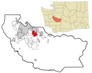
mapsize = 250x200px
map_caption = Location of Puyallup, Washington
mapsize1 =
map_caption1 =subdivision_type = Country
subdivision_name =United States
subdivision_type1 = State
subdivision_name1 =Washington
subdivision_type2 = County
subdivision_name2 = Piercegovernment_footnotes =
government_type =
leader_title =
leader_name =
leader_title1 =
leader_name1 =
established_title =
established_date =unit_pref = Imperial
area_footnotes =
area_magnitude =
area_total_km2 = 31.6
area_land_km2 = 31.4
area_water_km2 = 0.2
area_total_sq_mi = 12.2
area_land_sq_mi = 12.1
area_water_sq_mi = 0.1population_as_of = 2000
population_footnotes =
population_total = 33011
population_density_km2 = 1049.9
population_density_sq_mi = 2719.2timezone = Pacific (PST)
utc_offset = -8
timezone_DST = PDT
utc_offset_DST = -7
elevation_footnotes =
elevation_m = 14
elevation_ft = 46
latd = 47 |latm = 11 |lats = 6 |latNS = N
longd = 122 |longm = 17 |longs = 32 |longEW = Wpostal_code_type =
ZIP code s
postal_code = 98371-98375
area_code = 253
blank_name = FIPS code
blank_info = 53-56695GR|r2]
blank1_name = GNIS feature ID
blank1_info = 1533368GR|3
website =
footnotes =Puyallup, Washington (pronEng|pjuːˈɑːləp) is a city in Pierce County,
Washington about five miles east ofTacoma . The population was 33,011 at the 2000 census and estimated at 36,930 in 2008 by theState of Washington [cite web|url=http://www.ofm.wa.gov/pop/april1/finalpop2008.pdf|title=April 1 Population of Cities, Towns, and Counties - Used for Allocation of Selected State Revenues|publisher=State of Washington , Office of Financial Management, Forecasting Division|date=2008-06-30|accessdate=2008-07-08] . Named after the Puyallup Tribe of Indians, Puyallup means "the generous people."History
Native Americans numbered about 2,000 in what is now the Puyallup Valley in the 1830s and 1840's. The first European settelers arrived in the 1850s. In 1877,
Ezra Meeker platted a townsite and named it Puyallup after the local Puyallup Indian Tribes. By the 1880s Puyallup had become a major hop growing region and more people flocked to the area. The town grew rapidly throughout the 1880s and the town was incorporated in 1890, the first mayor beingEzra Meeker . The Turn of the 20th Century brought change to the valley with the growth of nearby Tacoma and the Interurban rail lines. The Western Washington Fairgrounds were developed giving local farmers a place to show off their crops and livestock. During the early part ofWorld War II the fairgrounds were home to over 7,000 Japanese residents, most of them whom were American citizens, atCamp Harmony .Fact|date=July 2008Population
Geography
Puyallup is located at coor dms|47|11|6|N|122|17|32|W|city (47.184870, -122.292224).GR|1
According to the
United States Census Bureau , the city has a total area of 12.2square mile s (31.6km² ), of which 12.1 square miles (31.4 km²) is land and 0.1 square miles (0.2 km²) (1.65%) is water, mainly consisting of the Puyallup River, which flows from the Puyallup and Carbon glaciers onMount Rainier , into Puget Sound at Tacoma, Washington.Demographics
As of the
census of 2000, there were 33,011 people, 12,870 households, and 8,519 families residing in the city. Thepopulation density was 2,719.2 people per square mile (1,049.9/km²). There were 13,467 housing units at an average density of 1,109.3/sq mi (428.3/km²). The racial makeup of the city was 87.88% White, 1.50% African American, 1.01% Native American, 3.27% Asian, 0.34% Pacific Islander, 1.94% from other races, and 4.06% from two or more races. Hispanic or Latino of any race were 4.67% of the population.There were 12,870 households out of which 36.0% had children under the age of 18 living with them, 49.7% were married couples living together, 11.7% had a female householder with no husband present, and 33.8% were non-families. 26.9% of all households were made up of individuals, 9.5% of which were 65 years of age or older. The average household size was 2.53 and the average family size was 3.08.
In the city the population was spread out with 27.3% under the age of 18, 10.2% from 18 to 24, 30.8% from 25 to 44, 20.8% from 45 to 64, and 10.9% who were 65 years of age or older. The median age was 34 years. For every 100 females there were 93.5 males. For every 100 females age 18 and over, there were 90.9 males.
The median income for a household in the city was $47,269, and the median income for a family was $57,322. Males had a median income of $43,562 versus $27,281 for females. The
per capita income for the city was $22,401. About 4.7% of families and 6.7% of the population were below thepoverty line , including 7.2% of those under age 18 and 6.5% of those age 65 or over.Culture
The Valley
The valley in which Puyallup was originally settled is the heart of the town. Its fertile soil is optimal for the acres of daffodils which are grown for distribution world-wide, and are featured in the town's annual spring parade. Despite the region's slug species, citizens are able to grow lush vegetable gardens in soil which has been nourished by eons of volcanic and glacial geologic activity. The Puyallup River meanders between the hills, through the glacial basin, from its name-sake glacier on Mt. Rainier, terminating in the Port of Tacoma, into the Puget Sound. It is cold, silty and greenish in color due to its glacial contents, and alpine origins. From most perspectives in the town of Puyallup, Mt. Rainier is visible to the south east, making the snow-covered cascade volcano a symbol of the town's strong northwestern natural tradition and culture.
Downtown Puyallup has several notable landmarks, including
Ezra Meeker 's mansion, which was built and inhabited by one of the town's founding families, who made their way to Puyallup via the Oregon trail. The downtown shopping district is made up of historic buildings, which date to the town's origin, and maintain the architecture of the pioneer spirit that formed much of the west. Pioneer Park, the town's center, is a community focal point, which boasts an impressive new public library, and a pleasant civic park, with a playground, and walking paths that wind through cut green grass, between shady old trees. As the focal point of the town, the park's main attraction is a bronze statue honoring Ezra Meeker. Southeast Puyallup is also where thePierce County Foothills Trail begins.Puyallup Fair
Puyallup is home to the Puyallup Fair, the largest annual
state fair in Washington attracting over 1 million people a year. The Puyallup Fair is also one of the ten largest fairs in the country. The city itself is built around the Puyallup Fairgrounds and the fairgrounds can be seen prominently from neighboring South Hill. The fair traditionally runs for three weeks in September and one weekend in April (i.e., the "Spring Fair"). The fair serves as an anchor for unique local businesses and restaurants. "Do The Puyallup" has been a longstanding promotionalslogan .During
World War II , The Puyallup Fairgrounds (i.e., The Puyallup Assembly Area) were used as aninternment camp for United States citizens or residents of Japanese descent or origin that was called "Camp Harmony ." [ [http://www.lib.washington.edu/exhibits/harmony/exhibit/ Camp Harmony Exhibit.] , University of Washington online]Daffodil Festival Parade
Puyallup also hosts and is origin of the annual four-part Daffodil Parade, which takes place every year in Tacoma, Puyallup, Sumner, and Orting.
Antique District
Puyallup is known for its myriad
antiques stores, many of which are located next to each other on the main north-south street of Meridian. Puyallup is one of many cities and towns in Washington that contains an 'old-fashioned'downtown shopping area.Paul H. Karshner Memorial Museum
The Karshner Museum is the only K-12 teaching museum owned and operated by a school district West of the Mississippi. The essential education and curriculum-based program serves the Puyallup School District's 20,000 K-12 student population. Since 1930, the Karshner Museum has provided hands-on and curriculum-based learning experiences to thousands of students through the museum visit program. The education trunk or “Discovery Kit” program has been serving students, teachers and community members since the 1970’s. These Kits ultilize real or replica artifacts for the purposes of bringing history, art and culture to life in the school classroom.
Arts Downtown Outdoor Gallery
Starting in 1995, the regional nonprofit organization Valley Arts United began working with local volunteers to support a rotating selection of outdoor public artwork. Consisting mostly of statuary dispersed about the downtown core, this collection has grown to a collection of about 32 permanent pieces. New works are added regularly. [ [http://www.valleyartsunited.org/ Valley Arts United] ]
Farmers' Market
Every Saturday (9 a.m. to 2 p.m.) and Sunday (10 a.m to 2 p.m.) from early May to late October, there is a
farmers' market located in Pioneer Park in downtown Puyallup, where many locals gather to sell home-grown produce and plants as well as baked goods and crafts. It is located at Pioneer Park, in the modern pavilion building next to the library.Education
The
Puyallup School District is home to over 30 schools. 20,000+ students attend the district. The district is the ninth largest in Washington state, and extends to neighboringSouth Hill , some ofTacoma , and theEdgewood area. [ [http://www.puyallup.k12.wa.us/employment/hr/ Overview of Puyallup School District] ]Media
The Herald is the local
newspaper for eastern Pierce County. It is published once a week on Thursdays. The paper is distributed byThe News Tribune . [ [http://www.puyallup-herald.com/aboutus/index.html About the Puyallup Herald] ]Trivia
*Contrary to the conventions in surrounding areas, Puyallup's streets generally run north-south, and its avenues run east-west.
*Though Puyallup is often known for its numerous one-way streets, there are in fact only two, which is really one; 3rd Street (Northbound), which transitions into 2nd Street (Northbound), and Meridian (southbound).Notable People from Puyallup
* Army Sgt. Nathan Chapman - First US casualty of
Operation Enduring Freedom [ [http://www.whitehouse.gov/stateoftheunion/2002/guest.html 2002 State of the Union guests] , WhiteHouse.gov, retrieved March 10, 2008]
*Nicholas Harmer -Bass player fromDeath Cab For Cutie
*Billy Joe Hobert -NFL quarterback
*Brock Huard - NFL quarterback
*Damon Huard - NFL quarterback
*Megan Jendrick (née Quann) - Olympicmedal ist swimmer
*Nathan Jendrick - Author
*Victor L. Kandle - World War II soldier, Congressional Medal of Honor recipient
*Dustin-Leigh Konzelman -Miss America contestant 2005, reality TV performer
*Jon Lester -Boston Red Sox pitcher
*Dane Looker - NFLwide receiver
*Ezra Meeker - pioneer
* Ryan Moore -PGA Tour golfer
*John R. Rogers - former Washington State governor
*Randy Tate - former U.S. Congressman, formerChristian Coalition leaderReferences
External links
* [http://www.ci.puyallup.wa.us/ City of Puyallup]
* [http://www.mrsc.org/nxt/gateway.dll/pylpmc?f=templates&fn=pylppage.htm$vid=municodes:Puyallup City of Puyallup Municipal Code]
*dmoz|Regional/North_America/United_States/Washington/Localities/P/Puyallup/|Puyallup, Washington
Wikimedia Foundation. 2010.