- Clark County, Washington
-
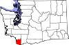
Clark County, Washington 
Location in the state of Washington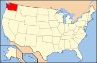
Washington's location in the U.S.Founded August 20, 1845 Seat Vancouver Area
- Total
- Land
- Water
656 sq mi (1,699 km²)
628 sq mi (1,627 km²)
28 sq mi (73 km²), 4.27%Population
- (2010)
- Density
425,363
677/sq mi (261.4/km²)Website www.clark.wa.gov Clark County is a county located in the southwestern part of the U.S. state of Washington, across the Columbia River from Portland, Oregon.
Clark County was the first county of Washington, named after William Clark of the Lewis and Clark Expedition. It was created by the provisional government of Oregon Territory on August 20, 1845, and at that time covered the entire present-day state.[1]
On April 1, 2010 Census, Clark County's population was to be 425,363. Its county seat is at Vancouver, which is also its largest city.
Contents
History
Clark County began as the District of Vancouver on July 27, 1844. It included all the land north of the Columbia River, west of the Rocky Mountains, and south of Alaska. In 1845 the provisional government changed its name to Vancouver County. At that time it stretched from the Columbia River to 54 degrees 40 minutes North Latitude in British Columbia. On June 15, 1846 the United States Senate approved the present boundary between the U.S. and Canada at the 49th Parallel.
On August 13, 1848, President James K. Polk signed an act creating the entire region as the Oregon Territory. On September 3, 1849, the Oregon Territorial Legislature modified the borders again and changed its name to Clarke County in honor of explorer William Clark. At this time it included all of present day Washington and continued to be divided and subdivided until reaching its present area in 1880. It was not until 1925 that the spelling was corrected to its present form.[2]
In September 1902 the Yacolt Burn, the largest fire in state history, began in neighboring Skamania County and swept west along a 12-mile front to Yacolt, nearly engulfing the town. Salvaging the remaining timber was a lucrative industry for a time.
Further reading
- Alley, B.F. (1885). History of Clarke County, Washington Territory : compiled from the most authentic sources : also biographical sketches of its pioneers and prominent citizens. Washington Pub. Available online through the Washington State Library's Classics in Washington History collection
Politics
Clark County is a swing county in U.S. presidential elections. In 2008, the Democratic candidate Barack Obama won the county with 95,356 votes (51.85%), while Republican John McCain won 84,242 votes (45.79%) and independent Ralph Nader won 1,791 votes (0.97%).[3] However, George W. Bush carried the county twice, by 52% to 47% over John Kerry in 2004 and by 49% to 46% over Al Gore in 2000. As a swing county, Clark County usually votes for the winning presidential candidate, for example, it voted for Ronald Reagan twice and for Bill Clinton twice. The last two presidential elections where Clark County did not vote for the national winner were 1968, when it voted for Humphrey over Nixon, and 1988, when it voted for Dukakis over Bush.
Democratic U.S. Senator Patty Murray narrowly carried Clark County in the United States Senate election in Washington, 2010 with 52% of the vote, but lost the county to Republican Senate candidate George Nethercutt in 2004.
At the state level, unsuccessful Republican candidate Dino Rossi won the county in the Washington gubernatorial election, 2008 with 91,301 votes (51.01%) over the Democratic incumbent Christine Gregoire, who won 87,683 votes (48.99%). Clark County also voted for Rossi over Gregoire by 53% to 45% in 2004.
Clark County's location in the Portland media market often results in the county voting differently on initiatives than the rest of the state. In addition, unlike the fairly socially liberal Seattle suburbs, Clark County is apt to vote for some types of socially conservative legislation (such as against legalising marijuana), which is seen as not appealing to family voters in the area.
Geography and climate
According to the U.S. Census Bureau, the county has a total area of 656 square miles (1,699.0 km2), of which 628 square miles (1,626.5 km2) is land and 28 square miles (72.5 km2) (4.27%) is water.
Clark County is surrounded on two sides by the Columbia River and on the north by the North Fork of the Lewis River. The East Fork of the Lewis River and the Washougal River cut across the county. The largest stream arising solely within the county is Salmon Creek, which terminates at Vancouver Lake before eventually flowing into the Columbia River.
Like most of Oregon and Washington south of Puget Sound into the Willamette Valley the landscape and climate of Clark County are determined by its placement between the volcanic Pacific Coast and Cascade Ranges, where glaciation helped form a U-shaped valley which meets the river valley of the Columbia River as it leaves the Columbia River Gorge. Volcanic andisol soils are common, with fertile mollisols in the lower areas. The central and southwest areas of the county are generally flat floodplains, sculpted by torrents of prehistoric Lake Missoula. A series of dramatic floods known as the Missoula Floods took place 15,000 - 13,000 years ago, as several ice dams melted, forming a series of low steps such as the "Heights", "Mill Plain", "Fourth Plain" and "Fifth Plain". Clark County's Köppen climate classification is "Csa."
Many lakes border the river in the lowlands near Ridgefield, including Vancouver Lake. Eastern and northern Clark County contain forested foothills of the Cascade Mountains, rising to an elevation of 4,000 feet (1,200 m) on the border with Skamania County. Larch Mountain is the county's highest free-standing peak.
Flora and fauna of the region include the normal ecological succession from lowland big leaf maple and western red cedar through Garry oak on up through fire-dependent species such as lodgepole pine and Douglas fir, as well as grand fir, silver fir and other species common to Gifford Pinchot National Forest. In addition to a wide variety of birds including great blue heron, raptors such as barred owl, osprey, red-tailed hawk and bald eagle, corvids (raven, crow, scrub and Steller's jay) and others, the native streams are home to various species of salmon and the Vancouver Trout Hatchery. Larger mammals include black-tailed deer, coyote, raccoon, skunk and invasive opossum. Common foods used by the indigenous people such as the Klickitat tribe and Chinook included salmon, huckleberry and Camassia quamash (after which the city of Camas, Washington is named).
Mount Hood, Mount Saint Helens and Mount Adams are all visible from Clark County, and cold winter winds through the Columbia River Gorge often bring freezing rain and a coating of glaze ice or clear ice known locally as a "silver thaw," especially in southeastern areas of the county closest to the gorge. The counterpart to this are warm winds from the southeast known locally as the "Pineapple Express".
Spring thaws can often swell county waterways, with two of the more destructive floods being those of the Columbia River in June 1894 and May, 1948. The 1948 Memorial Day flood almost topped the Interstate Bridge's support piers and completely destroyed nearby Vanport, Oregon. Construction of The Dalles Dam and destruction of Celilo Falls are credited with a decrease in such floods.
Significant windstorms in Clark County include the Columbus Day windstorm of October 12, 1962, and an April 6, 1972 tornado which rated F3 on the Fujita scale, striking a local school. A "Friday the 13th" storm in November 1981 brought winds up to 70 miles per hour (110 km/h), with other storms including the inauguration day storm of January 20, 1993, the Guadalupe Day storm of December 12, 1995 (with winds up to 95 miles per hour (153 km/h) at Washougal, Washington) and small tornado on January 10, 2008, which destroyed a boathouse at Vancouver Lake and caused damage to buildings in Hazel Dell before dissolving near Hockinson.[4]
Geographic features
- Cascade Mountains
- Columbia River
- Vancouver Lake
- East Fork Lewis River
- Lacamas Creek
- Lacamas Lake
- Battleground Lake
- Moulton Falls
- Lucia Falls
- Larch Mountain
- Silver Star Mountain
- Lewisville Park
- Daybreak Park
- Vancouver Lake Park
- Klineline Park
Major highways
 Interstate 5
 Interstate 205
 State Route 14
 State Route 500
 State Route 501
 State Route 502
 State Route 503
Former major highway
Adjacent counties
- Cowlitz County, Washington - north
- Skamania County, Washington - east
- Multnomah County, Oregon - south
- Columbia County, Oregon - southwest
National protected areas
- Fort Vancouver National Historic Site (part)
- Gifford Pinchot National Forest (part)
- Ridgefield National Wildlife Refuge
- Steigerwald Lake National Wildlife Refuge
Other
Clark County Youth Commission
The Clark County Youth Commission (CCYC) is a citizen advisory board to the Clark County Board of Commissioners (BOCC) in Clark County, Washington. The Youth Commission consists of approximately thirty 11-19 year-old youth from around the county, each school district in the county having two representatives. Since its establishment in 1998, the CCYC has given input to the BOCC and other county departments and organizations on various issues important to youth. In the past, the group worked on a fireworks policy and an economic development plan for the county.
In addition to helping shape county policy, the Youth Commission takes on a youth-driven project each year to promote or combat an issue. Past youth-driven projects include a Civil Rights Open House at the Youth House, a benefit concert for Invisible Children, and Freedom's Answer. Each year, the Youth Commission also hosts a Clark County Youth Achievement Celebration at Skyview High School to honor youth around the county.[5]
In 2008, the CCYC plans to be involved in shaping Sustainability Policy.
Demographics
Historical populations Census Pop. %± 1850 643 — 1860 2,384 270.8% 1870 3,081 29.2% 1880 5,490 78.2% 1890 11,709 113.3% 1900 13,419 14.6% 1910 26,115 94.6% 1920 32,805 25.6% 1930 40,316 22.9% 1940 49,852 23.7% 1950 85,307 71.1% 1960 93,809 10.0% 1970 128,454 36.9% 1980 192,227 49.6% 1990 238,053 23.8% 2000 345,238 45.0% 2010 425,363 23.2% As of the census[6] of 2000, there were 345,238 people, 127,208 households, and 90,953 families residing in the county. The population density was 550 people per square mile (212/km²). There were 134,030 housing units at an average density of 213 per square mile (82/km²). The racial makeup of the county was 88.82% White, 1.68% Black or African American, 0.84% Native American, 3.21% Asian, 0.37% Pacific Islander, 1.99% from other races, and 3.08% from two or more races. 4.71% of the population were Hispanic or Latino of any race. 17.7% were of German, 10.2% English, 8.6% Irish, 8.6% United States and 5.1% Norwegian ancestry according to Census 2000. 88.8% spoke English, 3.6% Spanish and 1.9% Russian as their first language.
There were 127,208 households out of which 37.20% had children under the age of 18 living with them, 56.80% were married couples living together, 10.30% had a female householder with no husband present, and 28.50% were non-families. 21.80% of all households were made up of individuals and 6.80% had someone living alone who was 65 years of age or older. The average household size was 2.69 and the average family size was 3.15.
In the county, the population was spread out with 28.70% under the age of 18, 8.40% from 18 to 24, 30.80% from 25 to 44, 22.60% from 45 to 64, and 9.50% who were 65 years of age or older. The median age was 34 years. For every 100 females there were 98.50 males. For every 100 females age 18 and over, there were 95.90 males.
The median income for a household in the county was $48,376, and the median income for a family was $54,016. Males had a median income of $41,337 versus $28,537 for females. The per capita income for the county was $21,448. About 6.90% of families and 9.10% of the population were below the poverty line, including 11.70% of those under age 18 and 6.80% of those age 65 or over.
Cities and Towns
- Battle Ground
- Camas
- La Center
- Ridgefield
- Vancouver
- Washougal
- Woodland (partly in Clark County, mainly in Cowlitz County)
- Yacolt
Census-designated communities
- Amboy
- Barberton
- Brush Prairie
- Cherry Grove
- Dollar Corner
- Felida
- Five Corners
- Hazel Dell, which the United States Census Bureau keeps data on in two separate sections:
- Hockinson
- Lake Shore
- Lewisville
- Meadow Glade
- Mill Plain
- Minnehaha
- Mount Vista
- Orchards
- Salmon Creek
- Venersborg
- Walnut Grove
Other communities
- Chelatchie
- Heisson
- Sifton
See also
- National Register of Historic Places listings in Clark County, Washington
- The Vancouver Voice
- Washington State University Vancouver
References
- ^ "Milestones for Washington State History — Part 1: Prehistory to 1850". HistoryLink.org. March 5, 2003. http://www.historylink.org/essays/output.cfm?file_id=5366.
- ^ Hanable, William S. (February 4, 2004). "Clark County — Thumbnail History". http://www.historylink.org/essays/output.cfm?file_id=5644.
- ^ Dave Leip. "Presidential Election 2008". Dave Leip's Atlas of U.S Presidential Elections. http://www.uselectionatlas.org/RESULTS/. Retrieved 2010-03-15.
- ^ "Region has long history of damaging windstorms," by Don Hamilton, The Columbian, January 11, 2008, p. A5.
- ^ Youth Commission - Youth Program - Community Services - Clark County Washington
- ^ "American FactFinder". United States Census Bureau. http://factfinder.census.gov. Retrieved 2008-01-31.
External links
- Official county website
- Clark County place name histories.
- Clark County Historic Photographs
- Guide to Clark County Washington

Cowlitz County 
Skamania County  Clark County, Washington

Columbia County, Oregon Multnomah County, Oregon Municipalities and communities of Clark County, Washington Cities Battle Ground | Camas | La Center | Ridgefield | Vancouver | Washougal | Woodland‡
Town CDPs Amboy | Barberton | Brush Prairie | Cherry Grove | Dollar Corner | Felida | Five Corners | Hazel Dell North | Hazel Dell South | Hockinson | Lake Shore | Lewisville | Meadow Glade | Mill Plain | Minnehaha | Mount Vista | Orchards | Salmon Creek | Venersborg | Walnut Grove
Unincorporated
communityFootnotes ‡ This populated place also has portions in an adjacent county or counties
Categories:- Washington (state) counties
- Clark County, Washington
- 1845 establishments in the United States
- Columbia River Gorge
- Portland metropolitan area


Wikimedia Foundation. 2010.