- Portland metropolitan area
-
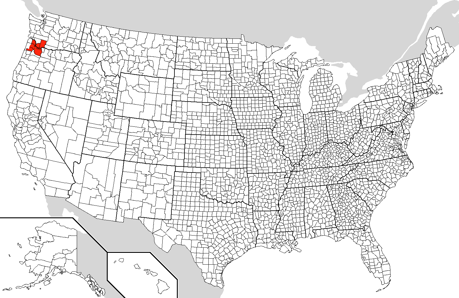
Portland-Vancouver-Hillsboro, OR-WA Metropolitan Statistical Area 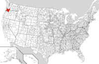
Common name: Portland metropolitan areaLargest city Portland, Oregon (583,776) Other cities Vancouver (161,791)
Gresham (105,594)
Hillsboro (91,611)Population Ranked 23rd in the U.S. - Total 2,226,009 - Density 333/sq. mi.
129/km²Area 6,684 sq. mi.
17,310 km²State(s) Oregon
WashingtonElevation - Highest point N/A feet (N/A m) - Lowest point N/A feet (N/A m) The Portland-Vancouver-Hillsboro, OR-WA Metropolitan Statistical Area (MSA), also known as the Portland metropolitan area or Greater Portland, is an urban area in the U.S. states of Oregon and Washington centered around the city of Portland, Oregon. The U.S. Census Bureau's definition for the MSA is currently all of the following counties: Clackamas County, Oregon; Columbia County, Oregon; Multnomah County, Oregon; Washington County, Oregon; Yamhill County, Oregon; Clark County, Washington; and Skamania County, Washington.[1] The Washington counties are separated from Oregon by the Columbia River.
The Oregon portion of the metropolitan area is the state's largest urban center. Portions of this are under the jurisdiction of Metro,[2] a directly elected regional government which, among other things, is responsible for land use planning in the region.
Contents
Cities and other communities
Major cities in the region in addition to Portland include Beaverton, Gresham, Hillsboro in Oregon, and Vancouver in Washington. The area also includes the smaller cities of Cornelius, Damascus, Fairview, Forest Grove, Gladstone, King City, Lake Oswego, Milwaukie, Oregon City, Sherwood, Tigard, Troutdale, Tualatin, West Linn, Wilsonville, Wood Village in Oregon, as well as Battle Ground, Camas, and Washougal in Washington.
It includes the unincorporated suburban communities in Oregon of Aloha, Beavercreek, Cedar Mill, Clackamas, Dunthorpe, Garden Home, Raleigh Hills, and West Slope.
Categorized lists of cities, neighborhoods, and communities are also available:
- Category:Multnomah County, Oregon
- Category:Washington County, Oregon
- Category:Clackamas County, Oregon
- Category:Clark County, Washington
- Category:Neighborhoods in Portland, Oregon
Metropolitan statistical area
The Portland–Vancouver–Hillsboro Metropolitan Statistical Area (MSA), the 23rd largest in the United States,[3][4] has a population of 2,226,009 (2010 Census). Of them, 1,789,580 live in Oregon (46.7% of the state's population) while the rest 436,429 live in Washington (6.7% of state's population). It consists of Multnomah, Washington, Clackamas, Columbia and Yamhill counties in Oregon, as well as Clark and Skamania counties in Washington. The area includes Portland and the neighboring cities of Beaverton, Gresham, Hillsboro, Milwaukie, Lake Oswego, Oregon City, Fairview, Wood Village, Troutdale, Tualatin, Tigard, West Linn, Vancouver, Camas and Washougal.
Before the recent (2003–2004) redefinition of metropolitan boundaries, the Portland Consolidated Metropolitan Area included the Salem Metropolitan Statistical Area.[5] If still considered a part of the metropolitan area the population would be 2,637,944 (2009 estimate).[6] Combined population close connected Portland, Salem and Longview metropolitan areas[clarification needed] is 2,739,910 (2009 estimate).[6]
Transportation
Portland is where Interstate 84 ends at Interstate 5, both major highways in the Pacific Northwest. Other primary roads include Interstate 205, an eastern bypass of the urban core, U.S. Route 26, which heads west and southeast, U.S. Route 30, which goes to the northwest, and Oregon Route 217, which connects US 26 with I-5 in the south, travelling through Beaverton. Both US 26 and US 30 go to the Oregon Coast. Also, Washington State Route 14 travels along the northern banks of the Columbia River from downtown Vancouver east to Camas and Washougal.
Transit service on the Oregon side is generally provided by TriMet. In addition, Sandy Area Metro serves Sandy, South Clackamas Transportation District serves nearby Molalla, Canby Area Transit serves Canby and South Metro Area Regional Transit serves Wilsonville. Service in Clark County is provided by C-TRAN. In Columbia County, the Columbia County Rider provides transit service on weekdays connecting St. Helens with downtown Portland and connecting Scappoose and St. Helens with certain points in urban Washington County, including the PCC Rock Creek campus, Tanasbourne and the Willow Creek MAX light rail station.[7]
References
- ^ "Update of Statistical Area Definitions and Guidance on Their Uses" (PDF). Office of Management and Budget. November 20, 2007. pp. 45. http://www.whitehouse.gov/omb/bulletins/fy2008/b08-01.pdf. Retrieved 2008-09-05.
- ^ "Jurisdictional Boundaries". Metro. http://www.oregonmetro.gov/index.cfm/go/by.web/id=2948. Retrieved 2011-08-01.
- ^ http://www.census.gov/popest/metro/tables/2008/CBSA-EST2008-01.xls
- ^ "OMB Bulletin No. 10-02: Update of Statistical Area Definitions and Guidance on Their Uses". United States Office of Management and Budget. December 1, 2009. http://www.whitehouse.gov/omb/assets/bulletins/b10-02.pdf. Retrieved January 18, 2010.
- ^ http://www.demographia.com/db-porugbmigr.pdf
- ^ a b http://www.census.gov/popest/metro/tables/2009/CBSA-EST2009-01.csv
- ^ "Schedules & Routes". Columbia County Rider. http://www.columbiacountyrider.com/Schedules_Routes.html. Retrieved 2009-10-10.
External links
- Metro government website
- Portland MSA 2010 Census numbers from the Population Resource Center
- pdx.edu/media/p/r/PRC_2007_Population_Report2_rev.pdf of key urban planning documents on the Portland Metropolitan area, at Portland State University
 State of Washington
Topics State government | Cities | Towns | Congressional delegation | City governments | Governors | History | Geography | People | Legislative initiatives | Popular initiatives | Legislature | Music | Parks | Highways | Symbols | Visitor attractions
Society Demographics · Economy · Education · Politics
Regions Larger cities and
metropolitan areasSeattle | Seattle metropolitan area | Spokane | Tacoma | Tri-Cities | Vancouver | Bellevue | Everett | Yakima
Smaller cities Aberdeen | Anacortes | Arlington | Auburn | Bainbridge Island | Battle Ground | Bellingham | Bonney Lake | Bothell | Bremerton | Burien | Camas | Centralia | Cheney | Cle Elum | Coupeville | Covington | Des Moines | East Wenatchee | Edmonds | Ellensburg | Enumclaw | Federal Way | Fort Lewis | Grandview | Hoquiam | Issaquah | Kelso | Kenmore | Kennewick | Kent | Kirkland | Lacey | Lake Forest Park | Lake Stevens | Lakewood | Langley | Longview | Lynden | Lynnwood | Mabton | Maple Valley | Marysville | Mercer Island | Mill Creek | Monroe | Moses Lake | Mountlake Terrace | Mount Vernon | Mukilteo | Naches | Oak Harbor | Olympia | Pasco | Port Angeles | Port Orchard | Port Townsend | Prosser | Pullman | Puyallup | Redmond | Renton | Richland | Sammamish | SeaTac | Sedro-Woolley | Selah | Shelton | Shoreline | Silverdale | Spokane Valley | Sunnyside | Toppenish | Tukwila | Tumwater | University Place | Walla Walla | Wapato | Washougal | Wenatchee | West Richland | Woodinville | Zillah
Counties Adams | Asotin | Benton | Chelan | Clallam | Clark | Columbia | Cowlitz | Douglas | Ferry | Franklin | Garfield | Grant | Grays Harbor | Island | Jefferson | King | Kitsap | Kittitas | Klickitat | Lewis | Lincoln | Mason | Okanogan | Pacific | Pend Oreille | Pierce | San Juan | Skagit | Skamania | Snohomish | Spokane | Stevens | Thurston | Wahkiakum | Walla Walla | Whatcom | Whitman | Yakima
Freeways in the Portland, Oregon Metropolitan Area Radial Circumferential Bridges Mass transit in the Portland metropolitan area Bus TriMet (list of transit centers • list of routes) • C-TRAN (list of routes) • Canby Area Transit • Mountain Express Bus • Sandy Area Metro • South Clackamas Transportation District • South Metro Area Regional TransitLight rail Streetcar Commuter rail Other Transportation in Portland, Oregon • Portland Aerial Tram • Free Rail Zone • Portland Transit Mall • Union Station • Caruthers Bridge • Vintage Trolley • Willamette Shore Trolley • I-205 Transitway • MetroItalics denote lines or services which are planned, under construction, or otherwise not operating at the present time.50 largest metropolitan statistical areas in the United States by population - New York
- Los Angeles
- Chicago
- Dallas–Fort Worth
- Philadelphia
- Houston
- Washington
- Miami
- Atlanta
- Boston
- San Francisco–Oakland
- Detroit
- Riverside–San Bernardino
- Phoenix
- Seattle
- Minneapolis–St. Paul
- San Diego
- St. Louis
- Tampa–St. Petersburg
- Baltimore
- Denver
- Pittsburgh
- Portland
- Sacramento
- San Antonio
- Orlando
- Cincinnati
- Cleveland
- Kansas City
- Las Vegas
- Memphis
- Louisville
- Richmond
- Oklahoma City
- Hartford
- New Orleans
- Buffalo
- Raleigh
- Birmingham
- Salt Lake City
Categories:- Portland, Oregon
- Portland metropolitan area
- Geography of Portland, Oregon
- Regions of Oregon
- Regions of Washington (state)
Wikimedia Foundation. 2010.