- Wood Village, Oregon
Infobox Settlement
official_name = Wood Village, Oregon
settlement_type =City
nickname =
motto = The city that cares
imagesize =
image_caption =
image_
imagesize =
image_caption =
image_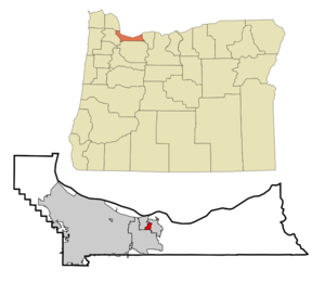
mapsize = 250px
map_caption = Location inOregon
mapsize1 =
map_caption1 =
subdivision_type = Country
subdivision_name =United States
subdivision_type1 = State
subdivision_name1 =Oregon
subdivision_type2 = County
subdivision_name2 = Multnomah
government_type =
leader_title =Mayor
leader_name = David Fuller
established_title = Incorporated
established_date =1951
area_magnitude =
area_total_sq_mi = 0.9
area_total_km2 = 2.5
area_land_sq_mi = 0.9
area_land_km2 = 2.5
area_water_sq_mi = 0
area_water_km2 = 0
area_urban_sq_mi =
area_urban_km2 =
area_metro_sq_mi =
area_metro_km2 =
population_as_of =2000
population_note =
population_total = 2860
population_metro =
population_urban =
population_density_km2 = 1162.4
population_density_sq_mi = 3004.1
timezone = Pacific
utc_offset = -8
timezone_DST = Pacific
utc_offset_DST = -7
latd = 45 |latm = 32 |lats = 6 |latNS = N
longd = 122 |longm = 25 |longs = 7 |longEW = W
elevation_m = 27.4 –100.6
elevation_ft = 90–330
website = [http://www.ci.wood-village.or.us/ http://www.ci.wood-village.or.us/]
postal_code_type =ZIP code
postal_code = 97060
area_code = 503
blank_name = FIPS code
blank_info = 41-83950GR|2
blank1_name = GNIS feature ID
blank1_info = 1136921GR|3
footnotes =Wood Village is a city in Multnomah County,
Oregon ,United States . The population was 2,860 at the 2000 census. Despite the name, Wood Village is classified as acity .Geography
Wood Village is located at coor dms|45|32|6|N|122|25|7|W|city (45.535041, -122.418706).GR|1
According to the
United States Census Bureau , the city has a total area of 0.9square mile s (2.5km² ), all of it land.Demographics
As of the
census GR|2 of 2000, there were 2,860 people, 1,014 households, and 701 families residing in the city. Thepopulation density was 3,004.1 people per square mile (1,162.4/km²). There were 1,089 housing units at an average density of 1,143.9/sq mi (442.6/km²). The racial makeup of the city was 81.68% White, 0.56% African American, 1.29% Native American, 1.71% Asian, 0.24% Pacific Islander, 9.86% from other races, and 4.65% from two or more races. Hispanic or Latino of any race were 15.21% of the population.There were 1,014 households out of which 38.6% had children under the age of 18 living with them, 45.9% were married couples living together, 16.8% had a female householder with no husband present, and 30.8% were non-families. 23.9% of all households were made up of individuals and 6.8% had someone living alone who was 65 years of age or older. The average household size was 2.76 and the average family size was 3.22.
In the city the population was spread out with 28.6% under the age of 18, 10.2% from 18 to 24, 32.8% from 25 to 44, 19.7% from 45 to 64, and 8.6% who were 65 years of age or older. The median age was 31 years. For every 100 females there were 102.7 males. For every 100 females age 18 and over, there were 97.2 males.
The median income for a household in the city was $43,384, and the median income for a family was $48,167. Males had a median income of $31,577 versus $25,500 for females. The
per capita income for the city was $17,833. About 6.9% of families and 8.3% of the population were below thepoverty line , including 7.9% of those under age 18 and 2.9% of those age 65 or over.History
Wood Village was built as a
company town for the Reynolds Aluminum plant, now closed. [http://www.ci.wood-village.or.us/history.htm>] It was formerly home to a 90,000-square-footMerix Corporation plant. [http://b2i.api.edgar-online.com/EFX_dll/EdgarPro.dll?FetchFilingHTML1?SessionID=hBKzCa5iihMcNFY&ID=4619256 Merix Corporation 2006 Annual Report] ]Infrastructure
General
Wood Village has one city park, Donald L. Robertson City Park, between NE Treehill Drive and NE Halsey Street. The city hall also has the maintenance yard, at NE Halsey and NE 238th Avenue.
Transportation
TriMet route [http://www.trimet.org/schedule/r077.htm 77 Broadway/Halsey] runs through town with several stops on NE Halsey Street. Due to the steep cliff of theColumbia River Gorge on NE 238th, connection to theMAX Light Rail system is made at 82nd Avenue in Portland rather than Cleveland Avenue in neighboring Gresham.The city has one exit, Exit 16, off Interstate 84 and U.S. Route 30. I-84 continues through Fairview to the west and Troutdale to the east. US 30 splits in Wood Village, with the main line following the route of I-84. US 30 Bypass starts on NE 238th Avenue, before turning west at NE Sandy Blvd. and continuing into Gresham.
Because of its location inside the Metro Region, all streets are named using Portland quadrant conventions, despite being about 15 miles away from the city. Because the entire City of Wood Village is north of Portland's Burnside Street and east of the
Willamette River , all streets are in "Northeast" Wood Village, regardless of their proximity to the center of town.References:
External links
* [http://www.ci.wood-village.or.us/ City of Wood Village]
* [http://bluebook.state.or.us/local/cities/sy/woodvillage.htm Oregon Blue Book entry for Wood Village]
Wikimedia Foundation. 2010.