- Douglas County, Oregon
-
Douglas County, Oregon 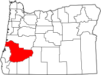
Location in the state of Oregon
Oregon's location in the U.S.Founded January 7, 1852 Seat Roseburg Area
- Total
- Land
- Water
5,134 sq mi (13,297 km²)
5,037 sq mi (13,046 km²)
97 sq mi (251 km²), 1.89%Population
- (2010)
- Density
107,667
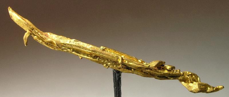
21/sq mi (8/km²)Website www.co.douglas.or.us  A gold "needle" from the Bohemia District in Douglas County
Douglas County is a county located in the U.S. state of Oregon. In 2010, its population was 107,667. It is named after Stephen A. Douglas, an American politician who supported Oregon statehood. The seat of the county is Roseburg[1].
Contents
History
The area originally was inhabited by the Umpqua Indians, who belonged to the Chinook tribe. Following the Rogue River Indian War in 1856, most of the remaining natives were moved by the government to the Grand Ronde Indian Reservation. However, seven families of Umpqua hid in the hills, eluding capture for many decades. They are now Federally recognized as the Cow Creek Band of Umpqua Tribe of Indians. The tribe manages a small reservation in Canyonville, Oregon, and has a Casino/Hotel named Seven Feathers to represent the seven families who refused forced removal to the Grand Ronde Reservation.
Douglas County was created on January 7, 1852, from the portion of Umpqua County which lay east of the Coast Range summit. In 1856 the Camas Valley was annexed to Douglas County from Coos County. In 1862, the rest of Umpqua county was absorbed into Douglas County, some say due to the loss of population following the end of the early gold boom, while others attribute the absorption to politics. Further boundary adjustments were made with Jackson and Lane Counties in 1915.
Economy
The entire watershed of the Umpqua River lies within the boundaries of Douglas County. The heavily timbered county contains nearly 1.8 million acres (7,300 km²) of commercial forest lands and one of the oldest stands of old growth timber in the world. Approximately 25-30% of the labor force is employed in the forest products industry. Agriculture, mainly field crops, orchards, and livestock (particularly sheep ranching,) is also important to the economy of the county. The land of Douglas County is roughly half-publicly and half-privately owned.[2]
The post-Prohibition wine industry in Oregon began with Richard Somer planting Hillcrest Vineyard at the south end of the Umpqua Valley in 1961. The Umpqua Valley wine appellation lies entirely within Douglas county.
Nickel has been refined at Riddle since 1954. There is a significant federal presence in the region; the Forest Service and Bureau of Land Management administer more than 50% of the county's land.
Geography
 An aerial view of the county
According to the U.S. Census Bureau, the county has a total area of 5,134 square miles (13,297.0 km2), of which 5,037 square miles (13,045.8 km2) is land and 97 square miles (251.2 km2) (1.89%) is water. A portion of the Umpqua National Forest is in Douglas County. Douglas County is one of two Oregon counties that extend from the Pacific Ocean to the Cascade Range. (The other is Lane County.)

Lane County Pacific Ocean 
Klamath County  Douglas County, Oregon

Coos County and Curry County Jackson County and Josephine County National protected areas
- Crater Lake National Park (part)
- Rogue River-Siskiyou National Forest (part)
- Siuslaw National Forest (part)
- Umpqua National Forest (part)
- Willamette National Forest (part)
Adjacent counties
- Lane County, Oregon - (north)
- Klamath County, Oregon - (east)
- Jackson County, Oregon - (south)
- Josephine County, Oregon - (south)
- Curry County, Oregon - (southwest)
- Coos County, Oregon - (west)
Demographics
Historical populations Census Pop. %± 1860 3,203 — 1870 6,066 89.4% 1880 9,596 58.2% 1890 11,864 23.6% 1900 14,565 22.8% 1910 19,674 35.1% 1920 21,332 8.4% 1930 21,965 3.0% 1940 25,728 17.1% 1950 54,549 112.0% 1960 68,458 25.5% 1970 71,743 4.8% 1980 93,748 30.7% 1990 94,649 1.0% 2000 100,399 6.1% 2010 107,667 7.2% [3][4][5] As of the census[6] of 2000, there were 100,399 people, 39,821 households, and 28,233 families residing in the county. The population density was 20 people per square mile (8/km²). There were 43,284 housing units at an average density of 9 per square mile (3/km²). The racial makeup of the county was 93.86% White, 0.18% Black or African American, 1.52% Native American, 0.63% Asian, 0.09% Pacific Islander, 1.02% from other races, and 2.70% from two or more races. 3.27% of the population were Hispanic or Latino of any race. 18.4% were of German, 13.2% American, 12.6% English and 10.2% Irish ancestry. 96.5% spoke English and 2.2% Spanish as their first language.
There were 39,821 households out of which 29.10% had children under the age of 18 living with them, 57.20% were married couples living together, 9.60% had a female householder with no husband present, and 29.10% were non-families. 23.90% of all households were made up of individuals and 11.00% had someone living alone who was 65 years of age or older. The average household size was 2.48 and the average family size was 2.90.
In the county, the population was spread out with 24.00% under the age of 18, 7.50% from 18 to 24, 24.20% from 25 to 44, 26.40% from 45 to 64, and 17.80% who were 65 years of age or older. The median age was 41 years. For every 100 females there were 96.80 males. For every 100 females age 18 and over, there were 94.20 males.
The median income for a household in the county was $33,223, and the median income for a family was $39,364. Males had a median income of $32,512 versus $22,349 for females. The per capita income for the county was $16,581. About 9.60% of families and 13.10% of the population were below the poverty line, including 16.60% of those under age 18 and 9.20% of those age 65 or over.
Media
Communities
Incorporated cities
Unincorporated communities and CDPs
- Anlauf
- Ash
- Azalea
- Camas Valley
- Clearwater
- Cleveland
- Curtin
- Days Creek
- Diamond Lake
- Dillard
- Drew
- Edenbower
- Elkhead
- Gardiner
- Glide
- Green
- Idleyld Park
- Lookingglass
- Milo
- Nonpareil
- Peel
- Rice Hill
- Roseburg North
- Round Prairie
- Scottsburg
- Shady
- Steamboat
- Sulphur Springs
- Tenmile
- Tiller
- Toketee
- Tri-City
- Tyee
- Umpqua
- Wilbur
- Winchester
- Winchester Bay
See also
References
- ^ "Find a County". National Association of Counties. http://www.naco.org/Counties/Pages/FindACounty.aspx. Retrieved 2011-06-07.
- ^ [1]
- ^ http://www.census.gov/population/www/censusdata/cencounts/files/or190090.txt
- ^ http://factfinder2.census.gov
- ^ http://mapserver.lib.virginia.edu/
- ^ "American FactFinder". United States Census Bureau. http://factfinder.census.gov. Retrieved 2008-01-31.
Municipalities and communities of Douglas County, Oregon Cities 
CDPs Glide | Green | Roseburg North | Tri-City | Winchester Bay
Unincorporated
communitiesAnlauf | Ash | Azalea | Brockway | Camas Valley | Curtin | Days Creek | Dillard | Drew | Elkhead | Gardiner | Idleyld Park | Leona | Lookingglass | Melrose | Millwood | Milo | Nonpareil | Peel | Rice Hill | Round Prairie | Scottsburg | Shady | Steamboat | Tenmile | Tiller | Umpqua | Wilbur | Winchester
Categories:- Oregon counties
- Douglas County, Oregon
- 1852 establishments in the United States


Wikimedia Foundation. 2010.