- Ontario, Oregon
-
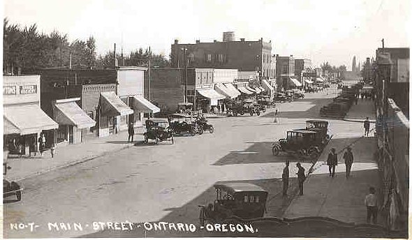
Ontario, Oregon — City — Main Street (now Oregon Street) looking south, early 1920s
Motto: Where Oregon Begins Location in Oregon
Coordinates: 44°1′37″N 116°58′7″W / 44.02694°N 116.96861°W Country United States State Oregon County Malheur Incorporated 1899 Government – Mayor Joe Dominick Area – Total 4.5 sq mi (11.6 km2) – Land 4.5 sq mi (11.6 km2) – Water 0 sq mi (0 km2) Elevation 2,150 ft (655.3 m) Population (2000) – Total 10,985 – Density 2,459.3/sq mi (948.8/km2) Time zone Mountain (UTC-7) – Summer (DST) Mountain (UTC-6) ZIP code 97914 Area code(s) 541 FIPS code 41-54900[1] GNIS feature ID 1125001[2] Website www.ontariooregon.org Ontario is the largest city in Malheur County, Oregon, United States. It lies along the Snake River at the Idaho border. The population was 10,985 at the 2000 census, with an estimated population of 11,245 in 2006.[3] The city is the largest community in the region of far eastern Oregon, also known as the Western Treasure Valley.
Ontario is the principal city of the Ontario, OR-ID Micropolitan Statistical Area, which includes Malheur County in Oregon and Payette County in Idaho.
Ontario is approximately halfway between Portland and Salt Lake City. It is the closest city to the Idaho border along Interstate 84. The city's slogan is "Where Oregon Begins".
Contents
History
Ontario was founded on June 11, 1883, by developers William Morfitt, Mary Richardson, Daniel Smith, and James Virtue, in anticipation of a railroad planned to go through that part of the state. It was named after Virtue's home province of Ontario in Canada.
Ontario was incorporated by the Oregon Legislative Assembly on February 11, 1899.[4]
Geography
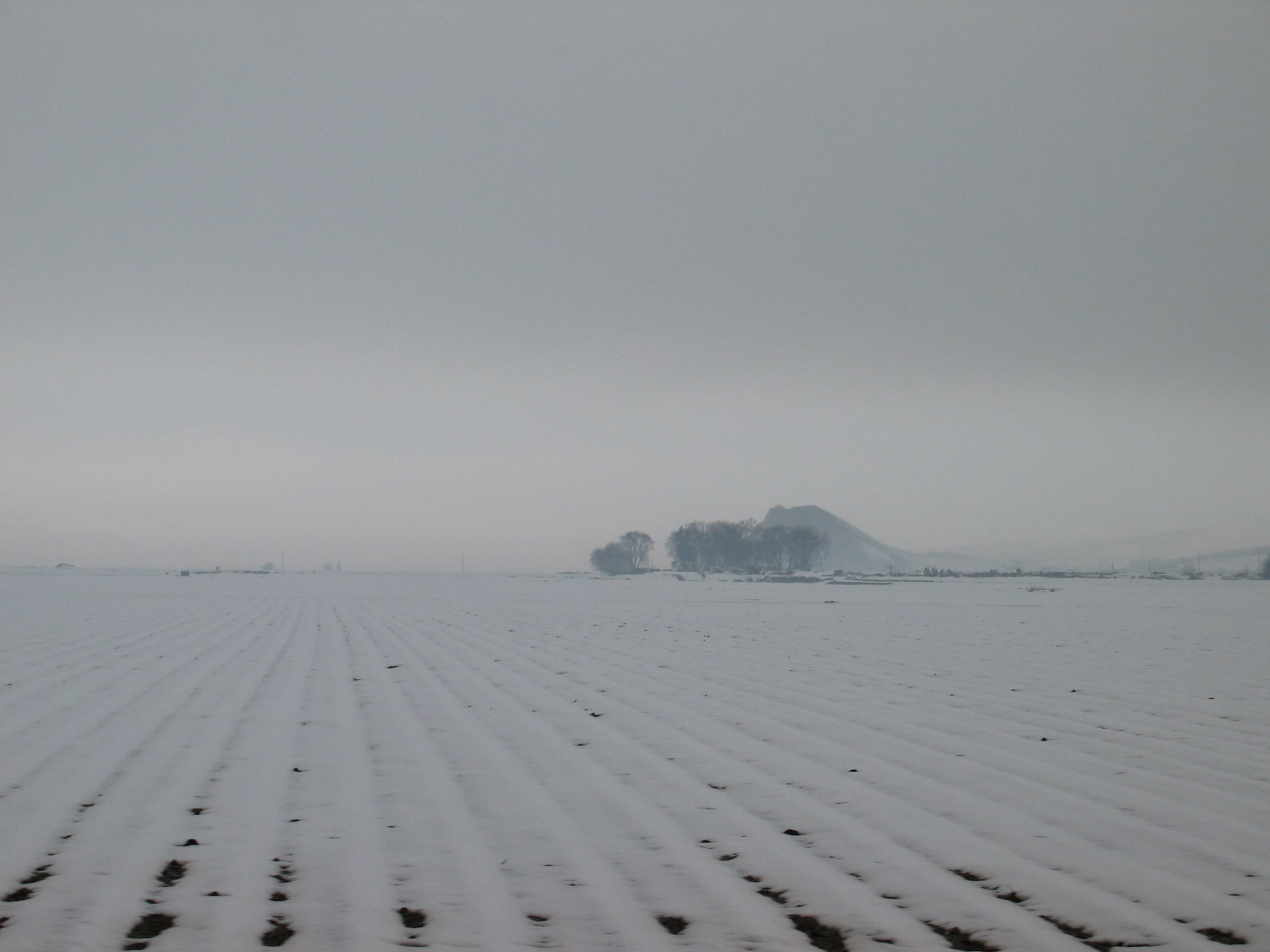
 Snowy field near Ontario with Malheur Butte in the background
Ontario is located at an elevation of 2,150 feet (660 m) above sea level.
According to the United States Census Bureau, the city has a total area of 4.5 square miles (12 km2), all of it land.[5]
Located at about river mile 373 on the Snake River, just north of the place where it begins to form the border of Oregon and Idaho, Ontario is served by Interstate 84, U.S. Route 30, and Oregon Route 201. Access to Interstate 84 is provided by exits 374 and 376. The city center is laid out in a simple block pattern aligned with the Union Pacific Railroad, and the city address system is divided by North and South Oregon Street and East and West Idaho Avenue. Moreover, Oregon Street and Idaho Avenue divide the city logically into NW, NE, SW, and SE quadrants and, somewhat unusually[citation needed] for an Oregon city, a preponderance of the city's streets are numbered; numbered avenues radiate north and south from Idaho Avenue whereas numbered streets radiate east and west from Oregon Street. The quadrant designations are prepended to the street name (e.g., SW 4th Ave, NE 3rd St).
Along with Idaho Street and Oregon Avenue, major streets across Ontario include SW 4th Avenue, providing access from the downtown core to Ontario Municipal Airport and the Tony Yturri Memorial Beltline. Built in 1994 and recently connected to I-84 via Exit 374, the beltline provides a bypass route around the northwest side of Ontario, connecting through traffic directly to the airport area and points beyond such as Vale, Nyssa, and the agricultural area south and west of town.
Bully Creek Reservoir is about 25 miles (40 km) west of Ontario, accessed through Vale.[6]
Demographics
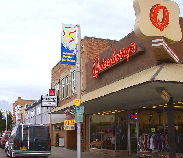
 Downtown Ontario
Historical populations Census Pop. %± 1890 200 — 1900 445 122.5% 1910 1,248 180.4% 1920 2,039 63.4% 1930 1,941 −4.8% 1940 3,551 82.9% 1950 4,465 25.7% 1960 5,101 14.2% 1970 6,523 27.9% 1980 8,814 35.1% 1990 9,392 6.6% 2000 10,985 17.0% Est. 2007 11,086 0.9% source:[7][8] As of the census[1] of 2000, there were 10,985 people, 4,084 households, and 2,634 families residing in the city. The population density was 2,459.3 people per square mile (948.8/km²). There were 4,436 housing units at an average density of 993.1 per square mile (383.2/km²). The racial makeup of the city was 69.27% White, 0.55% African American, 2.69% Asian, 0.88% Native American, 0.15% Pacific Islander, 23.09% from other races, and 3.39% from two or more races. Hispanic or Latino of any race were 32.05% of the population.
There were 4,084 households out of which 35.6% had children under the age of 18 living with them, 47.4% were married couples living together, 13.1% had a female householder with no husband present, and 35.5% were non-families. 30.4% of all households were made up of individuals and 15.4% had someone living alone who was 65 years of age or older. The average household size was 2.63 and the average family size was 3.30.
In the city the population was spread out with 30.5% under the age of 18, 11.5% from 18 to 24, 24.0% from 25 to 44, 18.6% from 45 to 64, and 15.4% who were 65 years of age or older. The median age was 31 years. For every 100 females there were 89.7 males. For every 100 females age 18 and over, there were 85.2 males.
The median income for a household in the city was $29,173, and the median income for a family was $35,625. Males had a median income of $29,775 versus $21,967 for females. The per capita income for the city was $14,683. About 16.4% of families and 20.8% of the population were below the poverty line, including 29.0% of those under age 18 and 14.3% of those age 65 or over.
Economy
 Southwest 4th Avenue overlooking Holy Rosary Medical Center
The region's primary industry is the cultivation of russet potatoes, sugar beets, and onions. The Heinz Frozen Food Company (formerly Ore-Ida), a subsidiary of H. J. Heinz Company, processes locally grown potatoes, and annually produces over 600 million pounds (272 million kg) of 75 different potato products, while employing approximately 1,000.[9] Ontario also has a growing retail-based economy which attracts shoppers from throughout the county and from Idaho's Payette County, particularly from the nearby cities of Payette, Fruitland, and New Plymouth. Big-box retailers Wal-Mart and Home Depot dominate the retail sector, however, the lack of a sales tax in the state attracts relocating retailers and shoppers from Idaho communities. Ontario also attracts employees, who benefit from a minimum wage that as of 2005 was 40% higher than the one paid in Idaho.
The Four Rivers Cultural Center, which was named by John and Chaundra Cammack, was named after the Snake, Malheur, Owyhee and Payette rivers, has a museum that traces the history of settlement in the area by the Northern Paiutes and Basque, Japanese American, Hispanic and European American immigrants. The center's theater and conference center contribute regional dollars to the local economy, as does Treasure Valley Community College, located near the cultural center.
Holy Rosary Medical Center is a 49-bed, acute care hospital, serving Ontario and the surrounding communities in eastern Oregon and southwestern Idaho.
Ontario's role as a regional center of economic growth is challenged by the westward expansion of Boise, Idaho, about fifty miles east of the city. While Oregon's lack of a sales tax is an asset, the state's land use laws make it hard for the city to grow a property tax base and match the pace of development seen across the state line in Idaho. An article in the August 14, 2005 edition of The Oregonian noted that half of the staff of the Snake River Correctional Institution, Oregon's largest state prison and a large Ontario employer, live in Idaho, commuting daily across the state line. The article also noted that the land use laws that protect farmland across the state work to a farmer's disadvantage if farmers cannot find a way to compete profitably.
Media
Ontario's daily paper is the Argus Observer.
Transportation
- Greyhound bus
- The Eastern Point is an intercity bus offering service between Bend and Ontario[10]
- Ontario Municipal Airport
- Interstate 84 - Portland - Boise - Ogden
Sister cities
Ontario has one sister city, as designated by Sister Cities International:[11]
See also
- Oregon Short Line Railroad Depot
- Reel Theatres
References
- ^ a b "American FactFinder". United States Census Bureau. http://factfinder.census.gov. Retrieved 2008-01-31.
- ^ "US Board on Geographic Names". United States Geological Survey. 2007-10-25. http://geonames.usgs.gov. Retrieved 2008-01-31.
- ^ PSU:Population Research Center
- ^ Leeds, W. H. (1899). "Special Laws". The State of Oregon General and Special Laws and Joint Resolutions and Memorials Enacted and Adopted by the Twentieth Regular Session of the Legislative Assembly (Salem, Oregon: State Printer): 683. http://books.google.com/?id=gsCwAAAAIAAJ&dq=%22ocean%20grove%22%20seaside%20oregon&pg=PA683.
- ^ "US Gazetteer files: 2010, 2000, and 1990". United States Census Bureau. 2011-02-12. http://www.census.gov/geo/www/gazetteer/gazette.html. Retrieved 2011-04-23.
- ^ Ontario, Oregon (September, 2008). GoNorthwest.com
- ^ Moffatt, Riley. Population History of Western U.S. Cities & Towns, 1850-1990. Lanham: Scarecrow, 1996, 214.
- ^ "Subcounty population estimates: Oregon 2000-2007" (CSV). United States Census Bureau, Population Division. 2009-03-18. http://www.census.gov/popest/cities/files/SUB-EST2007-41.csv. Retrieved 2009-04-29.
- ^ Worksource Oregon Department of Community Colleges and Workforce Development - Workforce Partners
- ^ "Eastern Point Schedule". TAC Transportation. http://www.highdesert-point.com/assets/Schedule-Docs/eastern-pointSchedule11.pdf. Retrieved July 24, 2011.
- ^ Sister Cities International
External links
- City of Ontario (official website)
- Ontario Chamber of Commerce
- Ontario information from the Oregon Blue Book
- Malheur Agricultural Experiment Station
- Four Rivers Cultural Center
- Snake River Correctional Institution
- Panoramic photos of Ontario from the Library of Congress
- 1930s-1940s farming photos of Ontario from the Library of Congress
- Oregon: End of the Trail: "A 1940 Journey Across Oregon—Ontario to Baker" online exhibit of the Federal Writers' Project book presented by the Oregon State Archives
Coordinates: 44°01′37″N 116°58′07″W / 44.026837°N 116.968672°W
Municipalities and communities of Malheur County, Oregon Cities Adrian | Jordan Valley | Nyssa | Ontario | Vale
Unincorporated
communitiesCategories:- Ontario, Oregon
- Cities in Oregon
- Populated places in Malheur County, Oregon
- Populated places established in 1883
- Ontario micropolitan area
- Basque American history


Wikimedia Foundation. 2010.