- Malheur County, Oregon
-
Malheur County, Oregon 
Location in the state of Oregon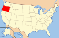
Oregon's location in the U.S.Founded February 17, 1887 Named for Malheur River Seat Vale Largest city Ontario Area
- Total
- Land
- Water
9,930 sq mi (25,719 km²)
9,887 sq mi (25,607 km²)
43 sq mi (111 km²), 0.43%Population
- (2010)
- Density
31,313
3/sq mi (1.2/km²)Time zone Mountain: UTC-7/-6 Website www.malheurco.org Malheur County (
 /mælˈhɪər/) is a county located in the southeast corner of the U.S. state of Oregon. It is included in the 8-county definition of Eastern Oregon. Most of the county observes the Mountain Time Zone, although the southern quarter of the county observes the Pacific Time Zone along with the rest of the state. The county was named for Malheur River, which flows through it. As of 2010[update], the population was 31,313. Ontario is the largest city and the county seat is Vale.[1] The word "malheur" means misfortune in French.
Malheur County is part of the Ontario, OR–ID Micropolitan Statistical Area.
Contents
History
Malheur County was created February 17, 1887, from the southern portion of Baker County. It was first settled by miners and stockmen in the early 1860s. The discovery of gold in 1863 attracted further development, including settlements and ranches. Basques settled in the region in the 1890s and were mainly engaged in sheep raising.
Geography
According to the U.S. Census Bureau, the county has a total area of 9,930 square miles (25,700 km2), of which 9,887 square miles (25,610 km2) is land and 43 square miles (110 km2) (0.43%) is water.
Adjacent counties
- Harney County - (west)
- Grant County - (northwest)
- Baker County - (north)
- Washington County, Idaho - (northeast)
- Payette County, Idaho - (east)
- Canyon County, Idaho - (east)
- Owyhee County, Idaho - (east)
- Humboldt County, Nevada - (south)
National protected areas
- Deer Flat National Wildlife Refuge (part)
- Malheur National Forest (part)
- Whitman National Forest (part)
See also: Bully Creek ReservoirHighways
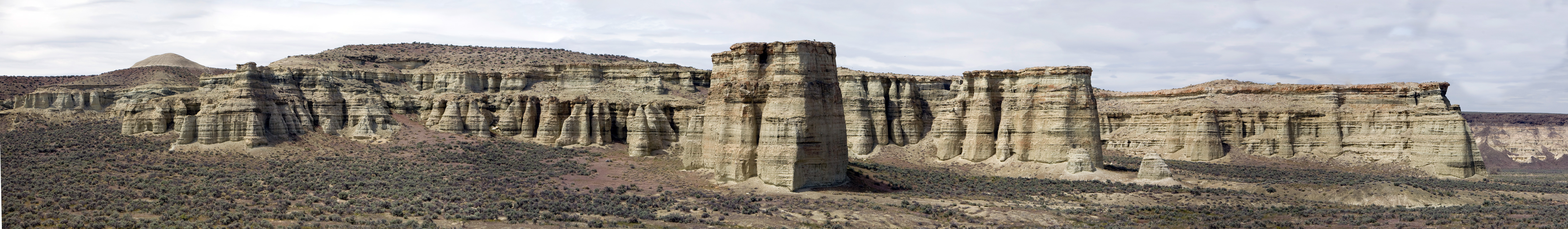
 Pillars of Rome, near Rome
Demographics
Historical populations Census Pop. %± 1900 4,203 — 1910 8,601 104.6% 1920 10,907 26.8% 1930 11,269 3.3% 1940 19,767 75.4% 1950 23,223 17.5% 1960 22,764 −2.0% 1970 23,169 1.8% 1980 26,896 16.1% 1990 26,038 −3.2% 2000 31,615 21.4% 2010 31,313 −1.0% sources:[2][3] As of the census[4] of 2000, there were 31,615 people, 10,221 households, and 7,348 families residing in the county. The population density was 3 people per square mile (1/km²). There were 11,233 housing units at an average density of 1 per square mile (0/km²). The racial makeup of the county was:
- 75.78% White
- 1.22% Black or African American
- 1.02% Native American
- 1.96% Asian
- 0.08% Pacific Islander
- 17.38% from other races
- 2.56% from two or more races
25.62% of the population were Hispanic or Latino of any race. 14.2% were of German, 10.5% English, 8.4% American and 6.9% Irish ancestry according to Census 2000. 79.4% spoke English and 19.4% Spanish as their first language.
There were 10,221 households out of which 36.20% had children under the age of 18 living with them, 57.30% were married couples living together, 10.40% had a female householder with no husband present, and 28.10% were non-families. 23.70% of all households were made up of individuals and 12.00% had someone living alone who was 65 years of age or older. The average household size was 2.77 and the average family size was 3.28.
In the county, the population was spread out with 27.60% under the age of 18, 10.60% from 18 to 24, 27.20% from 25 to 44, 21.00% from 45 to 64, and 13.70% who were 65 years of age or older. The median age was 34 years. For every 100 females there were 116.00 males. For every 100 females age 18 and over, there were 121.20 males.
The median income for a household in the county was $30,241, and the median income for a family was $35,672. Males had a median income of $25,489 versus $21,764 for females. The per capita income for the county was $13,895. About 14.60% of families and 18.60% of the population were below the poverty line, including 25.80% of those under age 18 and 11.60% of those age 65 or over.
Economy
The county is 94% rangeland, with the Bureau of Land Management (BLM) controlling 72% of the land. Irrigated fields in the county's northeast corner, known as Western Treasure Valley, are the center of intensive and diversified farming. Malheur County's economy also depends on tourism.
Because of its economic relationship with Idaho, most of Malheur county is in the Mountain time zone, making it the only county in Oregon that does not completely follow Pacific Time. The largely unpopulated southern quarter of the county, near McDermitt, observes Pacific Time. The legal dividing line between the two goes through the southwest corner of township 35 S, range 37 E, and lies at a latitude of approximately 42.4507448 N. Malheur is one of the few counties in the U.S. that legally observes two different time zones.
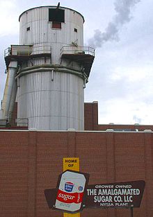
The county's two largest employers are the Snake River Correctional Institution and Ore-Ida, a potato processor owned by H.J. Heinz.[5]
Malheur County is the poorest county in Oregon.[6] As of 2008, 21% of its residents live in poverty.[5]
Politics
Like all counties in eastern Oregon, the majority of registered voters who are part of a political party in Malheur County are members of the Republican Party. In the 2008 presidential election, 69.10% of Malheur County voters voted for Republican John McCain, while 28.47% voted for Democrat Barack Obama and 2.42% of voters voted for a third-party candidate. These statistics do not include write-in votes.[7] These numbers show a small shift towards the Democratic candidate when compared to the 2004 presidential election, in which 74.9% of Malheur Country voters voted for George W. Bush, while 23.8% voted for John Kerry, and 1.3% of voters either voted for a third-party candidate or wrote in a candidate.[8]
Malheur County is one of the most Republican counties in Oregon when it comes to Presidential elections. It was one of only two counties in Oregon to give the majority of its vote to Barry Goldwater and has favored the Republican candidate for decades.[10] The last Democratic candidate to carry the county was Franklin D. Roosevelt in 1940.[11] Further every Republican candidate since 1996 has received more than 60% of the county's vote.[12]
As part of Oregon's 2nd congressional district it has been represented by Republicans for over 27 years with Greg Walden being the current representative.
Communities
Incorporated cities
Unincorporated communities
- Arock
- Brogan
- Burns Junction
- Danner (a ghost town)
- Harper
- Juntura
- McDermitt, Nevada-Oregon
- Rome
- Riverside
- Westside
See also
References
- ^ "Find a County". National Association of Counties. http://www.naco.org/Counties/Pages/FindACounty.aspx. Retrieved 2011-06-07.
- ^ census.gov Oregon population by county, 1900-90 - accessed 2009-05-02
- ^ http://factfinder2.census.gov
- ^ "American FactFinder". United States Census Bureau. http://factfinder.census.gov. Retrieved 2008-01-31.
- ^ a b Jacklet, Ben (April 2008). "Prisontown myth". Oregon Business magazine. http://www.oregonbusiness.com/.docs/action/detail/rid/32114/pg/10002. Retrieved 2008-03-25.
- ^ U.S. Census Data
- ^ http://www.malheurco.org/general2008nov4 Retrieved on 4/21/09
- ^ http://www.city-data.com/county/Malheur_County-OR.html Retrieved on 4/21/09
- ^ http://www.sos.state.or.us/elections/votreg/mar09.pdf Retrieved on 4/21/09
- ^ David Leip's Presidential Atlas (Maps for Oregon by election)
- ^ Geographie Electorale
- ^ The New York Times electoral map (Zoom in on Oregon)
External links
- Malheur County (official website)
- Information about Malheur County from Oregon State University Malheur Experiment Station
Municipalities and communities of Malheur County, Oregon Cities Adrian | Jordan Valley | Nyssa | Ontario | Vale
Unincorporated
communitiesCategories:- Oregon counties
- Malheur County, Oregon
- 1887 establishments
- Ontario micropolitan area
- Counties in multiple time zones
- Basque American history


Wikimedia Foundation. 2010.