- National Register of Historic Places listings in Malheur County, Oregon
-
This is a list of properties and districts in Malheur County, Oregon that are listed on the National Register of Historic Places.
Current listings
Site name Image Date listed Location City or Town Summary 1 Birch Creek Ranch Historic Rural Landscape August 25, 1997 Owyhee R., jct. with Birch Cr. and Gaging Stn.
43°13′23″N 117°30′10″W / 43.22306°N 117.50278°WJordan Valley 2 James Rowley and Mary J. Blackaby House December 28, 2001 717 SW 2nd St.
44°1′15″N 116°58′0″W / 44.02083°N 116.966667°WOntario 3 Jean Baptiste Charbonneau Memorial and Inskip Station Ruins March 14, 1973 N of Danner off US 95
42°52′0″N 117°20′15″W / 42.866667°N 117.3375°WDanner 4 First Bank of Vale March 5, 1992 148 Main St. S.
43°58′54″N 117°14′20″W / 43.98167°N 117.23889°WVale 5 Green Lantern Saloon September 6, 1996 11 S. 1st St.
43°52′35″N 116°59′35″W / 43.87639°N 116.99306°WNyssa 6 Moses and Mary Hart Stone House and Ranch Complex October 1, 2001[1] 1 mi. W of Post Office on Bully Creek County Rd. Westfall 7 Hotel Western September 6, 1996 9 Good Ave.
43°52′33″N 116°59′34″W / 43.87583°N 116.99278°WNyssa 8 Old Stone House May 19, 1972 283 S. Main St.
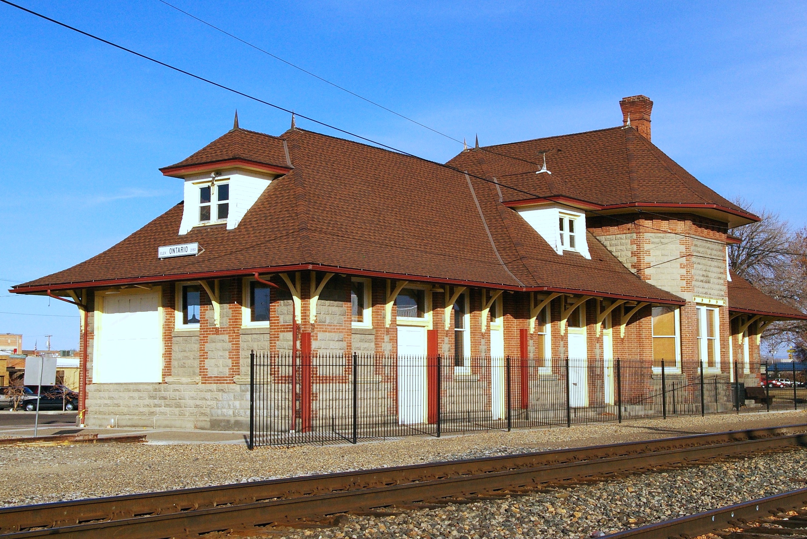
43°58′51″N 117°14′22″W / 43.98083°N 117.23944°WVale 9 Oregon Short Line Railroad Depot 
August 5, 1999 300 Depot Lane
44°1′26″N 116°57′42″W / 44.02389°N 116.96167°WOntario 10 Oregon Trail Historic District October 29, 1975 5 mi. SE of Vale at Lytle Blvd.
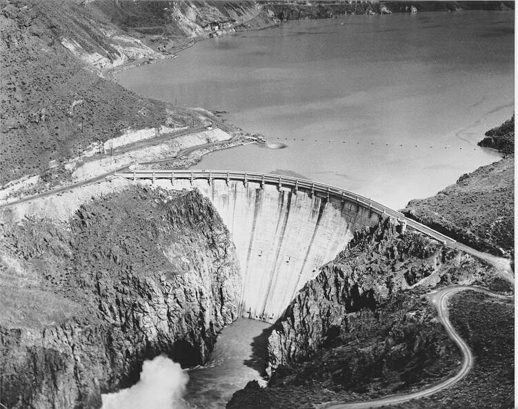
43°54′50″N 117°10′35″W / 43.91389°N 117.17639°WVale 11 Owyhee Dam Historic District 
September 23, 2010[2] Owyhee Lake Road[2]
43°35′30.57″N 117°14′32.60″W / 43.591825°N 117.242389°WAdrian vicinity[2] Historic district including Owyhee Dam that is a NPS featured property 12 Pelota Fronton 
May 19, 1972 Bassett St. (U.S. 95)
42°58′23″N 117°3′3″W / 42.97306°N 117.05083°WJordan Valley 13 Sheep Ranch Fortified House November 1, 1974 W of Arock
42°55′11″N 117°32′45″W / 42.91972°N 117.54583°WArock 14 Al Thompson and Son's Feed and Seed Company September 6, 1996 117 Good Ave.
43°52′33″N 116°59′38″W / 43.87583°N 116.99389°WNyssa 15 Vale Drug Store September 6, 2002 158 Main St. N
43°58′56″N 117°14′20″W / 43.98222°N 117.23889°WVale 16 Vale Hotel and Grand Opera House August 1, 1984 123 S. Main St.
43°58′56″N 117°14′43″W / 43.98222°N 117.24528°WVale 17 Vinsonhaler Blacksmith Shop September 6, 1996 122 Good Ave.
43°52′34″N 116°59′38″W / 43.87611°N 116.99389°WNyssa References
- ^ National Park Service (2001-05-18). "Weekly List of Actions Taken on Properties: 5/07/01 through 5/11/01". http://www.nps.gov/history/nr/listings/20010518.htm. Retrieved 2009-03-24.
- ^ a b c National Park Service (2010-10-01). "Weekly List of Actions Taken on Properties: 9/20/10 through 9/24/10". http://www.nps.gov/history/nr/listings/20101001.htm. Retrieved 2010-10-01.
U.S. National Register of Historic Places in Oregon Lists by county Baker • Benton • Clackamas • Clatsop • Columbia • Coos • Crook • Curry • Deschutes • Douglas • Gilliam • Grant • Harney • Hood River • Jackson • Jefferson • Josephine • Klamath • Lake • Lane • Lincoln • Linn • Malheur • Marion • Morrow • Multnomah: Portland North • Multnomah: Portland Northeast • Multnomah: Portland Northwest • Multnomah: Portland Southeast • Multnomah: Portland Southwest • Multnomah: Other • Polk • Sherman • Tillamook • Umatilla • Union • Wallowa • Wasco • Washington • Wheeler • Yamhill
Other lists Categories:- National Register of Historic Places listings by county in Oregon
- Malheur County, Oregon


Wikimedia Foundation. 2010.