- National Register of Historic Places listings in Hood River County, Oregon
-
 Location of Hood River County in Oregon
The following list presents the full set of National Register of Historic Places listings in Hood River County, Oregon, and offers brief descriptive information about each of them. The National Register of Historic Places (NRHP) recognizes buildings, structures, objects, sites, and districts of national, state, or local historic significance across the United States.[1] Out of over 80,000 NRHP sites nationwide,[2] Oregon is home to approximately 1,900,[3] and approximately 38 of those are found in Hood River County.
-
- This National Park Service list is complete through NPS recent listings posted November 10, 2011.[4]
Contents
Current listings
[5] Site name[6] Image Date listed[6] Location[7] City or Town[8] Summary 1 Barlow Road 
April 13, 1992 Mount Hood National Forest, north of the line of the Salmon and White rivers from southwest of Wamic to Rhododendron[9] (See also Wasco and Clackamas counties.)
45°13′50″N 121°34′47″W / 45.23065°N 121.5797°W (approx.)Wamic to Rhododendron[6] Beginning with its construction by Sam Barlow in 1846, this toll road provided the first overland connection for wagons between The Dalles and Oregon City over the south flanks of Mount Hood, and offered a majority of Oregon Trail emigrants an alternative to the hazardous raft passage down the Columbia River from The Dalles to Fort Vancouver.[10] 2 Butler Bank 
January 27, 2000 301 Oak Avenue
45°42′32″N 121°30′49″W / 45.70889°N 121.5135°WHood River 3 Cascade Locks Marine Park 
May 15, 1974 On the Columbia River
45°40′09″N 121°53′43″W / 45.66928°N 121.8954°WCascade Locks The opening of the Cascade Locks and Canal in 1896 allowed Columbia River steamboats to bypass the treacherous and usually impossible run through the Cascades Rapids, immediately improving river borne commerce. Much of the canal was submerged and rendered unnecessary by construction of the Bonneville Dam in 1938.[11] 4 Cascade Locks Work Center 
April 11, 1986 Mount Hood National Forest[6]
45°40′55″N 121°50′41″W / 45.68188°N 121.8448°WCascade Locks 5 Cliff Lodge 
May 5, 2000 3345 Cascade Avenue
45°42′38″N 121°32′45″W / 45.71062°N 121.5458°WHood River vicinity 6 Cloud Cap Inn 
October 18, 1974 Northeast flank of Mount Hood
45°24′13″N 121°39′17″W / 45.40359°N 121.6548°WParkdale vicinity 7 Cloud Cap – Tilly Jane Recreation Area Historic District 
March 22, 1981 South of Parkdale[6]
45°24′35″N 121°38′55″W / 45.40966°N 121.6485°WParkdale vicinity 8 Ernest S. and Clara C. Colby House 
July 14, 2000 1219 Columbia Avenue
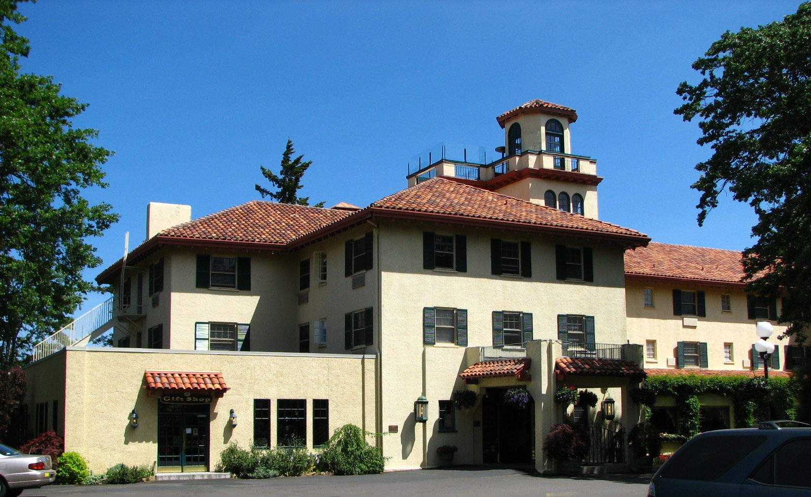
45°42′36″N 121°31′25″W / 45.71008°N 121.5237°WHood River 9 Columbia Gorge Hotel 
September 21, 1979 4000 Westcliff Drive
45°42′42″N 121°33′15″W / 45.71169°N 121.5543°WHood River 10 Columbia River Highway Historic District 
December 12, 1983 Linear district roughly bounded by the Chenoweth Creek Bridge, The Dalles, on the east, and the Sandy River Bridge, Troutdale, on the west[9] (See also Wasco and Multnomah counties.)
45°42′14.15″N 121°37′03.18″W / 45.7039306°N 121.61755°W (approx.)Troutdale to The Dalles[12] Constructed between 1913 and 1922, this was the first scenic highway in the United States. Designed specifically to provide visitors access to the most outstanding of the scenic features of the Columbia River Gorge, the highway is also an outstanding example of modern highway development for its pioneering advances in road engineering, and is the single most important contribution to the fields of civil engineering and landscape architecture by Samuel C. Lancaster.[13] 11 Simpson Copple House 
March 6, 1987 911 Montello Avenue
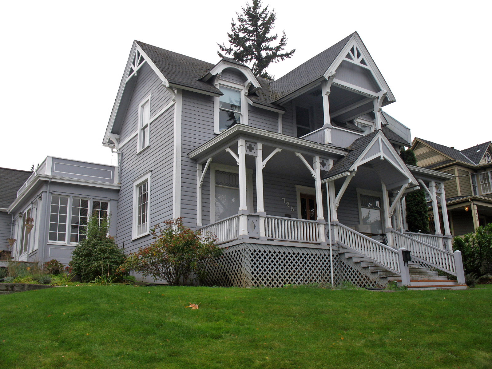
45°42′20″N 121°31′12″W / 45.70552°N 121.5201°WHood River 12 Davidson–Childs House 
October 30, 1989 725 Oak Street
45°42′32″N 121°31′04″W / 45.70887°N 121.5178°WHood River 13 Edward J. DeHart House 
February 23, 1990 3820 Westcliff Drive
45°42′45″N 121°32′44″W / 45.71251°N 121.5455°WHood River 14 John C. Duckwall House 
June 16, 1989 811 Oak Street
45°42′32″N 121°31′08″W / 45.70881°N 121.519°WHood River 15 First National Bank of Hood River 
January 26, 2006 304 Oak Street
45°42′32″N 121°30′49″W / 45.70892°N 121.5135°WHood River 16 Orrin B. Hartley House 
October 30, 1989 1029 State Street
45°42′29″N 121°31′18″W / 45.70794°N 121.5218°WHood River 17 Heilbronner Block 
January 26, 2006 110–118 3rd Street
45°42′34″N 121°30′48″W / 45.70945°N 121.5134°WHood River 18 Martin and Carrie Hill House 
July 17, 2007 2265 Highway 35
45°39′29″N 121°30′42″W / 45.658056°N 121.511667°W[6]Hood River vicinity Known today as the Gorge White House, the 1910 Dutch Colonial house is open to the public.[14] 19 Hood River County Library and Georgiana Smith Park 
May 29, 1998 502 State Street
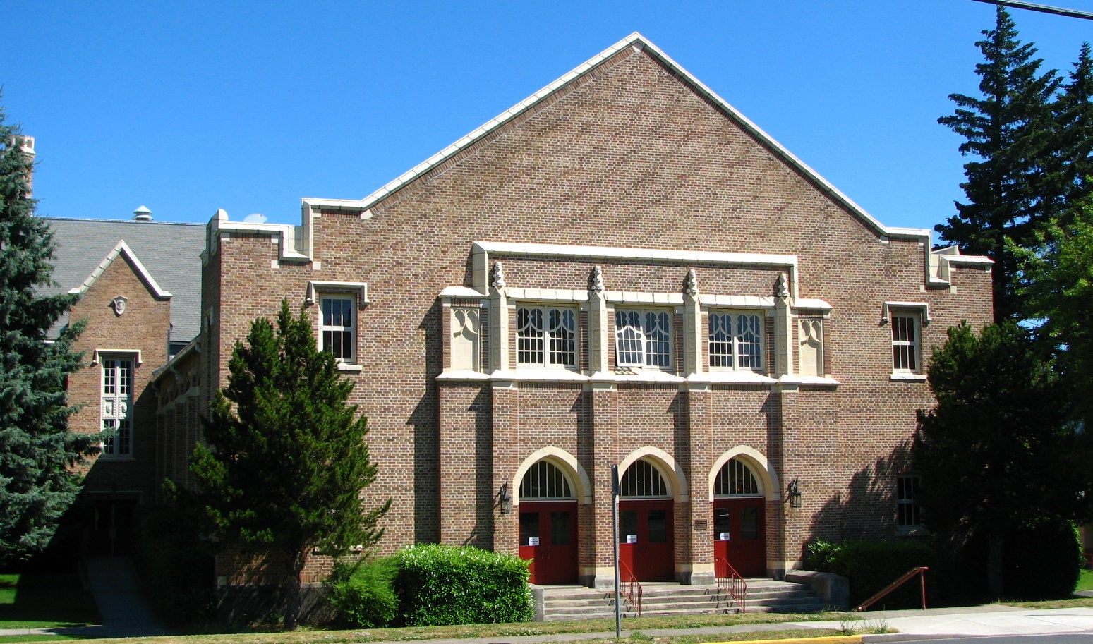
45°42′29″N 121°30′55″W / 45.70819°N 121.5154°WHood River 20 Hood River High School 
May 5, 1999 1602 May Street
45°42′15″N 121°31′43″W / 45.70405°N 121.5286°WHood River 21 IOOF – Paris Fair Building 
October 25, 1990 315 Oak Street
45°42′32″N 121°30′49″W / 45.70889°N 121.5136°WHood River 22 Robert and Mabel Loomis House 
October 25, 1990 1100 State Street
45°42′29″N 121°31′21″W / 45.70795°N 121.5224°WHood River 23 Mount Hood Hotel Annex 
January 21, 1994 102–108 Oak Street
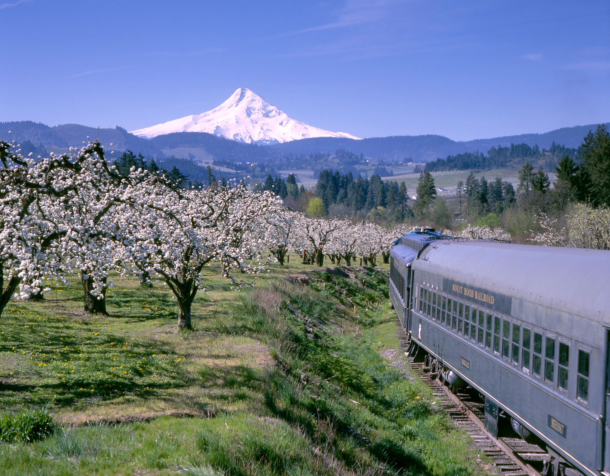
45°42′33″N 121°30′41″W / 45.70911°N 121.5114°WHood River 24 Mount Hood Railroad Linear Historic District 
January 24, 1994 Along the Mount Hood Railroad right-of-way from Hood River to Parkdale,[9] northern terminus at 110 Railroad Avenue, Hood River
45°36′25″N 121°34′31″W / 45.60697°N 121.5754°WHood River to Parkdale[6] 25 Mount Hood School House 
April 30, 1987 Oregon Route 35
45°32′21″N 121°34′00″W / 45.53916°N 121.5668°WMount Hood[15] 26 Lester and Hazel Murphy House 
October 25, 1990 1006 Sherman Street
45°42′26″N 121°31′17″W / 45.70721°N 121.5213°WHood River 27 Oak Grove Schoolhouse 
March 5, 1979 2121 Reed Road
45°39′38.72″N 121°35′10.64″W / 45.6607556°N 121.5862889°WHood River vicinity 28 Oregon–Washington Railroad and Navigation Company Passenger Station 
July 28, 1988 Foot of 1st Street[6]
45°42′35″N 121°30′42″W / 45.70983°N 121.5117°WHood River 29 Parkdale Ranger Station 
April 11, 1986 45°31′12″N 121°35′26″W / 45.51994°N 121.5905°W Parkdale vicinity 30 Miles B. and Eleanor Potter House 
October 8, 1992 4095 Belmont Drive
45°41′35″N 121°33′30″W / 45.69299°N 121.5582°WHood River vicinity 31 Ries–Thompson House 
October 8, 1992 4993 Baseline Road
45°31′11″N 121°35′56″W / 45.51961°N 121.599°WParkdale 32 Roe–Parker House 
March 9, 1988 416 State Street
45°42′29″N 121°30′53″W / 45.70819°N 121.5147°WHood River 33 Shaw–Dumble House 
October 30, 1990 318 9th Street
45°42′28″N 121°31′13″W / 45.70783°N 121.5202°WHood River 34 J.E. Slade House 
February 23, 1989 1209 State Street
45°42′29″N 121°31′25″W / 45.70792°N 121.5236°WHood River 35 E.L. Smith Building 
June 19, 1991 213–215 Oak Street
45°42′32″N 121°30′48″W / 45.70877°N 121.5132°WHood River 36 Clark Thompson House 
March 2, 1989 22 NW Cragmont Avenue
45°40′26″N 121°53′03″W / 45.67375°N 121.8841°WCascade Locks 37 Valley Theater 
June 1, 1990 4945 Baseline Road
45°31′10″N 121°35′49″W / 45.51958°N 121.597°WParkdale 38 Waucoma Hotel 
December 10, 1981 102–108 2nd Street
45°42′34″N 121°30′45″W / 45.70948°N 121.5124°WHood River See also
- National Register of Historic Places listings in Oregon
- Listings in adjacent counties: Clackamas, Klickitat, Multnomah, Skamania, Wasco
- List of National Historic Landmarks in Oregon
- Historic preservation
- History of Oregon
- Lists of Oregon-related topics
References
- ^ National Park Service (1997). "How to Apply the National Register Criteria for Evaluation". http://www.nps.gov/history/nr/publications/bulletins/nrb15/nrb15.pdf. Retrieved 2008-12-17.
- ^ National Park Service. "National Register Research". National Register of Historic Places. http://www.nps.gov/nr/research/index.htm. Retrieved 2008-12-17.
- ^ Oregon Parks and Recreation Department (2009-01-05). "Oregon National Register List". http://www.oregonheritage.org/OPRD/HCD/NATREG/docs/oregon_nr_list.pdf. Retrieved 2009-02-14.
- ^ "National Register of Historic Places: Weekly List Actions". National Park Service, United States Department of the Interior. Retrieved on November 10, 2011.
- ^ Numbers represent an ordering by significant words (e.g. last name). Various colorings (defined here) differentiate standalone NRHP sites from NRHP sites that also hold status as National Historic Landmarks, historic districts, National Historical Parks, or hold other historic designations.
- ^ a b c d e f g h National Park Service. "National Register Information System". http://www.cr.nps.gov/NR/research/nris.htm. Retrieved 2009-02-22.
- ^ Text: Except as otherwise noted, all entries are drawn from: Oregon Parks and Recreation Department (2009-01-05). "Oregon National Register List". http://www.oregonheritage.org/OPRD/HCD/NATREG/docs/oregon_nr_list.pdf.
Coordinates: Except as otherwise noted, all entries are drawn from either: (a) Google Earth KMZ files available at: National Park Service. "National Register Information System". http://www.cr.nps.gov/NR/research/nris.htm. (b) A Google Earth search for the given street address. In limited instances, editors have adjusted coordinates for accuracy. - ^ Except as otherwise noted, all entries are drawn from: Oregon Parks and Recreation Department (2009-01-05). "Oregon National Register List". http://www.oregonheritage.org/OPRD/HCD/NATREG/docs/oregon_nr_list.pdf. Retrieved 2009-02-14. In limited instances where the source locates the site in the "vicinity" of a city or town, editors may have removed the "vicinity" qualifier in the interest of clarity. In other instances, editors may similarly have added a "vicinity" qualifier.
- ^ a b c National Park Service. "National Register Information System". http://www.cr.nps.gov/NR/research/nris.htm. Retrieved 2010-09-09.
- ^ Clackamas Heritage Partners (2008). "The Final Leg of the Trail". Historic Oregon City. http://www.historicoregoncity.org/HOC/index.php?option=com_content&view=article&id=142:final-leg&catid=70:oregon-trail-history&Itemid=75. Retrieved 2009-02-22.
- ^ Northwest Power and Conservation Council. "Columbia River Chronology". http://www.nwcouncil.org/history/Chronology.asp. Retrieved 2009-03-26.
- ^ Smith, Dwight A. (October 3, 1983). National Register of Historic Places Inventory–Nomination Form: Columbia River Highway Historic District. OCLC 12786411.
- ^ National Park Service. "National Historic Landmark Program: NHL Database". http://tps.cr.nps.gov/nhl/default.cfm. Retrieved 2007-10-14.
- ^ "History". The Gorge White House. http://www.thegorgewhitehouse.com/history.html. Retrieved 2009-12-29.
- ^ Note that Mount Hood School House is located at the community of Mount Hood, rather than at the mountain for which the community was named.
External links
Municipalities and communities of Hood River County, Oregon Cities 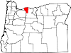
CDPs Communities Dee | Lenz | Mount Hood | Pine Grove | Wyeth
U.S. National Register of Historic Places in Oregon Lists by county Baker • Benton • Clackamas • Clatsop • Columbia • Coos • Crook • Curry • Deschutes • Douglas • Gilliam • Grant • Harney • Hood River • Jackson • Jefferson • Josephine • Klamath • Lake • Lane • Lincoln • Linn • Malheur • Marion • Morrow • Multnomah: Portland North • Multnomah: Portland Northeast • Multnomah: Portland Northwest • Multnomah: Portland Southeast • Multnomah: Portland Southwest • Multnomah: Other • Polk • Sherman • Tillamook • Umatilla • Union • Wallowa • Wasco • Washington • Wheeler • Yamhill
Other lists U.S. National Register of Historic Places Topics Lists by states Alabama • Alaska • Arizona • Arkansas • California • Colorado • Connecticut • Delaware • Florida • Georgia • Hawaii • Idaho • Illinois • Indiana • Iowa • Kansas • Kentucky • Louisiana • Maine • Maryland • Massachusetts • Michigan • Minnesota • Mississippi • Missouri • Montana • Nebraska • Nevada • New Hampshire • New Jersey • New Mexico • New York • North Carolina • North Dakota • Ohio • Oklahoma • Oregon • Pennsylvania • Rhode Island • South Carolina • South Dakota • Tennessee • Texas • Utah • Vermont • Virginia • Washington • West Virginia • Wisconsin • WyomingLists by territories Lists by associated states Other Categories:- National Register of Historic Places listings by county in Oregon
- Hood River County, Oregon
-


Wikimedia Foundation. 2010.