- National Register of Historic Places listings in Marion County, Oregon
-
 Location of Marion County in Oregon
The following list presents the full set of National Register of Historic Places listings in Marion County, Oregon, and offers brief descriptive information about each of them. The National Register of Historic Places (NRHP) recognizes buildings, structures, objects, sites, and districts of national, state, or local historic significance across the United States.[1] Out of over 80,000 NRHP sites nationwide,[2] Oregon is home to approximately 1,900,[3] and 106 of those are found in Marion County. At least three other Marion County sites that were once listed have been removed from the Register.
-
- This National Park Service list is complete through NPS recent listings posted November 10, 2011.[4]
Contents
Current listings
[5] Site name[6] Image Date listed[6] Location[7] City or Town[8] Summary 1 Louis J. Adams House image pending March 12, 2011 423 W. Main St.
45°0′11″N 122°47′13″W / 45.00306°N 122.78694°WSilverton Silverton, Oregon, and Its Environs MPS 2 Adolph Block 
February 1, 1980 360–372 State Street NE
44°56′24″N 123°02′21″W / 44.94013°N 123.0393°WSalem 3 Samuel Adolph House 
October 2, 1978 2493 State Street
44°55′57″N 123°00′37″W / 44.9326°N 123.0103°WSalem 4 James Mechlin Anderson House image pending October 16, 1979 728 Ankeny Hill Road
44°46′36″N 123°02′46″W / 44.7767°N 123.0462°WJefferson 5 Aurora Colony Historic District 
April 16, 1974 District roughly bounded by Cemetery Road, Bobs Avenue, and Liberty Street
45°13′57″N 122°45′30″W / 45.23258°N 122.7584°W (approx.)Aurora 6 Bank of Woodburn 
September 27, 1996 199 N Front Street
45°08′31″N 122°51′27″W / 45.14181°N 122.8574°WWoodburn 7 Oliver Beers House image pending August 1, 1984 10602 Wheatland Road, N
45°04′23″N 123°01′24″W / 45.07305°N 123.0232°WGervais vicinity 8 Frederick Bents House 
December 9, 1981 22776 Bents Road, NE
45°14′54″N 122°48′40″W / 45.24829°N 122.8111°WAurora vicinity Originally built in 1887, this French Prairie farmhouse expanded several times over subsequent years, resulting in an unusual admixture of multiple 19th-century architectural styles. It reflects the changing requirements of farm life and economics over a long period in this portion of the Willamette Valley.[9] 9 R.P. Boise Building 
December 2, 1981 217 State Street
44°56′26″N 123°02′28″W / 44.9406°N 123.0411°WSalem 10 Boon Brick Store 
November 20, 1975 888 Liberty Street, NE
44°56′55″N 123°01′59″W / 44.94859°N 123.033°WSalem 11 John D. Boon House 
January 17, 1975 1313 Mill Street, SE[6]
44°56′02″N 123°01′39″W / 44.93382°N 123.0275°WSalem Included in the Mission Mill Museum.[10] 12 Charles and Martha Brown House image pending September 6, 2002 425 N First Avenue
44°47′53″N 122°47′40″W / 44.798°N 122.7944°WStayton 13 Sam Brown House 
November 5, 1974 12878 Portland Road, NE
45°06′21″N 122°53′12″W / 45.10576°N 122.8868°WGervais 14 Burggraf–Burt–Webster House 
April 1, 1980 901 13th Street, SE
44°55′43″N 123°01′45″W / 44.92868°N 123.0293°WSalem 15 Bush and Brey Block and Annex 
December 21, 1981 179–197 Commercial Street, NE
44°56′30″N 123°02′25″W / 44.94153°N 123.0402°WSalem 16 Asahel Bush House 
January 21, 1974 600 Mission Street, SE
44°55′56″N 123°02′20″W / 44.93216°N 123.0388°WSalem 17 Bush–Breyman Block 
February 17, 1978 141–147 Commercial Street, NE
44°56′28″N 123°02′25″W / 44.94117°N 123.0404°WSalem 18 Calvary Lutheran Church and Parsonage 
June 6, 1985 310–314 Jersey Street
45°00′16″N 122°46′52″W / 45.0045°N 122.781°WSilverton 19 Hamilton Campbell House image pending March 13, 1979 Route 1
44°45′37″N 123°01′41″W / 44.76031°N 123.0281°WJefferson vicinity 20 William Case Farm 
March 21, 1973 20755 Case Road, NE
45°13′21″N 122°52′49″W / 45.2226°N 122.8804°WAurora 21 Champoeg Cemetery 
January 21, 2004 Champoeg Cemetery Road
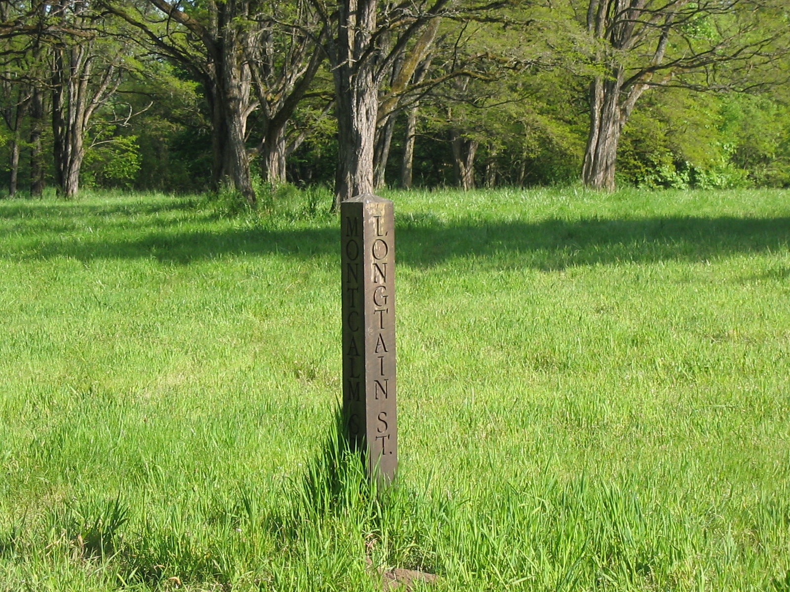
45°14′20″N 122°52′34″W / 45.23898°N 122.8762°WAurora 22 Champoeg State Park Historic Archeological District 
August 1, 1984 8239 Champoeg Road, NE
45°14′53.67″N 122°53′37.09″W / 45.2482417°N 122.8936361°W[11]St. Paul 23 Chemawa Indian School Site 
December 16, 1992 3700 Chemawa Road, NE
45°00′04″N 122°59′42″W / 45.00118°N 122.9951°WChemawa 24 Chemeketa Lodge No. 1 Odd Fellows Buildings 
April 8, 1988 185–195 High Street, NE
44°56′27″N 123°02′14″W / 44.94072°N 123.0371°WSalem 25 George Collins House 
December 1, 1989 1340 Chemeketa Street, NE
44°56′19″N 123°01′27″W / 44.93872°N 123.0241°WSalem 26 Jacob Conser House image pending January 21, 1974 114 Main Street
44°43′04″N 123°00′42″W / 44.7179°N 123.0117°WJefferson 27 Court Street – Chemeketa Street Historic District 
August 26, 1987 District roughly along Chemeketa and Court Streets, between Mill Creek and 14th Street
44°56′15″N 123°01′15″W / 44.93742°N 123.0208°W (approx.)Salem 28 Curtis Cross House 
December 18, 1981 1635 Fairmount Avenue, S
44°55′30″N 123°02′56″W / 44.92496°N 123.0489°WSalem 29 Dr. William A. Cusick House image pending February 23, 1990 415 Lincoln Street, S
44°55′31″N 123°02′56″W / 44.92536°N 123.049°WSalem 30 Alexander Daue House image pending June 6, 1985 1095 Saginaw Street
44°55′49″N 123°02′44″W / 44.93039°N 123.0455°WSalem 31 Murton E. and Lillian DeGuire House image pending March 12, 2011 631 B St.
45°0′35″N 122°46′46″W / 45.00972°N 122.77944°WSilverton Silverton, Oregon, and Its Environs MPS 32 Deidrich Building 
July 7, 2006 195 N 3rd Avenue
44°47′47″N 122°47′33″W / 44.79632°N 122.7924°WStayton 33 Delaney–Edwards House image pending July 23, 2004 4292 Delaney Road, SE
44°50′37″N 122°58′18″W / 44.84371°N 122.9717°WSalem 34 Joseph Despard Cabin Site image pending October 31, 1991 45°12′39.89″N 122°58′35.75″W / 45.2110806°N 122.9765972°W[12] St. Paul[6] 35 June D. Drake House image pending March 12, 2011 409 S. Water St.
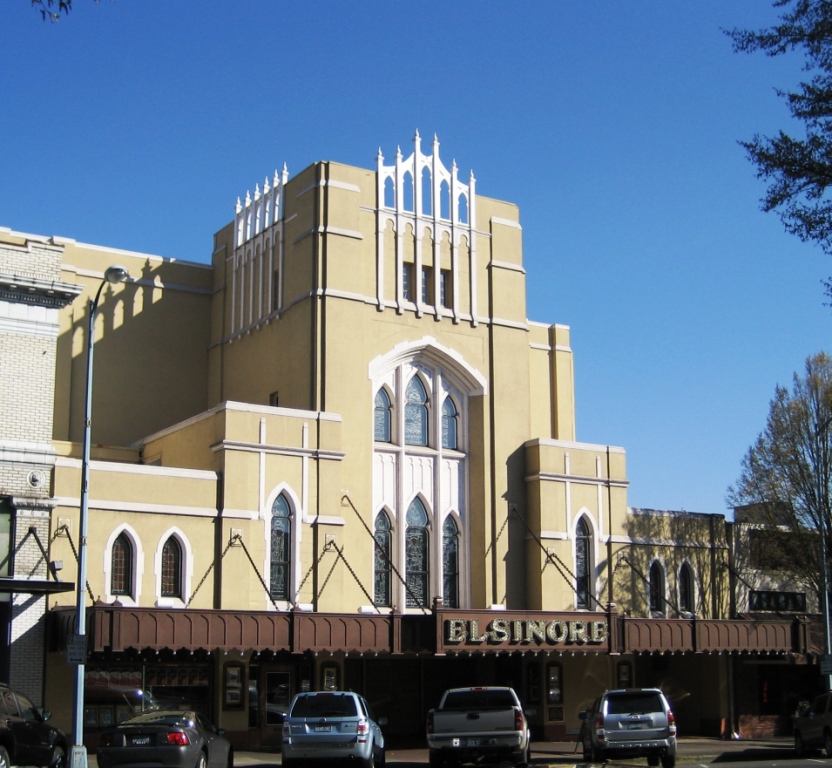
45°0′12″N 122°46′52″W / 45.00333°N 122.78111°WSilverton Silverton, Oregon, and Its Environs MPS 36 Elsinore Theater 
June 17, 1994 170 High Street, SE
44°56′20″N 123°02′15″W / 44.93892°N 123.0375°WSalem 37 Farrar Building 
August 26, 1982 351–373 State Street
44°56′25″N 123°02′21″W / 44.94015°N 123.0393°WSalem 38 Henry Fawk House 
February 20, 1991 310 Lincoln Street, S
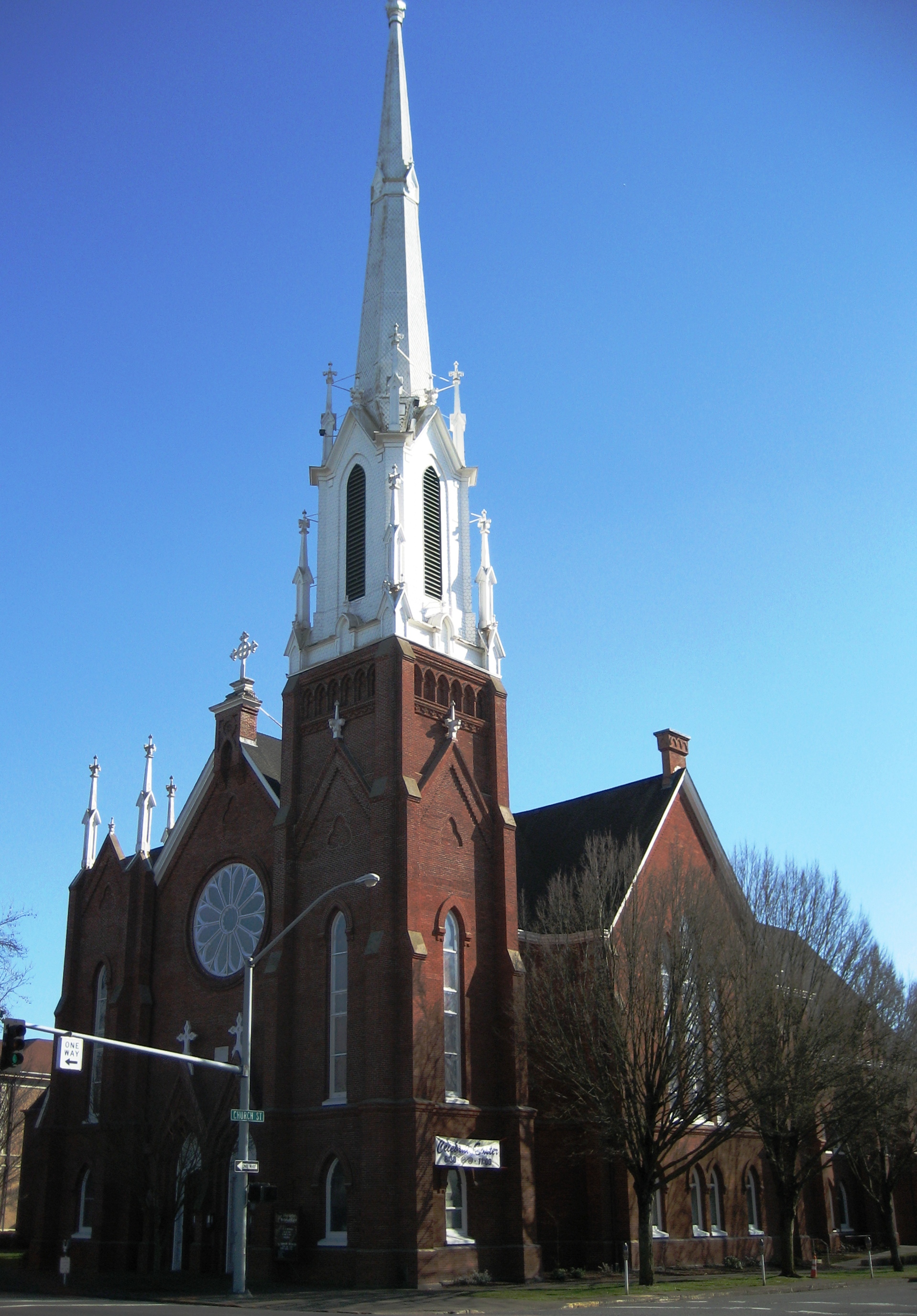
44°55′31″N 123°02′51″W / 44.92527°N 123.0476°WSalem 39 First Methodist Episcopal Church of Salem 
May 9, 1983 600 State Street
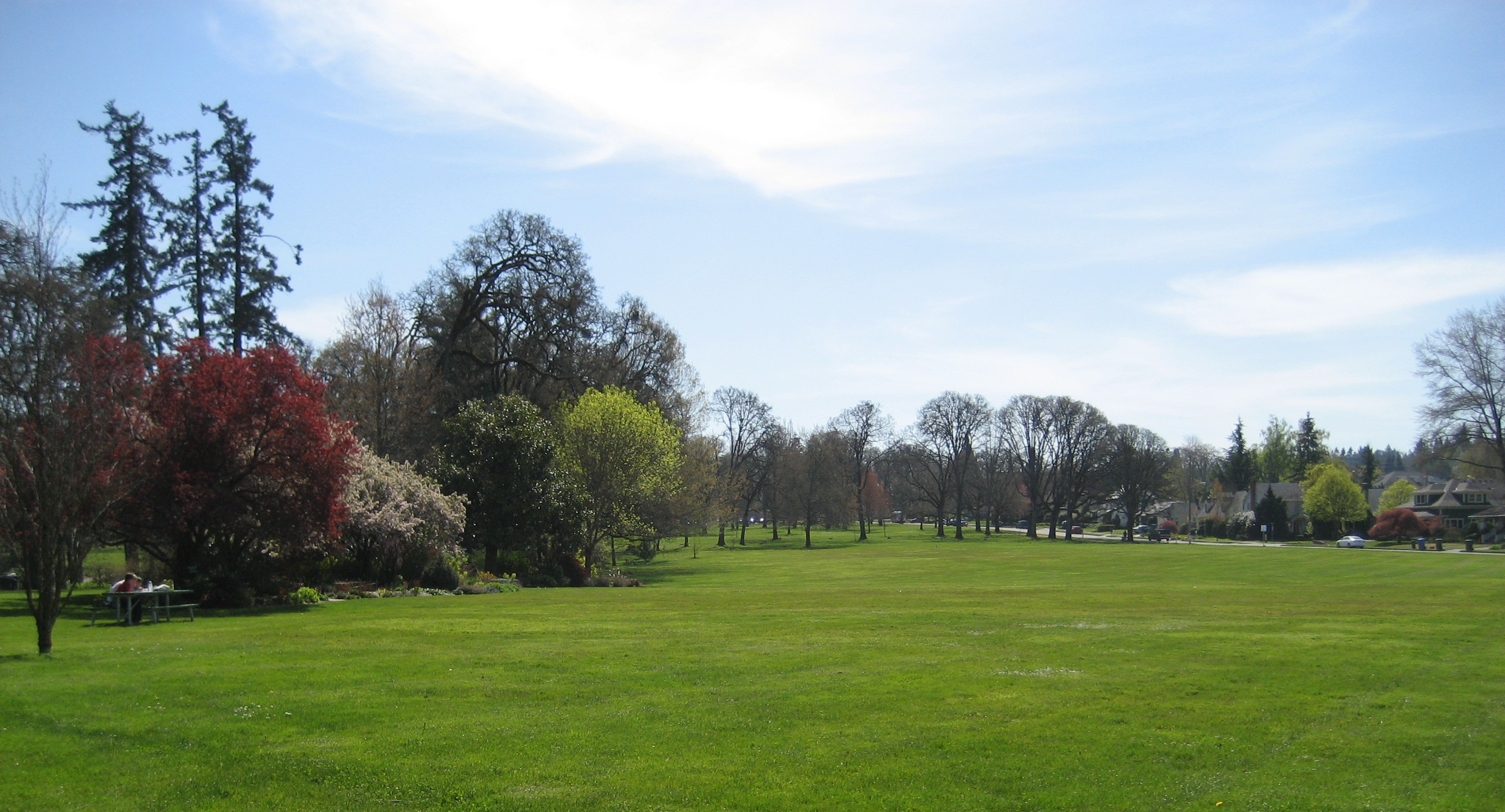
44°56′21″N 123°02′07″W / 44.93912°N 123.0354°WSalem 40 Gaiety Hill – Bush's Pasture Park Historic District 
October 10, 1986 Roughly bounded by Pringle Creek, Mission Street, Bush's Pasture Park, and Cross, High, and Liberty Streets
44°55′50″N 123°02′11″W / 44.93068°N 123.0365°W (approx.)Salem 41 Gallon House Bridge 
November 29, 1979 Abiqua Creek
45°01′56″N 122°47′53″W / 45.03218°N 122.7981°WSilverton vicinity 42 R.C. Geer Farmhouse image pending February 12, 1980 12390 Sunnyview Road
44°56′28″N 122°48′26″W / 44.94106°N 122.8072°WSalem vicinity 43 Andrew T. Gilbert House 
November 6, 1980 116 Marion Street, NE
44°56′42.95″N 123°02′27.64″W / 44.9452639°N 123.0410111°W[11]Salem 44 J.K. Gill Building 
February 1, 1980 356 State Street
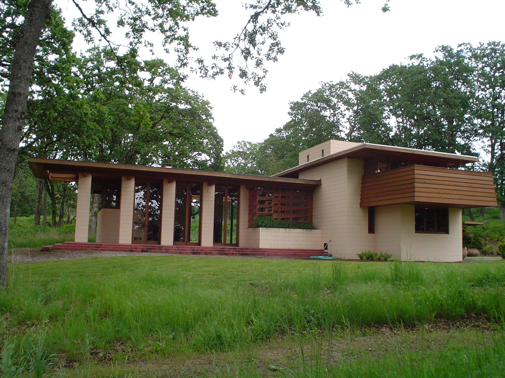
44°56′25″N 123°02′23″W / 44.94017°N 123.0396°WSalem 45 Gordon House 
September 22, 2004 879 W Main Street
44°59′55″N 122°47′36″W / 44.99857°N 122.7932°WSilverton 46 Benjamin F. Harding House image pending December 21, 1981 1043 High Street, SE
44°55′50″N 123°02′28″W / 44.9306°N 123.0412°WSalem 47 Hinkle–Reid House 
January 21, 1994 525 NE Alder Street
44°45′18″N 122°28′14″W / 44.75493°N 122.4706°WMill City 48 Hudson's Bay Company Granary and Clerk's House Site image pending October 31, 1991 45°12′39.89″N 122°58′35.75″W / 45.2110806°N 122.9765972°W[12] St. Paul[6] 49 Daniel B. Jarman House and Garden 
December 6, 1979 567 High Street, SE
44°56′06″N 123°02′23″W / 44.93497°N 123.0396°WSalem 50 Jefferson Methodist Church image pending November 6, 1980 310–342 N 2nd Street
44°43′12″N 123°00′38″W / 44.71999°N 123.0105°WJefferson 51 Jones–Sherman House 
December 21, 1981 835 D Street, NE
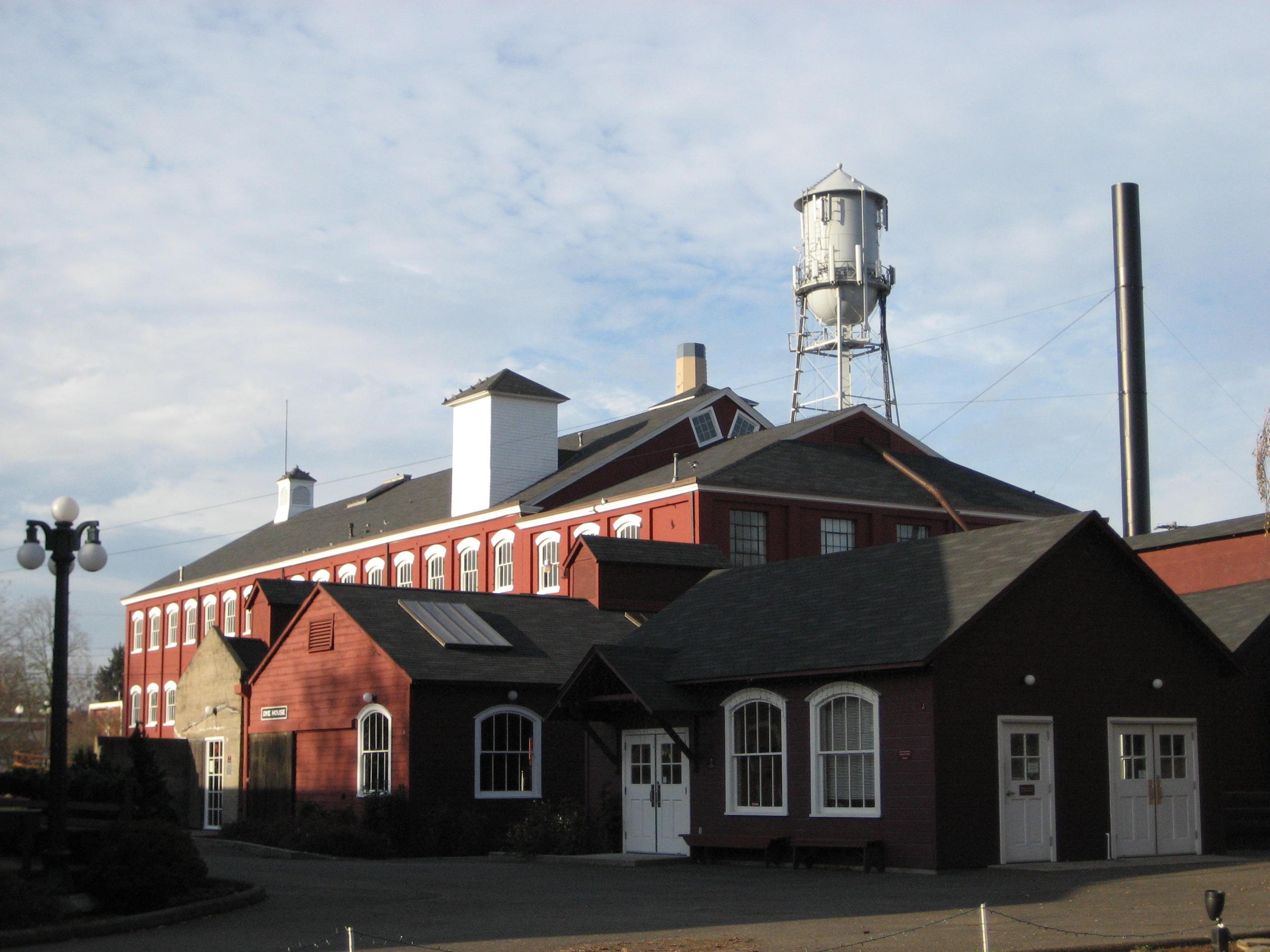
44°56′49″N 123°01′38″W / 44.94701°N 123.0273°WSalem 52 Thomas Kay Woolen Mill 
May 8, 1973 1313 Mill Street, SE
44°56′06″N 123°01′38″W / 44.93496°N 123.0273°WSalem Included in the Mission Mill Museum.[10] 53 John W. and Thomas F. Kirk House image pending June 17, 1987 4686 St. Paul Highway, NE
45°12′32″N 122°57′49″W / 45.20877°N 122.9635°WSt. Paul 54 Frederick S. Lamport House image pending June 19, 1991 590 Lower Ben Lomond Drive, SE
44°55′01″N 123°02′21″W / 44.91698°N 123.0392°WSalem 55 Lee Mission Cemetery 
December 29, 1978 D Street
44°56′34″N 123°00′35″W / 44.94278°N 123.0097°WSalem 56 Jason Lee House 
April 23, 1973 260 12th Street, SE
44°56′02″N 123°01′39″W / 44.93382°N 123.0275°WSalem Included in the Mission Mill Museum.[10] 57 T.A. Livesley House image pending April 26, 1990 533 Lincoln Street, S
44°55′31″N 123°02′59″W / 44.92537°N 123.0497°WSalem 58 S.A. Manning Building 
February 10, 1987 200–210 State Street
44°56′26″N 123°02′29″W / 44.9406°N 123.0413°WSalem 59 Marion County Housing Committee Demonstration House image pending August 11, 1988 140 Wilson Street, S
44°55′42″N 123°02′41″W / 44.92822°N 123.0448°WSalem 60 McCallister–Gash Farmhouse image pending November 6, 1980 9626 Kaufman Road
44°58′06″N 122°51′50″W / 44.96846°N 122.864°WSilverton vicinity 61 David McCully House image pending February 14, 1978 1365 John Street, S
44°55′40″N 123°03′00″W / 44.92788°N 123.0501°WSalem 62 Methodist Mission Parsonage 
December 31, 1974 1313 Mill Street, SE
44°56′02″N 123°01′39″W / 44.93382°N 123.0275°WSalem Included in the Mission Mill Museum.[10] 63 Miller Cemetery Church image pending August 10, 1978 Cascade Highway, NE
45°02′21″N 122°43′46″W / 45.03915°N 122.7295°WSilverton vicinity 64 John and Douglas Minto Houses image pending December 18, 1981 835 Saginaw Street, S
44°55′59″N 123°02′43″W / 44.93315°N 123.0453°WSalem 65 Carl E. Nelson House 
June 13, 1997 960 E Street, NE
44°56′51″N 123°01′29″W / 44.9474°N 123.0248°WSalem 66 Old First National Bank Building 
October 9, 1986 388 State Street
44°56′24″N 123°02′21″W / 44.94006°N 123.0391°WSalem 67 Old Garfield School 
December 2, 1981 528 Cottage Street, NE
44°56′37″N 123°01′53″W / 44.94357°N 123.0315°WSalem 68 Old Woodburn City Hall 
March 30, 1979 550 N 1st Street
45°08′39″N 122°51′21″W / 45.14413°N 122.8559°WWoodburn 69 Oregon Pacific Railroad Linear Historic District image pending October 29, 1999 Linear district in Marion, Linn, and Jefferson counties[13]
44°42′15.05″N 122°05′24.02″W / 44.7041806°N 122.0900056°W (approx.)[14]Idanha to the Cascade Range summit via Santiam Junction[6] 70 Oregon State Capitol 
June 29, 1988 Capitol Mall
44°56′21″N 123°01′49″W / 44.93928°N 123.0304°WSalem 71 Oregon State Fair Stadium and Poultry Building Ensemble 
June 20, 2002 2330 17th Street, NE
44°57′29″N 123°00′41″W / 44.95796°N 123.0114°WSalem 72 Oregon State Forester's Office Building 
April 15, 1982 2600 State Street
44°55′53″N 123°00′27″W / 44.93148°N 123.0076°WSalem 73 Oregon State Hospital Historic District 
February 28, 2008 2600 Center Street
44°56′23.72″N 123°00′12.78″W / 44.9399222°N 123.00355°W (approx.)[11]Salem 74 Christopher Paulus Building 
March 5, 1992 355–363 Court Street, NE
44°56′30″N 123°02′19″W / 44.94153°N 123.0387°WSalem 75 Edgar T. Pierce House image pending February 21, 1997 1610 Fir Street, S
44°55′30″N 123°02′50″W / 44.92509°N 123.0473°WSalem 76 Pleasant Grove Presbyterian Church 
February 10, 1987 1313 Mill Street, SE
44°56′02″N 123°01′39″W / 44.93382°N 123.0275°WSalem Included in the Mission Mill Museum.[10] 77 Dr. Luke A. Port House 
October 2, 1973 1116 Mission Street, SE
44°55′49″N 123°01′54″W / 44.93023°N 123.0316°WSalem 78 Port–Manning House 
October 2, 1978 4922 Halls Ferry Road, S
44°52′55″N 123°07′52″W / 44.88195°N 123.131°WSalem 79 Queen of Angels Priory 
July 8, 1982 840 S Main Street
45°03′43″N 122°48′10″W / 45.06207°N 122.8029°WMount Angel 80 Reed Opera House and McCornack Block Addition 
March 8, 1978 177–189 Liberty Street, NE
44°56′28″N 123°02′19″W / 44.9411°N 123.0386°WSalem 81 Dr. and Mrs. Charles G. Robertson House and Garden image pending May 19, 1983 460 Leffelle Street, S
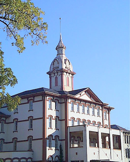
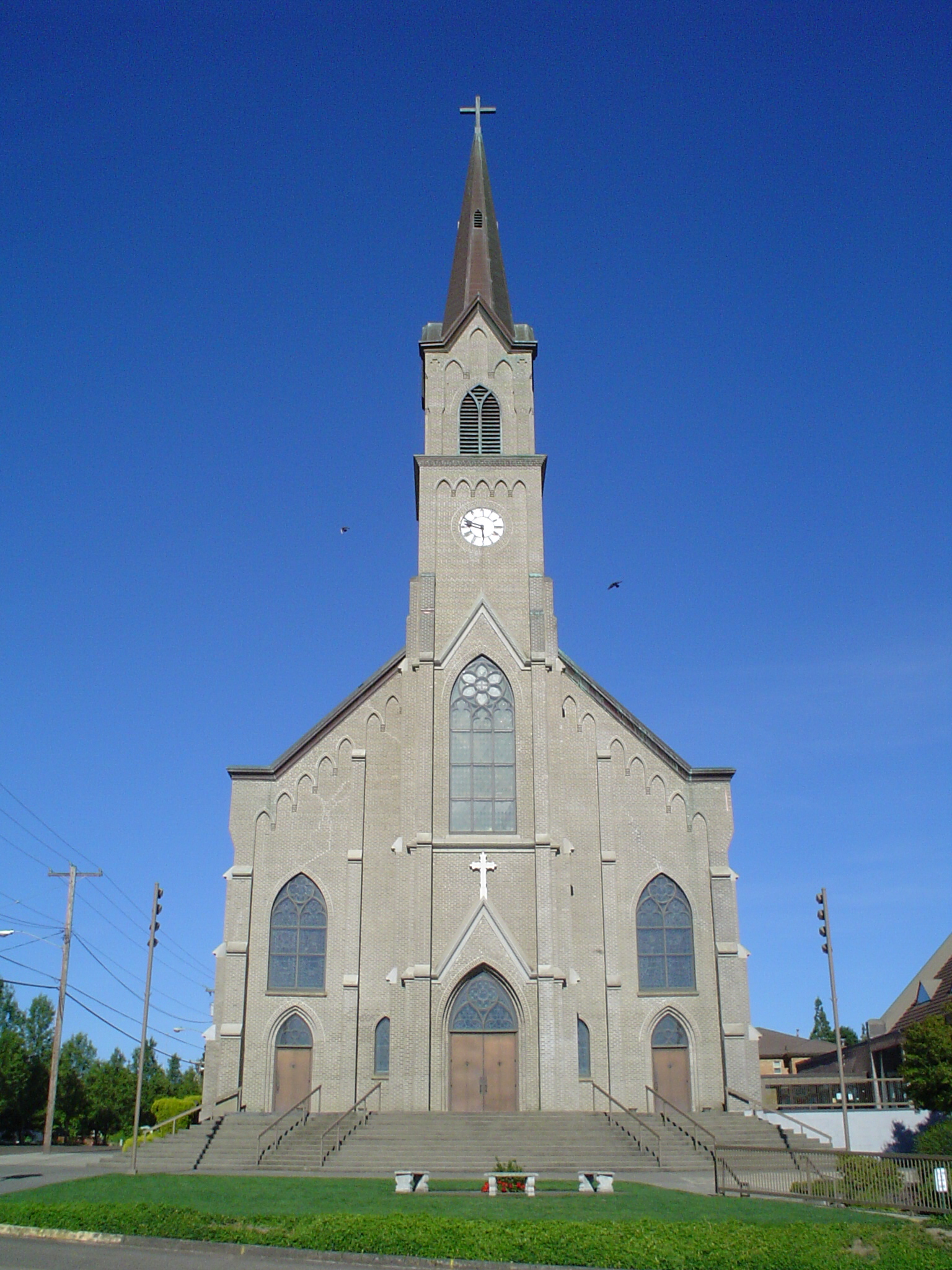
44°55′35″N 123°02′57″W / 44.92637°N 123.0493°WSalem 82 St. Mary's Roman Catholic Church 
October 22, 1976 575 E College Street
45°04′03″N 122°47′38″W / 45.06747°N 122.7939°WMount Angel 83 St. Paul Historic District 
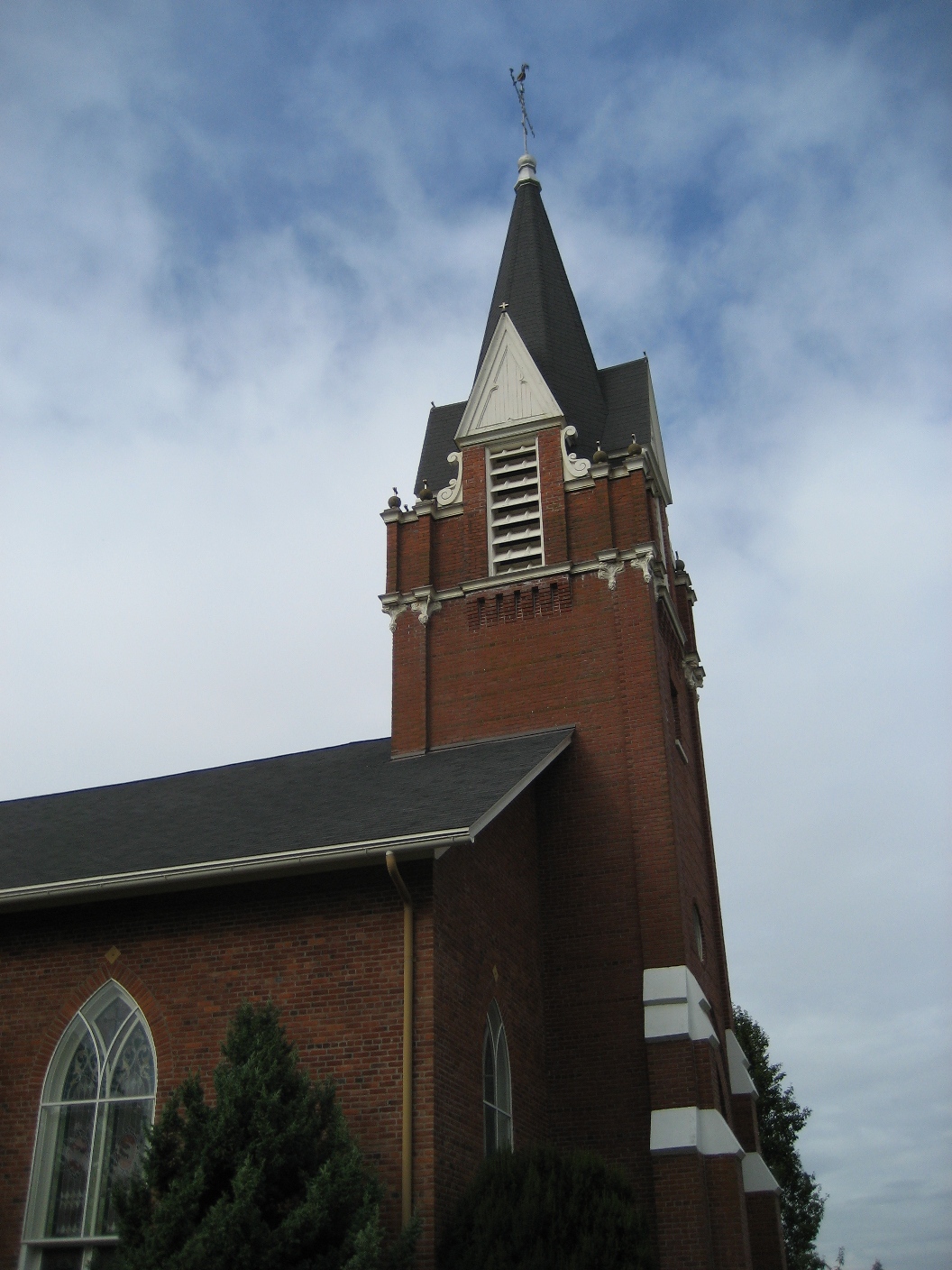
March 15, 1982 45°12′35″N 122°58′34″W / 45.20969°N 122.9761°W (approx.) St. Paul 84 St. Paul Roman Catholic Church 
October 16, 1979 Junction of Christie Street and Mission Avenue, NE
45°12′43″N 122°58′42″W / 45.21181°N 122.9783°WSt. Paul 85 Salem Downtown State Street – Commercial Street Historic District 
September 28, 2001 Roughly bounded by Ferry, High, Chemeketa, and Front Streets[6]
44°56′24″N 123°02′22″W / 44.94009°N 123.0394°W (approx.)Salem Located on the Willamette River transportation corridor and near Jason Lee's Mission Mill, Salem's central business district was first platted in 1846. Subsequent development patterns closely reflected the drivers of Salem's growth as an important agricultural and commercial center. Surviving buildings represent a wide range of architectural styles from the 1860s through the 1950s.[15] 86 Salem Southern Pacific Railroad Station[16] 
February 12, 2010[16] 500 13th Avenue, SE[16]
44°55′51.86″N 123°01′41.51″W / 44.9310722°N 123.0281972°W[11]Salem[16] This grand Beaux-Arts style train station, completed in 1918, is the third station to occupy the same site. The adjacent REA freight terminal is a remnant of the 1889 Queen Anne station that burned in 1917. In 1999, the buildings were restored to their appearance during the first half of the 20th century. The site has been in continuous use for passenger rail service from 1871 through at least 2009.[17] 87 William Riley Scheurer House 
December 23, 1981 23707 1st Street, NE
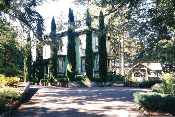
45°15′45″N 122°50′32″W / 45.26252°N 122.8422°WAurora Located in Butteville along the Willamette River. 88 Jesse H. Settlemier House 
December 19, 1974 355 N Settlemier Avenue
45°08′41″N 122°51′40″W / 45.14462°N 122.8612°WWoodburn 89 U.G. Shipley House and Garden 
October 14, 1994 260 Washington Street, S
44°55′27″N 123°02′48″W / 44.92426°N 123.0468°WSalem 90 Silver Creek Youth Camp – Silver Falls State Park image pending June 20, 2002 20024 Silver Falls Highway
44°51′23″N 122°36′36″W / 44.85637°N 122.6099°W (approx.)Sublimity vicinity 91 Silver Falls State Park Concession Building Area 
June 30, 1983 20024 Silver Falls Highway[6]
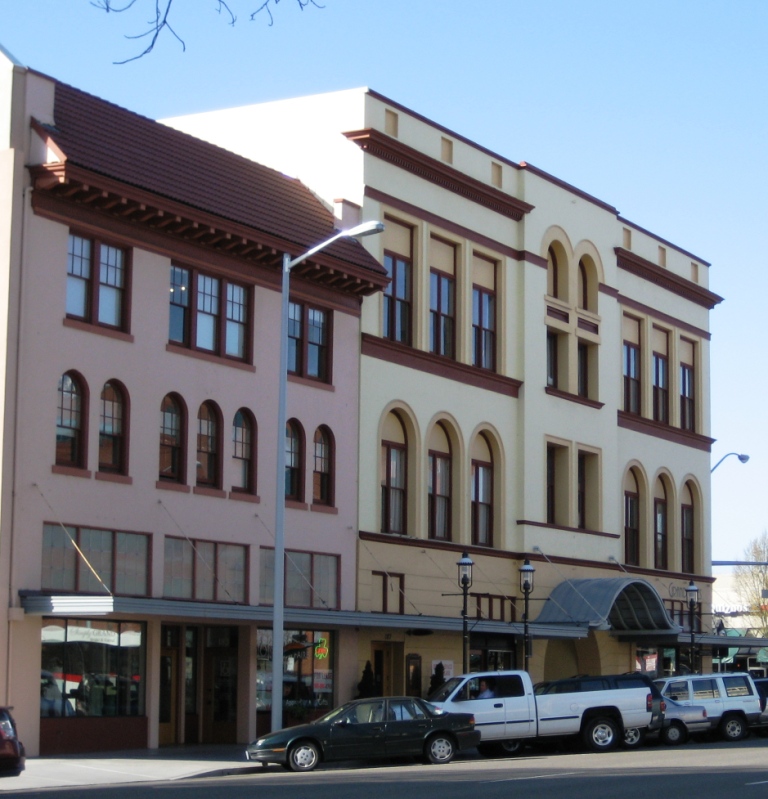
44°52′45″N 122°39′23″W / 44.87925°N 122.6565°W (approx.)Sublimity vicinity 92 Silverton Commercial Historic District 
July 29, 1987 Roughly bounded by High and Oak Streets, Silver Creek, and Lewis, Water, and 1st Streets[6]
45°00′18″N 122°46′58″W / 45.00488°N 122.7828°W (approx.)Silverton These 27 buildings in Silverton's downtown core, dating from between 1870 and 1936, recall the twin stories of water power and commercial development in this small Willamette Valley town.[18] 93 Smith–Ohmart House image pending November 16, 1979 2655 East Nob Hill Street, SE
44°54′55″N 123°02′35″W / 44.91527°N 123.0431°WSalem 94 South First National Bank Block 
March 31, 1983 241–247 Commercial Street, NE
44°56′31″N 123°02′23″W / 44.94191°N 123.0398°WSalem 95 Starkey–McCully Block 
March 12, 1979 223–233 Commercial Street, NE
44°56′31″N 123°02′23″W / 44.94183°N 123.0398°WSalem 96 John Stauffer House and Barn image pending May 1, 1974 13551 Stauffer Road, NE
45°11′37.53″N 122°46′56.60″W / 45.1937583°N 122.782389°W[11]Hubbard 97 C.C. Stratton House 
November 15, 1984 1599 State Street
44°56′08″N 123°01′18″W / 44.93561°N 123.0216°WSalem 98 Union Street Railroad Bridge and Trestle 
January 11, 2006 Junction of Union and Water Streets, NE
44°56′50″N 123°02′31″W / 44.94712°N 123.042°WSalem 99 Victor Point School image pending September 27, 1996 1175 Victor Point Road, SE
44°55′00″N 122°45′20″W / 44.91669°N 122.7556°WSilverton vicinity 100 William Lincoln Wade House image pending February 17, 1978 1305 John Street, S
44°55′42″N 123°03′00″W / 44.92825°N 123.0501°WSalem 101 Waller Hall, Willamette University 
November 20, 1975 900 State Street
44°56′17″N 123°01′52″W / 44.938°N 123.0311°WSalem 102 Williamette Station Site, Methodist Mission in Oregon image pending August 1, 1984 10991 Wheatland Ferry Road
45°04′50.29″N 123°01′52.81″W / 45.0806361°N 123.0313361°W[11]Gervais vicinity 103 Windischar's General Blacksmith Shop 
November 7, 1980 110 Sheridan Street
45°04′03.33″N 122°47′49.59″W / 45.0675917°N 122.7971083°W[19]Mount Angel 104 T.M. and Emma Witten Drug Store – House 
August 12, 1999 104 N Main Street
44°43′04″N 123°00′42″W / 44.71786°N 123.0117°WJefferson 105 Robert Witzel House 
November 15, 1979 6576 Joseph Street, SE
44°53′07″N 122°55′40″W / 44.88515°N 122.9277°WSalem 106 Casper Zorn Farmhouse 
February 12, 1980 8448 Champoeg Road, NE
45°14′43″N 122°53′10″W / 45.24538°N 122.8861°WSt. Paul vicinity Former listings
-
This list is incomplete; you can help by expanding it.
Site name Image Date listed/removed Location City or Town Summary 1 Breitenbush Guard Station image pending April 8, 1986 (listed)[6]
February 7, 2011 (removed)[20]Willamette National Forest44°46′54″N 121°58′03″W / 44.78169°N 121.9676°W Detroit vicinity 2 Paris Woollen Mill[21] image pending December 21, 1981 (listed)[6]
December 24, 2008 (removed)[21]535 E Florence Street (former)[6] Stayton[6] 3 Wilson–Durbin House[22] 
November 7, 1980 (listed)[23]
April 15, 1991 (removed)[22]434 Water Street (former)[23] Salem[23] This Gothic revival house was built in 1861, and was destroyed by fire in 1990. The Salem community built a replica of the house on the same site in 1999, which was incorporated into A.C. Gilbert's Discovery Village.[24] See also
- National Register of Historic Places listings in Oregon
- Historic preservation
- History of Oregon
- Lists of Oregon-related topics
References
- ^ National Park Service (1997), How to Apply the National Register Criteria for Evaluation, National Register Bulletins, archived from the original on 2008-06-25, http://web.archive.org/web/20080625011724/http://www.nps.gov/history/nr/publications/bulletins/nrb15/nrb15.pdf, retrieved 2008-12-17
- ^ National Park Service. "National Register Research". National Register of Historic Places. http://www.nps.gov/nr/research/index.htm. Retrieved 2008-12-17.
- ^ Oregon Parks and Recreation Department (2009-01-05), Oregon National Register List, http://www.oregonheritage.org/OPRD/HCD/NATREG/docs/oregon_nr_list.pdf, retrieved 2009-02-14
- ^ "National Register of Historic Places: Weekly List Actions". National Park Service, United States Department of the Interior. Retrieved on November 10, 2011.
- ^ Numbers represent an ordering by significant words (e.g. last name). Various colorings (defined here) differentiate standalone NRHP sites from NRHP sites that also hold status as National Historic Landmarks, historic districts, National Historical Parks, or hold other historic designations.
- ^ a b c d e f g h i j k l m National Park Service. "National Register Information System". http://www.cr.nps.gov/NR/research/nris.htm. Retrieved 2009-07-05.[dead link] Note that the NRIS lists the Olallie Lake Guard Station, the Marion Forks Guard Station, and the Edward W. St. Pierre House in Marion County in error. They are in fact in Jefferson, Linn, and Polk counties, respectively, as supported by: Oregon Parks and Recreation Department (2009-01-05), Oregon National Register List, http://www.oregonheritage.org/OPRD/HCD/NATREG/docs/oregon_nr_list.pdf and United States Forest Service (1993). Mt. Hood National Forest, Oregon (Map). 1:126,720. Forest Visitor Map. Section F8.
- ^ Text: Except as otherwise noted, all entries are drawn from: Oregon Parks and Recreation Department (2009-01-05), Oregon National Register List, http://www.oregonheritage.org/OPRD/HCD/NATREG/docs/oregon_nr_list.pdf.
Coordinates: Except as otherwise noted, all entries are drawn from Google Earth KMZ files available at: National Park Service. "National Register Information System". http://www.cr.nps.gov/NR/research/nris.htm. - ^ Except as otherwise noted, all entries are drawn from: Oregon Parks and Recreation Department (2009-01-05), Oregon National Register List, http://www.oregonheritage.org/OPRD/HCD/NATREG/docs/oregon_nr_list.pdf, retrieved 2009-02-14
- ^ Finch-Tepper, Sheila (March 18, 1981). National Register of Historic Places Inventory — Nomination Form: Bents, Frederick, House.
- ^ a b c d e Mission Mill Museum Association. "Exhibits". http://www.missionmill.org/exhibits.html. Retrieved 2009-10-19.
- ^ a b c d e f Coordinates based on a Google Earth search for the given address.
- ^ a b The NPS and SHPO do not publicly release specific location data for these sites in order to inhibit archeological looting. The coordinates given here are based on a Google Earth search for the stated locality name (i.e. "St. Paul, Oregon" in both cases). Retrieved on 2009-07-20.
- ^ Oregon Parks and Recreation Department (2009-01-05), Oregon National Register List, http://www.oregonheritage.org/OPRD/HCD/NATREG/docs/oregon_nr_list.pdf, retrieved 2009-02-14
- ^ The coordinates given for Oregon Pacific Railroad Linear Historic District are based on a Google Earth search for "Idanha, Oregon". Retrieved on 2009-08-09.
- ^ Evans, Gail E.H. (July 2001) (PDF). National Register of Historic Places Registration Form: Salem Downtown State Street – Commercial Street Historic District. http://www.oregonheritage.org/OPRD/HCD/NATREG/docs/hd_nominations/Marion_Salem_SalemDowntownHD_nrnom.pdf. Retrieved 2009-08-19.
- ^ a b c d National Park Service (2010-02-19). "Weekly List of Actions Taken on Properties: 2/08/10 through 2/12/10". http://www.nps.gov/nr/listings/20100219.htm. Retrieved 2010-02-19.
- ^ Osborn, Julie; Calpo, Janice Catlin; Skilton, David; Patton, Hazel (December 2009) (PDF), National Register of Historic Places Registration Form: Salem Southern Pacific Railroad Station, http://www.oregonheritage.org/OPRD/HCD/NATREG/docs/national_register_recent/Marion_SalemSoPacRRStation_nrnom.pdf
- ^ Watts-Olmstead, Laura; O'Brien, Elizabeth (August 15, 1986), National Register of Historic Places Inventory–Nomination Form: Silverton Commercial Historic District
- ^ Coordinates adjusted for accuracy by editor.
- ^ National Park Service (February 18, 2011). "Weekly List of Actions Taken on Properties: 2/7/11 through 2/11/11". http://www.nps.gov/history/nr/listings/20110218.htm. Retrieved February 20, 2011.
- ^ a b National Park Service (2009-01-02). "Weekly List of Actions Taken on Properties: 12/22/08 through 12/24/08". http://www.nps.gov/history/nr/listings/20090102.HTM. Retrieved 2009-05-13.
- ^ a b National Park Service (1991-05-03). "Weekly List of Listed Properties: 4/22/91 through 4/26/91". pp. 53–54. http://www.nps.gov/nr/listings/Weekly_Register_List_1991.pdf. Retrieved 2009-10-19.
- ^ a b c National Park Service (1982-02-02). "National Register of Historic Places; Annual Listing of Historic Properties". 47 FR 22, p. 4949. Retrieved 2009-10-19.
- ^ A.C. Gilbert's Discovery Village. "About Us". http://acgilbert.org/About%20Us.html. Retrieved 2009-10-19.
External links
Municipalities and communities of Marion County, Oregon Cities 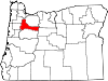
CDPs Brooks | Butteville | Four Corners | Hayesville | Labish Village | Marion | Mehama
Unincorporated
communitiesBreitenbush | Clear Lake | Macleay | McKee | Middle Grove | Monitor | Niagara | North Howell | Pratum | Saint Benedict | Saint Louis | Shaw | Talbot | Waconda | West Stayton
Ghost town Footnotes ‡This populated place also has portions in an adjacent county or counties
U.S. National Register of Historic Places in Oregon Lists by county Baker • Benton • Clackamas • Clatsop • Columbia • Coos • Crook • Curry • Deschutes • Douglas • Gilliam • Grant • Harney • Hood River • Jackson • Jefferson • Josephine • Klamath • Lake • Lane • Lincoln • Linn • Malheur • Marion • Morrow • Multnomah: Portland North • Multnomah: Portland Northeast • Multnomah: Portland Northwest • Multnomah: Portland Southeast • Multnomah: Portland Southwest • Multnomah: Other • Polk • Sherman • Tillamook • Umatilla • Union • Wallowa • Wasco • Washington • Wheeler • Yamhill
Other lists Categories:- National Register of Historic Places in Marion County, Oregon
- Oregon-related lists
-


Wikimedia Foundation. 2010.