- National Register of Historic Places listings in Josephine County, Oregon
-
This is a list of properties and districts in Josephine County, Oregon that are listed on the National Register of Historic Places.
Current listings
[1] Landmark name Image Date listed Location City or town Summary 1 John and Susanna Ahlf House May 9, 1983 762 NW 6th St.
42°26′44″N 123°19′21″W / 42.445556°N 123.3225°WGrants Pass 2 Allen Gulch Mill October 4, 2001 Approx. 1 mi. SE of Jct. of Waldo Rd. and Waldo Lookout Rd.
42°03′00″N 123°38′16″W / 42.05°N 123.637778°WCave Junction 3 Allen Gulch Townsite October 4, 2001 Approx. 1 mi. SE. of Jct. of Waldo Rd. and Waldo Lookout Rd.
42°02′50″N 123°37′55″W / 42.047222°N 123.631944°WCave Junction 4 George Calhoun House December 2, 1981 612 NW 5th St.
42°26′37″N 123°19′30″W / 42.443611°N 123.325°WGrants Pass 5 Cameron Mine October 4, 2001 Approx. 2 mi. S. of Jct. of Waldo Rd. and Waldo Lookout Rd.
42°02′29″N 123°38′15″W / 42.041389°N 123.6375°WCave Junction 6 Cedar Guard Station No. 1019 April 8, 1986 Illinois Valley Rd., Siskiyou National Forest
42°08′30″N 123°27′40″W / 42.141667°N 123.461111°WCave Junction 7 Clark-McConnell House June 3, 1998 961 SE 8th St.
42°25′52″N 123°19′39″W / 42.431111°N 123.3275°WGrants Pass 8 Clark-Norton House February 27, 1986 127 N.W. D St.
42°26′28″N 123°19′31″W / 42.441111°N 123.325278°WGrants Pass 9 Michael Clemens House April 29, 1982 612 NW 3rd St.
42°26′41″N 123°19′38″W / 42.444722°N 123.327222°WGrants Pass 10 Albert B. and Mary Cornell House October 31, 2002 121 NE B St.
42°26′35″N 123°19′24″W / 42.443056°N 123.323333°WGrants Pass 11 Thomas Croxton House March 29, 1979 1002 NW Washington Blvd.
42°26′54″N 123°19′28″W / 42.448333°N 123.324444°WGrants Pass 12 Deep Gravel Mine October 4, 2001 Approx. 1 mi. N. of Jct of Waldo Rd. and BLM Rd. 40-8-28
42°04′09″N 123°38′40″W / 42.069167°N 123.644444°WCave Junction 13 Dimmick-Judson House June 3, 1998 906 NE Eighth St.
42°26′48″N 123°19′08″W / 42.446667°N 123.318889°WGrants Pass 14 Esterly Pit No. 2-Llano De Oro Mine October 4, 2001 Approx. 1.5 mi. N. of Jct. of Waldo Rd. and BLM Rd. 40-8-28
42°04′26″N 123°38′13″W / 42.073889°N 123.636944°WCave Junction 15 Joseph Fetzner House October 25, 1990 314 NE. Fetzner St.
42°26′49″N 123°19′04″W / 42.446944°N 123.317778°WGrants Pass 16 Dr. William H. Flanagan House May 9, 1983 720 NW 6th St.
42°26′40″N 123°19′22″W / 42.444444°N 123.322778°WGrants Pass 17 Fry Gulch Mine October 4, 2001 Approx. .75 mi. from Jct. of Waldo Rd. and BLM Rd. 40-8-28
42°03′06″N 123°39′10″W / 42.051667°N 123.652778°WCave Junction 18 Golden Historic District 
July 25, 2002 3482 Coyote Creek Rd.
42°40′55″N 123°20′09″W / 42.681944°N 123.335833°WWolf Creek 19 Grant Pass City Hall and Fire Station 
September 7, 1984 4th and H Sts.
42°26′22″N 123°19′45″W / 42.439444°N 123.329167°WGrants Pass 20 Grants Pass G Street Historic District October 7, 1993 Bounded by SW. G and H Sts. and 4th and 6th Sts.
42°26′21″N 123°19′37″W / 42.439167°N 123.326944°WGrants Pass 21 Grants Pass Supervisor's Warehouse March 6, 1991 200 NE. Greenfield Rd.
44°52′07″N 123°21′08″W / 44.868611°N 123.352222°WGrants Pass 22 Grave Creek Bridge 
November 29, 1979 N of Grants Pass
42°38′11″N 123°22′34″W / 42.636389°N 123.376111°WSunny Valley 23 High Gravel Mine October 4, 2001 Approx. 1.3 mi. S. of Jct. of Waldo Rd. and Waldo Lookout Rd.
42°03′00″N 123°38′27″W / 42.05°N 123.640833°WCave Junction 24 Hotel Josephine Annex 
February 21, 1997 118 N.W. E St.
42°26′31″N 123°19′30″W / 42.441944°N 123.325°WGrants Pass 25 Hugo Community Baptist Church 
October 25, 1990 6501 Hugo Rd.
42°35′05″N 123°24′03″W / 42.584722°N 123.400833°WGrants Pass 26 Kienlen-Harbeck Building 
May 13, 1982 147 SW G St.
42°26′20″N 123°19′37″W / 42.438889°N 123.326944°WGrants Pass 27 Logan Cut October 4, 2001 Historic Channel of Logan Cut
42°05′29″N 123°38′25″W / 42.091389°N 123.640278°WCave Junction 28 Logan Drain Ditches October 4, 2001 Approx. 2 mi. N. of Jct. of Waldo Rd. and BLM Rd. 40-8-28
42°04′41″N 123°37′39″W / 42.078056°N 123.6275°WCave Junction 29 Logan Wash Ditch October 4, 2001 Historic Channel of Logan Wash Ditch
42°04′02″N 123°37′06″W / 42.067222°N 123.618333°WCave Junction 30 George H. Lundburg House March 6, 1987 404 N.W. A St.
42°26′43″N 123°19′38″W / 42.445278°N 123.327222°WGrants Pass 31 Robert and Lucy McLean House April 5, 1984 724 NW 4th St.
42°26′43″N 123°19′29″W / 42.445278°N 123.324722°WGrants Pass 32 Middle Ditch October 4, 2001 Historic Channel of Logan-Esterly Middle Ditch
42°03′53″N 123°37′53″W / 42.064722°N 123.631389°WCave Junction 33 William and Nannie Nauke House August 5, 1999 24195 Redwood Highway
42°11′52″N 123°38′56″W / 42.197778°N 123.648889°WKerby 34 Edwin Newell House November 15, 1979 591 SW G St
42°26′25″N 123°20′00″W / 42.440278°N 123.333333°WGrants Pass 35 Newman United Methodist Church December 23, 1977 128 NE B St.
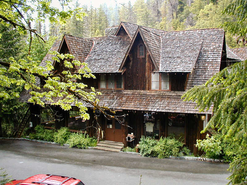
42°26′35″N 123°19′24″W / 42.443056°N 123.323333°WGrants Pass 36 Oregon Caves Chateau 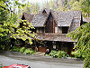
May 28, 1987 Off SR 46
42°05′58″N 123°24′27″W / 42.099444°N 123.4075°WOregon Caves National Monument 37 Oregon Caves Historic District 
February 25, 1992 Caves Hwy., Oregon Caves NM, Siskiyou NF
42°05′58″N 123°24′25″W / 42.099444°N 123.406944°WCave Junction 38 Osgood Ditch October 4, 2001 Historic Channel of Osgood Ditch
41°57′59″N 123°37′56″W / 41.966389°N 123.632222°WCave Junction 39 Plataurica Mine October 4, 2001 Approx. .75 mi. SE. of Jct. of Waldo Rd. and Waldo Lookout Rd.
42°03′10″N 123°38′07″W / 42.052778°N 123.635278°WCave Junction 40 Rand Ranger Station 
June 10, 1999 14335 Galice Rd.
42°35′53″N 123°34′59″W / 42.598056°N 123.583056°WMerlin 41 Redwoods Hotel 
October 25, 1979 310 NW 6th St
42°26′28″N 123°19′31″W / 42.441111°N 123.325278°WGrants Pass 42 Rogue River Valley Grange No. 469 March 9, 1992 2064 Upper River Rd.
42°26′26″N 123°21′04″W / 42.440556°N 123.351111°WGrants Pass 43 Rogue Theatre June 30, 2005 143 SE "H" St.
42°26′16″N 123°19′32″W / 42.437778°N 123.325556°WGrants Pass 44 St. Patrick's Roman Catholic Cemetery October 4, 2001 Approx. 1 mi. SE. of Jct. of Waldo Rd. and Waldo Lookout Rd.
42°03′05″N 123°38′05″W / 42.051389°N 123.634722°WCave Junction 45 Claus and Hannchen Schmidt House January 21, 2004 508 SW 5th
42°26′14″N 123°19′44″W / 42.437222°N 123.328889°WGrants Pass 46 Siskiyou Smokejumper Base November 17, 2006 Smokejumper Way, 4 mi. SE of Cave Junction off OR 199
42°06′16″N 123°40′48″W / 42.104444°N 123.68°WCave Junction 47 Herbert and Katherine Smith House May 9, 1983 139 SW I St.
42°26′15″N 123°19′40″W / 42.4375°N 123.327778°WGrants Pass 48 Speed's Place on the Rogue June 21, 1991 11407 Merlin-Galice Rd.
42°34′33″N 123°35′41″W / 42.575833°N 123.594722°WGalice 49 Store Gulch Guard Station No. 1020 April 8, 1986 Illinois Valley Rd., Siskiyou National Forest
42°17′53″N 123°45′04″W / 42.298056°N 123.751111°WCave Junction 50 Upper Ditch October 4, 2001 Historic Channel of Logan-Esterly Upper Ditch
42°01′10″N 123°38′06″W / 42.019444°N 123.635°WCave Junction 51 Amos E. Voorhies House February 23, 1990 421 NW. B St.
42°26′40″N 123°19′43″W / 42.444444°N 123.328611°WGrants Pass 52 Waldo Cemetery October 4, 2001 Approx. .5 mi. SW. of Jct. of Waldo Rd. and BLM Rd. 40-8-28
42°03′27″N 123°39′11″W / 42.0575°N 123.653056°WCave Junction 53 Waldo Chinese Cemetery October 4, 2001 Approx. .5 mi. SW. of Jct. of Waldo Rd. and BLM Rd. 40-8-28
42°03′27″N 123°39′11″W / 42.0575°N 123.653056°WCave Junction 54 Waldo Mine October 4, 2001 SW. of Jct. of Waldo Rd. and BLM Rd. 40-8-28
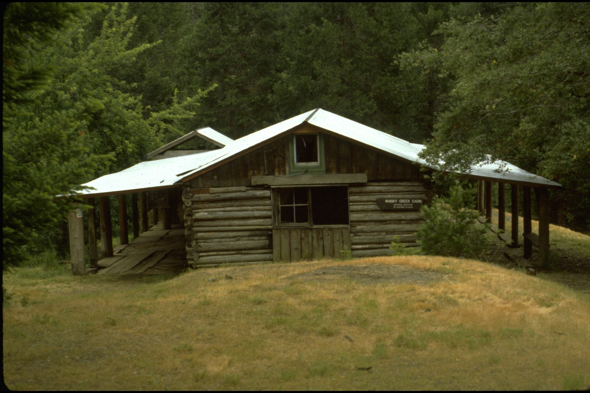
42°03′32″N 123°38′55″W / 42.058889°N 123.648611°WCave Junction 55 Whisky Creek Cabin 
September 5, 1975 10 mi. W of Wolf Creek at Rogue River
42°39′38″N 123°37′59″W / 42.660556°N 123.633056°WWolf Creek 56 Wimer Ditch October 4, 2001 Historic Channel of Wimer Ditch
42°04′01″N 123°38′19″W / 42.066944°N 123.638611°WCave Junction 57 Wolf Creek Tavern 
September 22, 1972 West side, Old Pacific Highway, OR 99, About .5 mi N of US 5
42°41′43″N 123°23′41″W / 42.695278°N 123.394722°WWolf Creek References
- ^ Numbers represent an ordering by significant words. Various colorings, defined here, differentiate National Historic Landmark sites and National Register of Historic Places Districts from other NRHP buildings, structures, sites or objects.
U.S. National Register of Historic Places in Oregon Lists by county Baker • Benton • Clackamas • Clatsop • Columbia • Coos • Crook • Curry • Deschutes • Douglas • Gilliam • Grant • Harney • Hood River • Jackson • Jefferson • Josephine • Klamath • Lake • Lane • Lincoln • Linn • Malheur • Marion • Morrow • Multnomah: Portland North • Multnomah: Portland Northeast • Multnomah: Portland Northwest • Multnomah: Portland Southeast • Multnomah: Portland Southwest • Multnomah: Other • Polk • Sherman • Tillamook • Umatilla • Union • Wallowa • Wasco • Washington • Wheeler • Yamhill
Other lists Categories:- National Register of Historic Places listings by county in Oregon
- Josephine County, Oregon


Wikimedia Foundation. 2010.