- National Register of Historic Places listings in Columbia County, Oregon
-
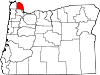
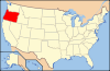
 Location of Columbia County in Oregon
The following list presents the full set of National Register of Historic Places listings in Columbia County, Oregon, and offers brief descriptive information about each of them. The National Register of Historic Places (NRHP) recognizes buildings, structures, objects, sites, and districts of national, state, or local historic significance across the United States.[1] Out of over 80,000 NRHP sites nationwide,[2] Oregon is home to approximately 1,900,[3] and 11 of those are found in Columbia County.
-
- This National Park Service list is complete through NPS recent listings posted November 10, 2011.[4]
Contents
Current listings
[5] Site name[6] Image Date listed[6] Location[7] City or Town[8] Summary 1 Dr. Charles G. and Lucinda McBride Caples Farmstead 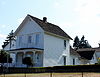
None 1925 1st Street
45°53′25″N 122°48′28″W / 45.89032°N 122.8077°WColumbia City 2 Cox–Williams House 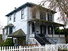
None 280 S 1st Street
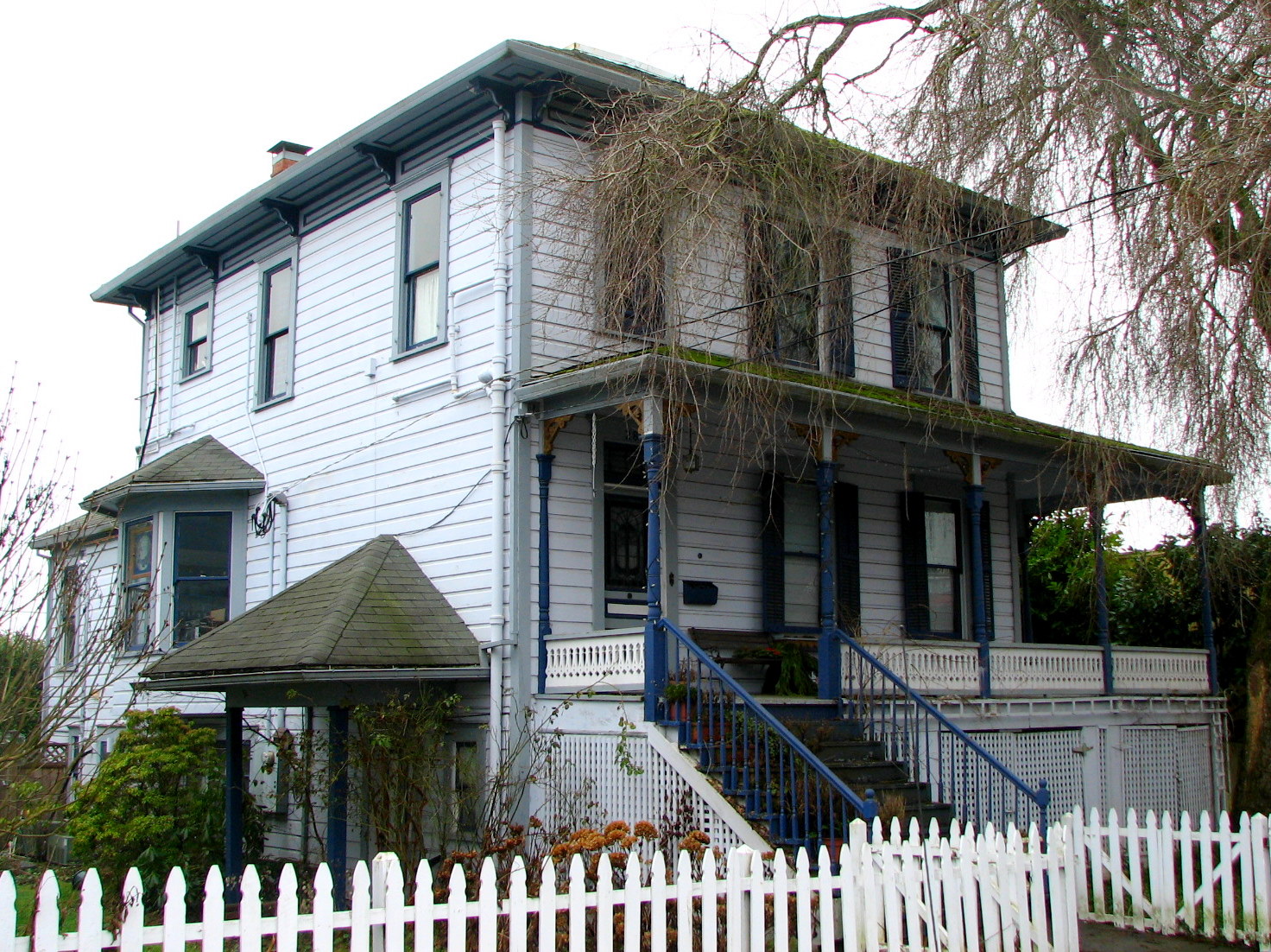
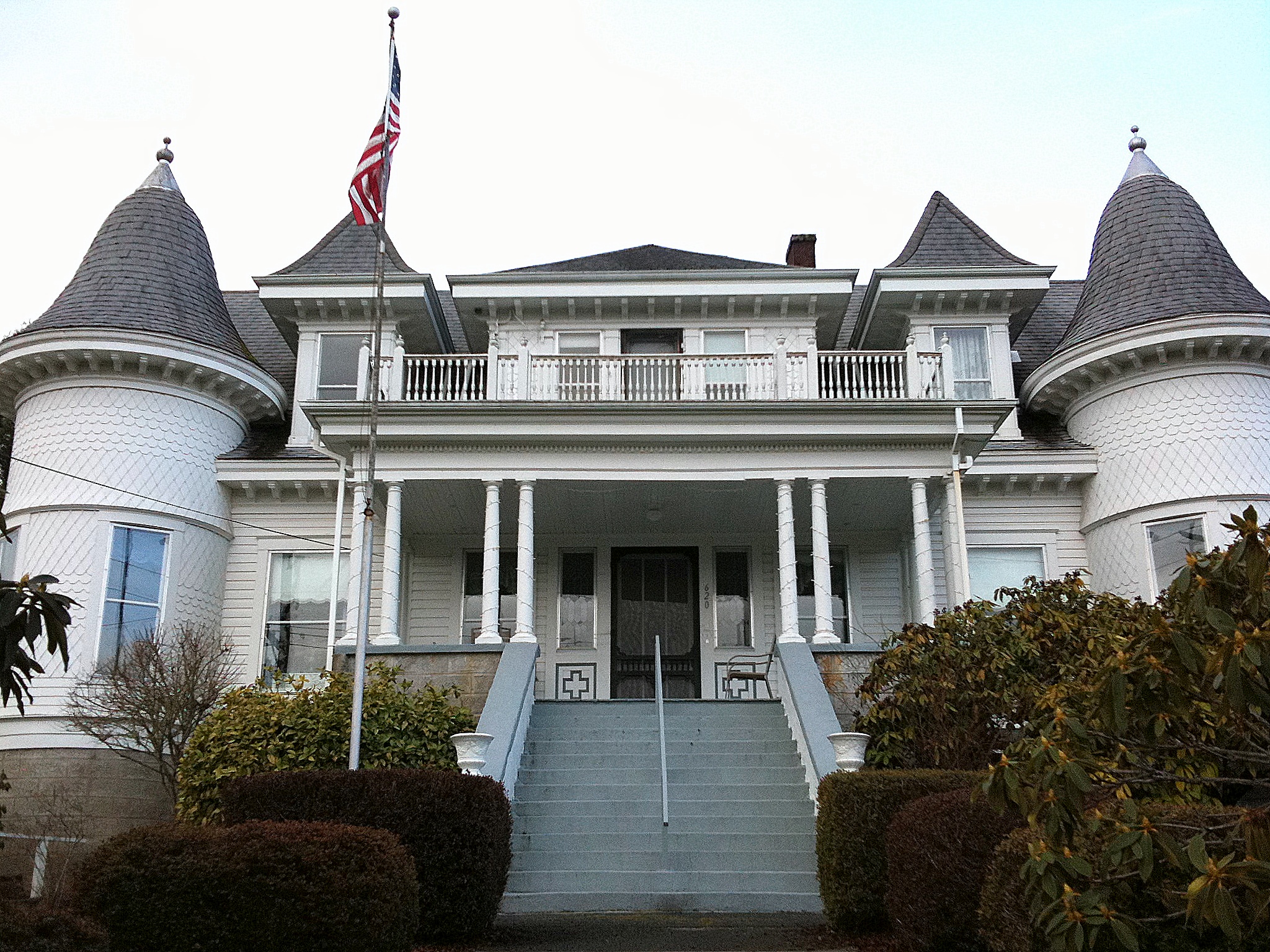
45°51′45″N 122°47′52″W / 45.86254°N 122.7978°WSt. Helens 3 Thomas J. Flippin House 
None 620 Tichenor Street
46°06′03″N 123°12′28″W / 46.10074°N 123.2077°WClatskanie 4 John and Carolena Heimuller Farmstead None 32600 SW J.P. West Rd.
45°45′21″N 122°53′45″W / 45.755833°N 122.895833°WScappoose vicinity 5 Longview Bridge 
None On Washington Highway 433 spanning the Columbia River[6]
46°05′58″N 122°58′00″W / 46.09934°N 122.9667°WRainier 6 George F. Moeck House 
None 713 B Street, W
46°05′28″N 122°56′42″W / 46.09115°N 122.9451°WRainier 7 Oregon–American Lumber Company Mill Office 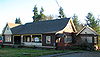
None 511 E Bridge Street
45°51′27″N 123°10′52″W / 45.85759°N 123.1811°WVernonia 8 Portland and Southwestern Railroad Tunnel 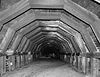
None Along the Scappoose–Vernonia Highway; details of the specific location are restricted.[9] Scappoose vicinity The Portland and Southwestern Railroad's 1910–1920 construction of this timber-lined tunnel across the Nehalem Divide was an unusual step for a logging railroad, which would typically rely on less permanent infrastructure. The tunnel and rail line were abandoned in 1945 as the timber industry transitioned to log transport by truck.[9] 9 St. Helens Downtown Historic District 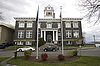
None Roughly Strand, 1st, 2nd, 3rd, Cowlitz, and St. Helens Streets, and Columbia Boulevard[6]
45°51′50″N 122°47′56″W / 45.86388°N 122.799°WSt. Helens 10 James Grant Watts House 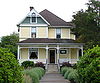
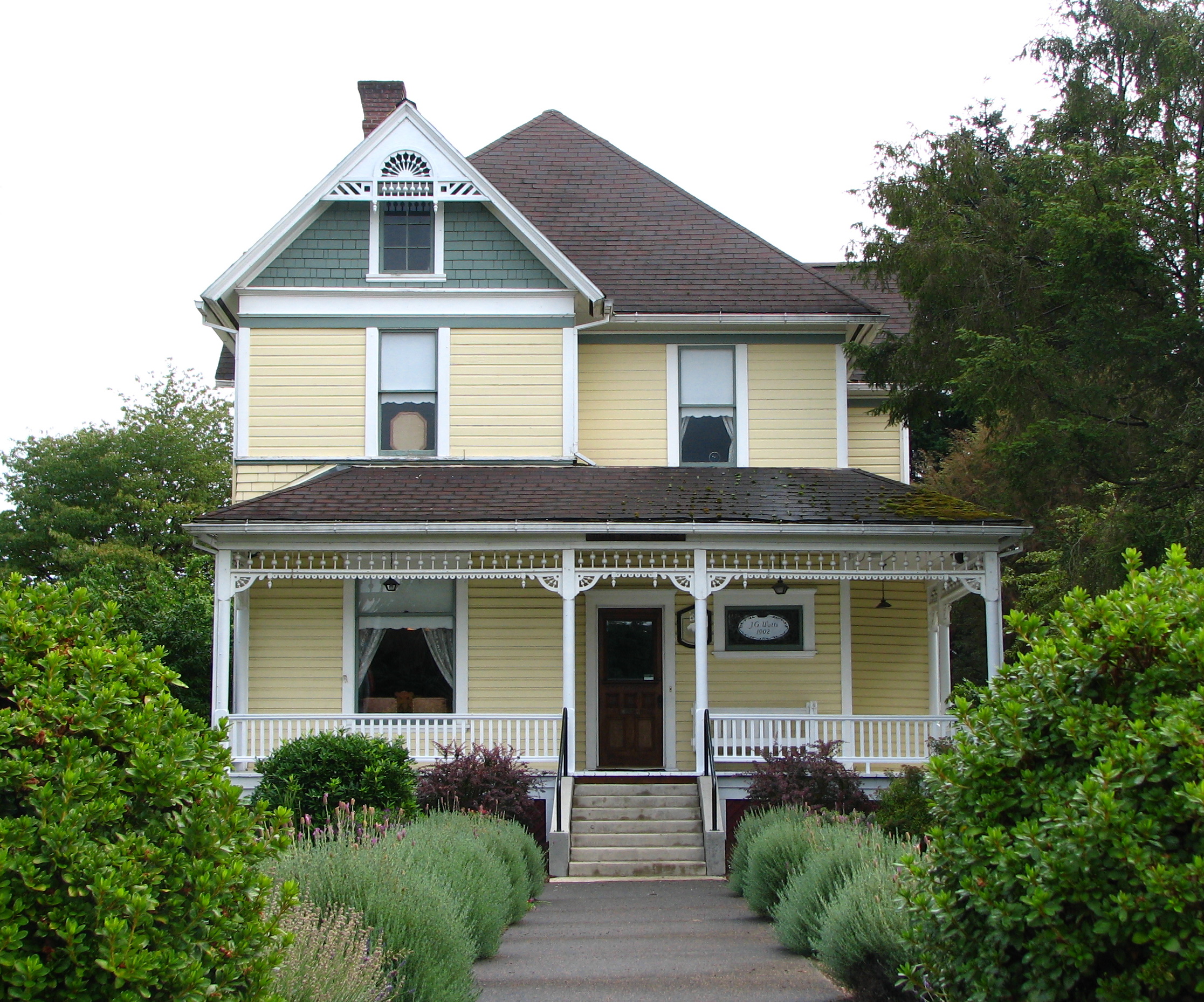
None 206 SE 1st Street
45°45′22″N 122°52′36″W / 45.75618°N 122.8767°WScappoose 11 Woodbine Cemetery – Green Mountain Cemetery 
None 75900 Larson Road
46°05′56″N 122°59′52″W / 46.09894°N 122.9977°WRainier vicinity See also
- National Register of Historic Places listings in Oregon
- Listings in adjacent counties: Clark, Clatsop, Cowlitz, Multnomah, Tillamook, Wahkiakum, Washington
- List of National Historic Landmarks in Oregon
- Historic preservation
- History of Oregon
- Lists of Oregon-related topics
References
- ^ National Park Service (1997). "How to Apply the National Register Criteria for Evaluation". http://www.nps.gov/history/nr/publications/bulletins/nrb15/nrb15.pdf. Retrieved 2008-12-17.
- ^ National Park Service. "National Register Research". National Register of Historic Places. http://www.nps.gov/nr/research/index.htm. Retrieved 2008-12-17.
- ^ Oregon Parks and Recreation Department (2009-01-05). "Oregon National Register List". http://www.oregonheritage.org/OPRD/HCD/NATREG/docs/oregon_nr_list.pdf. Retrieved 2009-02-14.
- ^ "National Register of Historic Places: Weekly List Actions". National Park Service, United States Department of the Interior. Retrieved on November 10, 2011.
- ^ Numbers represent an ordering by significant words (e.g. last name). Various colorings (defined here) differentiate standalone NRHP sites from NRHP sites that also hold status as National Historic Landmarks, historic districts, National Historical Parks, or hold other historic designations.
- ^ a b c d National Park Service. "National Register Information System". http://www.cr.nps.gov/NR/research/nris.htm. Retrieved 2009-03-29.[dead link]
- ^ Text: Except as otherwise noted, all entries are drawn from: Oregon Parks and Recreation Department (2009-01-05). "Oregon National Register List". http://www.oregonheritage.org/OPRD/HCD/NATREG/docs/oregon_nr_list.pdf..
Coordinates: Except as otherwise noted, all entries are drawn from Google Earth KMZ files available at: National Park Service. "National Register Information System". http://www.cr.nps.gov/NR/research/nris.htm. - ^ Except as otherwise noted, all entries are drawn from: Oregon Parks and Recreation Department (2009-01-05). "Oregon National Register List". http://www.oregonheritage.org/OPRD/HCD/NATREG/docs/oregon_nr_list.pdf. Retrieved 2009-02-14.
- ^ a b McCamish, Brian (2006-06-30). "Portland & Southwestern Railroad and the Nehalem Divide Tunnel". In Search of History Expeditions. Gresham, Oregon. http://www.brian894x4.com/PortlandandSouthwesternRR.html. Retrieved 2009-04-03.
External links
Municipalities and communities of Columbia County, Oregon County seat: St. Helens Cities Clatskanie | Columbia City | Prescott | Rainier | St. Helens | Scappoose | Vernonia
Unincorporated
communitiesU.S. National Register of Historic Places in Oregon Lists by county Baker • Benton • Clackamas • Clatsop • Columbia • Coos • Crook • Curry • Deschutes • Douglas • Gilliam • Grant • Harney • Hood River • Jackson • Jefferson • Josephine • Klamath • Lake • Lane • Lincoln • Linn • Malheur • Marion • Morrow • Multnomah: Portland North • Multnomah: Portland Northeast • Multnomah: Portland Northwest • Multnomah: Portland Southeast • Multnomah: Portland Southwest • Multnomah: Other • Polk • Sherman • Tillamook • Umatilla • Union • Wallowa • Wasco • Washington • Wheeler • Yamhill
Other lists Keeper of the Register • History of the National Register of Historic Places • Property types • Historic district • Contributing property U.S. National Register of Historic Places Topics Lists by states Alabama • Alaska • Arizona • Arkansas • California • Colorado • Connecticut • Delaware • Florida • Georgia • Hawaii • Idaho • Illinois • Indiana • Iowa • Kansas • Kentucky • Louisiana • Maine • Maryland • Massachusetts • Michigan • Minnesota • Mississippi • Missouri • Montana • Nebraska • Nevada • New Hampshire • New Jersey • New Mexico • New York • North Carolina • North Dakota • Ohio • Oklahoma • Oregon • Pennsylvania • Rhode Island • South Carolina • South Dakota • Tennessee • Texas • Utah • Vermont • Virginia • Washington • West Virginia • Wisconsin • WyomingLists by territories Lists by associated states Other  Category:National Register of Historic Places •
  Portal:National Register of Historic PlacesCategories:
- National Register of Historic Places in Columbia County, Oregon
- Oregon-related lists
-


Wikimedia Foundation. 2010.