- National Register of Historic Places listings in Clackamas County, Oregon
-
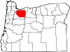
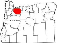 Location of Clackamas County in Oregon
The following list includes all of the National Register of Historic Places listings in Clackamas County, Oregon, and offers brief descriptive information about each of them. The National Register of Historic Places (NRHP) recognizes buildings, structures, objects, sites, and districts of national, state, or local historic significance across the United States.[1] Out of over 80,000 NRHP sites nationwide,[2] Oregon is home to approximately 1,900,[3] and 81 of those are found in Clackamas County.
-
- This National Park Service list is complete through NPS recent listings posted November 10, 2011.[4]
Contents
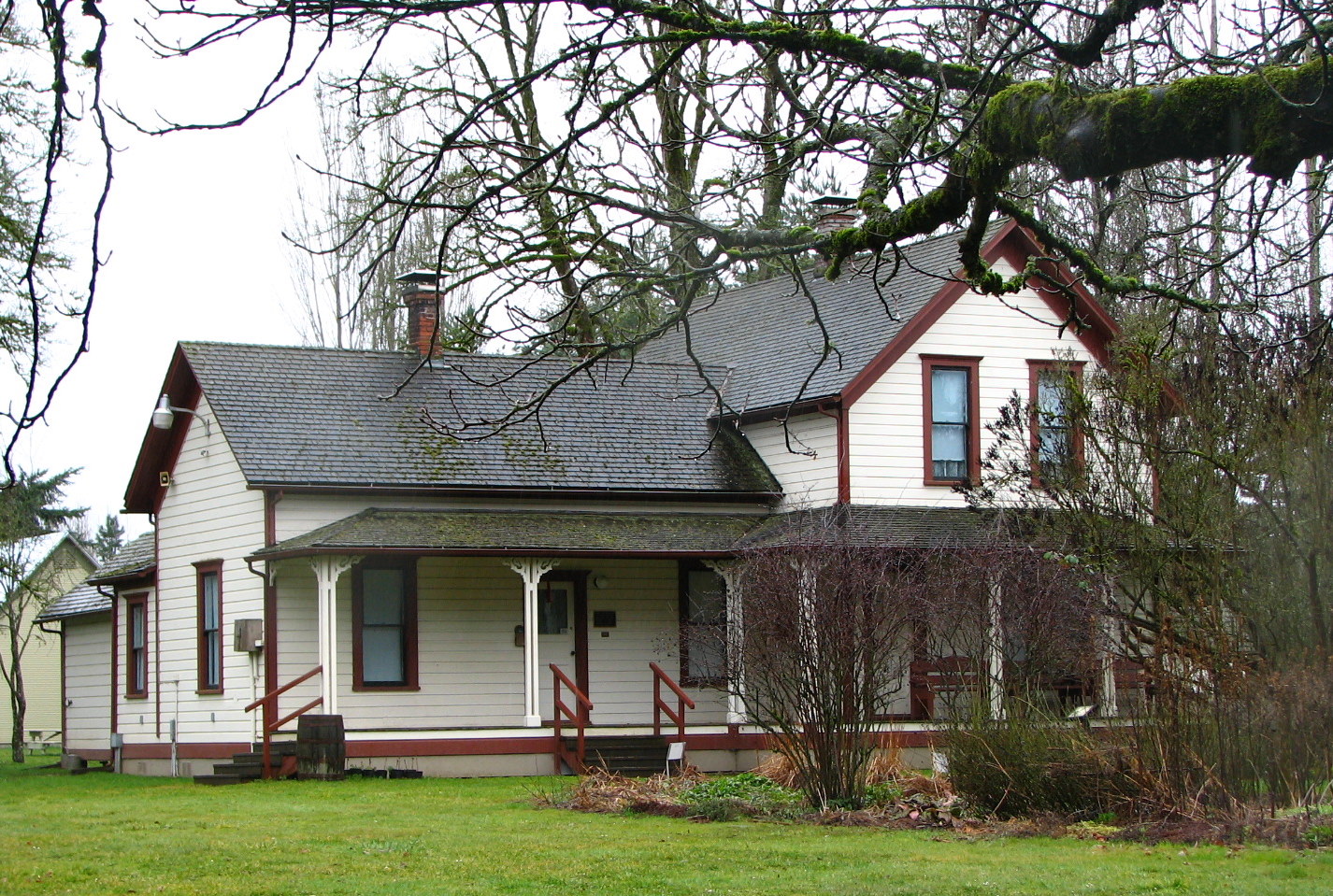
Current listings
[5] Site name[6] Image Date listed[6] Location[7] City or Town[8] Summary 1 Capt. John C. Ainsworth House 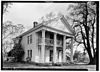
March 26, 1973 19131 S. Leland Road
45°19′46″N 122°36′11″W / 45.32944°N 122.603°WOregon City 2 Daniel Albright Farm image pending October 30, 1979 9912 S Wildcat Road
45°04′11″N 122°39′35″W / 45.06966°N 122.6596°WMarquam vicinity 3 Herman Anthony Farm image pending March 26, 1979 10205 S New Era Road
45°17′44″N 122°39′19″W / 45.29568°N 122.6554°WCanby 4 Charles C. Babcock House image pending October 29, 1982 1214 Washington Street
45°21′36″N 122°36′04″W / 45.36008°N 122.6012°WOregon City 5 Bagby Guard Station 
September 13, 1999 Forest Service Road 70
44°56′05″N 122°10′25″W / 44.93476°N 122.1735°WEstacada vicinity[6] 6 Lawrence D. Bailey House image pending February 23, 1990 13908 SE Fair Oaks Avenue
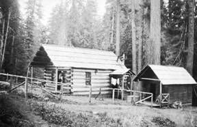
45°25′23″N 122°39′04″W / 45.42302°N 122.651°WMilwaukie 7 Horace Baker Log Cabin 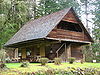
December 12, 1976 S. Hattan Road near S. Gronlund Road[9]
45°23′25″N 122°29′47″W / 45.39024°N 122.4965°WCarver vicinity 8 Dr. Forbes Barclay House 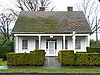
November 5, 1974 719 Center Street
45°21′25″N 122°36′21″W / 45.35699°N 122.6058°WOregon City Dr. Barclay built this house in 1849, after retiring from 10 years as a physician with the Hudson's Bay Company at Fort Vancouver. In Oregon City, he continued medical practice as well as holding a variety of public offices. The house was moved from its original location to its present address in the 1930s.[10] 9 Barlow Road 
April 13, 1992 Mount Hood National Forest, north of the line of the Salmon and White rivers from southwest of Wamic to Rhododendron[11] (See also Wasco and Hood River counties.)
45°13′51″N 121°34′43″W / 45.23083°N 121.57861°W (approx.)Rhododendron to Wamic[6] Beginning with its construction by Sam Barlow in 1846, this toll road provided the first overland connection for wagons between The Dalles and Oregon City over the south flanks of Mount Hood, and offered a majority of Oregon Trail emigrants an alternative to the hazardous raft passage down the Columbia River from The Dalles to Fort Vancouver.[12] 10 William Barlow House 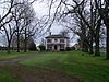
February 15, 1977 24670 S Oregon Route 99E
45°15′09″N 122°43′03″W / 45.25238°N 122.7176°WBarlow 11 John M. and Elizabeth Bates House No. 2 image pending June 13, 1990 16948 SW Bryant Road
45°24′11″N 122°43′23″W / 45.40314°N 122.7231°WLake Oswego 12 John M. and Elizabeth Bates House No. 3 image pending June 14, 1990 16884 SW Bryant Road
45°24′12″N 122°43′23″W / 45.40346°N 122.7231°WLake Oswego 13 John M. and Elizabeth Bates House No. 4 image pending June 13, 1990 4101 South Shore Boulevard
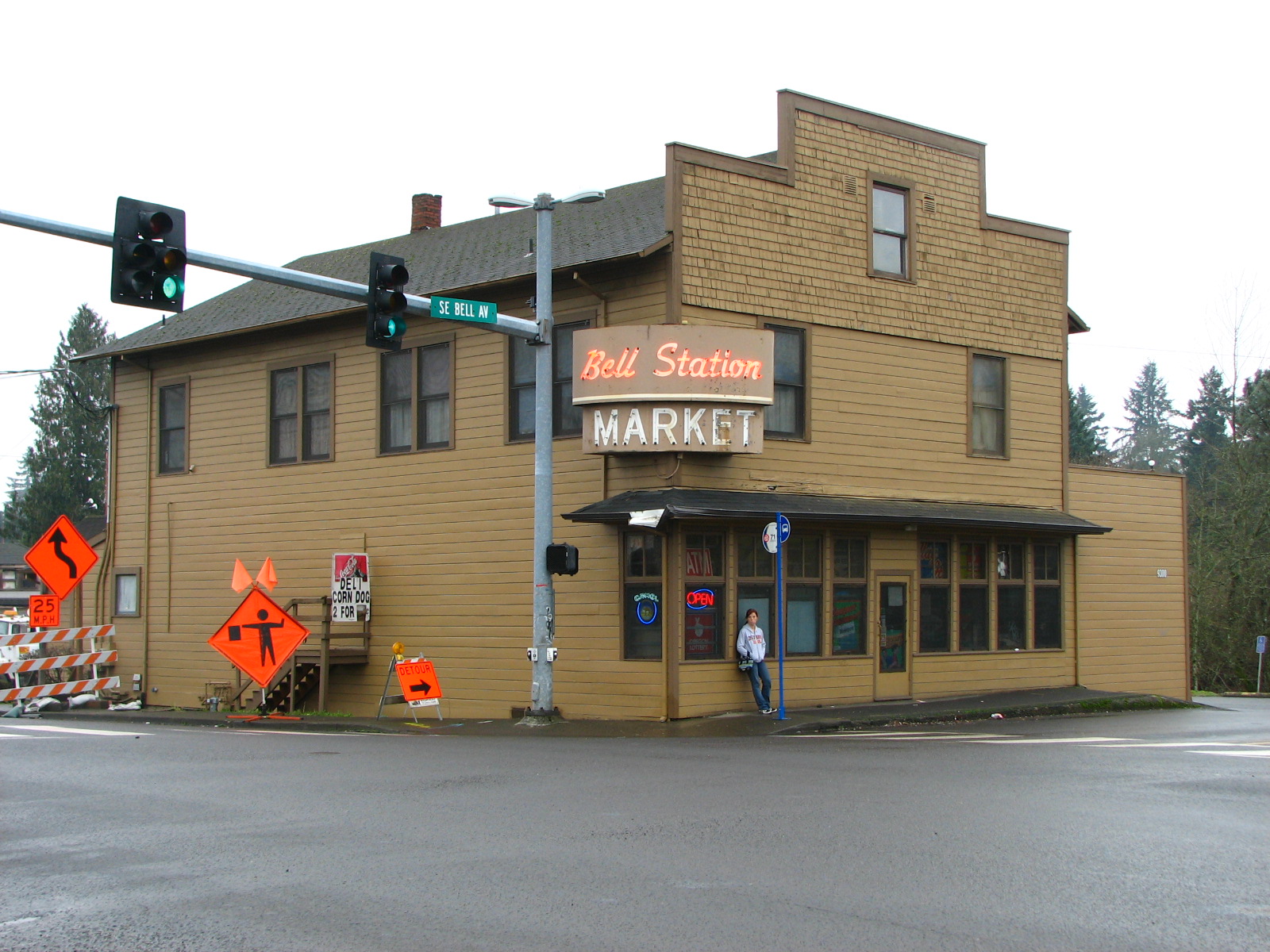
45°24′16″N 122°43′05″W / 45.40441°N 122.718°WLake Oswego 14 Bell Station Store 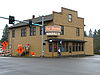
September 10, 1987 9300 SE Bell Avenue
45°27′21″N 122°35′34″W / 45.45592°N 122.5928°WMilwaukie vicinity 15 Dr. Walter Black House image pending February 20, 1991 1125 Maple Street
45°24′35″N 122°40′18″W / 45.40962°N 122.6716°WLake Oswego 16 W.S. and Gladys Boutwell House image pending February 20, 1991 920 SW Fairway Road
45°25′01″N 122°41′09″W / 45.417°N 122.6858°WLake Oswego 17 John F. and John H. Broetje House image pending September 15, 1987 3101 SE Courtney Avenue
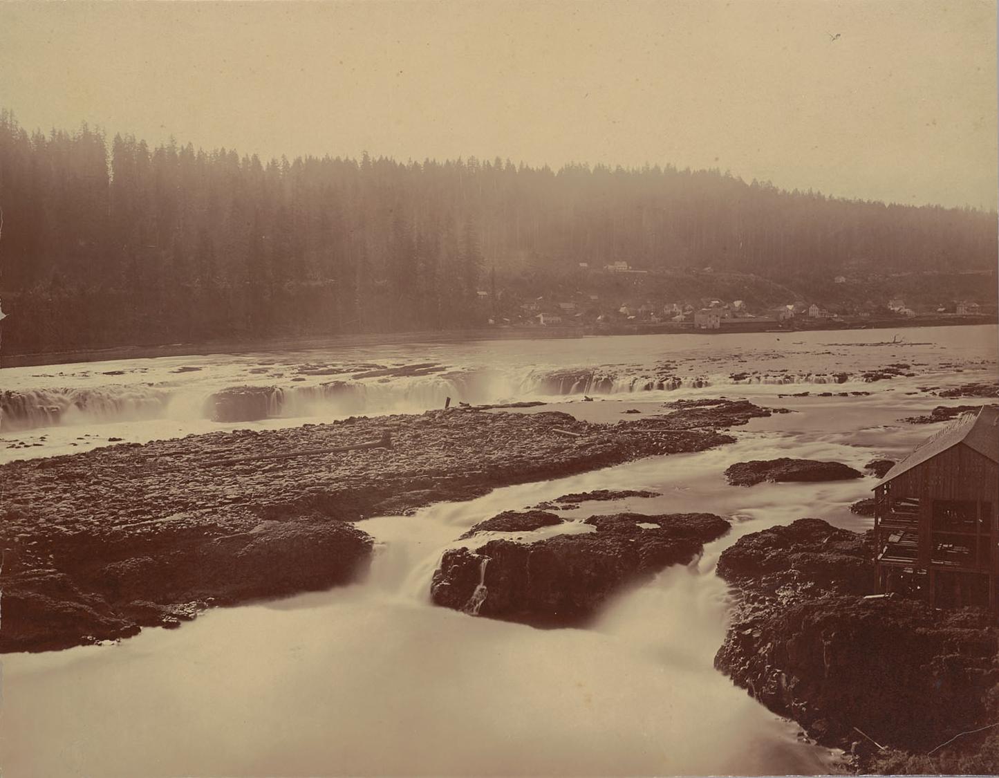
45°25′21″N 122°37′51″W / 45.42255°N 122.6307°WMilwaukie 18 Canemah Historic District 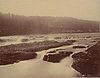
October 11, 1978 Roughly bounded by the Willamette River, 5th Avenue, Marshall Street, and Paquet Street
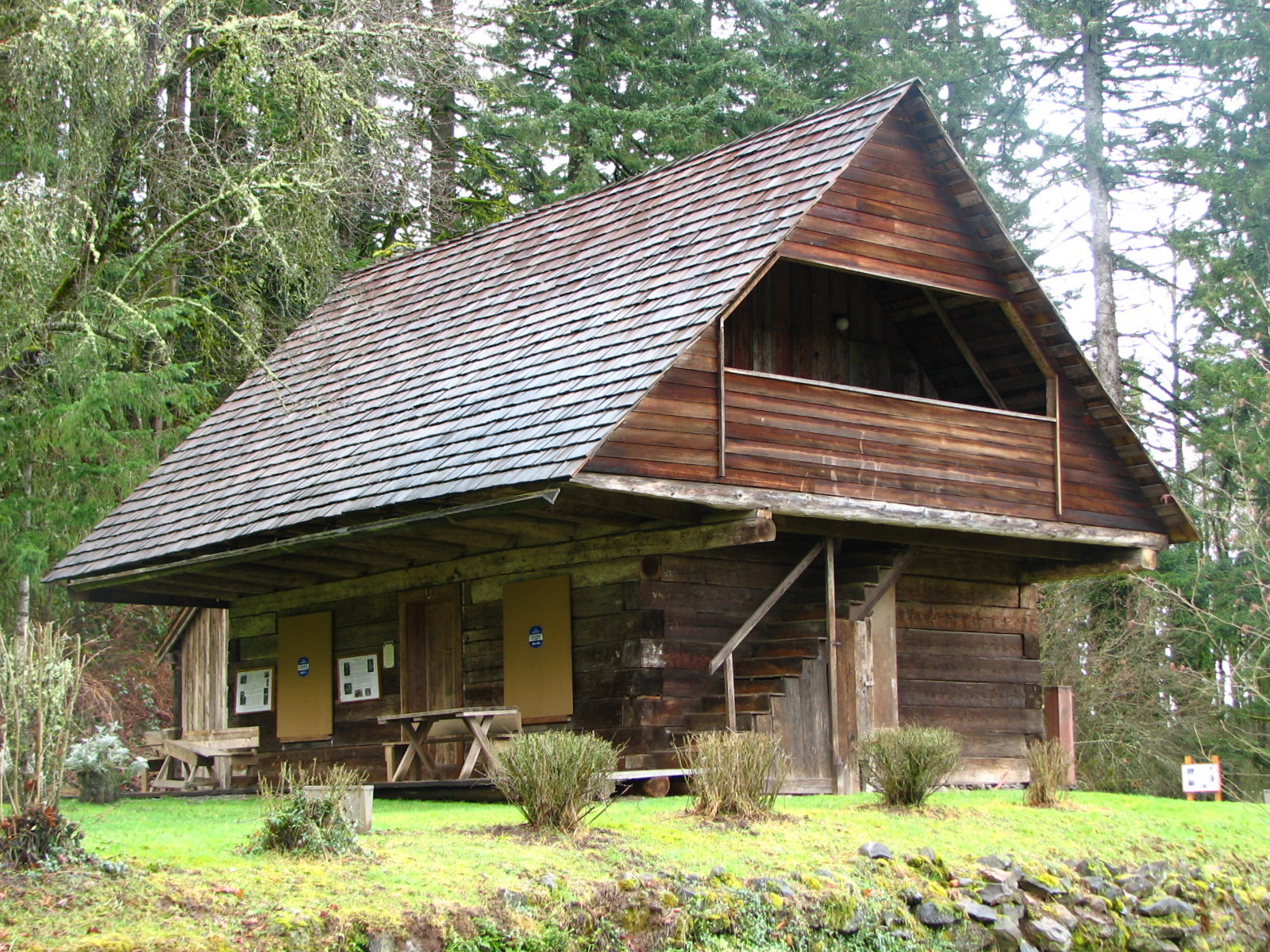
45°20′46″N 122°37′20″W / 45.34616°N 122.6222°WOregon City Established as the port at the upstream end of the portage around the Willamette Falls, Canemah became a thriving transportation hub and center of steamboat construction and river shipping in a period (about 1850 - 1878) when these industries were critical to the Oregon economy. As a residential neighborhood of Oregon City today, Canemah retains much of its 19th-century character.[13] 19 Clackamas Lake Ranger Station Historic District 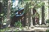
April 22, 1981 Forest Service Road 42
45°06′11″N 121°44′50″W / 45.10296°N 121.7471°WGovernment Camp vicinity 20 Elizabeth Clark House 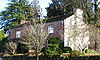
October 25, 1990 812 John Adams Street
45°21′25″N 122°36′12″W / 45.35682°N 122.6033°WOregon City 21 Harvey Cross House 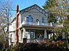
October 30, 1979 809 Washington Street
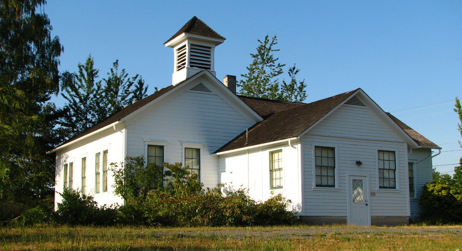
45°21′26″N 122°36′15″W / 45.35723°N 122.6042°WOregon City 22 Damascus School 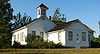
December 3, 1980 14711 SE Anderson Road
45°24′59″N 122°27′31″W / 45.41633°N 122.4586°WDamascus 23 Marshall Dana House image pending March 9, 1992 15725 SE Dana Avenue
45°24′33″N 122°38′56″W / 45.40927°N 122.6488°WMilwaukie 24 John and Magdalena Davis Farm image pending September 21, 2005 13678 S Spangler Road
45°15′20″N 122°35′25″W / 45.25551°N 122.5903°WOregon City vicinity 25 Horace L. Dibble House 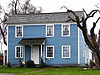
December 19, 1974 616 S Molalla Avenue
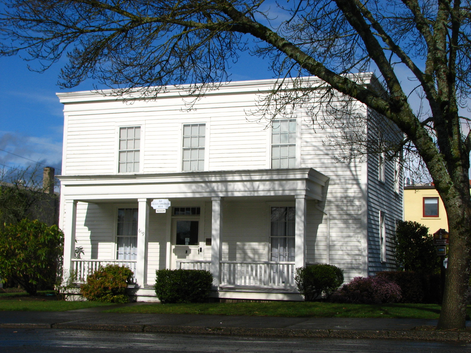
45°08′34″N 122°34′46″W / 45.1427°N 122.5795°WMolalla 26 Francis Ermatinger House 
September 17, 1987 619 6th Street
45°21′20″N 122°36′20″W / 45.35554°N 122.6056°WOregon City 27 Charles W. Ertz House 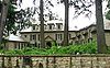
March 5, 1992 1650 North Shore Road
45°24′55″N 122°41′02″W / 45.41539°N 122.684°WLake Oswego 28 First Congregational Church of Oregon City 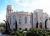
August 26, 1982 710 6th Street
45°21′19″N 122°36′18″W / 45.35518°N 122.605°WOregon City 29 Philip Foster Farm 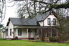
August 15, 1980 29912 SE. Oregon Route 211
45°21′31″N 122°21′19″W / 45.35856°N 122.3553°WEagle Creek 30 Clarence E. Francis House image pending February 19, 1993 9717 SE Cambridge Lane
45°27′09″N 122°38′59″W / 45.45253°N 122.6496°WMilwaukie 31 Erwin Charles Hackett House image pending February 14, 1985 415 17th Street
45°21′52″N 122°35′53″W / 45.36441°N 122.598°WOregon City 32 Hall–Chaney House image pending September 8, 1988 10200 SE Cambridge Lane
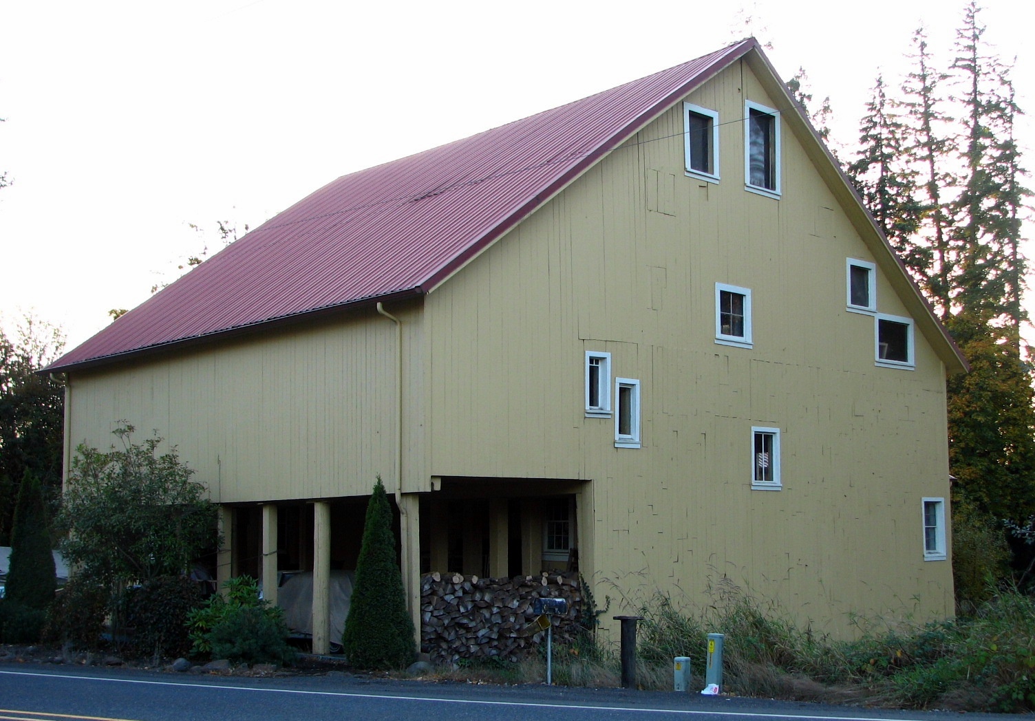
45°26′57″N 122°38′55″W / 45.44915°N 122.6486°WMilwaukie vicinity 33 William L. Holmes House image pending December 2, 1974 536 Holmes Lane
45°20′32″N 122°36′04″W / 45.34212°N 122.601°WOregon City 34 Howard's Gristmill 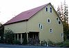
December 10, 1981 26401 S Oregon Route 213
45°13′26″N 122°34′55″W / 45.22377°N 122.5819°WMulino 35 Iron Workers' Cottage[14] 
July 16, 2009[14] 40 Wilbur Street[14]
45°24′45.85″N 122°39′47.94″W / 45.4127361°N 122.6633167°WLake Oswego[14] 36 C.S. "Sam" Jackson Log House image pending December 9, 1981 14999 S Springwater Road
45°23′21″N 122°29′36″W / 45.38905°N 122.4933°WOregon City vicinity 37 Carl C. Jantzen Estate image pending February 23, 1990 1850 North Shore Road
45°24′51.83″N 122°41′14.32″W / 45.4143972°N 122.6873111°WLake Oswego 38 Andrew J. and Anna B. Johnston Farmstead image pending February 21, 1997 18025 S Harding Road
45°20′43″N 122°25′22″W / 45.34538°N 122.4228°WOregon City 39 William Knight House 
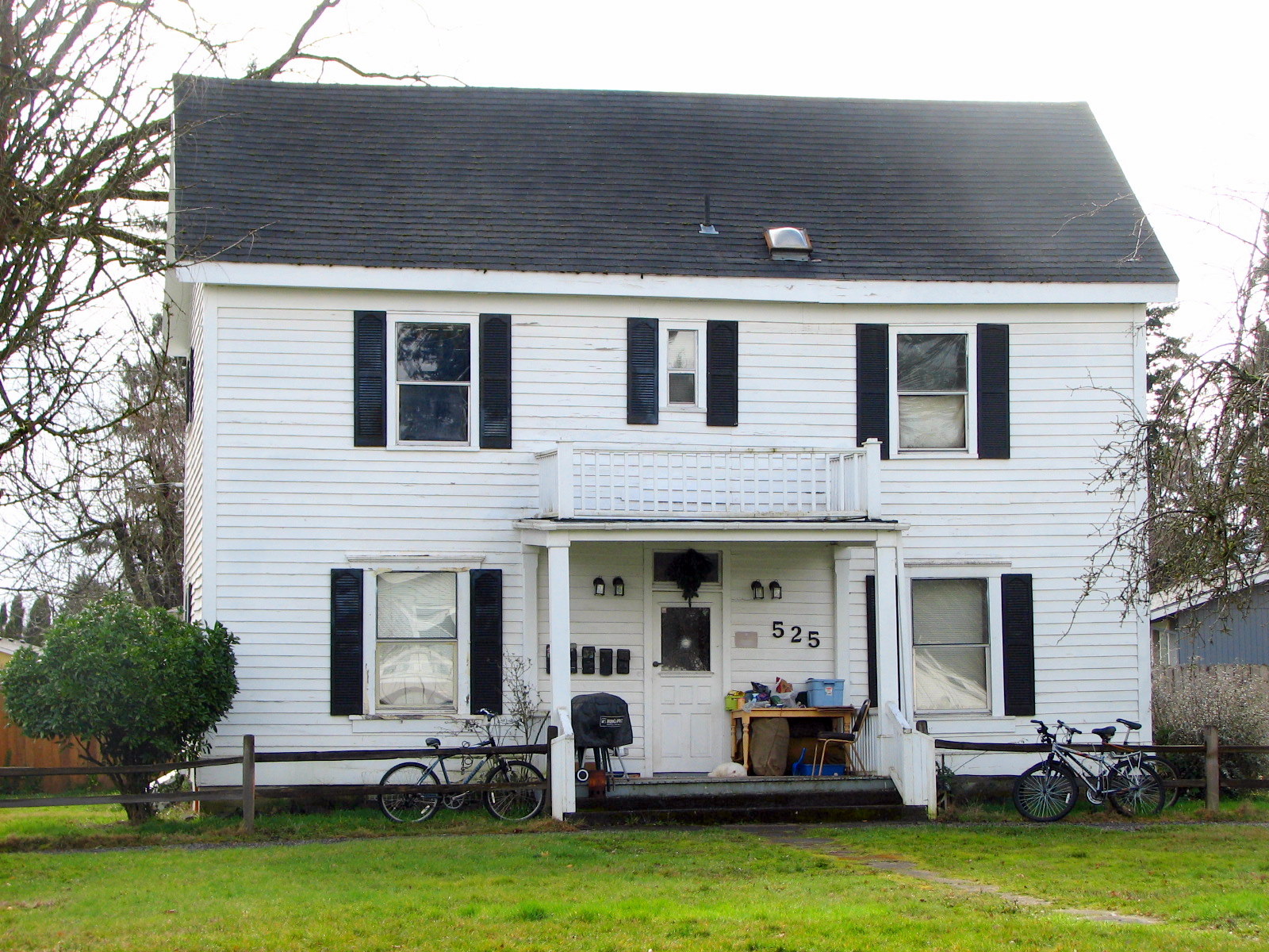
November 5, 1986 525 SW 4th Avenue
45°15′29″N 122°41′46″W / 45.25818°N 122.696°WCanby 40 Kraft–Brandes–Culberston Farmstead 
November 1, 1982 2525 N Baker Drive
45°17′12″N 122°42′26″W / 45.28678°N 122.7071°WCanby vicinity 41 Ladd Estate Company Model House 
October 30, 1989 432 Country Club Road
45°25′16″N 122°40′34″W / 45.42109°N 122.6761°WLake Oswego 42 Lake Oswego Hunt Club Ensemble 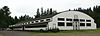
January 4, 1988 2725 SW Iron Mountain Boulevard
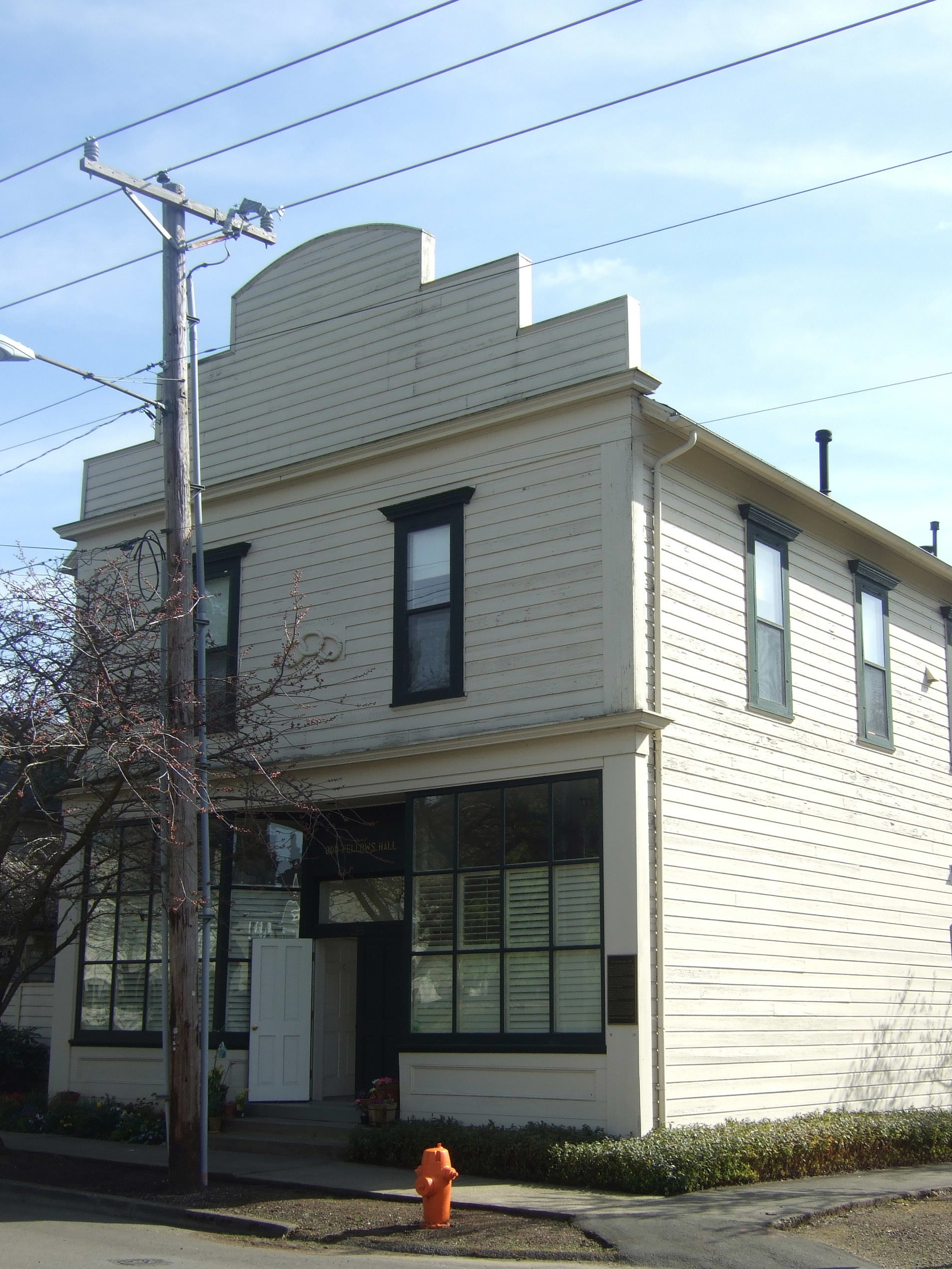
45°24′45″N 122°42′19″W / 45.4125°N 122.7053°WLake Oswego 43 Lake Oswego Odd Fellows Hall 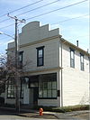
March 7, 1979 295 Durham Street
45°24′49″N 122°39′45″W / 45.41362°N 122.6624°WLake Oswego 44 Charles David Latourette House image pending February 27, 1980 503 High Street
45°21′21″N 122°36′30″W / 45.35582°N 122.6082°WOregon City 45 DeWitt Clinton Latourette House image pending March 5, 1992 914 Madison Street
45°21′24″N 122°36′03″W / 45.35671°N 122.6008°WOregon City 46 Lewthwaite–Moffatt House image pending January 21, 1994 4891 Willamette Falls Drive
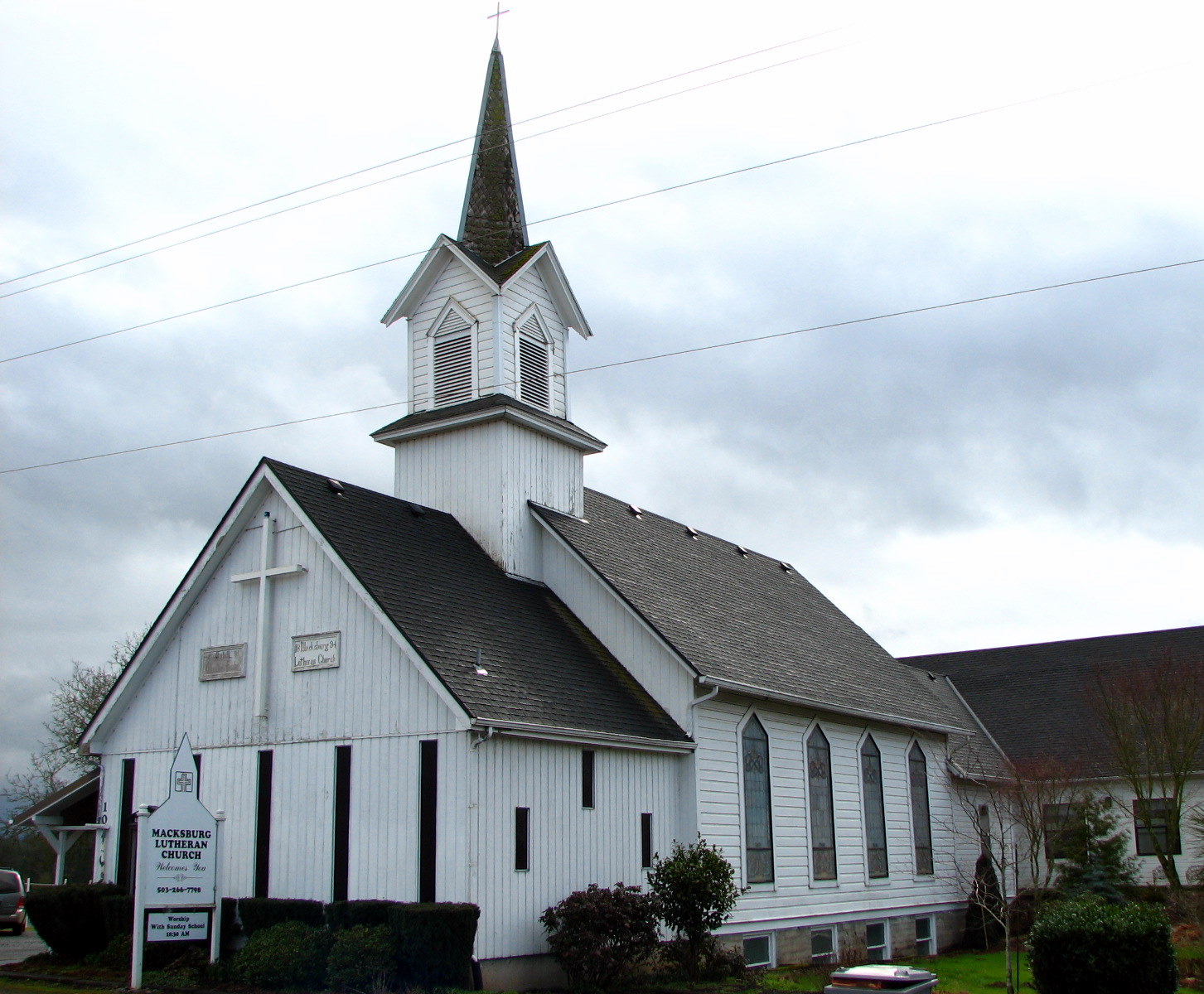
45°21′35″N 122°36′47″W / 45.35976°N 122.613°WWest Linn 47 Macksburg Lutheran Church 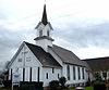
June 14, 1982 10190 S Macksburg Road
45°12′49″N 122°39′25″W / 45.21368°N 122.657°WCanby 48 Mathieson–Worthington House image pending June 1, 1990 885 McVey Avenue
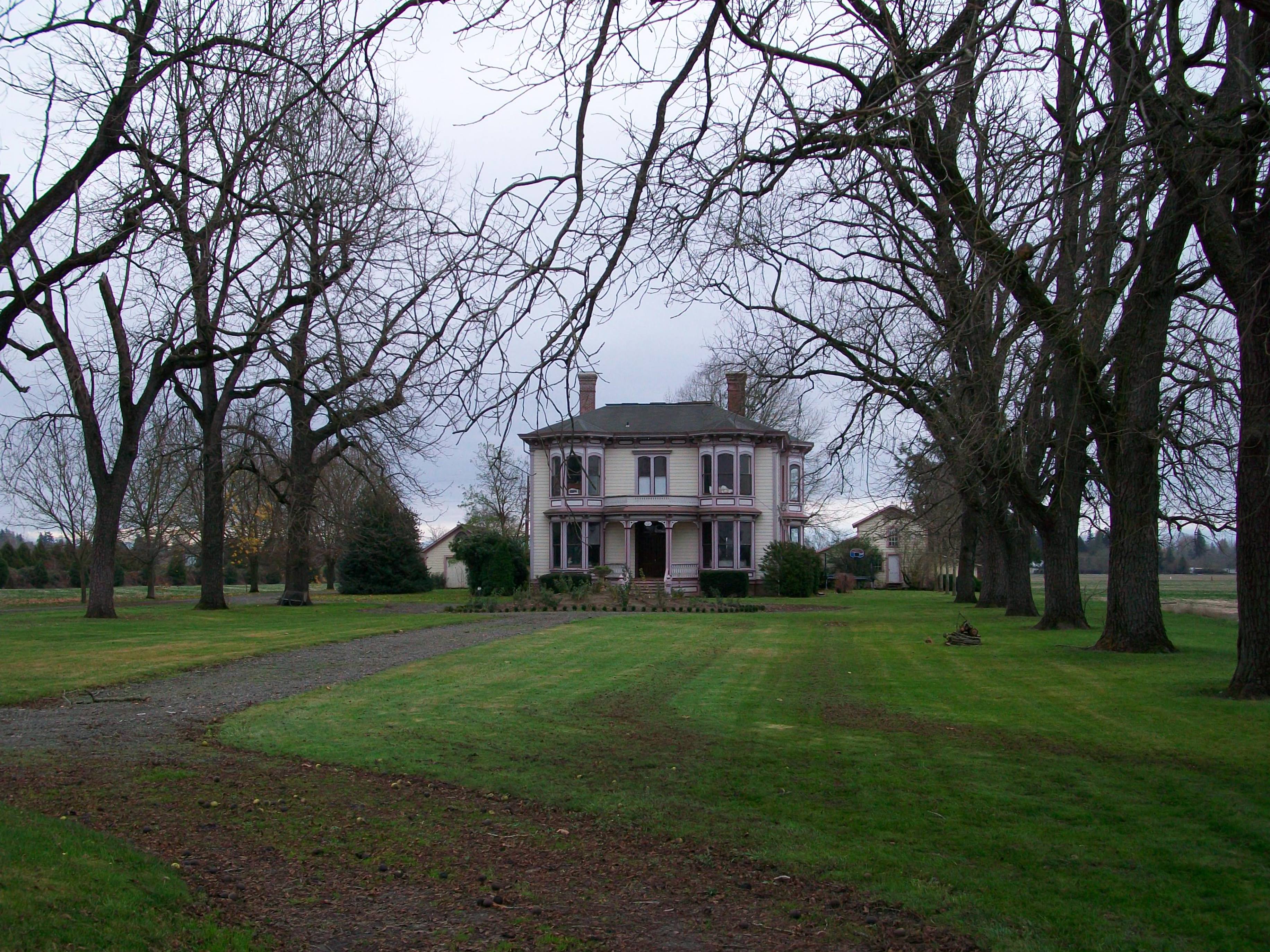
45°24′33″N 122°40′15″W / 45.4091°N 122.6708°WLake Oswego 49 Morton Matthew McCarver House image pending January 21, 1974 554 Warner–Parrott Road
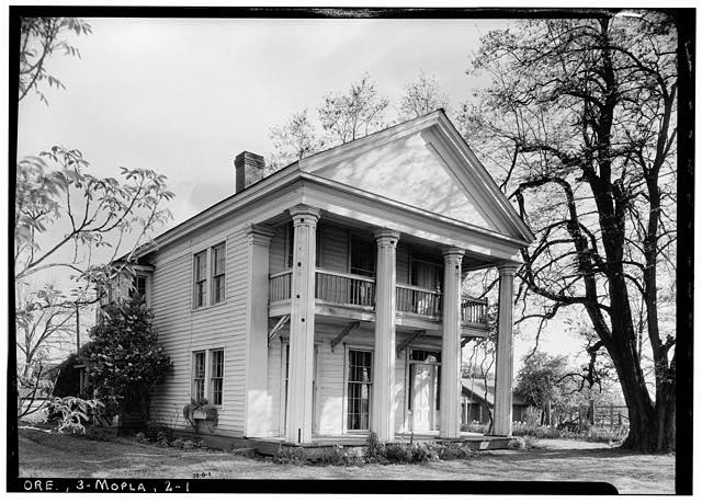
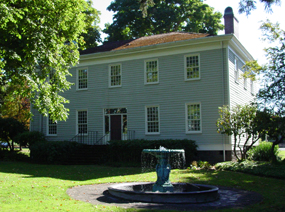
45°20′15″N 122°36′41″W / 45.33738°N 122.6114°WOregon City Named for pioneer and city founder Morton M. McCarver. 50 McLoughlin House National Historic Site 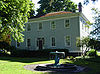
October 15, 1966 713 Center Street
45°21′26.38″N 122°36′20.96″W / 45.3573278°N 122.6058222°WOregon City Dr. John McLoughlin, known as the "Father of Oregon" for the support he provided to emigrants on the Oregon Trail, built this house in 1846 upon his retirement from 20 years as Chief Factor of the Hudson's Bay Company's Fort Vancouver. In retirement, he continued his activities as mayor of Oregon City, a private businessman, and philanthropist. The house was moved from its original location beside the Willamette River to its current blufftop site in 1909.[15] 51 James Milne House image pending March 12, 1979 224 Center Street
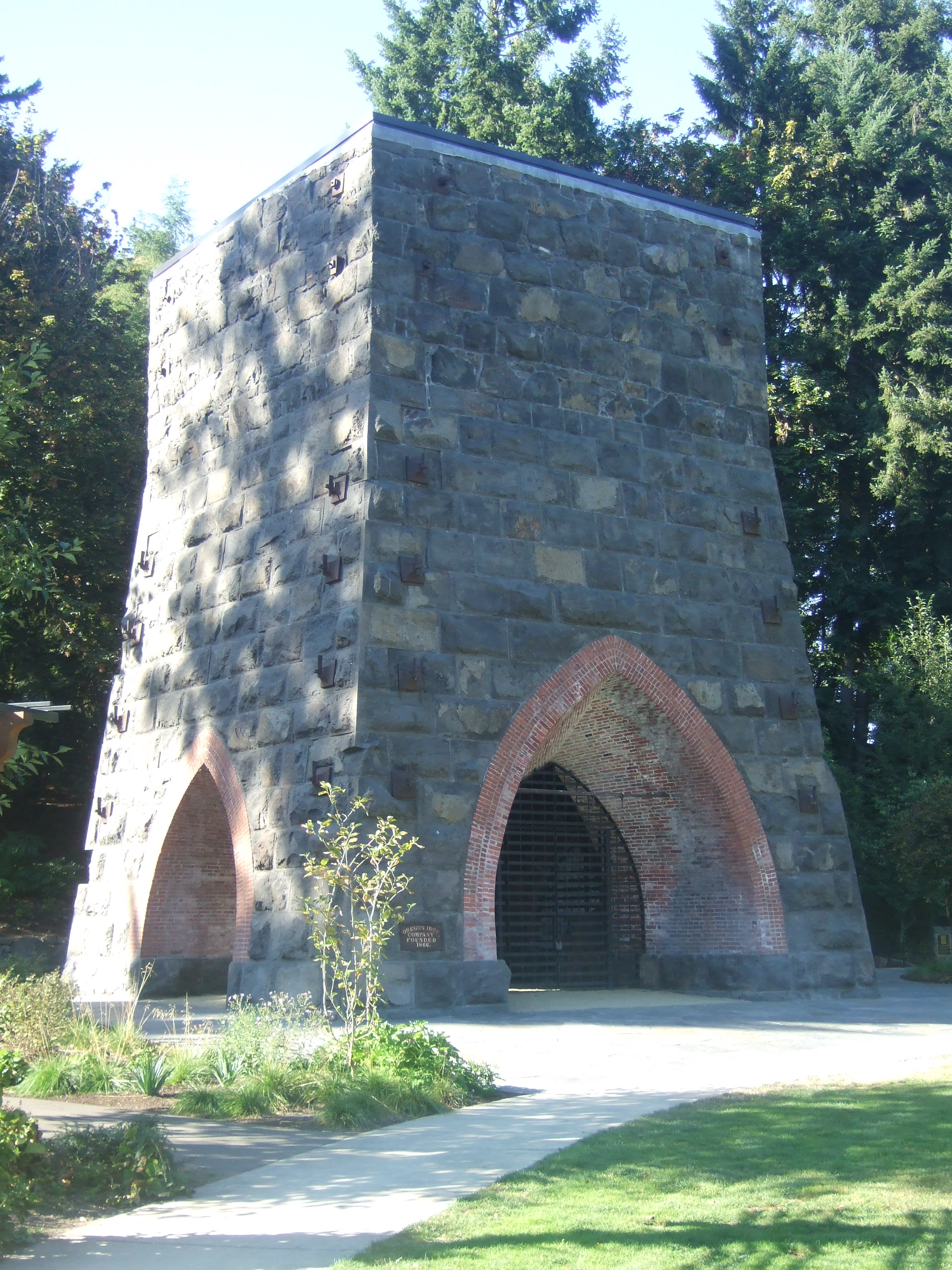
45°21′12″N 122°36′34″W / 45.35327°N 122.6094°WOregon City 52 Oregon Iron Company Furnace 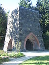
February 12, 1974 George Rogers Park
45°24′39″N 122°39′38″W / 45.41092°N 122.6605°WLake Oswego 53 Oregon Trail, Barlow Road Segment image pending November 20, 1974 Wildwood Recreation Site
45°21′49″N 121°59′07″W / 45.3637°N 121.9852°WWemme vicinity A 5-acre (20,000 m2) property including a segment of an alternate route of the Oregon Trail/Barlow Road 54 Richard B. Petzold Building 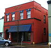
March 5, 1992 714 Main Street
45°21′28″N 122°36′30″W / 45.35791°N 122.6082°WOregon City 55 Richard Petzold House 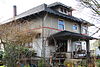
October 31, 1985 504 6th Street
45°21′22″N 122°36′24″W / 45.35599°N 122.6066°WOregon City 56 Wilbur and Evelyn Reid's Alderbrook Lodge image pending January 23, 2004 26863 E. Rolling Riffle Lane[16]
45°19′49.33″N 121°54′45.34″W / 45.3303694°N 121.9125944°WRhododendron[16] 57 River Mill Hydroelectric Project image pending May 10, 2001[17] 30878 NW Evergreen Way
45°17′56.09″N 122°20′48.01″W / 45.2989139°N 122.3466694°WEstacada vicinity 58 Robbins–Melcher–Schatz Farmstead 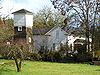
February 19, 1993 4875 SW Schatz Road
45°21′26″N 122°43′40″W / 45.35731°N 122.7277°WTualatin vicinity 59 Rock Corral on the Barlow Road image pending December 19, 1974 Off U.S. Route 26 near the Sandy River[6]
45°23′00″N 122°03′56″W / 45.38329°N 122.0656°WBrightwood vicinity 60 Rock Creek Methodist Church image pending October 29, 1975 Intersection of S. Sconce Road and S. Stuwe Road[9]
45°09′32″N 122°42′51″W / 45.15878°N 122.7143°WMolalla vicinity 61 George Rogers House 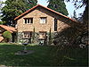
October 3, 1996 59 SW Wilbur Street
45°24′47″N 122°39′48″W / 45.41296°N 122.6633°WLake Oswego 62 Sherrard–Fenton House image pending February 20, 1991 13100 SW Riverside Drive
45°25′51″N 122°39′21″W / 45.43085°N 122.6559°WLake Oswego 63 William Shindler House image pending January 18, 1990 3235 SE Harrison Street
45°26′48″N 122°37′45″W / 45.44662°N 122.6292°WMilwaukie 64 Shipley–Cook Farmstead image pending January 29, 2008 18451 SW Stafford Road[18]
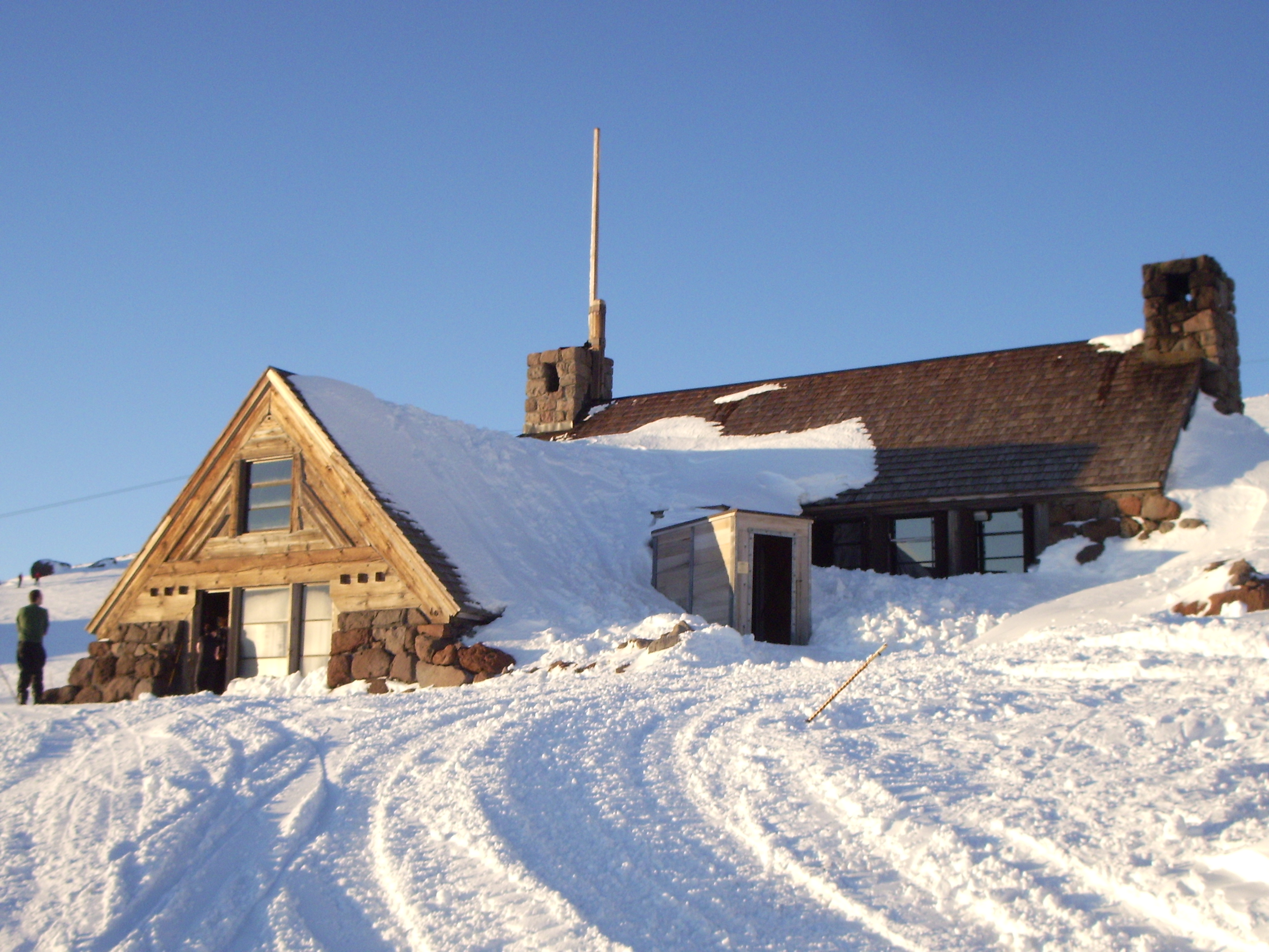
45°23′31.51″N 122°41′25.92″W / 45.3920861°N 122.6905333°WLake Oswego vicinity[18] 65 Silcox Hut 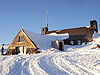
January 19, 1985 Timberline Road
45°20′40″N 121°42′34″W / 45.34454°N 121.7095°WGovernment Camp 66 R.S. Smith Motor Company Building 
January 21, 1994 39150 Pioneer Boulevard
45°23′46″N 122°15′38″W / 45.39624°N 122.2606°WSandy 67 St. John the Evangelist Roman Catholic Church image pending December 21, 1979 68835 E Barlow Trail Road
45°21′08″N 121°57′23″W / 45.3521°N 121.9564°WWelches vicinity 68 George Lincoln Storey House image pending March 10, 1983 910 Pierce Street
45°21′12″N 122°35′38″W / 45.3532°N 122.594°WOregon City 69 Hiram A. Straight House image pending February 17, 1978 16000 S Depot Lane
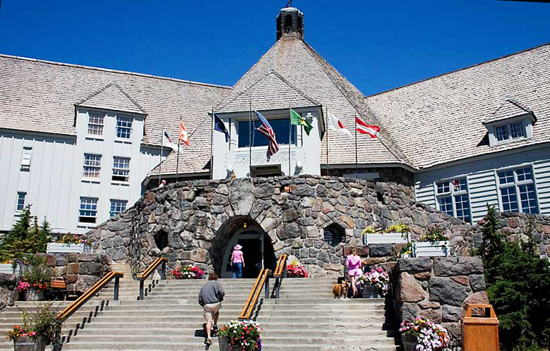
45°22′29″N 122°35′01″W / 45.37466°N 122.5836°WOregon City 70 Timberline Lodge 
November 12, 1973 6 miles (9.6 km) north of Government Camp in Mount Hood National Forest
45°19′52″N 121°42′36″W / 45.33111°N 121.71°WGovernment Camp President Franklin D. Roosevelt dedicated this lodge at an elevation of 6,000 feet (1,830 m) on the south slope of Mount Hood in 1937. It is considered the finest example of 1930s-era "mountain architecture" by the Works Progress Administration.[19] 71 Upper Sandy Guard Station Cabin 
September 9, 2009 4.5 mi (7.2 km). E. of jct. FS Rds. 18 and 1825, Mt. Hood National Forest
45°22′38.451″N 121°46′58.452″W / 45.3773475°N 121.78290333°WGovernment Camp vicinity 72 William Hatchette Vaughan House 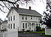
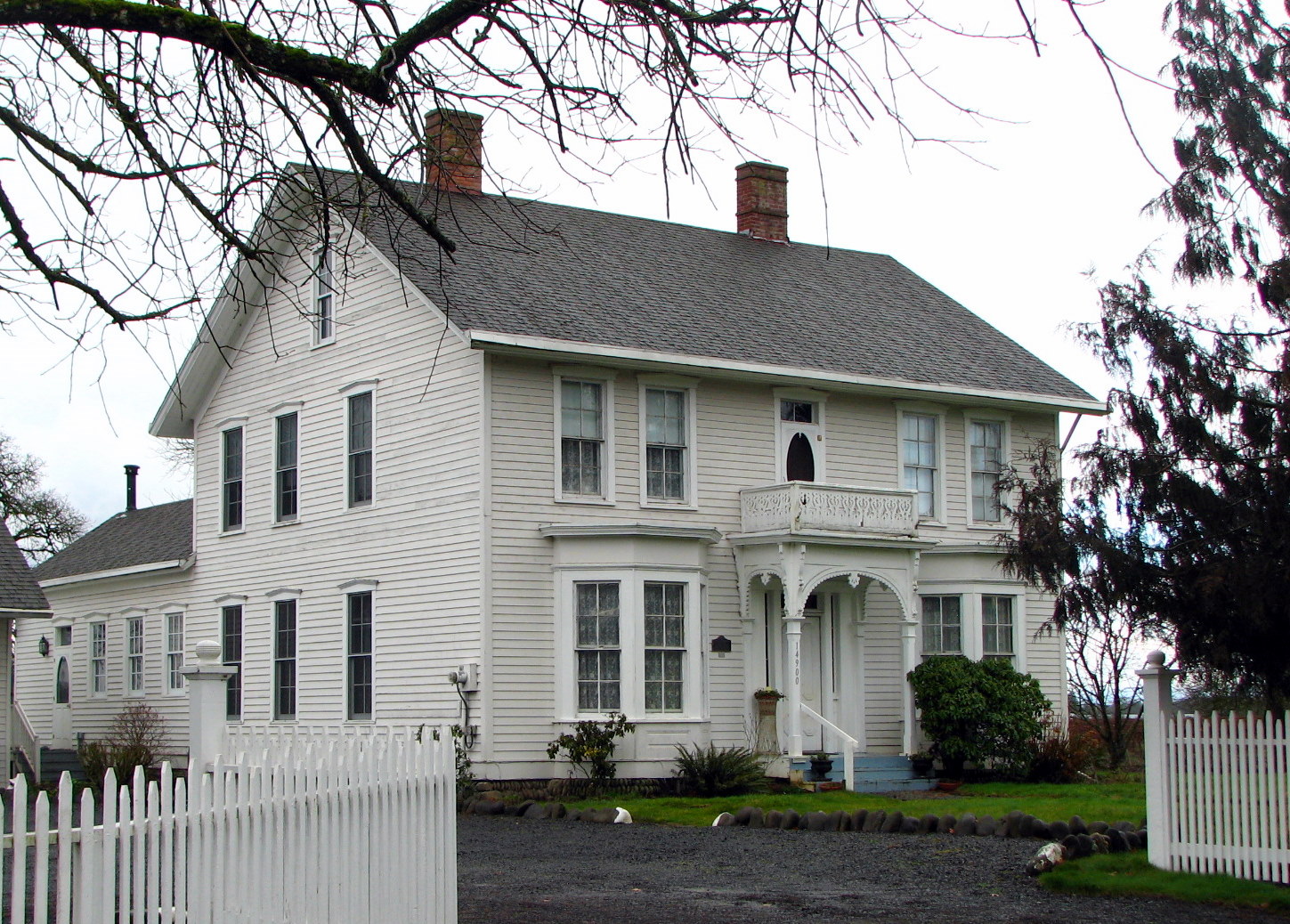
May 27, 1993 14900 S Macksburg Road
45°10′15″N 122°33′08″W / 45.17085°N 122.5521°WMolalla vicinity 73 Fred Vonder Ahe House and Summer Kitchen 
March 26, 1976 625 Metzler Avenue
45°08′32″N 122°34′51″W / 45.14222°N 122.5808°WMolalla 74 Nicholas O. Walden House 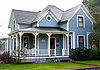
September 7, 1984 1847 SE 5th Avenue
45°20′34″N 122°39′14″W / 45.34276°N 122.654°WWest Linn 75 Clara and Samuel B. Weinstein House image pending March 5, 1992 16847 SW Greenbriar Road
45°24′13″N 122°42′29″W / 45.40371°N 122.7081°WLake Oswego 76 White–Kellogg House image pending May 16, 1989 19000 S Central Point Road
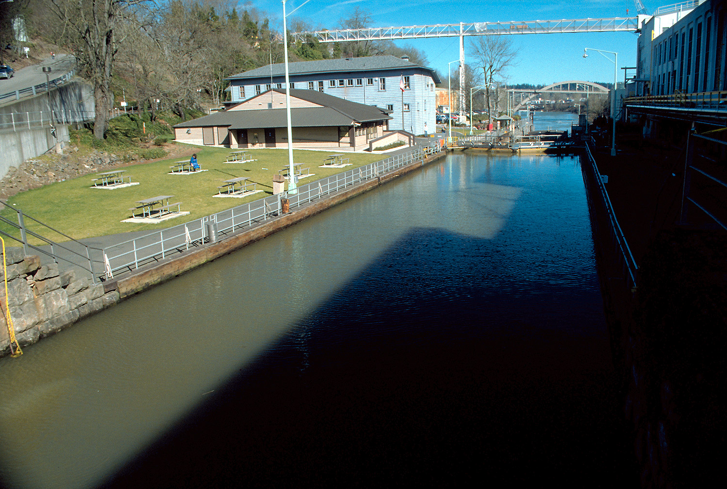
45°19′53″N 122°36′44″W / 45.33148°N 122.6121°WOregon City vicinity 77 Willamette Falls Locks 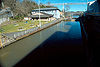
February 5, 1974 West bank of the Willamette River
45°21′26″N 122°36′52″W / 45.35721°N 122.6145°WWest Linn 78 Willamette Falls Neighborhood Historic District[20] 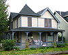
September 24, 2009[20] Roughly bound by Knapps Alley, 12th Street, 4th Avenue, and 15th Street[20]
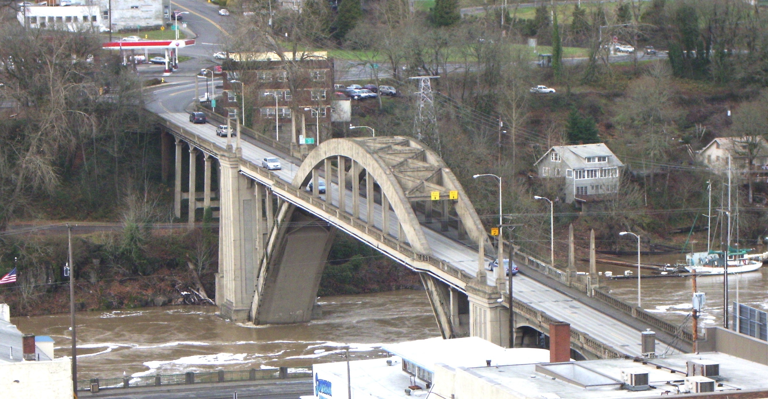
45°20′34″N 122°39′19″W / 45.34278°N 122.65528°WWest Linn[20] 79 Willamette River (Oregon City) Bridge (No. 357) 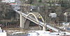
July 1, 2005 Highway 43 spanning the Willamette River[6]
45°21′33″N 122°36′35″W / 45.35923°N 122.6098°WOregon City and West Linn[6] 80 Andrew P. Wilson House image pending June 1, 1990 11188 SE 27th Avenue
45°26′33″N 122°38′06″W / 45.44256°N 122.6349°WMilwaukie 81 Zigzag Ranger Station 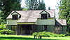
April 8, 1986 70220 E. U.S. Route 26
45°20′34″N 121°56′29″W / 45.3429°N 121.9414°WZigzag See also
- List of National Historic Landmarks in Oregon
- National Register of Historic Places listings in Oregon
- Listings in adjacent counties: Hood River, Marion, Multnomah, Wasco, Washington, Yamhill
- Historic preservation
- History of Oregon
- Lists of Oregon-related topics
References
- ^ National Park Service (1997). "How to Apply the National Register Criteria for Evaluation". http://www.nps.gov/history/nr/publications/bulletins/nrb15/nrb15.pdf. Retrieved 2008-12-17.
- ^ National Park Service. "National Register Research". National Register of Historic Places. http://www.nps.gov/nr/research/index.htm. Retrieved 2008-12-17.
- ^ Oregon Parks and Recreation Department (2009-01-05). "Oregon National Register List". http://www.oregonheritage.org/OPRD/HCD/NATREG/docs/oregon_nr_list.pdf. Retrieved 2009-02-14.
- ^ "National Register of Historic Places: Weekly List Actions". National Park Service, United States Department of the Interior. Retrieved on November 10, 2011.
- ^ Numbers represent an ordering by significant words (e.g. last name). Various colorings (defined here) differentiate standalone NRHP sites from NRHP sites that also hold status as National Historic Landmarks, historic districts, National Historical Parks, or hold other historic designations.
- ^ a b c d e f g National Park Service. "National Register Information System". http://www.cr.nps.gov/NR/research/nris.htm. Retrieved 2009-02-14.[dead link]
- ^ Text: Except as otherwise noted, all entries are drawn from: Oregon Parks and Recreation Department (2009-01-05). "Oregon National Register List". http://www.oregonheritage.org/OPRD/HCD/NATREG/docs/oregon_nr_list.pdf..
Coordinates: Except as otherwise noted, all entries are drawn from either: (a) Google Earth KMZ files available at: National Park Service. "National Register Information System". http://www.cr.nps.gov/NR/research/nris.htm. (b) A Google Earth search for the given street address. In limited instances, editors have adjusted coordinates for accuracy. - ^ Except as otherwise noted, all entries are drawn from: Oregon Parks and Recreation Department (2009-01-05). "Oregon National Register List". http://www.oregonheritage.org/OPRD/HCD/NATREG/docs/oregon_nr_list.pdf. Retrieved 2009-02-14. In limited instances where the source locates the site in the "vicinity" of a city or town, editors may have removed the "vicinity" qualifier in the interest of clarity. In other instances, editors may similarly have added a "vicinity" qualifier.
- ^ a b Observed location of placemark in Google Earth, as drawn from National Park Service. "National Register Information System". http://www.cr.nps.gov/NR/research/nris.htm. Retrieved 2009-02-14.[dead link]
- ^ McLoughlin Memorial Association. "Barclay House". http://www.mcloughlinhouse.org/barclay.html. Retrieved 2009-02-23.
- ^ National Park Service. "National Register Information System". http://www.cr.nps.gov/NR/research/nris.htm. Retrieved 2010-09-09.[dead link]
- ^ Clackamas Heritage Partners (2008). "The Final Leg of the Trail". Historic Oregon City. http://www.historicoregoncity.org/HOC/index.php?option=com_content&view=article&id=142:final-leg&catid=70:oregon-trail-history&Itemid=75. Retrieved 2009-02-22.
- ^ Lohr, Jeff; Catherine Galbraith (April 1978) (PDF). National Register of Historic Places Inventory — Nomination Form. http://www.oregonheritage.org/OPRD/HCD/NATREG/docs/hd_nominations/clackamas_oregoncity_CanemahHD_nom.pdf. Retrieved 2009-02-20. (Nomination of Canemah Historic District to the NRHP.)
- ^ a b c d National Park Service (2009-07-24). "Weekly List of Actions Taken on Properties: 7/13/09 through 7/17/09". http://www.nps.gov/history/nr/listings/20090724.htm. Retrieved 2009-07-23.
- ^ National Park Service. "Fort Vancouver National Historic Site: McLoughlin House". http://www.nps.gov/fova/historyculture/mcloughlin-house.htm. Retrieved 2009-02-23.
- ^ a b Alderbrook Lodge, LLC. "Alderbrook Lodge". http://alderbrooklodgellc.com/. Retrieved 2009-02-17.
- ^ National Park Service (2001-05-18). "Weekly List of Actions Taken on Properties: 5/07/01 through 5/11/01". http://www.nps.gov/history/nr/listings/20010518.htm. Retrieved 2009-03-24.
- ^ a b National Park Service (2008-02-08). "Weekly List of Actions Taken on Properties: 1/28/08 through 2/1/08". http://www.nps.gov/history/nr/listings/20080208.HTM. Retrieved 2009-02-18.
- ^ National Park Service. "National Historic Landmark Program: NHL Database". http://tps.cr.nps.gov/nhl/default.cfm. Retrieved 2009-02-20.
- ^ a b c d National Park Service (2009-10-09). "Weekly List of Actions Taken on Properties: 9/28/09 through 10/02/09". http://www.nps.gov/history/nr/listings/20091009.htm. Retrieved 2009-10-09.
External links
Municipalities and communities of Clackamas County, Oregon Cities Barlow | Canby | Damascus | Estacada | Gladstone | Happy Valley | Johnson City | Lake Oswego‡ | Milwaukie‡ | Molalla | Oregon City | Portland‡ | Rivergrove‡ | Sandy | Tualatin‡ | West Linn | Wilsonville‡
CDPs Hamlets Village Unincorporated
communitiesBarton | Boring | Brightwood | Bull Run | Carus | Carver | Cazadero | Cherryville | Clackamas | Colton | Cottrell | Eagle Creek | Government Camp | Jean | Kelso | Ladd Hill | Lakewood | Liberal | Logan | Lone Elder | Macksburg | Marmot | Marquam | Marylhurst | Milwaukie Heights | Mountain Air Park | Needy | New Era | Redland | Rhododendron | Ripplebrook | Riverside | Shadowood | Springwater | Wankers Corner | Welches | Wemme | Yoder | Zigzag
Footnotes ‡This populated place also has portions in an adjacent county or counties
U.S. National Register of Historic Places in Oregon Lists by county Baker • Benton • Clackamas • Clatsop • Columbia • Coos • Crook • Curry • Deschutes • Douglas • Gilliam • Grant • Harney • Hood River • Jackson • Jefferson • Josephine • Klamath • Lake • Lane • Lincoln • Linn • Malheur • Marion • Morrow • Multnomah: Portland North • Multnomah: Portland Northeast • Multnomah: Portland Northwest • Multnomah: Portland Southeast • Multnomah: Portland Southwest • Multnomah: Other • Polk • Sherman • Tillamook • Umatilla • Union • Wallowa • Wasco • Washington • Wheeler • Yamhill
Other lists Categories:- National Register of Historic Places in Clackamas County, Oregon
-


Wikimedia Foundation. 2010.