- Oregon City, Oregon
-
"Oregon City" redirects here. For other uses, see Oregon City (disambiguation).
City of Oregon City — City — 
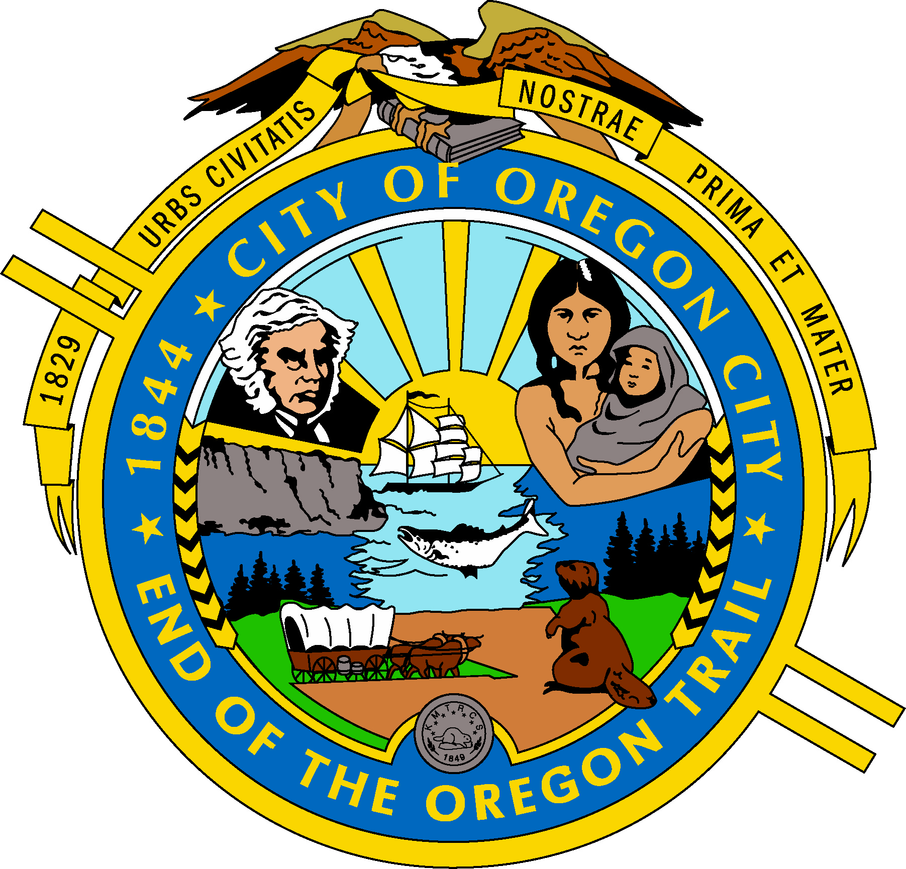
SealNickname(s): End of the Oregon Trail, OC Motto: Urbs civitatis nostrae prima et mater Location in Oregon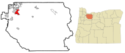
Coordinates: 45°21′26″N 122°36′26″W / 45.35722°N 122.60722°WCoordinates: 45°21′26″N 122°36′26″W / 45.35722°N 122.60722°W Country United States State Oregon County Clackamas Founded 1829 Incorporated 1844 Government – Mayor Doug Neeley Area – Total 8.4 sq mi (21.6 km2) – Land 8.1 sq mi (21.1 km2) – Water 0.2 sq mi (0.5 km2) Elevation 141 ft (42 m) Population (2010) – Total 31,859 – Density 3,163.9/sq mi (1,221.6/km2) Time zone PST (UTC-8) – Summer (DST) PDT (UTC-7) ZIP code 97045 Area code(s) 503 and 971 FIPS code 41-55200[1] GNIS feature ID 1136601[2] Website www.orcity.org Oregon City was the first city in the United States west of the Rocky Mountains to be incorporated. It is the county seat of Clackamas County, Oregon. As of the 2010 census, the city population was 31,859.
The city's motto is Urbs civitatis nostrae prima et mater (First and mothertown of our state), as seen on the city's seal.
Contents
History
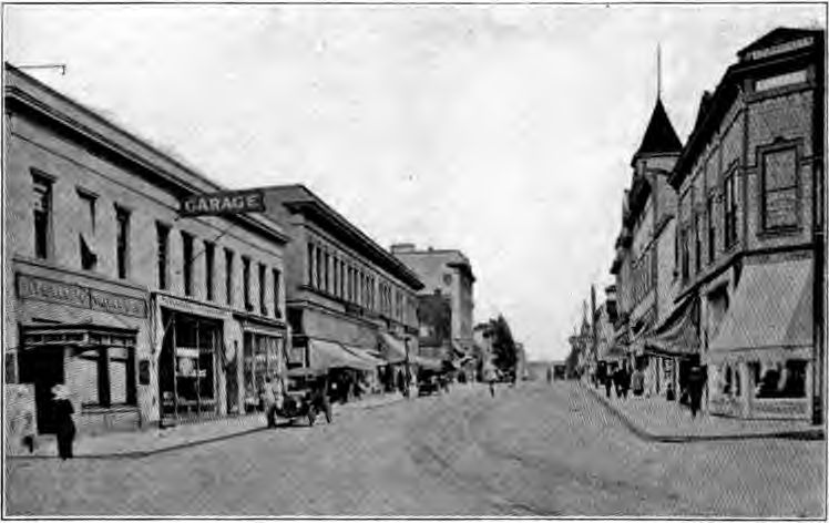
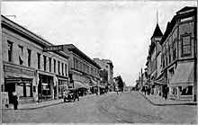 Main Street circa 1920
Known in recent decades as the site of several large paper mills on the Willamette River, the city played a significant role in the early history of the Oregon Country. It was established by Hudson's Bay Company's Dr. John McLoughlin in 1829 near the confluence of the Clackamas River with the Willamette to take advantage of the power of Willamette Falls to run a lumber mill. During the 1840s and 1850s it was the destination for those wanting to file land claims after traveling the Oregon Trail as the last stop on the trail.[3][4] It was the capital of the Oregon Territory from its establishment in 1848 until 1851, and rivaled Portland for early supremacy in the area. In 1846, the city's newspaper, the Oregon Spectator, was the first American newspaper to be published west of the Rocky Mountains. The center of the city retains part of its historic character through the preservation of houses and other buildings from the era of the city's founding.
Geography
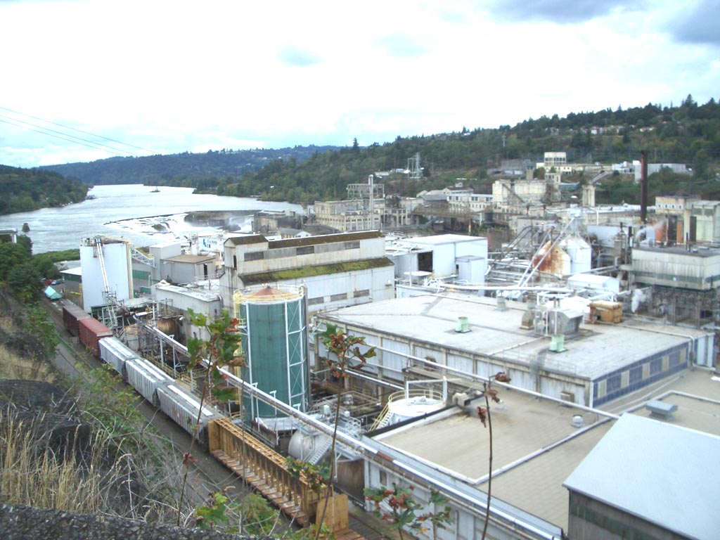
 Willamette Falls and a paper mill at Oregon City Oregon, on the Willamette River
According to the United States Census Bureau, the city has a total area of 8.4 square miles (21.6 km²), of which, 8.1 square miles (21.1 km²) of it is land and 0.2 square miles (0.5 km²) of it (2.52%) is water.[5]
Waterways
The major waterways of Oregon City include the Willamette River, which flows along the northwest side of the city, and the Clackamas River, which merges with the larger Willamette to the north of the city. The Willamette forms the boundary between Oregon City and West Linn; the Clackamas serves as the boundary between Oregon City and Gladstone.
Other notable tributaries of the Willamette are Abernathy (sometimes spelled Abernethy) and Singer Creeks; Newell Creek is a tributary of Abernathy Creek which flows through a canyon on the city's eastern boundary.
Willamette Falls
Main article: Willamette FallsThe Willamette Falls Locks in West Linn were the first multi-lift navigational locks in the United States and are now a National Historical Site, although still in use. The first long-distance electrical service in the United States originated in Oregon City, transmitting electricity 14 miles to Portland.
Topography
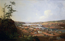 Oregon City, c. 1850–1852
The town is divided into upper and lower areas; the lower area is on a bench next to the Willamette River, and the upper area atop a bluff composed of Columbia Plateau basalt. For many years, Indian trails connected the two, but stairs were built in the 19th century. In 1915 the town built the water-powered Oregon City Municipal Elevator to connect the two parts, which was converted to electricity in the 1920s. In 1952, a new electric elevator was constructed with the specification that it was to be "as plain as possible and without ornament."
Neighborhoods
Oregon City has several neighborhoods represented by official neighborhood associations:[6]
- The Park Place neighborhood is in the northeastern corner of the city, located on a bluff overlooking Abernethy Green. The neighborhood includes a housing project, as well as numerous rural properties. Park Place, formerly an independent community, also includes unincorporated areas outside the city limits. First called Clackamas (a name that was later given to a community three miles north), then Paper Mill, the community was finally named Park Place for a park in a nearby oak grove. Park Place was platted in 1889, and a post office was established the following year. For a while the name was changed to "Parkplace."[7]
- The McLoughlin neighborhood is bordered by Washington Street and Singer Hill on the Northwest, a bluff overlooking Abernethy Creek on the northeast and east, and Division Street on the south. It also includes extends to the west to border the Canemah district. The John McLoughlin House and the upper entrance to the Municipal Elevator are located in this neighborhood.
- The Barclay Hills neighborhood lies between Rivercrest Park on the west, the city limits on the east, the McLoughlin Neighborhood on the north, and Warner-Milne Road on the south. This neighborhood is bisected by Molalla Avenue, the former route of Oregon Route 213 before it was moved to the Oregon City Bypass to the east.
- The Canemah neighborhood lies along Oregon Route 99E, and is a narrow strip of land sandwiched between the Willamette River and a bluff. Canemah was once an independent city before being annexed into Oregon City. Canemah was founded in 1845 and was the portage site around Willamette Falls for many years. It was supposedly named after an Indian chief.[7]
- The Rivercrest neighborhood includes Rivercrest Park, and the residential communities overlooking the Willamette River to the west.
- The South End neighborhood lies to the southwest of Rivercrest Park. It centers around the intersection of South End and Warner-Parrot roads, and was the location of Oregon City's (now defunct) drive-in movie theater.
- The Hazel Grove/Westling Farm neighborhood lies in the southwestern corner of the city, lying between the bluffs over the Willamette River and the unincorporated areas to the south.
- The Tower Vista neighborhood lies southeast of South End, and east of Hazel Grove/Whistling Farm. It is bordered on the east and southeast by Leland Road.
- The Hillendale neighborhood lies south of Warner-Milne Road, east of Leland Road, north of Clairmont Way and Beavercreek Road, and west of OR 213 and the city limits. The former site of City Hall is located here, as is the Clackamas County jail.
- The Gaffney Lane neighborhood, centered around the elementary school of the same name, lies south of Hillendale, west of OR 213, and north/east of the city limits.
- The Caufield neighborhood contains those parts of the city located south of Park Place, and east of OR 213. Clackamas Community College is located here, as is Oregon City High School.
In addition, the downtown core of Oregon City, along with Abernethy Green and those portions of the city north of I-205, are not represented by any neighborhood association.
Climate
Climate data for Oregon City, OR Month Jan Feb Mar Apr May Jun Jul Aug Sep Oct Nov Dec Year Average high °F (°C) 48
(9)53
(12)58
(14)63
(17)70
(21)76
(24)83
(28)83
(28)78
(26)66
(19)53
(12)47
(8)64.83 Average low °F (°C) 36
(2)37
(3)40
(4)43
(6)48
(9)52
(11)56
(13)56
(13)52
(11)46
(8)40
(4)36
(2)45.17 Precipitation inches (mm) 6.59
(167.4)5.51
(140)4.7
(119)3.46
(87.9)2.7
(69)1.83
(46.5)0.83
(21.1)1
(25)1.93
(49)3.48
(88.4)6.79
(172.5)7.23
(183.6)46.05
(1,169.7)Source: The Weather Channel[8] Demographics
Historical populations Census Pop. %± 1880 1,262 — 1890 3,167 151.0% 1900 3,494 10.3% 1910 4,987 42.7% 1920 5,686 14.0% 1930 5,761 1.3% 1940 6,124 6.3% 1950 7,082 15.6% 1960 7,996 12.9% 1970 9,176 14.8% 1980 14,673 59.9% 1990 14,698 0.2% 2000 25,754 75.2% 2010 31,859 23.7% U.S. Decennial Census As of the census[1] of 2000, there were 25,754 people, 9,471 households, and 6,667 families residing in the city. The population density was 3,163.9 people per square mile (1,221.6/km²). There were 10,110 housing units at an average density of 1,242.0 per square mile (479.5/km²). The racial makeup of the city was 92.44% White, 1.12% Asian, 0.11% Pacific Islander, 1.08% Native American, 0.58% African American, 2.15% from other races, and 2.53% from two or more races. Hispanic or Latino of any race were 4.98% of the population.
There were 9,471 households out of which 36.6% had children under the age of 18 living with them, 53.0% were married couples living together, 12.3% had a female householder with no husband present, and 29.6% were non-families. 22.4% of all households were made up of individuals and 7.8% had someone living alone who was 65 years of age or older. The average household size was 2.62 and the average family size was 3.06.
In the city the population was spread out with 27.0% under the age of 18, 10.3% from 18 to 24, 32.5% from 25 to 44, 20.5% from 45 to 64, and 9.7% who were 65 years of age or older. The median age was 33 years. For every 100 females there were 96.8 males. For every 100 females age 18 and over, there were 94.7 males.
The median income for a household in the city was $45,531, and the median income for a family was $51,597. Males had a median income of $38,699 versus $29,547 for females. The per capita income for the city was $19,870. About 6.5% of families and 8.9% of the population were below the poverty line, including 11.0% of those under age 18 and 7.5% of those age 65 or over.
Economy
For much of its existence, Oregon City's economy has been dominated by the forestry industry, until the decline of the Pacific Northwest lumber industry started in the 1980s. At its height, several mills operated in the city and surrounding communities; all but one paper mill have been shuttered.
Today, the city is home to several notable high technology and light manufacturing concerns. Notable companies based in Oregon City include Benchmade, a leading manufacturer of high-end cutlery. Chrome Systems Corporation (formerly Chrome Data) was founded there, but has since moved its operations to nearby Portland. Medrisk, LLC is a major insurance brokerage which does business in the Northwest and is headquartered in Oregon City. In 2006 Anderson Vending Inc. chose Oregon City as its new headquarters.
Education
The city, and several surrounding communities, is served by the Oregon City School District,[9] a public school district consisting of 10 elementary schools, two middle schools, a traditional four-year high school (Oregon City High School), and an alternative secondary school. Several schools in the district offer bilingual English/Spanish programs. Oregon City High School is the third most populated high school in Oregon, and is a state and national power in girls' basketball, winning three consecutive USA Today girls' national championships in the 1990s.[citation needed]
The city also is the home of Clackamas Community College, numerous private and parochial schools, and a public library that is part of the Library Information Network of Clackamas County.
Points of interest
Museums
Many historical buildings have been preserved in Oregon City, including the McLoughlin House, John McLoughlin's Georgian home. The Ermatinger House, the oldest house in Clackamas County, dates to about 1845. The Stevens Crawford Museum is an 1908 structure with 15 furnished rooms, many with their original fittings, as the house was used as a home continuously until 1968.
Other museums include the Museum of the Oregon Territory and the End of the Oregon Trail Interpretive Center, with costumed "living history" guides. The Clackamas County Historical Society archives, housed in the Museum of the Oregon Territory, also include the incorporation plat for the city of San Francisco. Clackamas Heritage Partners owns and operates these museums, along with the Stevens Crawford Museum. In 2009, Clackamas Heritage Partners announced that it could no longer afford to keep the museums open. The End of the Oregon Trail Interpretive Center was closed to the public indefinitely in September 2009, while the Stevens Crawford Museum and Museum of the Oregon Territory, which are staffed largely by volunteers, will operate on a limited schedule.[10]
Parks
Oregon City currently has over 22 city parks, with more planned for the future. One of the city's larger parks is Clackamette Park, at the confluence of the Clackamas and Willamette Rivers. The park's features include RV camping, a boat launch and dock, a skateboard park, and other recreational facilities. Several community festivals are held there throughout the year. Other major parks include Chapin, Hillendale, Rivercrest, and the new Wesley Lynn.
Transportation
 Municipal Elevator in Oregon City
The city is served by the following transportation links:
Road
Interstate 205 passes through the city's northern edge, and is the only freeway to serve the city. In addition, three state highways (OR 43, OR 99E, and OR 213) pass through or terminate in Oregon City. The former two serve the city's downtown core, the latter provides service to the southern parts of Oregon City.
Rail
The Union Pacific Railroad mainline passes through the city, and provides service to the Blue Heron paper mill immediately west of downtown. The city also has an Amtrak depot, which is served twice daily in each direction by Amtrak Cascades trains running between Portland and Eugene, Oregon.
Air
There are no public airports located within the city. A small private airfield is located along Beavercreek Road, south of Oregon City. Oregon City is served by Portland International Airport, located 15 miles (25 km) to the north, and by Portland-Mulino Airport, a general-aviation facility located in the town of Mulino, located approximately 15 miles (24 km) to the south.
Water
The Willamette River in Oregon City is navigable to small craft, and Oregon City has a thriving fishing and recreational boating industry. The Willamette Falls Locks allow boats to navigate around the falls. The Clackamas River is not navigable, except for the lowermost portions.
Transit
As part of the greater Portland metropolitan area, Oregon City is served by TriMet, the regional transit authority, with several bus lines. Until 1958, an interurban trolley line operated by the now-defunct Portland Traction Company connected Oregon City with Portland;[11] remnants of this line are still visible (such as an abandoned bridge across the Clackamas River, just east of the OR 99E bridge). Today, the city operates a "historic trolley" service during the summer months, primarily to serve the needs of tourism, but the vehicles used are trolley-replica buses, rather than actual trolley cars.
Two other public agencies provide transit service in Oregon City, supplementing that of TriMet. The South Clackamas Transportation District (SCTD) operates a route between Clackamas Community College on the south east end of Oregon City to Molalla, about 18 miles (29 km) south on Oregon Route 213. Canby Area Transit (CAT) operates regular service on Oregon Route 99E between the Oregon City Transit Center and Canby. SMART, South Metro Area Regional Transit, serving Wilsonville, connects to CAT in Canby. CAT also has service to Woodburn.
Dial-a-ride service is operated by TriMet, but CAT also operates within the Oregon City city limits for trips originating or terminating in the CAT service area. If transfers between TriMet and CAT are necessary, they are accomplished at the Oregon City Transit Center (OCTC) at 11th & Main, which is at the northeast end of the downtown area.
Notable people
Oregon pioneer history
- John McLoughlin, the "Father of Oregon". Chief factor of the Hudson's Bay Company until 1845; lived in Oregon City from 1846 until his death in 1857.
Early governors of Oregon
Oregon City was the capital of the Oregon Territory until 1851; the following governors served during that time:
- George Abernethy, provisional governor of the Oregon Country (1845–1848)
- George Law Curry, journalist and acting territorial governor
- John P. Gaines, governor of Oregon territory, 1850-1853. During his term (and against his wishes), the territorial capital of Oregon moved to Salem.
- Joseph Lane, First governor of the Oregon Territory, 1848–1850; acting governor in 1853.
- Kintzing Prichette, acting governor, 1850
Other notable figures from the pioneer era
- John C. Ainsworth, pioneer, businessman, steamship captain
- George H. Atkinson, pioneer, missionary, co-founder of Pacific University
- Asahel Bush, pioneer, printer, founder of the Salem Statesman Journal
- Tabitha Brown, pioneer, co-founder of Pacific University
- Captain John H. Couch, seaman and trader
- Philip Foster, settler and businessman
- Gustavus Hines, missionary
- Amory Holbrook, mayor, attorney
- Peter Skene Ogden, explorer and fur trader
- Samuel Parker, politician, pioneer
- Peter G. Stewart, pioneer, politician, watchmaker
- William G. T'Vault, pioneer, postmaster, publisher
- Aaron E. Waite, pioneer, first chief justice of the state of Oregon
- Alvin F. Waller, pioneer, missionary
Sports
- Brian Burres, major league baseball pitcher
- Jeff Charleston, professional American football player
- Ed Coleman, major league baseball player
- Jeff Lahti, major league baseball pitcher
- Matt Lindland, Olympics silver medalist in wrestling, mixed martial artist
- Dan Monson, basketball coach
- Jonah Nickerson, pitcher for the Oregon State Beavers men's baseball team, and the Most Outstanding Player of the 2006 College World Series
- Dean Peters, professional wrestler
- Trevor Wilson, a former major-league pitcher for the San Francisco Giants and Anaheim Angels
- Lindsey Yamasaki, professional women's basketball player
- John Stalberger and Mike Marshall, the inventors of Hacky Sack
- Brad Tinsley Basketball. Vanderbilt University in Nashville, Tennessee
Arts
- Meredith Brooks, singer/songwriter
- M. K. Hobson, science fiction writer
- Kenneth Scott Latourette, historian
- Edwin Markham, American Poet Laureate
- Bobby Preston, actor
- Louis Conrad Rosenberg, artist and architect
- Jeffrey St. Clair, journalist and author
Business
- Melville Eastham, businessman, engineer, radio pioneer
- David Eccles, railroadman and businessman
Other
- Larry G. Dahl, Medal of Honor recipient
- Ward Weaver III, child murderer
Sister cities
Oregon City has one sister city, as designated by Sister Cities International:
See also
- Canemah, Oregon
- Steamboats of the Willamette River
References
- ^ a b "American FactFinder". United States Census Bureau. http://factfinder.census.gov. Retrieved 2008-01-31.
- ^ "US Board on Geographic Names". United States Geological Survey. 2007-10-25. http://geonames.usgs.gov. Retrieved 2008-01-31.
- ^ The Oregon Trail: Oregon City
- ^ America's Byways: Historic Columbia River Highway
- ^ "US Gazetteer files: 2010, 2000, and 1990". United States Census Bureau. 2011-02-12. http://www.census.gov/geo/www/gazetteer/gazette.html. Retrieved 2011-04-23.
- ^ Neighborhood Associations
- ^ a b McArthur, Lewis A.; Lewis L. McArthur (2003) [1928]. Oregon Geographic Names (Seventh Edition ed.). Portland, Oregon: Oregon Historical Society Press. ISBN 0-87595-277-1.
- ^ "Monthly Averages for Oregon City, OR". Weather.com. 2010. http://www.weather.com/weather/wxclimatology/monthly/USOR0260. Retrieved 2010-04-17.
- ^ [1] Oregon City School District Home Page
- ^ "Iconic Oregon City museum closing again". Oregon City News. http://www.oregoncitynewsonline.com/news/story.php?story_id=125062467268885900. Retrieved 2009-09-09.
- ^ Thompson, Richard (2006). Portland's Streetcars, pp. 114-121. Arcadia Publishing. ISBN 0-7385-3115-4.
External links
- Entry for Oregon City in the Oregon Blue Book
- Historic Oregon City
- Oregon City Chamber of Commerce
- Oregon City community profile from the Oregon Infrastructure Finance Authority
Municipalities and communities of Clackamas County, Oregon County seat: Oregon CityCities Barlow | Canby | Damascus | Estacada | Gladstone | Happy Valley | Johnson City | Lake Oswego‡ | Milwaukie‡ | Molalla | Oregon City | Portland‡ | Rivergrove‡ | Sandy | Tualatin‡ | West Linn | Wilsonville‡
CDPs Hamlets Village Unincorporated
communitiesBarton | Boring | Brightwood | Bull Run | Carus | Carver | Cazadero | Cherryville | Clackamas | Colton | Cottrell | Eagle Creek | Government Camp | Jean | Kelso | Ladd Hill | Lakewood | Liberal | Logan | Lone Elder | Macksburg | Marmot | Marquam | Marylhurst | Milwaukie Heights | Mountain Air Park | Needy | New Era | Redland | Rhododendron | Ripplebrook | Riverside | Shadowood | Springwater | Wankers Corner | Welches | Wemme | Yoder | Zigzag
Footnotes ‡This populated place also has portions in an adjacent county or counties
 State of Oregon
Topics Society Regions Metros Cities - Albany
- Astoria
- Baker City
- Beaverton
- Brookings
- Coos Bay
- Corvallis
- Florence
- Grants Pass
- Gresham
- Hillsboro
- Hood River
- Independence
- Klamath Falls
- La Grande
- Lake Oswego
- Lakeview
- Madras
- McMinnville
- Milwaukie
- Monmouth
- Newberg
- Newport
- Ontario
- Oregon City
- Pendleton
- Prineville
- Roseburg
- Sandy
- The Dalles
- Tigard
- Tillamook
- Tualatin
- Umatilla
- West Linn
- Wilsonville
- Woodburn
Counties Categories:- Oregon City, Oregon
- Cities in Oregon
- Populated places in Clackamas County, Oregon
- County seats in Oregon
- Willamette Valley
- Oregon Trail
- United States colonial and territorial capitals
- Populated places established in 1829
- Portland metropolitan area


Wikimedia Foundation. 2010.