- Molalla, Oregon
-
For other uses, see Molalla (disambiguation).
Molalla, Oregon — City — Vonder Ahe House Location in Oregon
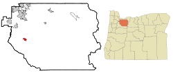
Coordinates: 45°8′58″N 122°34′45″W / 45.14944°N 122.57917°W Country United States State Oregon County Clackamas Incorporated 1913 Government – Mayor Mike A. Clarke Area – Total 1.9 sq mi (5.0 km2) – Land 1.9 sq mi (5.0 km2) – Water 0 sq mi (0 km2) Elevation 371 ft (113.1 m) Population (2000) – Total 5,647 – Density 2,939.4/sq mi (1,135.6/km2) Time zone Pacific (UTC-8) – Summer (DST) Pacific (UTC-7) ZIP code 97038 Area code(s) 503 FIPS code 41-49450[1] GNIS feature ID 1124282[2] Website www.cityofmolalla.com Molalla (
 /məˈlɑːlə/) is a city in Clackamas County, Oregon, United States. The population was 5,647 at the 2000 census.
Contents
History
Molalla was named after the Molalla River, which in turn was named for the Molala, a Native American tribe that inhabited the area. William H. Vaughan took up a donation land claim in the area in 1844. Molalla post office was established in 1850, near the site of Liberal, and was discontinued in 1851. The post office was reestablished in 1868 and it ran until 1874, then was reestablished in 1875, which is when it was probably placed at the present location of Molalla.[3]
Since the late 1990s the city has been experiencing a surge in growth and expansion in the residential sector.[citation needed] A number of business franchises have located in Molalla since 2000.[citation needed] In 2005, Molalla installed its first stoplight, at the intersection of Oregon Route 211 and Oregon Route 213, because of the traffic brought by the increased business activity.[citation needed]
Geography
Molalla is located in the foothills of the Cascade Range, near the Mount Hood National Forest, 15 miles south of Oregon City and 13 miles from Interstate 5. Molalla is surrounded by farms and rural residential development.
According to the United States Census Bureau, the city has a total area of 1.9 square miles (4.9 km2), all of it land.
Demographics
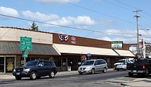 Main street in Molalla
As of the census[1] of 2000, there were 5,647 people, 1,948 households, and 1,425 families residing in the city. The population density was 2,939.4 people per square mile (1,135.6/km²). There were 2,027 housing units at an average density of 1,055.1 per square mile (407.6/km²). The racial makeup of the city was 88.60% White, 0.44% African American, 1.29% Native American, 0.50% Asian, 0.28% Pacific Islander, 6.69% from other races, and 2.20% from two or more races. Hispanic or Latino of any race were 10.55% of the population.
There were 1,948 households out of which 43.8% had children under the age of 18 living with them, 56.7% were married couples living together, 11.6% had a female householder with no husband present, and 26.8% were non-families. 21.6% of all households were made up of individuals and 9.2% had someone living alone who was 65 years of age or older. The average household size was 2.84 and the average family size was 3.29.
In the city the population was spread out with 31.8% under the age of 18, 9.7% from 18 to 24, 32.4% from 25 to 44, 15.6% from 45 to 64, and 10.6% who were 65 years of age or older. The median age was 30 years. For every 100 females there were 94.7 males. For every 100 females age 18 and over, there were 91.3 males.
The median income for a household in the city was $42,672, and the median income for a family was $46,915. Males had a median income of $37,172 versus $25,988 for females. The per capita income for the city was $16,738. About 7.3% of families and 9.7% of the population were below the poverty line, including 10.2% of those under age 18 and 10.8% of those age 65 or over.
Economy
Molalla's economy was traditionally based on logging and agriculture, but with the downturn in the timber industry, the city is turning to manufacturing to revitalize its economy.[4][5] Major employers in Molalla include the Molalla River School District, Brentwood Industries, RSG Forest Products, and RMS Technology, Inc.[citation needed]
Arts and culture
Annual cultural events
Molalla is the home of the Molalla Buckeroo Rodeo and the Apple Festival. It also hosts the Ross Coleman Invitational, an annual Professional Bull Riders (PBR) minor-league tour event hosted by PBR bull rider and Molalla native Ross Coleman.
Museums and other points of interest
There is a miniature steam train, the Shady Dell Pacific Railroad, in Molalla Train Park three miles east of Molalla.[6]
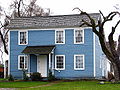
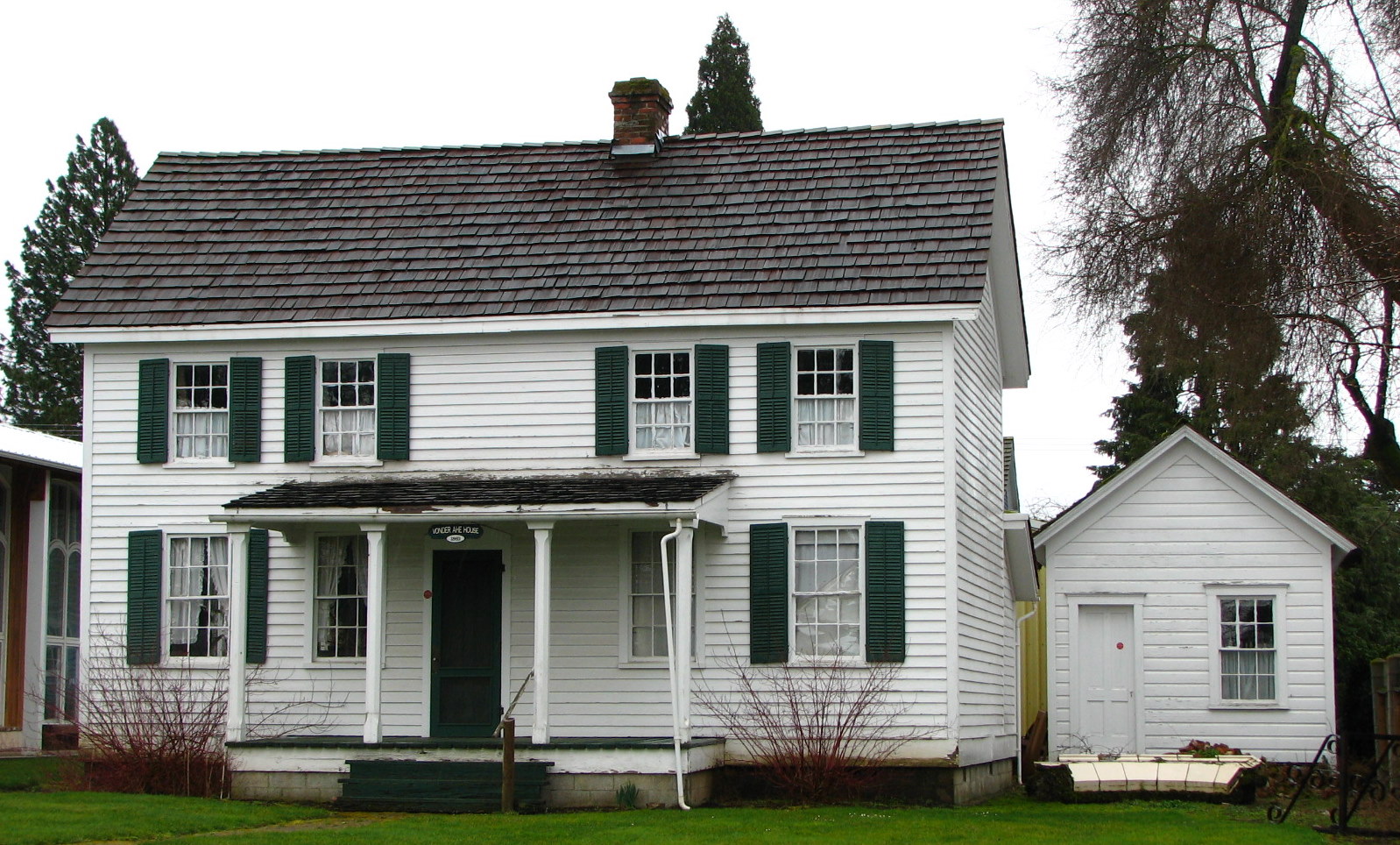
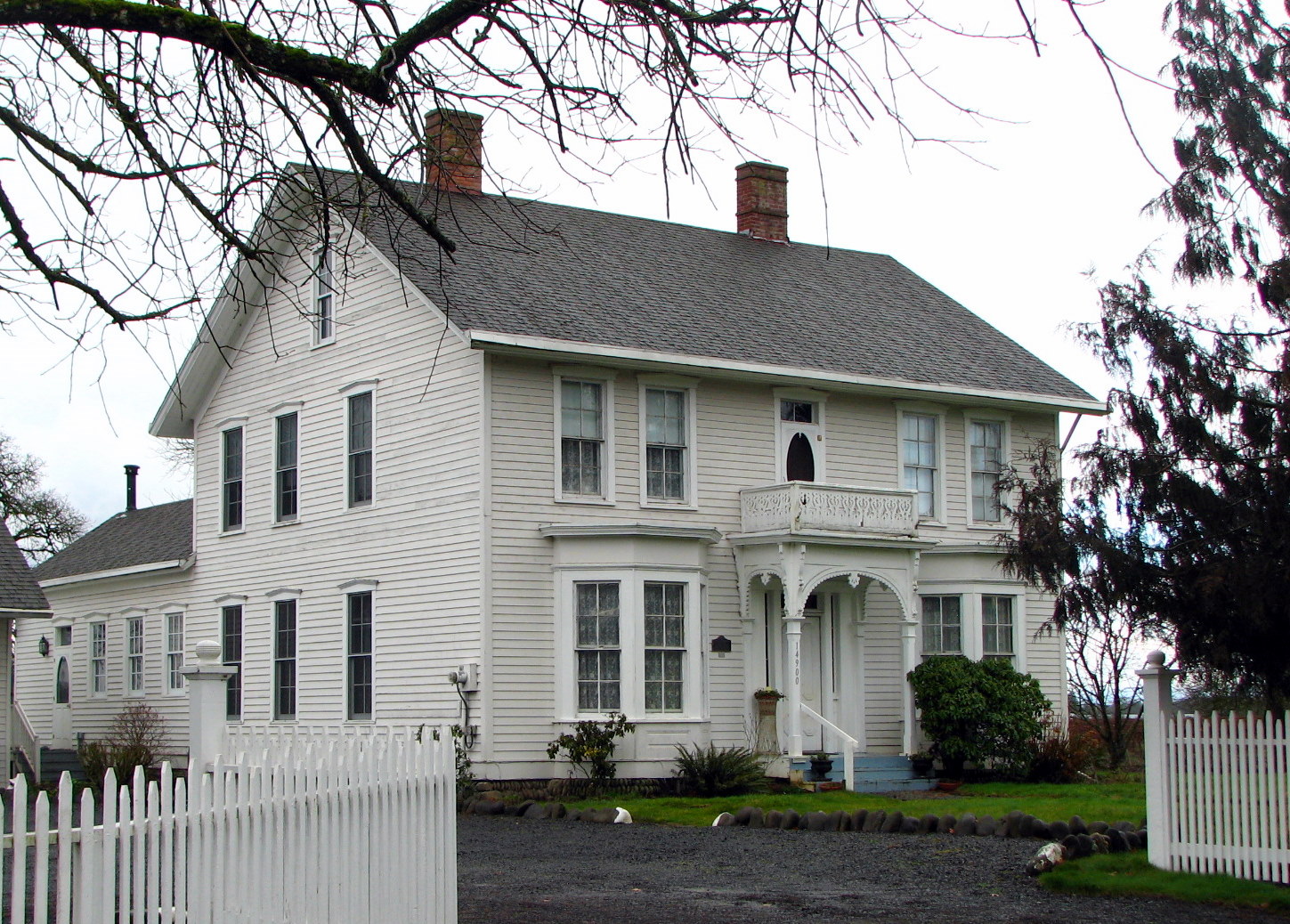
The Horace L. Dibble House and the Fred Vonder Ahe House and Summer Kitchen are buildings in Molalla on the National Register of Historic Places (NRHP) that have been preserved by the Molalla Area Historical Society.[7][8][9] The NRHP-listed Rock Creek Methodist Church and William Hatchette Vaughan House are also in the Molalla area.[10]
Parks and recreation
The Molalla River corridor offers opportunities for outdoor activities, including fishing, hunting, and hiking. Along the corridor to the east, Table Rock is a favorite local rocky promontory that provides visitors with a view of Molalla and the surrounding countryside for miles in every direction.
Education
Molalla is served by the Molalla River School District. There is one public high school within the Molalla River School District, Molalla High School, and seven primary and middle schools. Molalla is also home of the private Country Christian School which serves students from preschool to twelfth grade (PK-12) and has 288 students. Both schools compete in the Oregon School Activities Association.
The city operates a public library that is part of the Library Information Network of Clackamas County.
Media
The Molalla Pioneer is a bi-weekly paper published Wednesday and Saturday by Eagle Newspapers.[11] Molalla is also served by radio and TV broadcasting stations from Portland, and residents have access to cable and satellite systems.
Infrastructure
Transportation
- Road
Molalla's principal road links are Oregon routes 211 and 213. Route 213, heading north, links Molalla to Oregon City and Portland. Heading south, Route 213 connects Molalla to Silverton and Salem. Route 211, which intersects Route 213, connects the city to Canby and Woodburn to the west, and Colton, Estacada, and Sandy to the east.
- Air
Molalla is served by a number of small regional airports:
- Skydive Oregon (About two miles west)
- Portland-Mulino Airport (About four miles north)
- Lenhardt Airpark (About 11 miles west)
- Aurora State Airport (About 12 miles northwest)
- Rail
Molalla does not have a rail link within city limits, although it was formerly served by the Oregon Pacific Railroad. The Oregon Pacific tracks now end at Liberal, three miles to the north.[12] The closest Amtrak station is in Oregon City.
Utilities
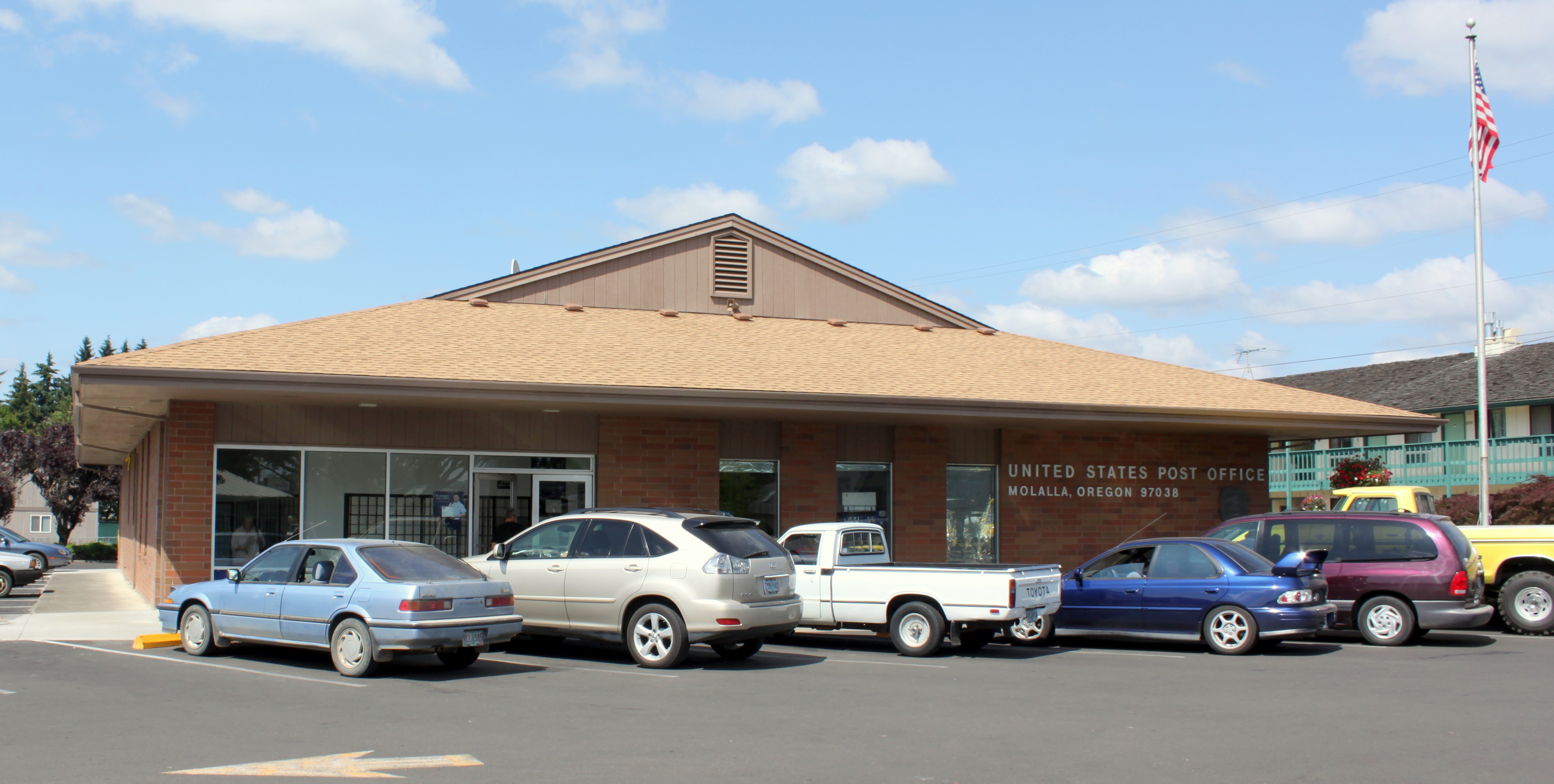
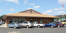 Molalla post office
Water and wastewater treatment are provided by the City of Molalla.[13] Natural gas is provided by NW Natural and electricity is provided by Portland General Electric.[13]
Healthcare
Molalla is served by Silverton Hospital in Silverton and Willamette Falls Hospital in Oregon City.[13][14]
Notable people
- Roger Beyer, Oregon state senator
- Kevin Freeman, Olympic equestrian
- Ralph M. Holman, Oregon Supreme Court judge
- Rufus C. Holman, United States senator
- Macy Morse, peace activist
Gallery
-
Dibble House
-

Vaughan House
References
- ^ a b "American FactFinder". United States Census Bureau. http://factfinder.census.gov. Retrieved 2008-01-31.
- ^ "US Board on Geographic Names". United States Geological Survey. 2007-10-25. http://geonames.usgs.gov. Retrieved 2008-01-31.
- ^ McArthur, Lewis A.; Lewis L. McArthur (2003) [1928]. Oregon Geographic Names (7th ed.). Portland, Oregon: Oregon Historical Society Press. p. 655. ISBN 0-87595-277-1.
- ^ Molalla Area Chamber of Commerce: History & Lodging
- ^ Culverwell, Wendy (August 24, 2007). "Growing Molalla reaps rewards". Portland Business Journal. http://www.bizjournals.com/portland/stories/2007/08/27/story2.html. Retrieved March 8, 2009.
- ^ Molalla Train Park
- ^ Molalla Area Chamber of Commerce: Area Attractions
- ^ City of Molalla: Von der Ahe House
- ^ City of Molalla: Dibble House
- ^ "Oregon National Register List". Oregon State Parks and Recreation Department. January 5, 2009. http://www.oregon.gov/OPRD/HCD/NATREG/docs/oregon_nr_list.pdf. Retrieved March 8, 2009.
- ^ Molalla Pioneer
- ^ Molalla Branch of the Oregon Pacific Railroad
- ^ a b c Molalla profile from Oregon Economic & Community Development Department
- ^ Silverton Hospital: Silverton Hospital Network
External links
- City of Molalla (official website)
- Listing for Molalla in the Oregon Blue Book
- Historic images of Molalla from Salem Public Library
Coordinates: 45°08′58″N 122°34′45″W / 45.149578°N 122.579206°W
Municipalities and communities of Clackamas County, Oregon Cities Barlow | Canby | Damascus | Estacada | Gladstone | Happy Valley | Johnson City | Lake Oswego‡ | Milwaukie‡ | Molalla | Oregon City | Portland‡ | Rivergrove‡ | Sandy | Tualatin‡ | West Linn | Wilsonville‡
CDPs Hamlets Village Unincorporated
communitiesBarton | Boring | Brightwood | Bull Run | Carus | Carver | Cazadero | Cherryville | Clackamas | Colton | Cottrell | Eagle Creek | Government Camp | Jean | Kelso | Ladd Hill | Lakewood | Liberal | Logan | Lone Elder | Macksburg | Marmot | Marquam | Marylhurst | Milwaukie Heights | Mountain Air Park | Needy | New Era | Redland | Rhododendron | Ripplebrook | Riverside | Shadowood | Springwater | Wankers Corner | Welches | Wemme | Yoder | Zigzag
Footnotes ‡This populated place also has portions in an adjacent county or counties
Categories:- Cities in Oregon
- Populated places in Clackamas County, Oregon
- Portland metropolitan area
- Populated places established in 1913
- Populated places established in 1850
- Molalla, Oregon


Wikimedia Foundation. 2010.