- Rivergrove, Oregon
Infobox Settlement
official_name = Rivergrove, Oregon
settlement_type =City
nickname =
motto =
imagesize =
image_caption =
image_
imagesize =
image_caption =
image_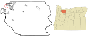
mapsize = 250px
map_caption = Location inOregon
mapsize1 =
map_caption1 =
subdivision_type = Country
subdivision_name =United States
subdivision_type1 = State
subdivision_name1 =Oregon
subdivision_type2 = Counties
subdivision_name2 = Clackamas, Washington
government_type =
leader_title =Mayor
leader_name = Hafez Daraee
established_title = Incorporated
established_date =1971
area_magnitude =
area_total_sq_mi = 0.2
area_total_km2 = 0.5
area_land_sq_mi = 0.2
area_land_km2 = 0.5
area_water_sq_mi = 0
area_water_km2 = 0
area_urban_sq_mi =
area_urban_km2 =
area_metro_sq_mi =
area_metro_km2 =
population_as_of =2000
population_note =
population_total = 324
population_metro =
population_urban =
population_density_km2 = 1807.9
population_density_sq_mi = 695.0
timezone = Pacific
utc_offset = -8
timezone_DST = Pacific
utc_offset_DST = -7
latd = 45 |latm = 23 |lats = 7 |latNS = N
longd = 122 |longm = 44 |longs = 2 |longEW = W
elevation_m = 40.2
elevation_ft = 132
website =
postal_code_type =
postal_code =
area_code =
blank_name = FIPS code
blank_info = 41-62250GR|2
blank1_name = GNIS feature ID
blank1_info = 1136685GR|3
footnotes =Rivergrove is city in Clackamas,
Oregon ,United States . A small portion of the city extends into Washington County. Its name comes from a combination of theTualatin River (which forms its southern border), and Lake Grove, a community that is now part of Lake Oswego. The population was 324 at the 2000 census.History
Rivergrove came into existence January 27, 1971, after a vote of 57 to 48 in favor of incorporation. The residents were afraid of being ultimately incorporated into either lake Oswego to the northwest, or Tualatin to the southwest.
Other than some subtle signage on three streets entering Rivergrove, there is no clear demarkation separating Rivergrove from either adjacent community: one has to know that it exists to even be aware that one is driving through the city.
Geography
Rivergrove is located at coor dms|45|23|7|N|122|44|2|W|city (45.385199, -122.733977)GR|1.
According to the
United States Census Bureau , the city has a total area of 0.2square mile s (0.5km² ).None of the area is covered with water.Demographics
As of the
census GR|2 of 2000, there were 324 people, 117 households, and 87 families residing in the city. Thepopulation density was 1,807.9 people per square mile (695.0/km²). There were 122 housing units at an average density of 680.7/sq mi (261.7/km²). The racial makeup of the city was 93.83% White, 2.47% Asian, 1.54% from other races, and 2.16% from two or more races. Hispanic or Latino of any race were 2.78% of the population.There were 117 households out of which 34.2% had children under the age of 18 living with them, 69.2% were married couples living together, 3.4% had a female householder with no husband present, and 24.8% were non-families. 18.8% of all households were made up of individuals and 4.3% had someone living alone who was 65 years of age or older. The average household size was 2.77 and the average family size was 3.18.
In the city the population was spread out with 27.5% under the age of 18, 4.3% from 18 to 24, 28.7% from 25 to 44, 32.4% from 45 to 64, and 7.1% who were 65 years of age or older. The median age was 39 years. For every 100 females there were 94.0 males. For every 100 females age 18 and over, there were 102.6 males.
The median income for a household in the city was $85,000, and the median income for a family was $93,212. Males had a median income of $58,125 versus $40,500 for females. The
per capita income for the city was $31,546. About 4.8% of families and 4.7% of the population were below thepoverty line , including 8.6% of those under age 18 and none of those age 65 or over.References
External links
* [http://bluebook.state.or.us/local/cities/lr/rivergrove.htm Oregon Blue Book listing for Rivergrove]
* [http://rivergrove.home.comcast.net Rivergrove, Oregon volunteer supported web page]
Wikimedia Foundation. 2010.