- High Desert (Oregon)
-
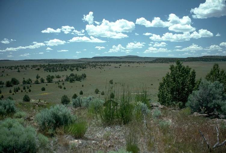
Oregon High Desert "Oregon Outback" and "Great Sandy Desert" Region 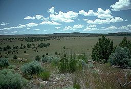 Oregon high desert near Frenchglen
Country United States State Oregon Municipality Crook, Deschutes, Grant, Harney, Lake, and
Malheur countiesPart of Columbia Plateau (north) and Great Basin (south) Borders on Cascade Mountains (west)
Blue Mountains (north)
Idaho border (east)
Nevada border (south)City Bend, Burns, Lakeview, and Prineville Highest point - location Steens Mountain - elevation 9,733 ft (2,967 m) Length 130 mi (209 km), North-South Width 200 mi (322 km), East-West 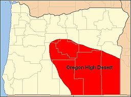
The Oregon High Desert is a region of the U.S. state of Oregon located in the central and eastern parts of the state. It covers most of five Oregon counties. The southern region is part of the Great Basin. The somewhat less arid northern region is part of the Columbia Plateau and supports some farming.
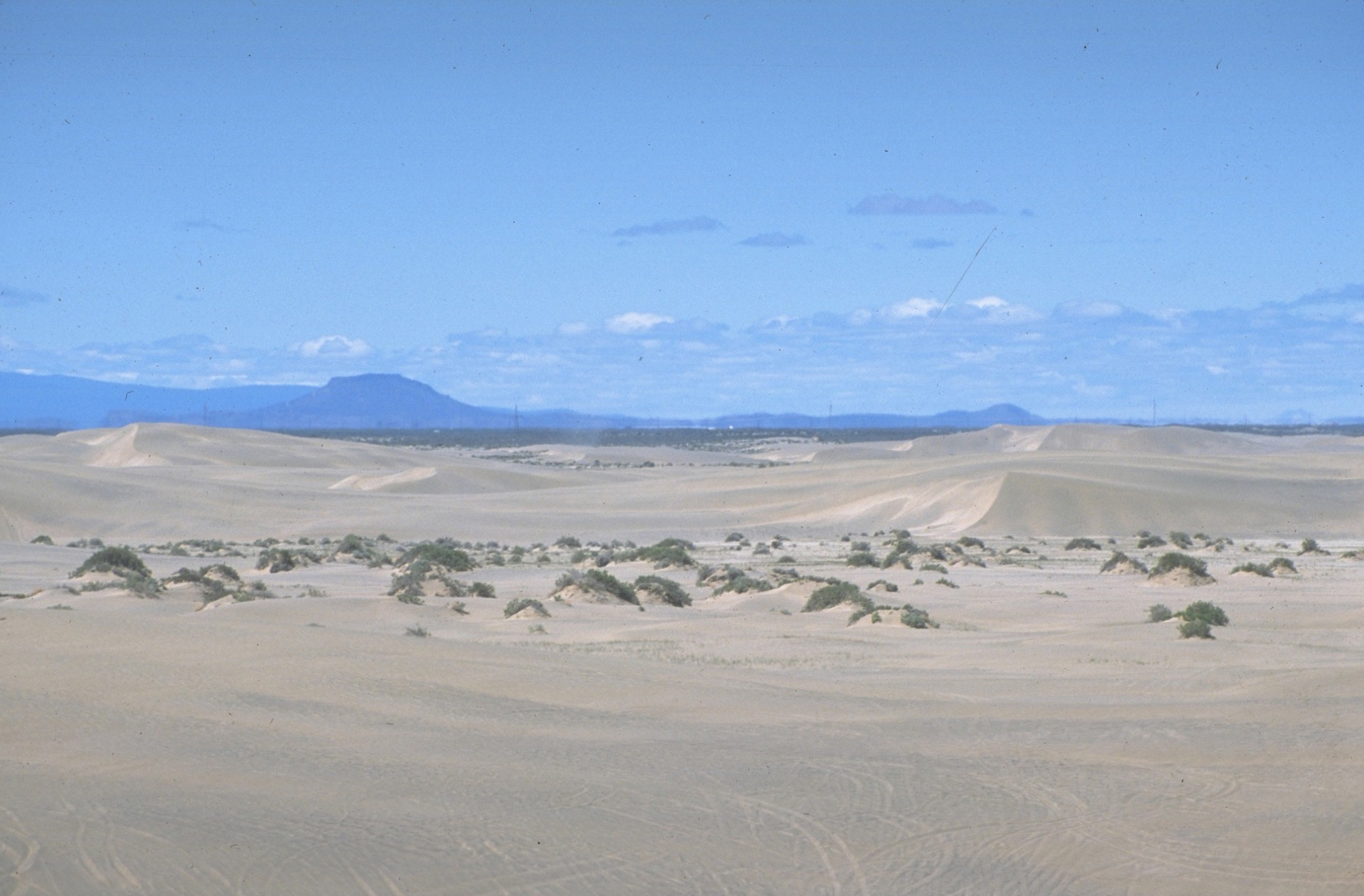
While the High Desert is somewhat dry, it is only arid relative to Western Oregon for the most part, aside from a few patches, such as the Alvord Desert, which gets only 7 inches of rain. Contrary to its name, most of the High Desert is not dry enough to truly qualify as desert and some areas even support sparse tree growth. Biologically most of it is classified as scrubland or steppe.
Contents
Place names
In the nineteenth century, Oregon's high desert area was called the Great Sandy Desert (a misnomer, as there is very little sand in Oregon's high desert), the Rolling Sage Plain, and the Artemisia Desert. Over the years, the region has also been known as Oregon’s Empty Quarter, the Great Wide Open, and Oregon’s Cowboy Country. Today, many local residents call it the Oregon Outback. However, the old names are still used sometimes. For example, a 1996 National Geographic magazine Map of the United States Physical Landscape used the pioneer name, Great Sandy Desert, to identify the southeast quarter of Oregon. However, the region is most commonly known as Oregon’s High Desert.[1][2]
Geography
The high desert of Oregon is located in the central and southeastern part of the state. It covers approximately 24,000 square miles (62,000 km2). Most of the high desert is located in Crook, Deschutes, Harney, Lake, and Malheur counties. The area extends approximately 200 miles (320 km) from central Oregon east to the Idaho border and 130 miles (210 km) from central Oregon to the Nevada border to the south.[1][3][4]
The Oregon high desert is bordered by the eastern foothills of the Cascade Mountains on the west. The Blue Mountains are the northern geographical boundary. The southern part of Oregon’s high desert is part of the North America’s Basin and Range Province, which extends south through Nevada and Arizona into Mexico. However, the Oregon high desert portion of this province ends at the Oregon-Nevada border. To the east, the high desert country of the Columbia Plateau extends into Idaho.[1][5][6]
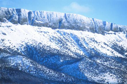
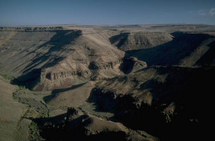
The high desert gets its name from its generally high elevation, averaging about 4,000 feet (1,200 m) across the region.[7] The northern part of Oregon’s high desert is a semi-arid plateau while the southern part is rugged basin and range country. The area has large alkali lakes and spectacular cliffs, some with a prominence of over 2,000 feet (610 m).[1][8] Steens Mountain in Harney County is the highest point within the region; its summit is 9,733 feet (2,967 m) above sea level.[9]
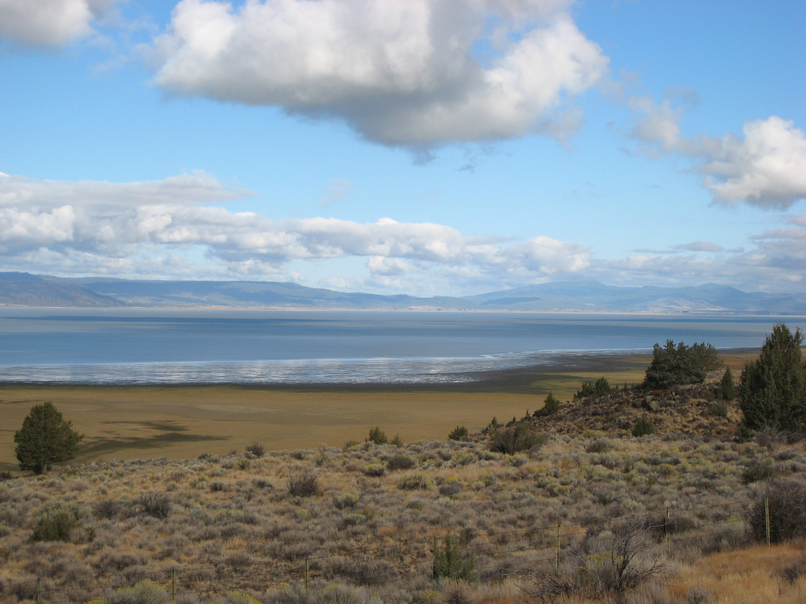
A number of rivers flow through Oregon’s high desert. They include the Deschutes River and its tributary the Crooked River as well as the Malheur, Owyhee, and John Day Rivers. These rivers flow into the Columbia River and ultimately the Pacific Ocean. There are also a number of smaller rivers that flow into closed basins. These include the Chewaucan River, the Donner und Blitzen River, and the Silvies River.[4][10][11][12]
Geology
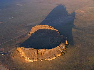
Between seventeen million and fifteen million years ago, magma from deep beneath eastern Oregon rose to the surface, creating a period of significant volcanic activity. A series of lava floods erupted from a series of fissures near the Oregon-Idaho-Washington border. The resulting lava flows traveled up to 400 miles (640 km) from their source. Some individual flows covered as much as 10,000 square miles (26,000 km2) to a depth of 100 feet (30 m). Eventually, these lava flows covered half the state of Oregon, creating a formation known as the Columbia River Basalt. This is the geologic foundation beneath much of the Oregon’s high desert.[13]
After the original eruptions subsided, the earth’s crust began to crack. This created hundreds of new volcanoes that added additional layers of lava on top of the Columbia River Basalt. These new flows blanketed the southeast third of the state. This second period of volcanic activity began about 15 million ago and lasted until 2 million years ago. Many of the volcanic mountains and smaller cinder cones from this period can still be seen in eastern Oregon. Subsequent rifting produced large block faults throughout the region. The escarpment-type mountains and high elevation valleys created by these faults produced the basin and range landscape that makes up much of Oregon’s high desert country.[14][15]
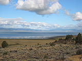
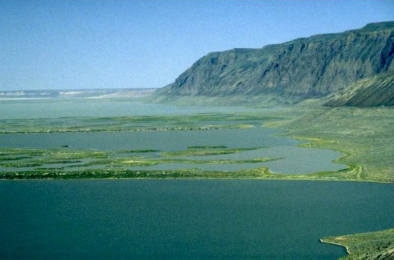
During the last two million years, a series of ice ages altered the landscape. As the most recent ice sheet melted, runoff and increased rainfall filled many of the region’s closed basins, forming large pluvial lakes. The Goose Lake, Harney, and Klamath basins were filled along with many other smaller basins. Some of the lakes covered as much as 1,000 square miles (2,600 km2). However, as the climate became drier, these large lakes shrank away. Goose Lake, Harney Lake, Malheur Lake, Summer Lake, Lake Abert, and the Warner Lakes are remnants of ancient pluvial lakes.[8]
-
- Goose Lake Valley
-

- Pueblo Mountains
-
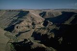
- Trout Creek Canyon
 Stitched panorama of the Central Oregon high desert, near the GI ranch. Includes pioneer stone house.
Climate
Annual precipitation throughout Oregon’s high desert region is relatively low, less than 15 inches (380 mm) per year in most areas. Bend, the region’s largest city, only receives 12 inches (300 mm) of precipitation per year. Burns receives about 11 inches (280 mm) of precipitation per year while Rome in central Malheur County and the official weather station at Whitehorse Ranch in southern Harney County receive only 8 inches (200 mm) in an average year. Some of the mountainous areas, however, receive significantly more precipitation in the form of snow. For example, the high-elevation town of Lakeview has an average snowfall of 68 inches (1,700 mm).[16][17][18]
Most high desert areas receive their highest precipitation in the winter months, decreasing steadily through late summer into the fall. Some areas in the eastern and southern parts of the region receive peak precipitation in the late spring and early summer. For example, at Hart Mountain in Lake County, the wettest time of the year is March through June. The driest months throughout Oregon’s high desert are July through September. However, there are still isolated thunderstorms during that period.[16][17]
Monthly normal high and low temperatures (°F) for various Oregon High Desert cities[16][17][18][19] City Jan Feb Mar Apr May Jun Jul Aug Sep Oct Nov Dec Annual
Max/MinBend 40/23 44/25 51/27 57/30 65/36 73/41 81/46 81/46 72/39 62/32 46/28 40/23 102 / -24 Burns 35/14 40/19 49/25 57/29 66/36 75/41 85/46 84/44 75/35 62/26 45/21 35/15 102 / -28 Lakeview 39/21 42/24 48/28 56/32 65/38 74/44 84/55 83/48 75/42 63/33 46/26 39/21 102 / -20 Prineville 42/21 48/24 54/25 61/28 69/34 77/40 86/43 86/42 78/35 66/29 49/25 42/21 107 / -34 Ecology
The Oregon Badlands Wilderness, 15 miles (24 km) east of Bend, has vegetation typical of the high desert region. The native plants are adapted to survive on less than 12 inches (300 mm) of rain per year. The area is dominated by big sagebrush and rabbitbrush along with hardy grasses like Idaho fescue, bluebunch wheatgrass, and bunchgrass. In the spring, there are native wildflowers including Yellow Oregon sunshine, dwarf purple monkeyflower, sulfur buckwheat, Indian paintbrush, and mariposa lilies. Other high desert wild flowers common throughout the region include buttercups, larkspur, phlox, primroses, and coral mallow. Western juniper trees in the high desert can live for over 1,000 years. The oldest known tree in Oregon is located in the Oregon Badlands Wilderness. It is estimated to be over 1,600 years old.[3][20]
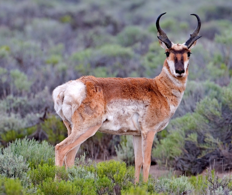
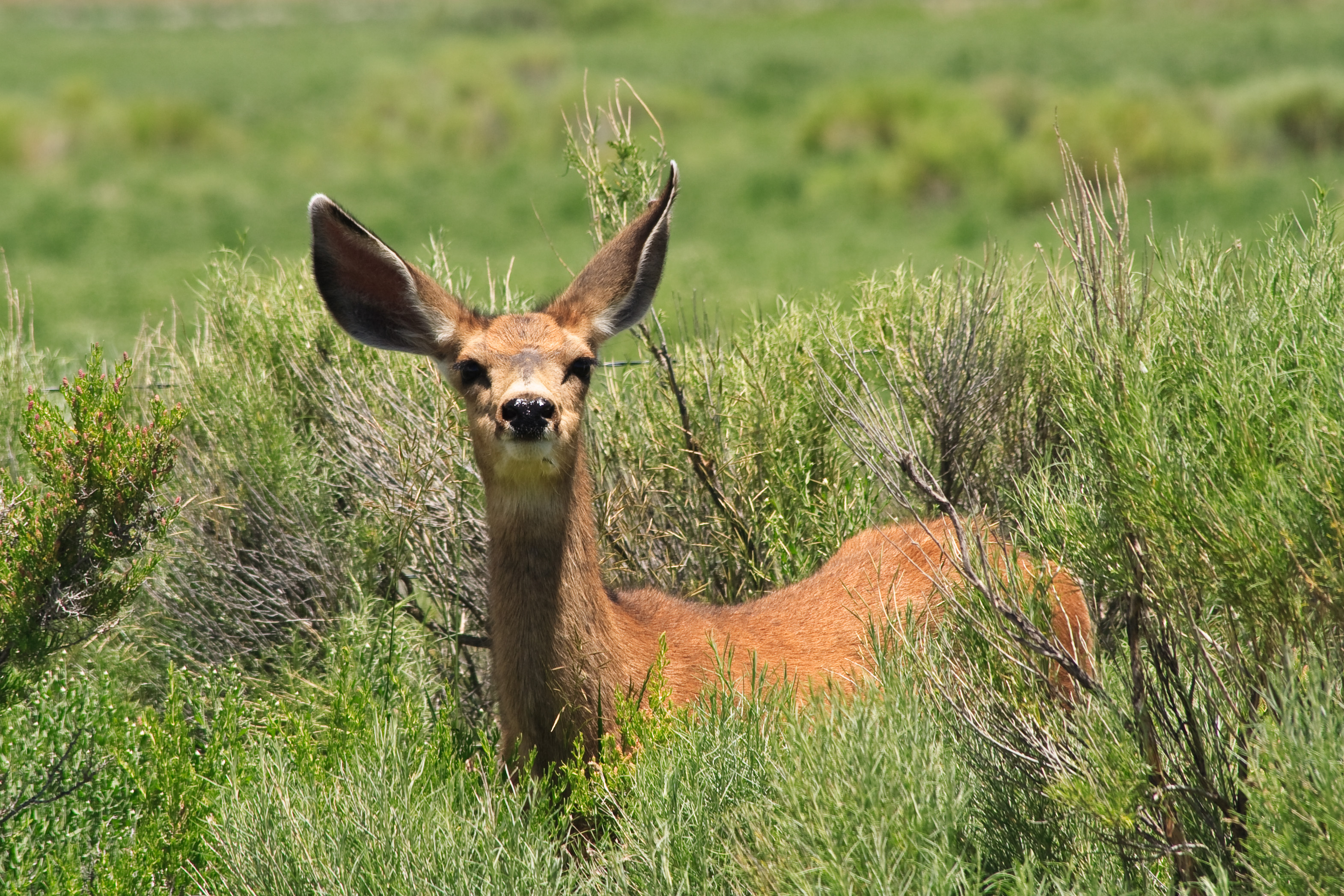
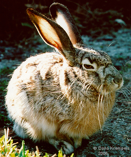
Hundreds of animal species are found in Oregon's high desert environment. In the Hart Mountain National Antelope Refuge alone, there are over 300 animal species, including 42 mammals.[21][22] Throughout the high desert region, Mule deer, pronghorn, coyotes, badgers, and Black-tailed Jackrabbits are common. Elk, bighorn sheep, cougar, bobcat, gray fox, red fox, porcupine, and beaver are also found in some parts of the high desert.[3][23]
-
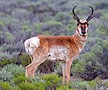
- Pronghorn
-

- Coyote
-

- Mule deer
-
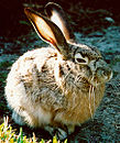
- Jackrabbit
Smaller mammals native to the area include Long-tailed Weasels, woodchucks, cottontail rabbits. pygmy rabbits, Golden-mantled ground squirrels, antelope squirrels, speckled ground squirrels, Belding's ground squirrels, Townsend's ground squirrels, Yellow-pine Chipmunks, Least Chipmunks, Ord's Kangaroo Rats, Northern Pocket Gophers, and Townsend's Pocket Gophers. Mice species include Great Basin Pocket Mouse, northern grasshopper mouse, western harvest mouse, deer mouse, meadow mouse, and Creeping Vole. There are also numerous bat species that live in Oregon’s high desert country.[24][25]
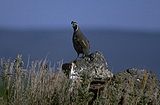
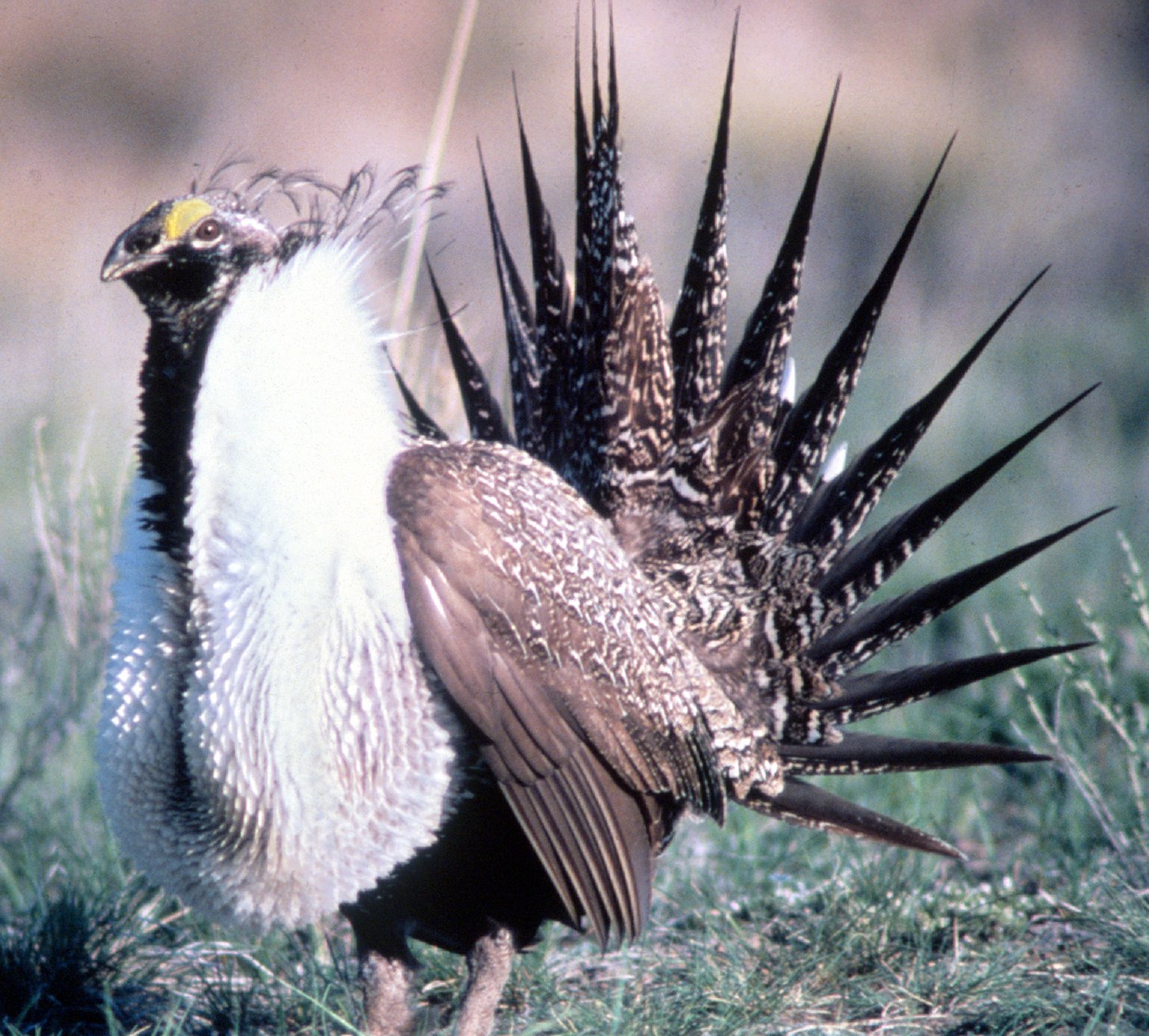
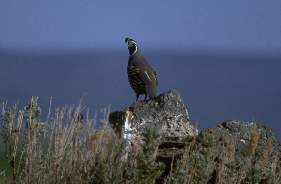
Common high desert birds include Sage Grouse, quail, chukar, and Sage Thrasher. Near high desert lakes and in riparian areas there are Dusky Flycatchers, Yellow Warblers, Orange-crowned Warblers, House Wrens, Spotted Towhees, Brewer's Blackbirds, Western Meadowlarks, swallows, and nighthawks. Mountain Chickadees, Cassin's Finches, Black-headed Grosbeaks, Green-tailed Towhees, Yellow-rumped Warblers, MacGillivray's Warblers, Mountain Bluebirds, Common Ravens, Northern Flickers, and White-headed Woodpeckers are common in parts the high desert country. There are also owls, hawks, Prairie Falcons, Golden Eagles, and Bald Eagles found throughout the high desert region.[26][27][28] As an illustration of the variety of birds found in Oregon’s high desert, there are 239 species that can be found within the boundaries of the Hart Mountain refuge.[22]
-

- Sage Grouse
-
- California Quail
-
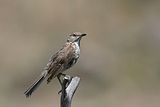
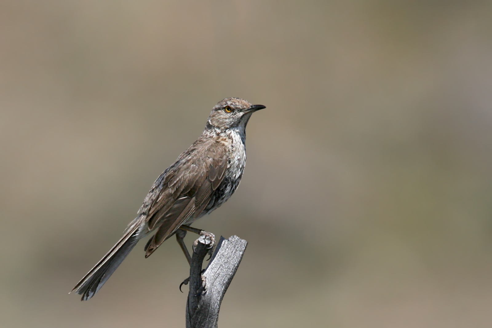
- Sage Thrasher
-

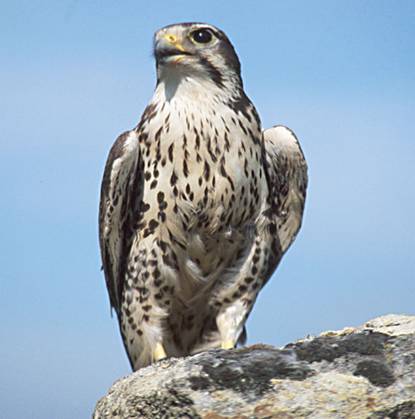
- Prairie Falcon
Land use
The largest land owner in eastern Oregon is the United States Government. The Bureau of Land Management administers over 13,600,000 acres (55,000 km2) in the bureau’s Burn, Lakeview, Prineville, and Vale districts. Most of those lands are in the state’s high desert country.[29] In addition, the United States Congress has designated specific sections of the Crooked, Deschutes, Donner und Blitzen, Malheur, and Owyhee rivers as part of the National Wild and Scenic Rivers system.[30]
Agriculture is the largest industry in the high desert country of Oregon. Livestock ranches utilize large tracts of private and government land for grazing. Ranchers raise cattle and sheep in many parts of the region. Because of the region’s low rainfall, most crops require irrigation. Agricultural crops include alfalfa and other hay crops, wheat, oats, barley, potatoes, onions, sugar beets, and mint.[17][31]
See also
References
- ^ a b c d Brogan, Phil F., "Oregon’s High Desert", East of the Cascades, Binfords and Mort, Portland, Oregon, 1965, pp. 267-269.
- ^ LaLande, Jeff, "High Desert History", Oregon History Projects, Oregon Historical Society, Portland, Oregon, 2005.
- ^ a b c Jackman, E.R., and R.A. Long, The Oregon Desert, Caxton Press, Caldwell, Idaho, 1964, p. 2.
- ^ a b Oregon topographic map, United States Geological Survey, United States Department of Interior, Reston, Virginia; displayed via ACME mapper, www.acme.com, 9 February 2010.
- ^ "Basin and Range province", United States Geological Survey, United States Department of Interior, Reston, Virginia, 10 October 2000.
- ^ "Columbia Plateau", United States Geological Survey, United States Department of Interior, Reston, Virginia, 10 October 2000.
- ^ Carmichael, Suzanne, "Oregon’s High Desert", The New York Times, New York, New York, 12 June 1994.
- ^ a b "Pluvial Lakes: Oregon’s inland seas", Oregon: A Geologic History, Oregon Department of Geology and Mineral Industries, Portland, Oregon, 23 February 2010.
- ^ McArthur, Lewis A. and Lewis L. McArthur, "Steens Mountain", Oregon Geographic Names (Seventh Edition), Oregon Historical Society Press, Portland, Oregon, 2003, p. 912.
- ^ Brogan, Phil F., "The Strange Deschutes", East of the Cascades, Binfords and Mort, Portland, Oregon, 1965, pp. 14-15.
- ^ "Owyhee Wild and Scenic River", Vale District, Bureau of Land Management, United States Department of Interior, Vale, Oregon, 28 February 2010.
- ^ Jackman, E.R., and R.A. Long, "Water on the Desert", The Oregon Desert, Caxton Press, Caldwell, Idaho, 1964, p. 347.
- ^ "Columbia River Basalt: the Yellowstone hot spot arrives in a flood of fire", Oregon: A Geologic History, Oregon Department of Geology and Mineral Industries, Portland, Oregon, 23 February 2010.
- ^ "Rift Volcanoes: aftermath of the Yellowstone hot spot", Oregon: A Geologic History, Oregon Department of Geology and Mineral Industries, Portland, Oregon, 23 February 2010.
- ^ "High Desert Volcanoes: sleeping giants of eastern Oregon", Oregon: A Geologic History, Oregon Department of Geology and Mineral Industries, Portland, Oregon, 23 February 2010.
- ^ a b c Taylor, George (State Climatologist), "Climate of Deschutes County", Oregon Climate Service, Oregon State University, Corvallis, Oregon, 7 March 2010.
- ^ a b c d Taylor, George (State Climatologist), "Climate of Harney County", Oregon Climate Service, Oregon State University, Corvallis, Oregon, 7 March 2010.
- ^ a b Taylor, George (State Climatologist), "Climate of Lake County", Oregon Climate Service, Oregon State University, Corvallis, Oregon, 7 March 2010.
- ^ Taylor, George (State Climatologist), "Climate of Crook County", Oregon Climate Service, Oregon State University, Corvallis, Oregon, 7 March 2010.
- ^ Jackman, E.R., and R.A. Long, The Oregon Desert, Caxton Press, Caldwell, Idaho, 1964, p. 8.
- ^ "Welcome", Hart Mountain National Antelope Refuge, Sheldon-Hart Mountain National Wildlife Refuge Complex, United States Fish and Wildlife Service, Department of Interior, Lakeview, Oregon, 18 July 2008.
- ^ a b "About Hart Mountain National Antelope Refuge", Friends of Hart Mountain, Plush, Oregon, 24 February 2010.
- ^ "South Fork Crooked River", Wilderness in Central Oregon, Oregon Natural Desert Association, Bend, Oregon, 24 February 2010.
- ^ Jackman, E.R., and R.A. Long, "The Little Folk of the Desert", The Oregon Desert, Caxton Press, Caldwell, Idaho, 1964, pp. 192-217.
- ^ Moir, William H., Jerry F. Franklin, and Chris Maser, Lost Forest Research Natural Area, Pacific Northwest Forest and Range Experiment Station, United States Forest Service, Department of Agriculture, Portland, Oregon, 1973.
- ^ "Basin and Range Birding Trail", Southern Oregon Basin and Range Site Management Agencies, Lakeview District, Bureau of Land Management and National Park Service Rivers and Trails Program, Lakeview, Oregon, 2010.
- ^ Rakestraw, John, "Hart Mountain National Antelope Refuge and the Warner Valley", Birding Oregon, Morris Book Publishing, Kearney, Nebraska, 2007, pp. 20-22.
- ^ "Warner Wetlands", Welcome to Lake County, Oregon's Outback, OregonsOutback.com, Lakeview, Oregon, 12 October 2009.
- ^ "District Offices", Oregon State Office, Bureau of Land Management, United States Department of Interior, Portland, Oregon, 9 March 2010.
- ^ "Designated Wild and Scenic Rivers - Oregon", National Wild and Scenic Rivers, Interagency Wild and Scenic Rivers Council (Council members: Bureau of Land Management, National Park Service, United States Fish and Wildlife Service, and United States Forest Service), www.rivers.gov, 8 March 2010.
- ^ "Region 6 – Southeast Oregon", Growing region in Oregon, Oregon Department of Agriculture, State of Oregon, Salem, Oregon, 14 April 2009.
External links
- High Desert Museum
- Oregon Public Broadcasting program on Reub Long's Oregon Desert
- Oregon Public Broadcasting program on Abert Lake
- Oregon Public *Broadcasting program on Desert Plants
Categories:- Deserts of Oregon
- Great Basin deserts
- Deserts and xeric shrublands in the United States
- Ecoregions of the United States
- Regions of Oregon
- Deserts of the United States


Wikimedia Foundation. 2010.