- Christmas Valley Sand Dunes
-
Christmas Valley Sand Dunes  Bureau of Land Management, Lakeview District
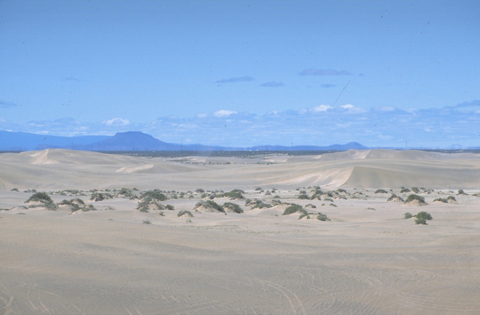
Country United States State Oregon County Lake Elevation 4,318 ft (1,316 m) Coordinates 43°18′43″N 120°25′55″W / 43.31203°N 120.43183°W Area 18 sq mi (47 km2) Christmas Valley Sand Dunes are a natural sand dune complex covering 11,000 acres (45 km2) of public lands east of Christmas Valley in Lake County, Oregon, United States, about 100 miles (160 km) southeast of Bend. The area is accessible via the Christmas Valley National Back Country Byway.[1] The dunes are up to 60 feet (18 m) high.[1] It is the largest inland shifting sand dune system in the Pacific Northwest.[2] The dunes are composed mostly of ash and pumice from the eruption of Mount Mazama that formed Crater Lake 7,000 years ago.[3] Approximately 8,900 acres (36 km2) of dunes are open to vehicles.[3]
Contents
Administration
The area is part of a Bureau of Land Management (BLM) Area of Critical Environmental Concern and the land around nearby Fossil Lake is closed to vehicles.[1] The BLM-administered lands also include the Lost Forest Research Natural Area to the east of the dunes.
Recreational use
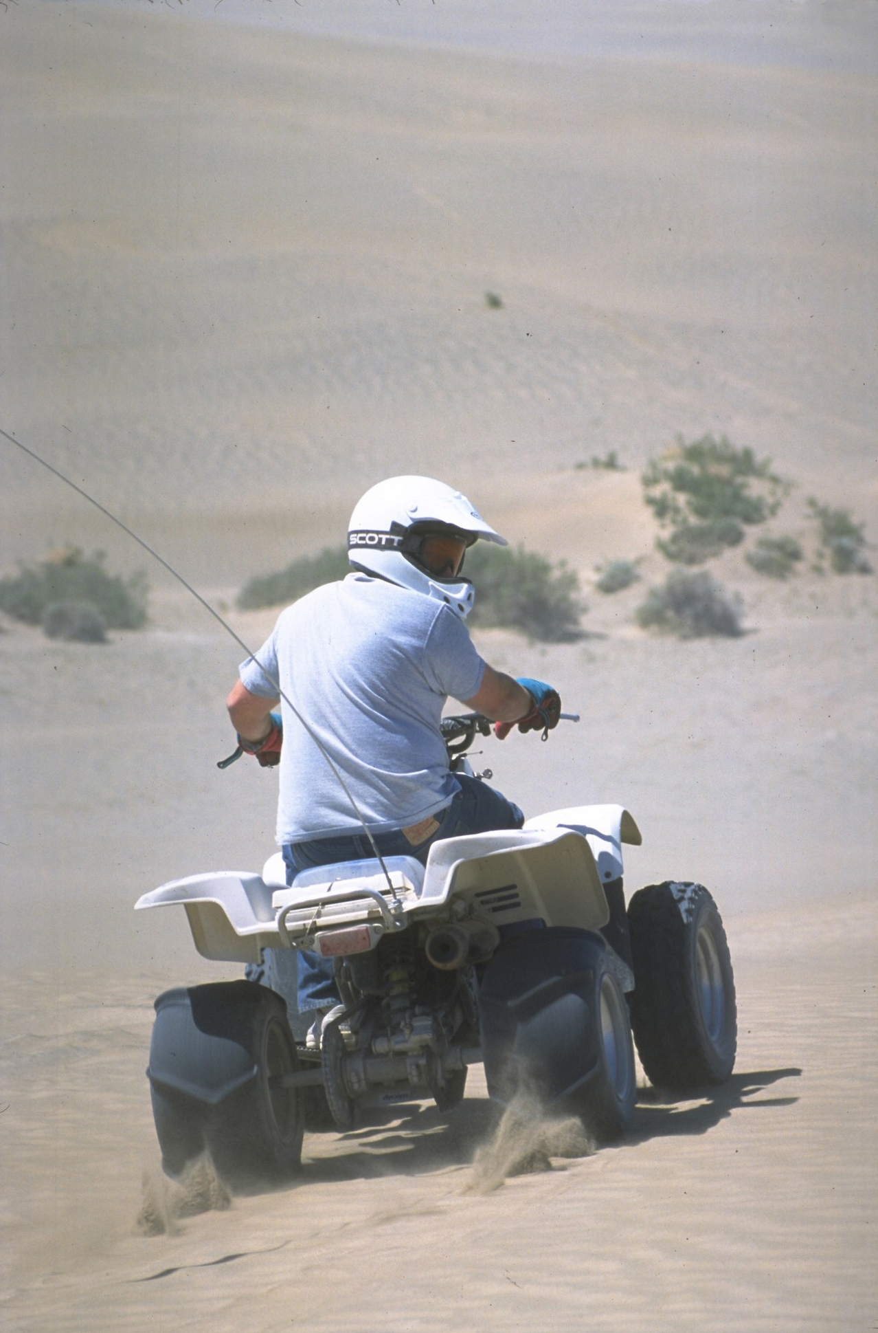
The dunes are available for off-road and ATV recreational use.[4] The area is open all year, but can be inaccessible during the winter and spring months due to extremely muddy roads.[4][5]
A $10 Oregon ATV operator permit may be required. A valid driver's license in addition to an Oregon DOT helmet for persons under 18 years of age.[1][6]
See also
Gallery
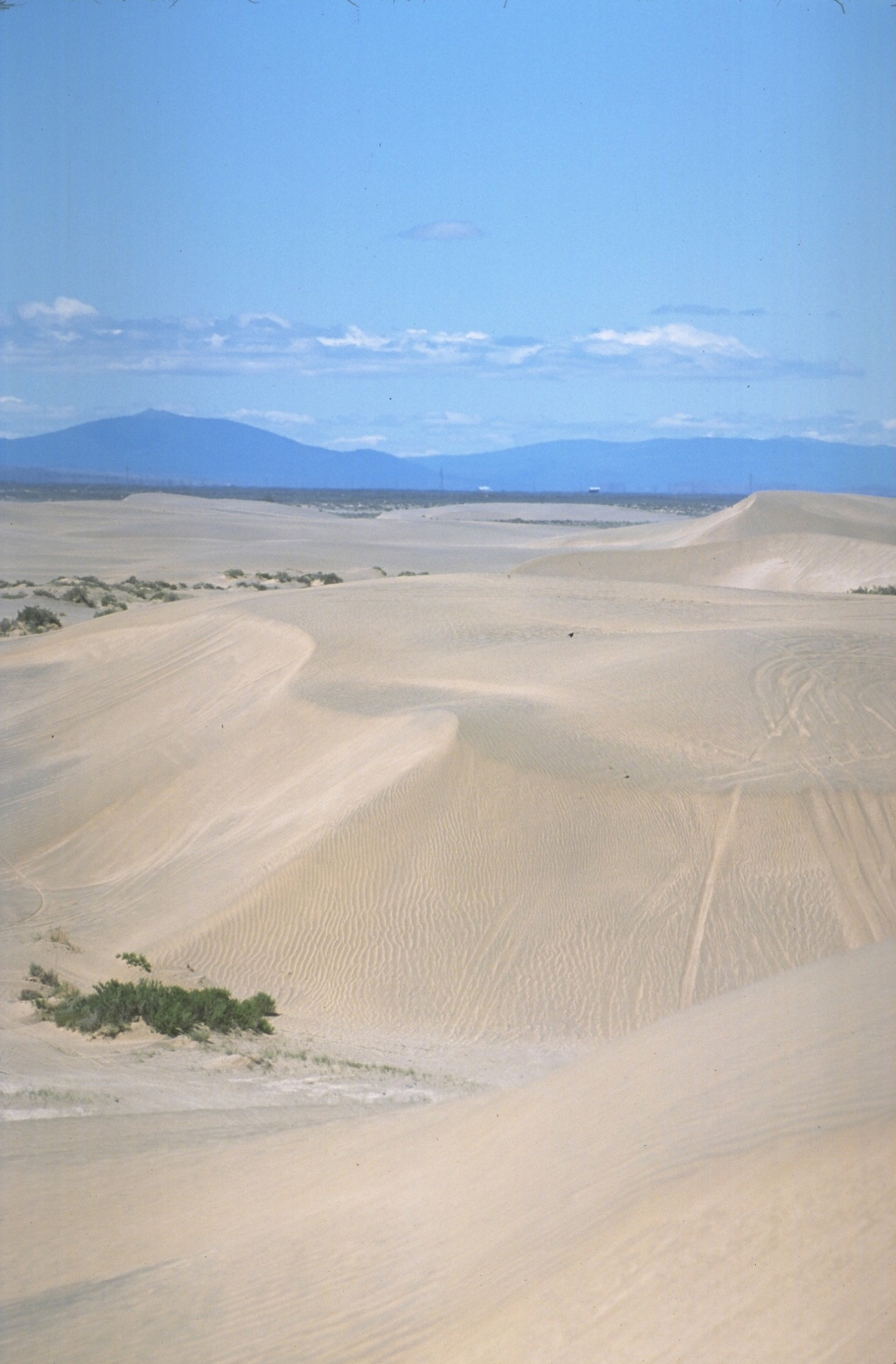
-

High shifting dunes
-

All terrain vehicle run
References
- ^ a b c d http://www.christmasvalley.org/sanddunes.php
- ^ "Christmas Valley". Bureau of Land Management. http://www.blm.gov/or/resources/recreation/site_info.php?siteid=85. Retrieved 2009-12-04.
- ^ a b Christmas Valley Sand Dunes: Area of Critical Environmental Concern brochure from the BLM
- ^ a b http://www.oohva.org/ohv%20area%20pages/xmas.html
- ^ http://www.duneguide.com/sand_dune_guide_christmas_valley.htm
- ^ http://eastfortrock.com/index-1.html
External links
- Christmas Valley Back Country Byway from the National Scenic Byways Program
Protected Areas of Oregon Federal State Arcadia Beach • Bob Straub • Bradley • Cape Kiwanda • Cape Lookout • Cape Meares • Clay Myers at Whalen Island • Del Rey Beach • Ecola • Elmer Feldenheimer • Fishing Rock • Fort Stevens • Gearhart Ocean • Haystack Hill • Hug Point • John Yeon • Manhattan Beach • Munson Creek Falls • Neahkahnie–Manzanita • Nehalem Bay • Oceanside Beach • Oswald West • Rockaway Beach • Sunset Beach • Sunset Highway Forest • Symons • Tolovana Beach • Tolovana Beach • Twin Rocks • Wilson River Highway Forest
Agate Beach • Alsea Bay • Beachside • Beaver Creek • Beverly Beach • Boiler Bay • Carl G. Washburne • Collins Creek • D River • Darlingtonia • Devils Lake • Devils Punch Bowl • Driftwood Beach • Ellmaker • Fogarty Creek • Gleneden Beach • Governor Patterson • H.B. Van Duzer • Heceta Head Lighthouse • Jessie M. Honeyman • Joaquin Miller Forest • L. Presley & Vera C. Gill • Lost Creek • Muriel O. Ponsler • Neptune • Neskowin Beach • Ona Beach • Otter Crest • Pritchard • Roads End • Rocky Creek • San Marine • Seal Rock • Smelt Sands • South Beach • Stonefield Beach • Tokatee Klootchman • W. B. Nelson • Whale Watching • Yachats • Yachats Ocean Road • Yaquina Bay
Albert H. Powers • Alfred A. Loeb • Arizona Beach • Bandon • Bolon Island Tideways • Bullards Beach • Cape Arago • Cape Blanco • Cape Sebastian • Conde B. McCullough • Coquille Myrtle Grove • Crissey Field • Elk Creek Tunnel Forest • Face Rock • Floras Lake • Geisel Monument • Golden and Silver Falls • Harris Beach • Hoffman • Humbug Mountain • Hutchinson • Maria C. Jackson • McVay Rock • Ophir • Otter Point • Paradise Point • Pistol River • Port Orford Cedar Forest • Port Orford Heads • Samuel H. Boardman • Seven Devils • Shore Acres • Sisters Rock • Sunset Bay • Sweet Myrtle • Umpqua • Umpqua Lighthouse • Umpqua Myrtle • William M. Tugman • Winchuck • Yoakam Point
Banks–Vernonia • Bonnie Lure • Government Island • L. L. "Stub" Stewart • Mary S. Young • Milo McIver • Tryon Creek • Willamette Stone
Ainsworth • Benson • Bonneville • Bridal Veil Falls • Crown Point • Dabney • Dalton Point • George W. Joseph • Guy W. Talbot • Historic Columbia River Highway • John B. Yeon • Koberg Beach • Lang Forest • Lewis and Clark • Lindsey Creek • Mayer • McLoughlin • Memaloose • Multnomah Falls • Portland Women's Forum • Rocky Butte • Rooster Rock • Seneca Fouts • Shepperd's Dell • Sheridan • Starvation Creek • Viento • Vinzenz Lausmann • Wyeth • Wygant
Alderwood • Bald Peak • Blachly Mountain Forest • Bowers Rock • Cascadia • Champoeg • Detroit Lake • Dexter • Elijah Bristow • Erratic Rock • Fall Creek • Fort Yamhill • Holman • Jasper • Lowell • Luckiamute • Maples • Maud Williamson • Molalla River • North Santiam • Sarah Helmick • Silver Falls • State Capitol • Thompson's Mills • Washburne • Willamette Mission
Ben Hur Lampman • Canyon Creek Forest • Casey • Collier Memorial • Illinois River Forks • Jackson F. Kimball • Joseph H. Stewart • Klamath Falls – Lakeview Forest • OC&E Woods Line • Prospect • Rough and Ready Forest • Stage Coach Forest • TouVelle • Tub Springs • Valley of the Rogue • Wolf Creek Inn
Cline Falls • Deschutes River • Dyer • Elliott Corbett • La Pine • Ochoco • Peter Skene Ogden • Pilot Butte • Prineville Reservoir • Redmond–Bend Juniper • Sisters • Smith Rock • The Cove Palisades • Tumalo • White River Falls
Bates • Battle Mountain Forest • Blue Mountain Forest • Booth • Catherine Creek • Chandler • Clyde Holliday • Crooked Creek • Deadman's Pass • Emigrant Springs • Farewell Bend • Fort Rock • Fort Rock Cave • Frenchglen Hotel • Goose Lake • Hat Rock • Hilgard Junction • Kam Wah Chung • Lake Owyhee • Minam • Ontario • Pete French Round Barn • Red Bridge • Succor Creek • Sumpter Valley Dredge • Ukiah–Dale Forest • Unity Forest • Unity Lake • Wallowa Lake • Wallowa Lake Highway Forest • Wallowa River
Bridge Creek • Dean Creek • Denman • E.E. Wilson • Elkhorn • Fern Ridge • Irrigon • Jewell Meadows • Klamath • Ladd Marsh • Lower Deschutes • Phillip W. Schneider • Prineville • Riverside • Sauvie Island • Snake River Islands • Summer Lake • Wenaha • White River • Willow Creek
Regions Portland metroBlue Lake • Cooper Mountain • Glendoveer • Howell • Oregon Zoo • Oxbow • Smith and Bybee • Mount Talbert
Cities PortlandForest Park • Washington Park
Heritage registers: National Register of Historic Places • National Historic Landmarks • National Natural Landmarks • World Network of Biosphere Reserves Categories:- Dunes of the United States
- BLM-administered lands in Oregon
- Landforms of Lake County, Oregon
- Protected areas of Lake County, Oregon
- Landforms of Oregon
- Oregon geography stubs
-
Wikimedia Foundation. 2010.