Rooster Rock State Park

Rooster Rock State Park

Infobox park
park=Rooster Rock State Park
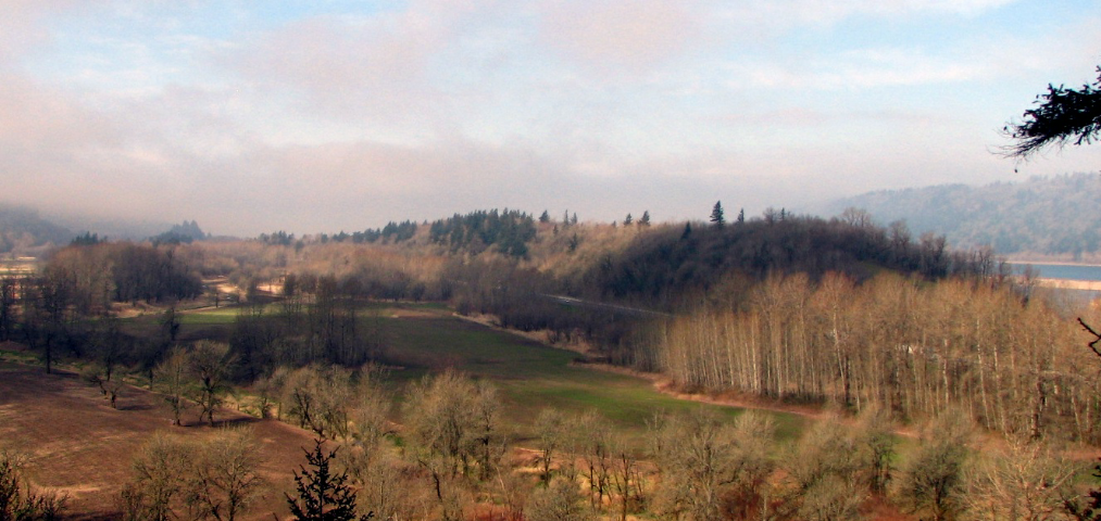


image size=270px
caption=Rooster Rock State Park from the Historic Columbia River Highway. Rooster Rock itself is in the left distance.
type=Public, state
location=Multnomah County, Oregon
coordinates= coord|45|32|50|N|122|13|58|W|type:mountain_region:US
size=
opened=
operator=Oregon State Parks and Recreation Department
annual visitors=
status=

Rooster Rock State Park is a state park located east of Corbett, Oregon. One of the features of the park include Rooster Rock, a column of basalt, a natural obelisk, which stands near the Oregon side of the Columbia River Gorge, in the lee of Crown Point.

A large placard near the park's entrance asserts (or once did) that the monolith was noted by the explorers Lewis and Clark in their journal, and that "the name is phallic in origin". Specifically, the column's original name was "Cock Rock". It is unclear whether the noble explorers themselves named it, or if that happened later. Either way, plain-speaking Oregonians still call it by that name.

A portion of the park is designated as a clothing-optional beach, with no apparent irony intended on the part of state park officials.

ee also

*Clothes free movement
*List of public outdoor clothes free places
*Nude beach
*Public nudity

External links

* [http://www.oregonstateparks.org/park_175.php Rooster Rock State Park]
* [http://englishriverwebsite.com/LewisClarkColumbiaRiver/Regions/Places/rooster_rock.html One of many sites about Rooster Rock]
* [http://www.orcoba.org/wst_page2.html Oregon Clothing Optional Beach Alliance] - Info about clothing optional section of Rooster Rock beach


Wikimedia Foundation. 2010.

Игры ⚽ Поможем решить контрольную работу

Look at other dictionaries:

  • Rooster Rock State Park — Rooster Rock Der Rooster Rock State Park ist ein State Park im Multnomah County im US Bundesstaat Oregon. Der Park befindet sich unterhalb des Aussichtspunkts Crown Point, in unmittelbarer Nähe befinden sich am Historic Columbia River Highway der …   Deutsch Wikipedia

  • Smith Rock State Park — is a state park located in central Oregon s high desert near the town of Terrebonne. Its sheer cliffs of tuff and basalt are ideal for rock climbing of all difficulty levels. Smith Rock is generally considered the birthplace of modern American… …   Wikipedia

  • Shepperd’s Dell State Park — Shepperd s Dell State Park …   Deutsch Wikipedia

  • Guy W. Talbot State Park — Latourell Falls im Guy W. Talbot State Park Der Guy W. Talbot State Park ist ein 89 Hektar großer State Park im Multnomah County im US Bundesstaat Oregon. Der Park liegt am Historic Columbia River Highway in der Columbia River Gorge und ist ein… …   Deutsch Wikipedia

  • Henry W. Coe State Park — IUCN Category V (Protected Landscape/Seascape) Location Santa Clara and Stanislaus counties, California, USA Nearest …   Wikipedia

  • McVay Rock State Recreation Site — McVay Rock State Recreation Site …   Wikipedia

  • Collier Memorial State Park — Collier Memorial State Park …   Wikipedia

  • Oswald West State Park — The sand beach at Oswald West State Park s Smuggler Cove; more than 50 surfers are visible (at full image resolution) …   Wikipedia

  • Milo McIver State Park — Clackamas River flowing through Milo McIver State Park …   Wikipedia

  • Nehalem Bay State Park — Nehalem Bay State Park …   Wikipedia

Share the article and excerpts

Direct link
Do a right-click on the link above
and select “Copy Link”