- Oswald West State Park
-
Oswald West State Park 
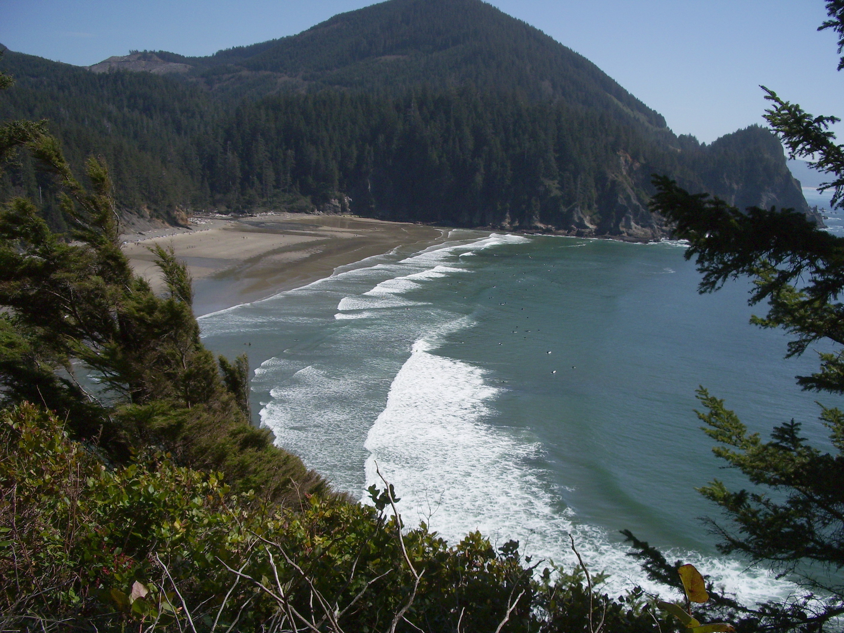
The sand beach at Oswald West State Park's Smuggler Cove; more than 50 surfers are visible (at full image resolution)

Type Public, state Location Tillamook County, Oregon Nearest city Manzanita Coordinates 45°46′11″N 123°57′35″W / 45.7698288°N 123.9598595°WCoordinates: 45°46′11″N 123°57′35″W / 45.7698288°N 123.9598595°W[1] Area 2,448 acres (9.91 km2) Operated by Oregon Parks and Recreation Department Oswald West State Park is part of the state park system of the U.S. state of Oregon. It is located about 10 miles (16 km) south of the city of Cannon Beach, on the Pacific Ocean. Oswald West has unique walk-in access, with wheelbarrows provided by the parks system for transporting gear from the parking area to the 30 primitive camping sites, which are one third of a mile from the ocean. The campsites are situated in stands of old growth Sitka Spruce. The park covers 2,448 acres (9.91 km2), with many miles of hiking trails both inside the park grounds and linking to other parks and landmarks beyond.
The state park also contains Neahkahnie Mountain, Short Sand Beach, Short Sand Creek, Necarney Creek, Cape Falcon, Smugglers Cove and the Oregon Coast Trail. The cove is a popular surf destination and is known as "Short Sands".[2] Urban legend claims pirate treasure is buried near Smugglers Cove but has never been found.
Contents
History
The park was named after Oswald West, the 14th Governor of Oregon and the man who led preserving Oregon's beaches for public use. A memorial marker for Matt Kramer, a journalist whose articles helped shift public opinion to preserve the beaches, sits at the trail divide between Short Sands beach and Cape Falcon.
Camping
Oswald West is currently a day-use area only, though the park has 30 walk-in tent sites with picnic tables, fire rings, water, and flush toilets nearby, located 0.25 miles (0.40 km) from the parking lot between the Short Sand Creek and the Necarney Creek.[3] The campsite is surrounded by giant old-growth Sitka spruce, Douglas-fir, western hemlock and western red cedar,[4] as well as smaller brush including red huckleberry, salmonberry and salal bushes.[3]
During the Summer of 2008, a large Sitka Spruce fell with no warning in the campground. The state immediately conducted a survey of other trees in the park and determined there were several other trees that could fall at any moment. Subsequently, the Oregon Parks and Recreation Department decided to close the campgrounds indefinitely citing public safety.[5] Although camping is currently not permitted, the park is still open with full access.[6]
Gallery
-
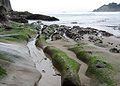
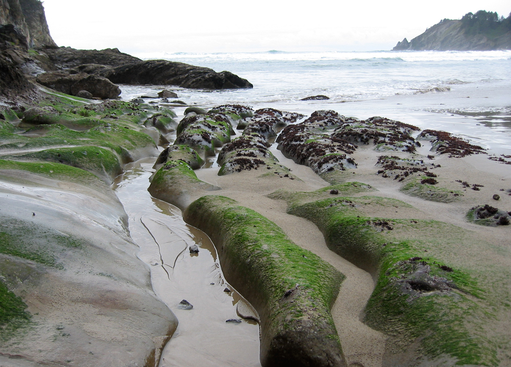
Rock formations at Smuggler Cove
-
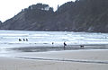
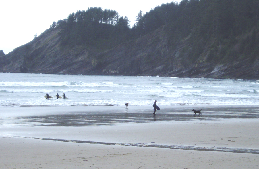
Beach goers and surfers at Short Sands
-
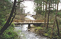
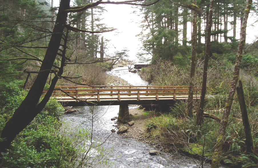
The footbridge over Short Sand Creek
See also
References
- ^ "Oswald West State Park". Geographic Names Information System, U.S. Geological Survey. http://geonames.usgs.gov/pls/gnispublic/f?p=gnispq:3:::NO::P3_FID:1125053. Retrieved July 5, 2011.
- ^ "Short Sands". wannaSurg. http://www.wannasurf.com/spot/North_America/USA/North_West/Oregon_North/short_sands/. Retrieved accessdate=July 5, 2011.
- ^ a b Bannan, Jan Gumprecht (2002). Oregon State Parks: A Complete Recreation Guide (2nd ed.). Seattle: Mountaineers Books. p. 105. ISBN 0898867940. http://books.google.com/books?id=Bpf7evm8Vs4C.
- ^ "Oswald West State Park" (brochure). Oregon Parks and Recreation Department. Archived from the original on March 22, 2007. http://classic-web.archive.org/web/20070422052950/www.oregonstateparks.org/images/pdf/oswest_full.pdf/images/pdf/oswest_full.pdf/images/pdf/oswest_full.pdf. Retrieved July 5, 2011.
- ^ "Camping or Trees?". Oregon Parks and Recreation Department. http://www.oregon.gov/OPRD/PARKS/oswest.shtml. Retrieved September 11, 2009.
- ^ "Oswald West State Park". State Parks. Oregon Parks and Recreation Department. Arpril 4, 2009. http://www.oregonstateparks.org/park_195.php. Retrieved September 11, 2009.
External links
- "Oswald West State Park Hazard Trees". Oregon Parks and Recreation Department. http://www.oregon.gov/OPRD/PARKS/docs/os-west-campground.pdf. Retrieved July 5, 2011.
- "Oswald West State Park & Short Sands Beach". Neahkahnie net. http://www.neahkahnie.net/oswaldwestpark.htm. Retrieved July 5, 2011.
Protected Areas of Oregon Federal State Arcadia Beach • Bob Straub • Bradley • Cape Kiwanda • Cape Lookout • Cape Meares • Clay Myers at Whalen Island • Del Rey Beach • Ecola • Elmer Feldenheimer • Fishing Rock • Fort Stevens • Gearhart Ocean • Haystack Hill • Hug Point • John Yeon • Manhattan Beach • Munson Creek Falls • Neahkahnie–Manzanita • Nehalem Bay • Oceanside Beach • Oswald West • Rockaway Beach • Sunset Beach • Sunset Highway Forest • Symons • Tolovana Beach • Tolovana Beach • Twin Rocks • Wilson River Highway Forest
Agate Beach • Alsea Bay • Beachside • Beaver Creek • Beverly Beach • Boiler Bay • Carl G. Washburne • Collins Creek • D River • Darlingtonia • Devils Lake • Devils Punch Bowl • Driftwood Beach • Ellmaker • Fogarty Creek • Gleneden Beach • Governor Patterson • H.B. Van Duzer • Heceta Head Lighthouse • Jessie M. Honeyman • Joaquin Miller Forest • L. Presley & Vera C. Gill • Lost Creek • Muriel O. Ponsler • Neptune • Neskowin Beach • Ona Beach • Otter Crest • Pritchard • Roads End • Rocky Creek • San Marine • Seal Rock • Smelt Sands • South Beach • Stonefield Beach • Tokatee Klootchman • W. B. Nelson • Whale Watching • Yachats • Yachats Ocean Road • Yaquina Bay
Albert H. Powers • Alfred A. Loeb • Arizona Beach • Bandon • Bolon Island Tideways • Bullards Beach • Cape Arago • Cape Blanco • Cape Sebastian • Conde B. McCullough • Coquille Myrtle Grove • Crissey Field • Elk Creek Tunnel Forest • Face Rock • Floras Lake • Geisel Monument • Golden and Silver Falls • Harris Beach • Hoffman • Humbug Mountain • Hutchinson • Maria C. Jackson • McVay Rock • Ophir • Otter Point • Paradise Point • Pistol River • Port Orford Cedar Forest • Port Orford Heads • Samuel H. Boardman • Seven Devils • Shore Acres • Sisters Rock • Sunset Bay • Sweet Myrtle • Umpqua • Umpqua Lighthouse • Umpqua Myrtle • William M. Tugman • Winchuck • Yoakam Point
Banks–Vernonia • Bonnie Lure • Government Island • L. L. "Stub" Stewart • Mary S. Young • Milo McIver • Tryon Creek • Willamette Stone
Ainsworth • Benson • Bonneville • Bridal Veil Falls • Crown Point • Dabney • Dalton Point • George W. Joseph • Guy W. Talbot • Historic Columbia River Highway • John B. Yeon • Koberg Beach • Lang Forest • Lewis and Clark • Lindsey Creek • Mayer • McLoughlin • Memaloose • Multnomah Falls • Portland Women's Forum • Rocky Butte • Rooster Rock • Seneca Fouts • Shepperd's Dell • Sheridan • Starvation Creek • Viento • Vinzenz Lausmann • Wyeth • Wygant
Alderwood • Bald Peak • Blachly Mountain Forest • Bowers Rock • Cascadia • Champoeg • Detroit Lake • Dexter • Elijah Bristow • Erratic Rock • Fall Creek • Fort Yamhill • Holman • Jasper • Lowell • Luckiamute • Maples • Maud Williamson • Molalla River • North Santiam • Sarah Helmick • Silver Falls • State Capitol • Thompson's Mills • Washburne • Willamette Mission
Ben Hur Lampman • Canyon Creek Forest • Casey • Collier Memorial • Illinois River Forks • Jackson F. Kimball • Joseph H. Stewart • Klamath Falls – Lakeview Forest • OC&E Woods Line • Prospect • Rough and Ready Forest • Stage Coach Forest • TouVelle • Tub Springs • Valley of the Rogue • Wolf Creek Inn
Cline Falls • Deschutes River • Dyer • Elliott Corbett • La Pine • Ochoco • Peter Skene Ogden • Pilot Butte • Prineville Reservoir • Redmond–Bend Juniper • Sisters • Smith Rock • The Cove Palisades • Tumalo • White River Falls
Bates • Battle Mountain Forest • Blue Mountain Forest • Booth • Catherine Creek • Chandler • Clyde Holliday • Crooked Creek • Deadman's Pass • Emigrant Springs • Farewell Bend • Fort Rock • Fort Rock Cave • Frenchglen Hotel • Goose Lake • Hat Rock • Hilgard Junction • Kam Wah Chung • Lake Owyhee • Minam • Ontario • Pete French Round Barn • Red Bridge • Succor Creek • Sumpter Valley Dredge • Ukiah–Dale Forest • Unity Forest • Unity Lake • Wallowa Lake • Wallowa Lake Highway Forest • Wallowa River
Bridge Creek • Dean Creek • Denman • E.E. Wilson • Elkhorn • Fern Ridge • Irrigon • Jewell Meadows • Klamath • Ladd Marsh • Lower Deschutes • Phillip W. Schneider • Prineville • Riverside • Sauvie Island • Snake River Islands • Summer Lake • Wenaha • White River • Willow Creek
Regions Portland metroBlue Lake • Cooper Mountain • Glendoveer • Howell • Oregon Zoo • Oxbow • Smith and Bybee • Mount Talbert
Cities PortlandForest Park • Washington Park
Categories:- Oregon state parks
- Parks in Tillamook County, Oregon
-

Wikimedia Foundation. 2010.