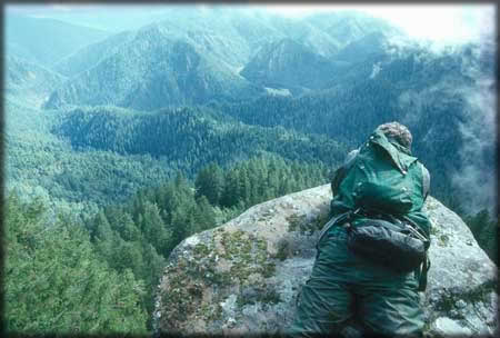
- Wild Rogue Wilderness
Infobox_protected_area
name = Rogue-Umpqua Divide Wilderness
iucn_category = Ib

caption =
locator_x =
locator_y =
location =Oregon ,USA
nearest_city =Grants Pass, Oregon
coords = coord|42.6039981|-124.0428666|type:landmark_region:US-OR_scale:300000_elevation:598|display=inline,title [ gnis|1639417 ]
area = convert|35818|acre|km2
established =1978
visitation_num =
visitation_year =
governing_body =United States Forest Service andBureau of Land Management The Wild Rogue Wilderness is a
wilderness area surrounding the eighty-four mile (135 km) Wild and Scenic portion of the Rogue River in southwesternOregon ,U.S. to protect the watershed. The Wilderness was established in 1987 and now comprises 35,818 acres (56 mi², 145 km²). Because it spans part of theRogue River-Siskiyou National Forest as well as the Medford district of theBureau of Land Management , the Wild Rogue Wilderness is administered by both the BLM and the Forest Service. [http://www.fs.fed.us/r6/rogue-siskiyou/recreation/wilderness/wild-rogue.shtml Roge River Wilderness] - Rogue River-Siskiyou National Forest] [http://www.blm.gov/or/resources/recreation/rogue/index.php Rogue River National Wild and Scenic River] - Bureau of Land Management]History
The lure of gold in the 1850s attracted many miners, hunters, and stocker raisers. Conflicts between white settlers and Native Americans culminated in the 1855-56 Rogue River "Indian War." After their defeat, Native Americans were taken to reservations. Mining remnants such as pipe, flumes, trestles, and stamp mills can still be found in the Wilderness.
Management
The Wild Rogue Wilderness is unusual in that the management of the Wild and Scenic river permits
motorboat operation and lodge construction for accommodation. This would not normally be allowed in a designated Wilderness area.Recreation
Popular recreation activities in the Wild Rogue Wilderness include hiking, camping, rock climbing, and whitewater rafting. The Rogue River is one of the most popular white water runs in the world because of a steady water level due to upstream
dam s, sunny summer weather, and exciting white water rapids in scenic forests and steep canyons.There are several hiking trails in the Wild Rogue, including the Rogue River National Recreation Trail, the Panther Ridge Trail along the northern border of the Wilderness, and the Mule Creek Trail on the BLM portion of the Wilderness. The Blossom fire of 2005 destroyed some of the hiking trails, which are still closed as the end of 2007.
References
ee also
*
List of Oregon Wildernesses
*List of U.S. Wilderness Areas
*Wilderness Act External links
* [http://www.fs.fed.us/r6/rogue-siskiyou/recreation/wilderness/wild-rogue.shtml Wild Rogue Wilderness] - Rogue River-Siskiyou National Forest
* [http://savethewildrogue.org/ Save the Wild Rogue] - Environmental group
* [http://www.oregonwild.org/press-room/press-clips/to-save-the-rogue-river-its-wilderness-area-must-be-expanded "To save the Rogue River, its wilderness area must be expanded"] by Todd Weck and Chris Daughters, Eugene Register-Guard, February 01, 2008
Wikimedia Foundation. 2010.
