- Mount Hood Wilderness
-
Mount Hood Wilderness IUCN Category Ib (Wilderness Area)
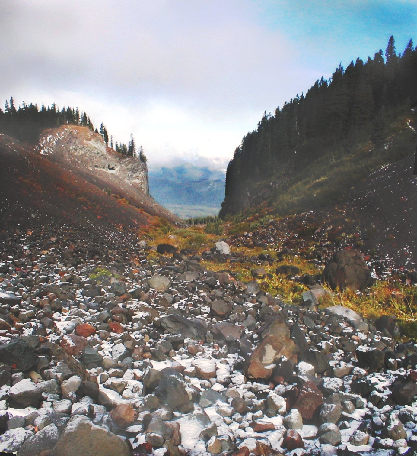
Glaciated valley on the west side of Mount HoodLocation Clackamas / Hood River counties, Oregon, USA Nearest city Government Camp, Oregon Coordinates 45°23′0″N 121°45′0″W / 45.383333°N 121.75°WCoordinates: 45°23′0″N 121°45′0″W / 45.383333°N 121.75°W Area 67,320 acres (27,240 ha) Established 1964 Governing body U.S. Forest Service The Mount Hood Wilderness is a protected wilderness area inside the Mount Hood National Forest which is located in the U.S. state of Oregon. The area, covering 67,320 acres (27,240 ha), includes the peak of Mount Hood and its upper slopes, and ranges from temperate rain forests at the lower elevations, to glaciers and rocky ridges at higher elevations.
The wilderness wraps around the mountain from west to northeast, and borders Timberline Lodge and Mount Hood Meadows ski lifts on some of the south and east slopes of the mountain.
Contents
Trails
Journeys to the summit are popular, but are certainly not for everyone. Mount Hood offers experienced and novice mountaineers opportunities to traverse glaciers, snowfields, steep volcanic soil, and deal with rapidly changing and difficult to predict weather.[1] More than 10,000 climbers annually make the attempt, making Mount Hood's summit the most visited snowclad peak in America.[2]
Numerous trails circle the mountain, from Lolo Pass on the northwest (which the Pacific Crest Trail crosses) to Cloud Cap on the northeast to the ski areas on the south. There are several historic structures (predating the wilderness designation), one of which is the remains of a stone lodge near Cairn Basin on the northwest side. Numerous pristine areas are easily accessible, such as Elk Cove on the north side of the mountain near the tree line.
The best known trail is the forty-one mile Timberline Trail which circles the mountain. The trail, Forest Service trail #600, shares eleven miles with the Pacific Crest Trail and alternates above and below the timberline. The trail is rerouted periodically due to washouts and to avoid sensitive high altitude and alpine meadows. It has a handful of informal campsites for backpackers, although camping is permitted anywhere outside the meadows and at least 200 feet (61 m) from water bodies. There are several hazardous stream crossings, especially on the west side and at landslide-prone Eliot Branch near Cloud Cap which closed the trail there in 2007. The trail has several significant vertical ascents and descents totally 9,000 feet (2,700 m), mostly at canyon crossings. Elevation of the trail varies from 3,250 feet (990 m) (half a mile west of dramatic Ramona Falls on the west side) to 7,300 feet (2,200 m) on the east side. The trail is accessible from Timberline Lodge, which has free parking for backpackers, and numerous connecting trails.
Restrictions
Wilderness permits are required, but free, to enter the area and can be filled out at ranger stations or at kiosks along trails where they enter the wilderness. Climbers ascending to or near the summit should register (and sign out at return) at the climber's registration in Timberline's day lodge, or at other wilderness permit registration kiosks. Mountain Locator Units can be inexpensively rented in Government Camp and at some area recreation businesses.
U.S. Wilderness Areas do not allow motorized or mechanized vehicles, including bicycles. Although camping and fishing are allowed with proper permit, no roads or buildings are constructed and there is also no logging or mining, in compliance with the 1964 Wilderness Act. Wilderness areas within National Forests and Bureau of Land Management areas also allow hunting in season.
References
See also
- Mount Hood climbing accidents
- List of Oregon Wildernesses
- List of U.S. Wilderness Areas
- Wilderness Act
External links
- Mount Hood Wilderness information - Wilderness.net
- TopoQuest map
- Satellite image (Google Mapping)
- Forests and Global Warming - Oregon Wild
- "Mount Hood Expansion Blocked" from BlueOregon, March 10, 2008
- Timberline Trail information
Protected Areas of Oregon Federal State Arcadia Beach • Bob Straub • Bradley • Cape Kiwanda • Cape Lookout • Cape Meares • Clay Myers at Whalen Island • Del Rey Beach • Ecola • Elmer Feldenheimer • Fishing Rock • Fort Stevens • Gearhart Ocean • Haystack Hill • Hug Point • John Yeon • Manhattan Beach • Munson Creek Falls • Neahkahnie–Manzanita • Nehalem Bay • Oceanside Beach • Oswald West • Rockaway Beach • Sunset Beach • Sunset Highway Forest • Symons • Tolovana Beach • Tolovana Beach • Twin Rocks • Wilson River Highway Forest
Agate Beach • Alsea Bay • Beachside • Beaver Creek • Beverly Beach • Boiler Bay • Carl G. Washburne • Collins Creek • D River • Darlingtonia • Devils Lake • Devils Punch Bowl • Driftwood Beach • Ellmaker • Fogarty Creek • Gleneden Beach • Governor Patterson • H.B. Van Duzer • Heceta Head Lighthouse • Jessie M. Honeyman • Joaquin Miller Forest • L. Presley & Vera C. Gill • Lost Creek • Muriel O. Ponsler • Neptune • Neskowin Beach • Ona Beach • Otter Crest • Pritchard • Roads End • Rocky Creek • San Marine • Seal Rock • Smelt Sands • South Beach • Stonefield Beach • Tokatee Klootchman • W. B. Nelson • Whale Watching • Yachats • Yachats Ocean Road • Yaquina Bay
Albert H. Powers • Alfred A. Loeb • Arizona Beach • Bandon • Bolon Island Tideways • Bullards Beach • Cape Arago • Cape Blanco • Cape Sebastian • Conde B. McCullough • Coquille Myrtle Grove • Crissey Field • Elk Creek Tunnel Forest • Face Rock • Floras Lake • Geisel Monument • Golden and Silver Falls • Harris Beach • Hoffman • Humbug Mountain • Hutchinson • Maria C. Jackson • McVay Rock • Ophir • Otter Point • Paradise Point • Pistol River • Port Orford Cedar Forest • Port Orford Heads • Samuel H. Boardman • Seven Devils • Shore Acres • Sisters Rock • Sunset Bay • Sweet Myrtle • Umpqua • Umpqua Lighthouse • Umpqua Myrtle • William M. Tugman • Winchuck • Yoakam Point
Banks–Vernonia • Bonnie Lure • Government Island • L. L. "Stub" Stewart • Mary S. Young • Milo McIver • Tryon Creek • Willamette Stone
Ainsworth • Benson • Bonneville • Bridal Veil Falls • Crown Point • Dabney • Dalton Point • George W. Joseph • Guy W. Talbot • Historic Columbia River Highway • John B. Yeon • Koberg Beach • Lang Forest • Lewis and Clark • Lindsey Creek • Mayer • McLoughlin • Memaloose • Multnomah Falls • Portland Women's Forum • Rocky Butte • Rooster Rock • Seneca Fouts • Shepperd's Dell • Sheridan • Starvation Creek • Viento • Vinzenz Lausmann • Wyeth • Wygant
Alderwood • Bald Peak • Blachly Mountain Forest • Bowers Rock • Cascadia • Champoeg • Detroit Lake • Dexter • Elijah Bristow • Erratic Rock • Fall Creek • Fort Yamhill • Holman • Jasper • Lowell • Luckiamute • Maples • Maud Williamson • Molalla River • North Santiam • Sarah Helmick • Silver Falls • State Capitol • Thompson's Mills • Washburne • Willamette Mission
Ben Hur Lampman • Canyon Creek Forest • Casey • Collier Memorial • Illinois River Forks • Jackson F. Kimball • Joseph H. Stewart • Klamath Falls – Lakeview Forest • OC&E Woods Line • Prospect • Rough and Ready Forest • Stage Coach Forest • TouVelle • Tub Springs • Valley of the Rogue • Wolf Creek Inn
Cline Falls • Deschutes River • Dyer • Elliott Corbett • La Pine • Ochoco • Peter Skene Ogden • Pilot Butte • Prineville Reservoir • Redmond–Bend Juniper • Sisters • Smith Rock • The Cove Palisades • Tumalo • White River Falls
Bates • Battle Mountain Forest • Blue Mountain Forest • Booth • Catherine Creek • Chandler • Clyde Holliday • Crooked Creek • Deadman's Pass • Emigrant Springs • Farewell Bend • Fort Rock • Fort Rock Cave • Frenchglen Hotel • Goose Lake • Hat Rock • Hilgard Junction • Kam Wah Chung • Lake Owyhee • Minam • Ontario • Pete French Round Barn • Red Bridge • Succor Creek • Sumpter Valley Dredge • Ukiah–Dale Forest • Unity Forest • Unity Lake • Wallowa Lake • Wallowa Lake Highway Forest • Wallowa River
Bridge Creek • Dean Creek • Denman • E.E. Wilson • Elkhorn • Fern Ridge • Irrigon • Jewell Meadows • Klamath • Ladd Marsh • Lower Deschutes • Phillip W. Schneider • Prineville • Riverside • Sauvie Island • Snake River Islands • Summer Lake • Wenaha • White River • Willow Creek
Regions Portland metroBlue Lake • Cooper Mountain • Glendoveer • Howell • Oregon Zoo • Oxbow • Smith and Bybee • Mount Talbert
Cities PortlandForest Park • Washington Park
Heritage registers: National Register of Historic Places • National Historic Landmarks • National Natural Landmarks • World Network of Biosphere Reserves Categories:- IUCN Category Ib
- Protected areas of Clackamas County, Oregon
- Protected areas of Hood River County, Oregon
- Wilderness Areas of Oregon
- Mount Hood
- Mount Hood National Forest
Wikimedia Foundation. 2010.