- Crooked River (Oregon)
-
Crooked River 
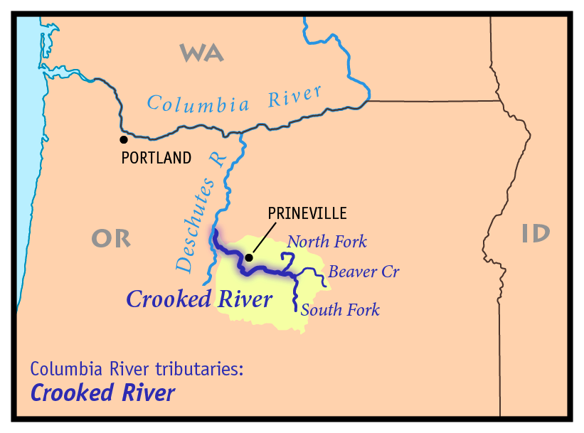
Country United States State Oregon Tributaries - right Beaver Creek, North Fork Crooked River, Ochoco Creek City Prineville Source South Fork Crooked River - elevation 4,775 ft (1,455 m) [1] - coordinates 43°38′55″N 120°23′30″W / 43.64861°N 120.39167°W [2] Mouth Deschutes River - location Lake Billy Chinook - elevation 1,950 ft (594 m) [1] - coordinates 44°34′25″N 121°16′19″W / 44.57361°N 121.27194°W [3] Length 125 mi (201 km) [4] Basin 4,500 sq mi (11,655 km2) [5] Discharge for near mouth - average 1,544 cu ft/s (44 m3/s) [6] - max 6,660 cu ft/s (189 m3/s) - min 656 cu ft/s (19 m3/s)  Map of the Crooked River watershed, its main tributaries and downriver connection to the Columbia River via the Deschutes River.
The Crooked River is a tributary, 125 miles (201 km) long, of the Deschutes River in the U.S. state of Oregon.[4] The river begins at the confluence of South Fork Crooked River and Beaver Creek. Of the two tributaries, the South Fork Crooked River is the larger and is sometimes considered part of the Crooked River proper. A variant name of the South Fork Crooked River is simply "Crooked River".[2][3]
The river is part of the Columbia River basin, being a tributary of the Deschutes River, which is tributary to the Columbia River.
Contents
Course
The South Fork Crooked River originates in an area called Misery Flat, along the Deschutes County, Lake County and Harney County boundaries, north of Glass Buttes. South Fork's tributaries drain Hampton Buttes to the west and Mackey Butte to the east. The South Fork Crooked River flows north for 76 miles (122 km),[7] collecting tributaries including Buck Creek and Twelvemile Creek before joining Beaver Creek to form the Crooked River proper near Paulina in Crook County.
Beaver Creek arises in two forks, North Fork and South Fork Beaver Creek, in Grant County, Oregon. South Fork Beaver Creek drains the slopes of Snow Mountain and Funny Butte before joining the North Fork. Beaver Creek then flows west through Paulina Valley and is joined by Grindstone Creek just upstream from Paulina. Downstream of Paulina, Beaver Creek joins the South Fork Crooked River to form the Crooked River proper.
From the confluence of the South Fork and Beaver Creek, the Crooked River flows west, collecting the tributary Camp Creek from the south and then the North Fork Crooked River from the north. The North Fork Crooked River arises in Big Summit Prairie on the southern side of the Ochoco Mountains.
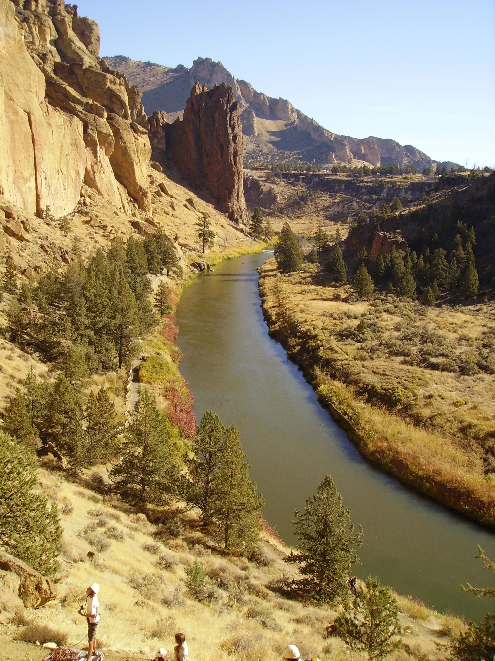
Below the North Fork confluence, the Crooked River continues flowing west, between the Ochoco Mountains to the north and the Maury Mountains to the south. The river passes Post, Oregon, the geographic center of the state. Then the river flows into Prineville Reservoir, created by Bowman Dam (also called Prineville Dam) on the Crooked River. Below the dam, the river bends northward to Prineville, Oregon, where it is joined by Ochoco Creek from the northeast. Like the North Fork, Ochoco Creek drains the Ochoco Mountains. After Prineville, the Crooked River flows northwest, collecting McKay Creek and several other minor tributaries before emptying into Lake Billy Chinook, an impoundment of the Deschutes River created by Round Butte Dam. The dam also impounds the lower reach of the Crooked River.[8]
Some of the Crooked River's drainage basin lies within Ochoco National Forest and Crooked River National Grassland. A portion of the Crooked River near the Crooked River National Grassland is designated a National Wild and Scenic River. Most of the North Fork Crooked River is also designated a National Wild and Scenic River.
Natural history
The Crooked River and its tributaries were once a major spawning ground for anadromous fish such as spring Chinook Salmon, Steelhead trout, and Pacific lamprey. Non-migratory fish such as Redband trout and Bull trout, as well as various non-game fish were also abundant. Fish populations began to drop in the early 19th century due to irrigation withdrawals.[5]
The Cove Power Plant on the lower Crooked River, built around 1910, effectively blocked upriver migration of spring Chinook Salmon during low streamflow conditions. In addition, Ochoco Dam, built in 1922 on Ochoco Creek, blocked fish passage completely. Round Butte Dam, built in the 1950s on the Deschutes River below the Crooked River confluence, included fish passage facilities. But attempts to pass anadromous fish failed by the late 1960s, thus blocking migratory fish, such as salmon, from historic spawning and rearing habitat in the Crooked River basin. Redband trout are the only native game fish left in the Crooked River basin. There are efforts currently underway to reestablish fish passage at the dam. Some hatchery fish have been introduced in an attempt to mitigate the losses.[5]
History

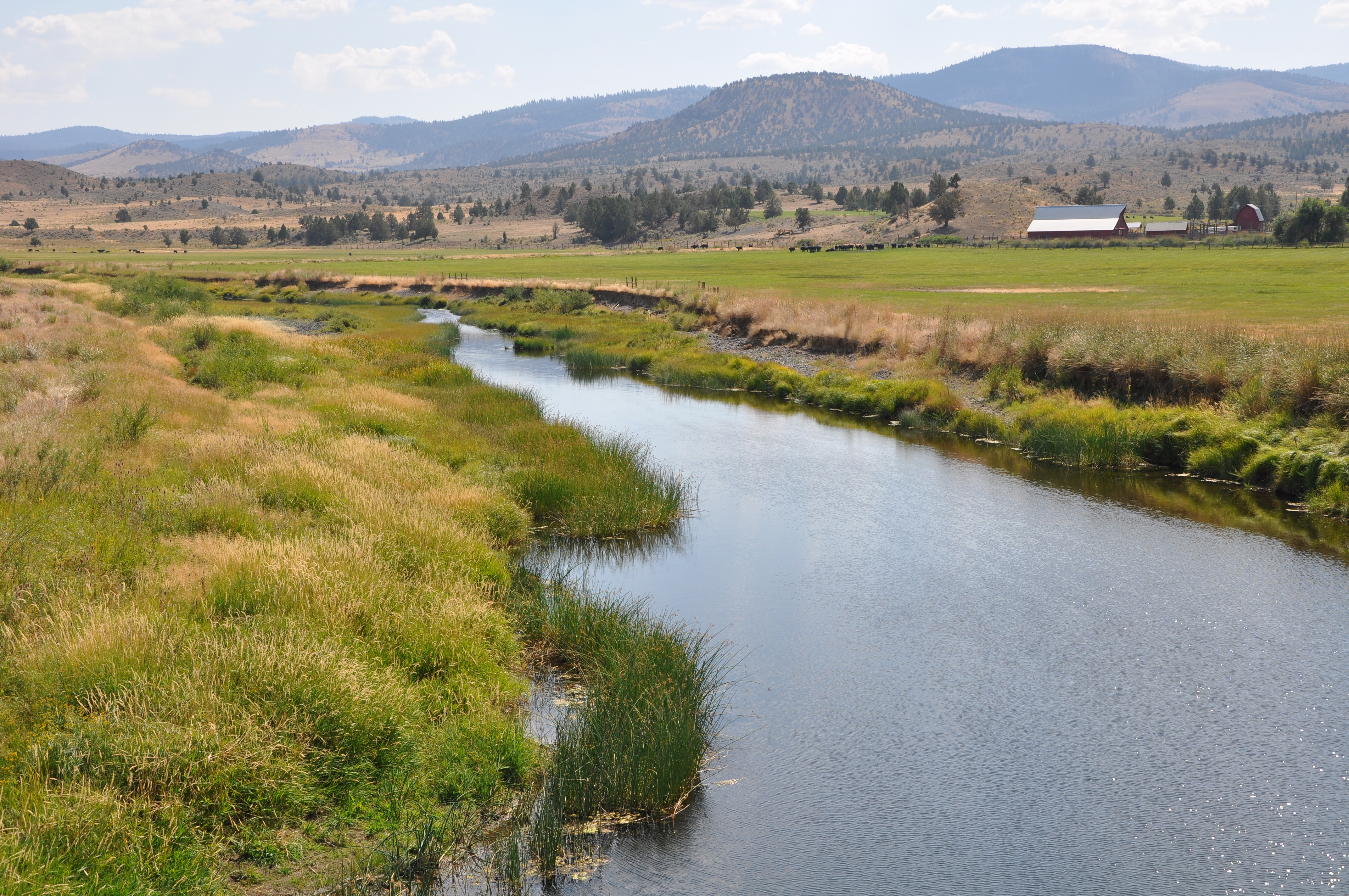
Early explorers described the lower Crooked River's floodplain as large and filled with waist-high grasses and willow trees ("Ochoco" is a Paiute word for "willow"). Beaver were also plentiful, especially on the upper river and tributaries, thus fur trappers frequented the region until the beaver were depleted.[5]
Water diversion in the Crooked River basin for irrigation agriculture began in the 19th century. Two large reservoirs were built to supply irrigation water during the summer growing season: Prineville Reservoir on the Crooked River and Ochoco Reservoir on Ochoco Creek. Today irrigation diversions during the summer remove most of the Crooked River's flow below Prineville.[5]
See also
- List of rivers in Oregon
- List of longest streams of Oregon
References
- ^ a b Google Earth elevation for GNIS coordinates
- ^ a b U.S. Geological Survey Geographic Names Information System: South Fork Crooked River, USGS, GNIS
- ^ a b U.S. Geological Survey Geographic Names Information System: Crooked River, USGS, GNIS
- ^ a b United States Geological Survey. "United States Topographic Map". http://www.topoquest.com/map.php?lat=44.101389&lon=-120.051111&datum=nad83&zoom=4. Retrieved March 14, 2011. The map includes river mile markers up to the confluence of the South Fork and Beaver Creek.
- ^ a b c d e Deschutes Subbasin Plan, Northwest Power and Conservation Council
- ^ Water Resources Data for Oregon, Water Year 2005, USGS
- ^ "National Hydrography Dataset". United States Geological Survey. http://nhd.usgs.gov/index.html. Retrieved September 3, 2010.
- ^ Course info mainly from: Allan, Stuart; Aileen R. Buckley, James E. Meacham (2001). Atlas of Oregon (2nd ed.). University of Oregon Press. ISBN 0-87114-101-9.; and: Oregon Road & Recreation Atlas (2nd ed.). Benchmark Maps. 2002. ISBN 0-929591-50-X.
External links
 Media related to Crooked River (Oregon) at Wikimedia Commons
- Cohen, Scott. Crooked River in the Oregon Encyclopedia
Categories:- Rivers of Oregon
- Wild and Scenic Rivers of the United States
- Landforms of Crook County, Oregon
- Landforms of Deschutes County, Oregon
- Landforms of Jefferson County, Oregon
Wikimedia Foundation. 2010.