- Deschutes River (Oregon)
-
This article is about the river in Oregon. For other uses, see Deschutes (disambiguation).
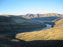
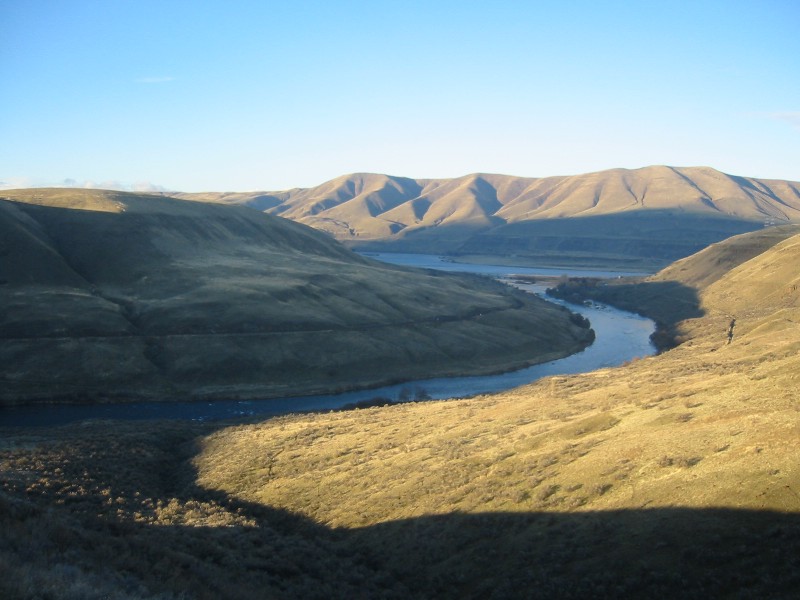
Deschutes River  Deschutes River near its mouth on the Columbia. Pioneers camped on the bluff to the left.
Name origin: From Riviere des Chutes, used by early 19th-century fur traders[1] Country United States State Oregon County Deschutes, Jefferson,
Sherman, and WascoSource Little Lava Lake - location Cascade Range, Deschutes County, Oregon - elevation 4,747 ft (1,447 m) [2] - coordinates 43°54′33″N 121°45′40″W / 43.90917°N 121.76111°W [3] Mouth Columbia River - location between Moody and Biggs Junction, on border between Wasco County
and Sherman County, Oregon- elevation 164 ft (50 m) [3] - coordinates 45°38′07″N 120°54′52″W / 45.63528°N 120.91444°W [3] Length 252 mi (406 km) [4] Basin 10,500 sq mi (27,200 km2) [5] Discharge for Moody, 1.4 miles (2.3 km) from mouth - average 5,814 cu ft/s (200 m3/s) [5][6] - max 70,300 cu ft/s (2,000 m3/s) - min 2,400 cu ft/s (100 m3/s) 
 Location of the mouth of the Deschutes River in Oregon
The Deschutes River (
 /dəˈʃuːts/) in central Oregon is a major tributary of the Columbia River. The river provides much of the drainage on the eastern side of the Cascade Range in Oregon, gathering many of the tributaries that descend from the eastern, drier flank of the mountains. It provided a major route to and from the Columbia for Native Americans and later pioneers on the Oregon Trail. It flows mostly through rugged and arid country, and its valley provides a cultural heart for central Oregon. Today the river provides irrigation and is popular in the summer for whitewater rafting and fishing.
Contents
Description
The headwaters of the Deschutes River is Little Lava Lake, a lake in the Cascade Mountains located approximately 26 miles (42 km) northwest of the city of LaPine. The river flows south into Crane Prairie Reservoir then into a second reservoir (the Wickiup Reservoir, from there it heads in a northeasterly direction past the resort community of Sunriver into the city of Bend). In Bend, much of the river's waters is diverted for irrigation; as a result, the river is much smaller when it leaves the city.

The river continues north from Bend, past the city of Redmond. As it heads north through the central Oregon desert; the river carves a gorge. By the time it reaches Lake Billy Chinook west of Madras, the river is approximately 300 feet (91 m) below the surrounding plateau, Little Agency Plains and Agency Plains. At Lake Billy Chinook (a lake formed by Round Butte Dam), the river is joined by the Crooked and Metolius rivers.
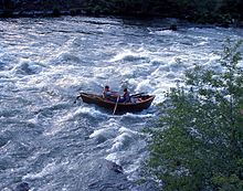
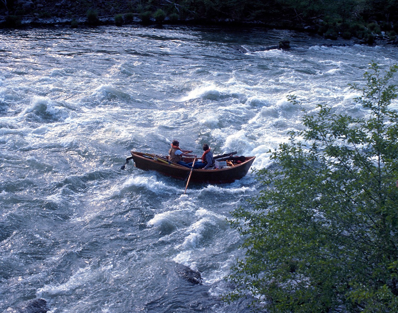
Beyond the dam, the river continues to flow north in a gorge well below the surrounding countryside. It passes through the Warm Springs Indian Reservation, including the city of Warm Springs and the Kah-Nee-Ta resort. There are two main sections of the river that are popular for whitewater rafting. The upstream section is a short segment upriver from the city of Bend. The lower and more heavily used section is from the town of Warm Springs downstream to just above Sherars Falls. The river ends at its confluence with the Columbia, 5 miles (8 km) southwest of Biggs Junction.
History
Prior to 80,000 years ago, the river ran along the east side of Pilot Butte and a lava flow from Lava Top Butte filled in this ancient channel.[7] Previously, the Basalt of the Bend lava flow, associated with the Lava River Cave, had diverted the river westward to its present day location.[8][9]
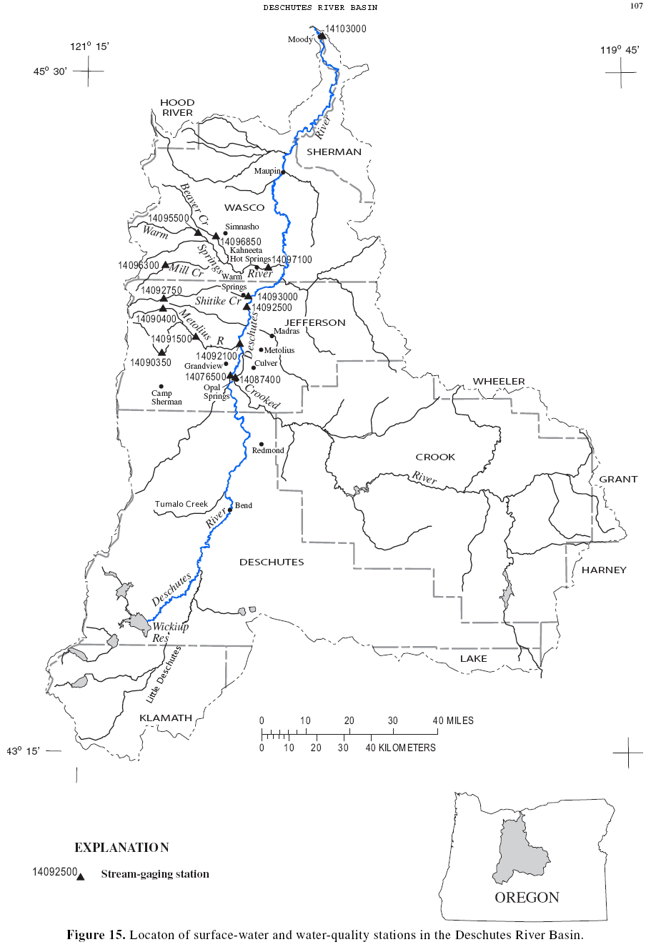
 The Deschutes River watershed
The river was named Riviere des Chutes or Riviere aux Chutes, French for River of the Falls, during the period of fur trading.[1] The waterfall it referred to was the Celilo Falls on the Columbia River, near where the Deschutes flowed into it. (These falls no longer exist, having been inundated by the lake behind The Dalles Dam).
Lewis and Clark encountered the river on October 22, 1805, and referred to it by the Native American name Towarnehiooks; on their return journey they gave it the new name Clarks River.[1] Variant names include Clarks River, River of the Falls, Riviere des Chutes, Chutes River, and Falls River.[3]
During the middle 19th century, the river was a major obstacle for immigrants on the Oregon Trail. The major crossing point on the river was near its mouth in present-day Deschutes River State Recreation Area. Many immigrants camped on the bluff on the west side of the river after making the crossing. The remains of the trail leading up to the top of the bluff are still visible.
Fishing
 Deschutes in winter at its confluence with the Columbia
The river is world renowned for its fly fishing. It is home to a unique wild and native strain of Rainbow trout known locally as "redsides" or redband trout. The redsides grow larger than most and also have a distinct darker red stripe than most wild rainbow trout. They are abundant in this stretch of the river, which has counts of 1,700 fish of 7 inches in size per mile (1,100 fish of 18 centimeters in size per kilometer) above Sherars Falls, and they are noticeably stronger than trout who do not have to cope with life in such a big, powerful river. The average catch for these fish is 8 inches (20 cm) to 15 inches (38 cm), and some are much larger. These redside or redband trout are found throughout the river. Fishing for them is most popular from Warm Springs down to Macks Canyon. (Warm Springs Reservation owns the entire Deschutes West Bank from 16 miles (26 km) south of Maupin to Lake Billy Chinook and on up to Jefferson Creek on the Metolius River arm) below Pelton Dam. Fishing from Tribal lands requires special permits. From Pelton Dam to the mouth the Deschutes is one of America's most productive trout waters and a top producer of summer steelhead, managed primarily for wild trout. This 100-mile (160 km) stretch of river drops 1,233 feet (376 m), carving a volcanic rock canyon 700 feet (213 m) to 2,200 feet (671 m) deep.
Fly fishermen come from around the world in the last two weeks in May through the first two weeks in June to take advantage of the Stoneflies (both salmonflies and golden stones) hatch. These bugs are in the river year-round; however their large adults are a major food source for the fish. Weighted stonefly nymph patterns are a staple for Deschutes anglers and produce year round.
Sport fishing for Steelhead occurs in the river from the mouth to Round Butte Dam. Sport fishing for spring and fall chinook salmon occurs from the mouth to Sherars Falls. Tribal fishing for chinook and steelhead occurs at Sherars Falls.
In Lake Billy Chinook (reservoir), there are fisheries for kokanee, bull trout, rainbow trout, brown trout, and several warm water species such as large mouth bass and a very large population of small mouth bass. There are also periodic commercial fisheries for crayfish. The bull trout that are caught in this reservoir are some of the largest bull trout caught on the west coast. The numbers are scarce because the bull's are endangered; however, numbers have risen every year since they became protected. The lake allows an individual to keep a bull trout that measures more than 24 inches (61 cm). (This is included for a daily bag limit.)
River use
 Maupin
Much of the flow of the upper Deschutes River is diverted into canals to irrigate farmland; Irrigation Districts take as much as 97% of the river's flow in the summer months.[citation needed] The growth of cities like Bend and Redmond also increased demand on the river's water, which is over allocated. Because the existing canals lose about 65% of their water due to leaks and evaporation, there is pressure to convert these canals into pipelines, a move that is resisted by many locals for historic or scenic reasons. Golf courses have also been an issue with water allocation. There are thirteen golf courses throughout Bend, Redmond, and Sunriver.
The lower river is used primarily for recreation.
The river flows north, which is unusual in the United States. Several other Oregon tributaries of the Columbia River, including the Willamette and John Day Rivers, also flow in a northerly direction.
See also
- List of Oregon rivers
- List of longest streams of Oregon
- List of National Wild and Scenic Rivers
- Boxcar Rapids
References
- ^ a b c McArthur, Lewis A.; McArthur, Lewis L. (2003). Oregon Geographic Names, Seventh Edition. Portland, Oregon: Oregon Historical Society Press. pp. 282–83. ISBN 0-87595-277-1.
- ^ Source elevation derived from Google Earth search using GNIS source coordinates.
- ^ a b c d "Deschutes River". Geographic Names Information System (GNIS). United States Geological Survey (USGS). November 28, 1980. http://geonames.usgs.gov/pls/gnispublic/f?p=gnispq:3:::NO::P3_FID:1140916. Retrieved October 13, 2008.
- ^ "Online Topographic Maps from the United States Geological Survey". TopoQuest. http://www.topoquest.com/map.php?lat=43.909167&lon=-121.761111&datum=nad83&zoom=4. Retrieved October 13, 2008.
- ^ a b "USGS 14103000 Deschutes River at Moody, near Biggs, OR". United States Geological Survey. 2008. http://waterdata.usgs.gov/nwis/uv?14103000. Retrieved October 13, 2008.
- ^ The average discharge rate was calculated by adding average annual discharge rates for the 10 calendar years, 1997–2006, from USGS records from the Moody gauge and dividing by 10.
- ^ Jensen, Robert A. (2009). A field guide to Newberry Volcano, Oregon; The Geological Society of America, Field Guide 15. pp. 53–79.
- ^ Champion, Duane E. (2002-05-14, abstract). "Mapping Newberry Volcano's Extensive North Flank Basalts". http://gsa.confex.com/gsa/2002CD/finalprogram/abstract_34405.htm. Retrieved 2009-07-19.
- ^ Donnelly-Nolan, Julie M. (2004). "Magnetic Excursion Recorded in Basalt at Newberry Volcano, Central Oregon". http://adsabs.harvard.edu/abs/2004AGUFMGP43B0861C. Retrieved 2009-07-19.
External links
 Media related to Deschutes River at Wikimedia Commons
Categories:- Lewis and Clark Expedition
- Rivers of Oregon
- Columbia River Gorge
- Landforms of Jefferson County, Oregon
- Landforms of Wasco County, Oregon
- Wild and Scenic Rivers of the United States
- Tributaries of the Columbia River
- Landforms of Deschutes County, Oregon


Wikimedia Foundation. 2010.