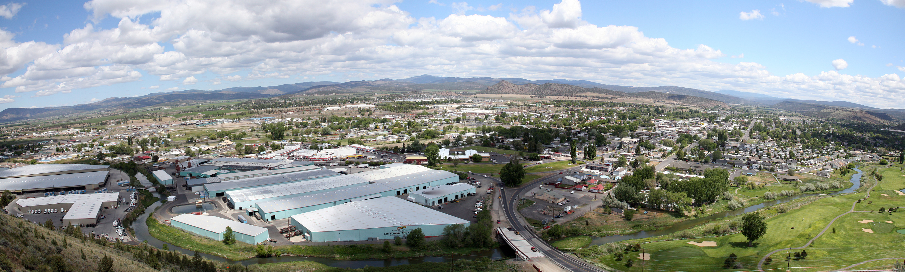
- Prineville, Oregon
-
Prineville, Oregon — City — 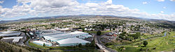 Location in Oregon
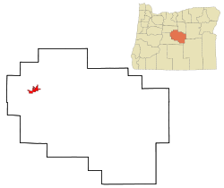
Coordinates: 44°18′14″N 120°50′46″W / 44.30389°N 120.84611°WCoordinates: 44°18′14″N 120°50′46″W / 44.30389°N 120.84611°W Country United States State Oregon County Crook Incorporated 1880 Government – Mayor Betty Jean Roppe Area – Total 6.7 sq mi (17.2 km2) – Land 6.7 sq mi (17.2 km2) – Water 0 sq mi (0 km2) Elevation 2,868 ft (874.2 m) Population (2000) – Total 7,356 – Density 1,105.9/sq mi (427.1/km2) Time zone Pacific (UTC-8) – Summer (DST) Pacific (UTC-7) ZIP code 97754 Area code(s) 541 FIPS code 41-59850[1] GNIS feature ID 1154317[2] Website www.cityofprineville.com Prineville is a city in and the county seat of Crook County, Oregon, United States.[3] It was named for the first merchant located in the present location, Barney Prine. The population was 9,253 at the 2010 census.[4]
Contents
History
Prineville was founded in 1877 when Monroe Hodges filed the original plat for the city. The post office for the community had been established with the name of Prine on April 13, 1871, but changed to Prineville on December 23, 1872. The city was incorporated by the Oregon Legislative Assembly on October 23, 1880,[5] and obtained its first high school in 1902.
Long the major town in central Oregon, Prineville was snubbed in 1911 when the railroad tycoons James J. Hill and Edward H. Harriman bypassed the city as they laid track south from The Dalles. In a period when the presence of a railroad meant the difference between prosperity and the eventual fate as a ghost town, in a 1917 election, Prineville residents voted 355 to 1 to build their own railway, and raised the money to connect their town to the main line 19 miles (31 km) away.
Helped by timber harvests from the nearby Ochoco National Forest, the City of Prineville Railroad prospered for decades. The profits from the railroad were so abundant that between 1964 and 1968, the city levied no property taxes. However, with the decline of the timber industry in Oregon, the railroad reported a loss of nearly $1 Million between 2002-04 [1].
Geography
According to the United States Census Bureau, the city has a total area of 6.7 square miles (17 km2), all of it land.[6]
Prineville is located on the Crooked River at the mouth of Ochoco Creek, 14 miles (23 km) northwest of the Prineville Reservoir.
During the Miocene and Oligocene, great basaltic flows swept through the area.[7]
Demographics
As of the census[1] of 2000, there were 7,356 people, 2,817 households, and 1,907 families residing in the city. The population density was 1,105.9 people per square mile (427.1/km²). There were 3,022 housing units at an average density of 454.3 per square mile (175.5/km²). The racial makeup of the city was 91.80% White, 0.01% African American, 1.50% Native American, 0.73% Asian, 0.01% Pacific Islander, 4.50% from other races, and 1.44% from two or more races. Hispanic or Latino of any race were 7.42% of the population.
Of the 2,817 households, 35.8% had children under the age of 18 living with them, 51.4% were married couples living together, 11.7% had a female householder with no husband present, and 32.3% were non-families. 27.1% of all households were made up of individuals and 13.2% had someone living alone who was 65 years of age or older. The average household size was 2.55 and the average family size was 3.09.
In the city the population was spread out with 29.3% under the age of 18, 9.6% from 18 to 24, 27.0% from 25 to 44, 18.6% from 45 to 64, and 15.5% who were 65 years of age or older. The median age was 33 years. For every 100 females there were 93.1 males. For every 100 females age 18 and over, there were 88.0 males.
The median income for a household in the city was $30,435, and the median income for a family was $36,587. Males had a median income of $31,224 versus $22,852 for females. The per capita income for the city was $14,163. About 10.0% of families and 14.3% of the population were below the poverty line, including 16.6% of those under age 18 and 13.1% of those age 65 or over.
Economy
Les Schwab Tire Centers, a chain of tire stores based in Prineville, has been associated with the city since the company's founding in 1952. As of 2005, the Les Schwab Tire Center chain operates more than 390 stores in California, Idaho, Montana, Nevada, Oregon, Utah, and Washington, does more than $1.5 billion in sales each year, and, according to the AP, is the number two private tire retailer in the United States. The company announced December 12, 2006, that it would be moving the corporate headquarters to nearby Bend, where a growing number of its executives live, including Dick Borgman who became CEO on the same day. In 2006, journalist Mike Rogoway noted:
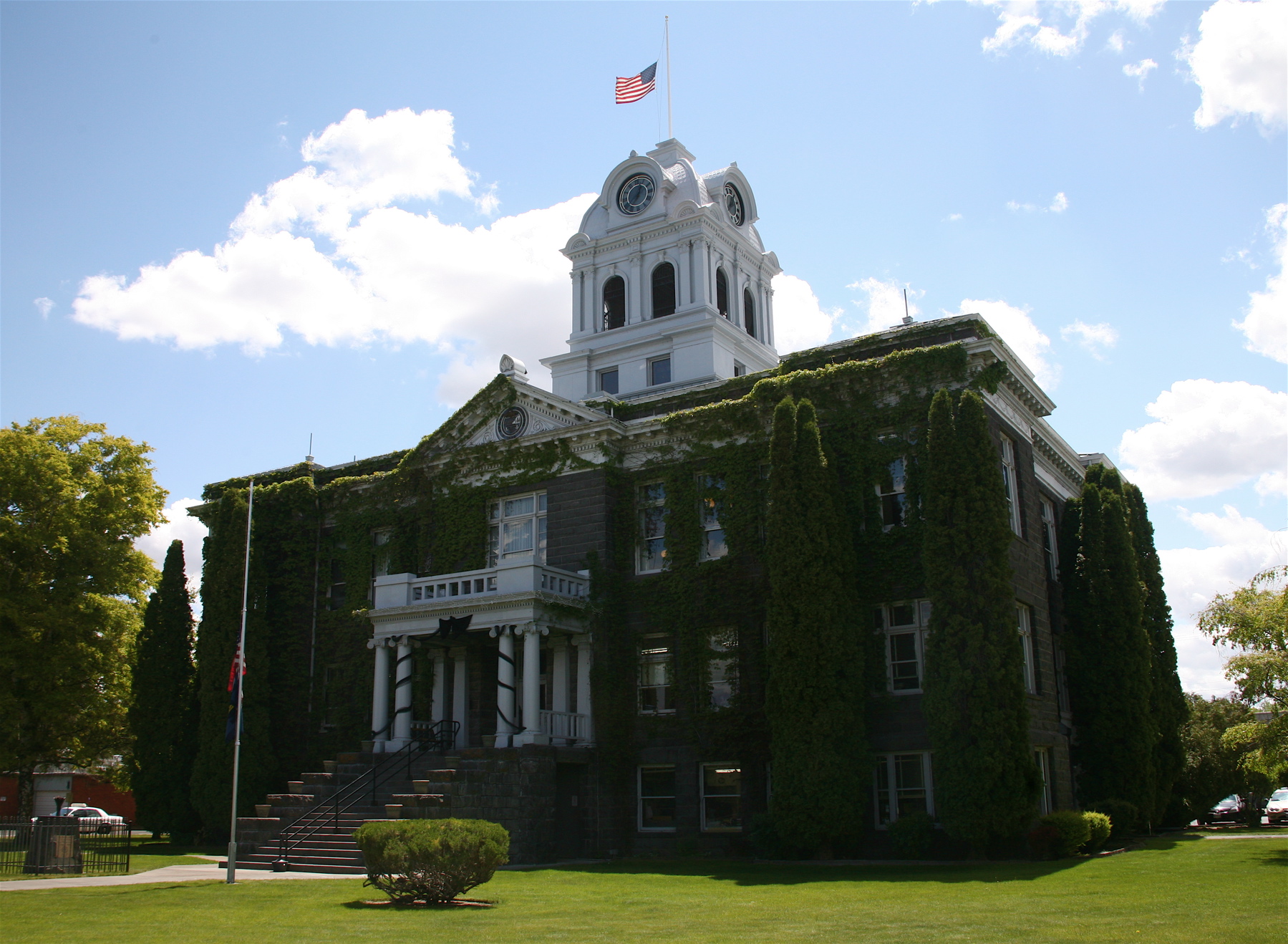
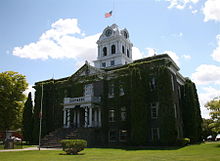 Crook County Courthouse
A decade ago, Schwab could have devastated Prineville by pulling out. Now, though, the city that suffered through the downturn in the wood products industry is enjoying an economic renaissance. Federal jobs with the Bureau of Land Management and Forest Service help anchor the economy [Judge Scott Cooper, Crook County administrator, was quoted], while a housing boom and a growing tourism industry have diversified the area.
Prineville got its first Starbucks in 2006, and a plan was floated to reopen the city's long-shuttered movie theater. In December 2006, unemployment was 4.4 percent, the lowest since the 1960s.[8]
In 2010, Prineville was selected as the location for a new data center for Facebook.[9] This center has been met with notable criticism from environmental groups such as Greenpeace because the power utility company contracted for the center, PacifiCorp, generates 70% of its electricity from coal.[10][11]
Media
Prineville Territory Magazine is a seasonal magazine covering the life and history of the Territory
The Central Oregonian is a bi-weekly newspaper published in Prineville.
A Facebook Data Center is located in Prineville.[12]
Transportation
References
- ^ a b "American FactFinder". United States Census Bureau. http://factfinder.census.gov. Retrieved 2008-01-31.
- ^ "US Board on Geographic Names". United States Geological Survey. 2007-10-25. http://geonames.usgs.gov. Retrieved 2008-01-31.
- ^ "Find a County". National Association of Counties. http://www.naco.org/Counties/Pages/FindACounty.aspx. Retrieved 2011-06-07.
- ^ "Population by City, 2000 and 2010". Population Research Center. Portland State University. http://www.pdx.edu/sites/www.pdx.edu.prc/files/media_assets/CITIES.xls. Retrieved 2011-07-28.
- ^ Leeds, W. H. (1899). "Special Laws". The State of Oregon General and Special Laws and Joint Resolutions and Memorials Enacted and Adopted by the Twentieth Regular Session of the Legislative Assembly (Salem, Oregon: State Printer): 896. http://books.google.com/?id=gsCwAAAAIAAJ&dq=%22ocean%20grove%22%20seaside%20oregon&pg=PA896.
- ^ "US Gazetteer files: 2010, 2000, and 1990". United States Census Bureau. 2011-02-12. http://www.census.gov/geo/www/gazetteer/gazette.html. Retrieved 2011-04-23.
- ^ "Field trip guide to the Oligocene Crooked River caldera: Central Oregon’s Supervolcano, Crook, Deschutes, and Jefferson Counties, Oregon, Oregon Geology Volume 69, Number 1, Fall 2009". OregonGeology.org. http://www.oregongeology.org/pubs/og/OGv69n01-CrookedRivercaldera.pdf. Retrieved November 3, 2011.
- ^ Mike Rogoway, "Tire giant rolls hub out of town", The Oregonian December 13, 2006, p. B1+
- ^ Rogoway, Mike (2010-01-21). "Facebook picks Prineville for its first data center". OregonLive.com. http://www.oregonlive.com/business/index.ssf/2010/01/facebook_picks_prineville_for.html. Retrieved 21 January 2010.
- ^ Kaufman, Leslie (September 17, 2010). "You're 'So Coal': Angling to Shame Facebook - NYTimes.com". The New York Times. http://green.blogs.nytimes.com/2010/09/17/youre-so-coal-trying-to-shame-facebook/.
- ^ "Greenpeace Attacks Facebook on Coal-Powered Data Center". http://www.pcmag.com/article2/0,2817,2369306,00.asp.
- ^ http://www.facebook.com/prinevilledatacenter
External links
 Media related to Prineville, Oregon at Wikimedia Commons
- Entry for Prineville in the Oregon Blue Book
- Prineville Chamber of Commerce
- City of Prineville Railroad
- Prineville Territory Magazine
Municipalities and communities of Crook County, Oregon County seat: PrinevilleCity Prineville

Communities Paulina | Post | Powell Butte
Categories:- Prineville, Oregon
- Cities in Oregon
- County seats in Oregon
- Populated places in Crook County, Oregon
- Populated places established in 1877
- Micropolitan areas of Oregon


Wikimedia Foundation. 2010.