- Umatilla, Oregon
Infobox Settlement
official_name = Umatilla, Oregon
settlement_type =City
nickname =
motto = Catch the vision
imagesize =
image_caption =
image_
imagesize =
image_caption =
image_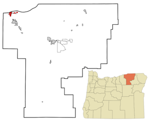
mapsize = 250px
map_caption = Location inOregon
mapsize1 =
map_caption1 =
subdivision_type = Country
subdivision_name =United States
subdivision_type1 = State
subdivision_name1 =Oregon
subdivision_type2 = County
subdivision_name2 = Umatilla
government_type =
leader_title =Mayor
leader_name = David Trott
established_title = Incorporated
established_date = 1864
area_magnitude =
area_total_sq_mi = 3.7
area_total_km2 = 9.7
area_land_sq_mi = 3.5
area_land_km2 = 9.1
area_water_sq_mi = 0.5
area_water_km2 = 0.2
area_urban_sq_mi =
area_urban_km2 =
area_metro_sq_mi =
area_metro_km2 =
population_as_of = 2006
population_note =
population_total = 6385
population_metro =
population_urban =
population_density_km2 = 546.0
population_density_sq_mi = 1415.3
timezone = Pacific
utc_offset = -8
timezone_DST = Pacific
utc_offset_DST = -7
latd = 45 |latm = 55 |lats = 4 |latNS = N
longd = 119 |longm = 19 |longs = 35 |longEW = W
elevation_m = 90.2
elevation_ft = 296
website = http://www.umatilla.org
postal_code_type =ZIP code
postal_code = 97882
area_code = 541
blank_name = FIPS code
blank_info = 41-75650GR|2
blank1_name = GNIS feature ID
blank1_info = 1128399GR|3
footnotes =Umatilla (pronEng|ˌjuməˈtɪlə) is a city in Umatilla County,
Oregon ,United States . It is named for theUmatilla River , which enters theColumbia River on the side of the city. The river is named after the Umatilla Tribe. The city is located on the south side of the Columbia River, and is located on U.S. Route 730 and I-82. TheUmatilla Chemical Depot , and the Umatilla Chemical Agent Disposal Facility, is located four-miles southwest of the city, northeast of the intersection of I-84 and I-82. The population was 4,978 at the 2000 census. The 2006 estimate is 6,385 residents. [http://www.pdx.edu/media/p/r/PRC_Certified_Cities_2006.pdf PSU:Population Research Center] ]Umatilla is part of the Pendleton–Hermiston Micropolitan Statistical Area.
History
The first post office for Umatilla was established September 26, 1851. The present town was surveyed by Timothy K. Davenport in 1863, and the town incorporated as Umatilla Landing in 1864.
Umatilla's earliest importance was as a trade and distribution center on the
Columbia River , during thegold rush of the 1860s and 1870s in easternOregon . It remained a major commercial center until the 1880s when it withered before theOregon Railway and Navigation Company .The Umatilla Chemical Depot opened in 1941, to gear up for
World War II . The depot's mission was to store and maintain a variety ofmilitary items, fromblanket s toammunition . The depot took on its chemical weapons storage mission in 1962. From 1990 to 1994 the facility reorganized in preparation for eventual closure, shipping all conventional ammunition and supplies to other installations. Today, the chemical weapons are the only items still stored at the depot.Geography
Umatilla is located at coor dms|45|55|4|N|119|19|35|W|city (45.917668, -119.326400)GR|1. It lies 30 miles northwest of Pendleton.
According to the
United States Census Bureau , the city has a total area of 3.7square mile s (9.7km² ), of which, 3.5 square miles (9.1 km²) of it is land and 0.2 square miles (0.5 km²) of it (5.63%) is water.Demographics
As of the
census GR|2 of 2000, there were 4,978 people, 1,364 households, and 1,062 families residing in the city. Thepopulation density was 1,415.3 people per square mile (546.0/km²). There were 1,511 housing units at an average density of 429.6/sq mi (165.7/km²). The racial makeup of the city was 72.10% White, 2.69% African American, 1.35% Native American, 0.38% Asian, 0.06% Pacific Islander, 21.49% from other races, and 1.93% from two or more races. Hispanic or Latino of any race were 32.58% of the population.There were 1,364 households out of which 45.7% had children under the age of 18 living with them, 58.2% were married couples living together, 13.0% had a female householder with no husband present, and 22.1% were non-families. 16.9% of all households were made up of individuals and 5.1% had someone living alone who was 65 years of age or older. The average household size was 3.14 and the average family size was 3.51.
In the city the population was spread out with 31.0% under the age of 18, 12.1% from 18 to 24, 34.7% from 25 to 44, 16.5% from 45 to 64, and 5.7% who were 65 years of age or older. The median age was 29 years. For every 100 females there were 137.8 males. For every 100 females age 18 and over, there were 157.3 males.
The median income for a household in the city was $33,844, and the median income for a family was $32,969. Males had a median income of $28,500 versus $20,337 for females. The
per capita income for the city was $11,469. About 15.6% of families and 19.4% of the population were below thepoverty line , including 24.2% of those under age 18 and 21.1% of those age 65 or over.External links
* [http://www.umatilla.org/ City government and Chamber of Commerce website]
* [http://bluebook.state.or.us/local/cities/sy/umatilla.htm Oregon Blue Book entry for Umatilla]References
Wikimedia Foundation. 2010.