- Marion County, Oregon
-
For counties with a similar name, see Marion County (disambiguation).
Marion County, Oregon 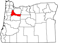
Location in the state of Oregon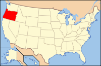
Oregon's location in the U.S.Founded July 5, 1843 Seat Salem Area
- Total
- Land
- Water
1,194 sq mi (3,092 km²)
1,184 sq mi (3,067 km²)
10 sq mi (26 km²), 0.85%Population
- (2010)
- Density
315,335
266/sq mi (102.8/km²)Website www.co.marion.or.us Marion County is a county located in the U.S. state of Oregon. It was originally named the Champooick District, after Champoeg, a meeting place on the Willamette River. On September 3, 1849, the territorial legislature renamed it in honor of Francis Marion, a Continental Army general of the American Revolutionary War. The population was 315,335 at the 2010 census.[1] The county seat is Salem.[2]
Marion County is part of the Salem Metropolitan Statistical Area.
Contents
History
Marion County was created on July 5, 1843, one of the original four districts of the Oregon territory along with Twality (later Washington), Clackamas, and Yamhill counties. The four districts were redesignated as counties in 1845.
Originally, this political entity stretched southward to the California border and eastward to the Rocky Mountains. With the creation of Wasco, Linn, Polk, and other counties, its area was reduced in size. Marion County's present geographical boundaries were established in 1856.
In 1849, Salem was designated the county seat. The territorial capital was moved from Oregon City to Salem in 1852. The ensuing controversy over the location of the capital was settled in 1864 when Salem was confirmed as the state capital.
Geography
According to the U.S. Census Bureau, the county has a total area of 1,194 square miles (3,093 km²), of which 1,184 square miles (3,066 km²) is land and 10 square miles (26 km²) (0.85%) is water.
Adjacent counties
- Linn County, Oregon - (south)
- Polk County, Oregon - (west)
- Yamhill County, Oregon - (northwest)
- Clackamas County, Oregon - (north)
- Wasco County, Oregon - (northeast)
- Jefferson County, Oregon - (east)
National protected areas
Demographics
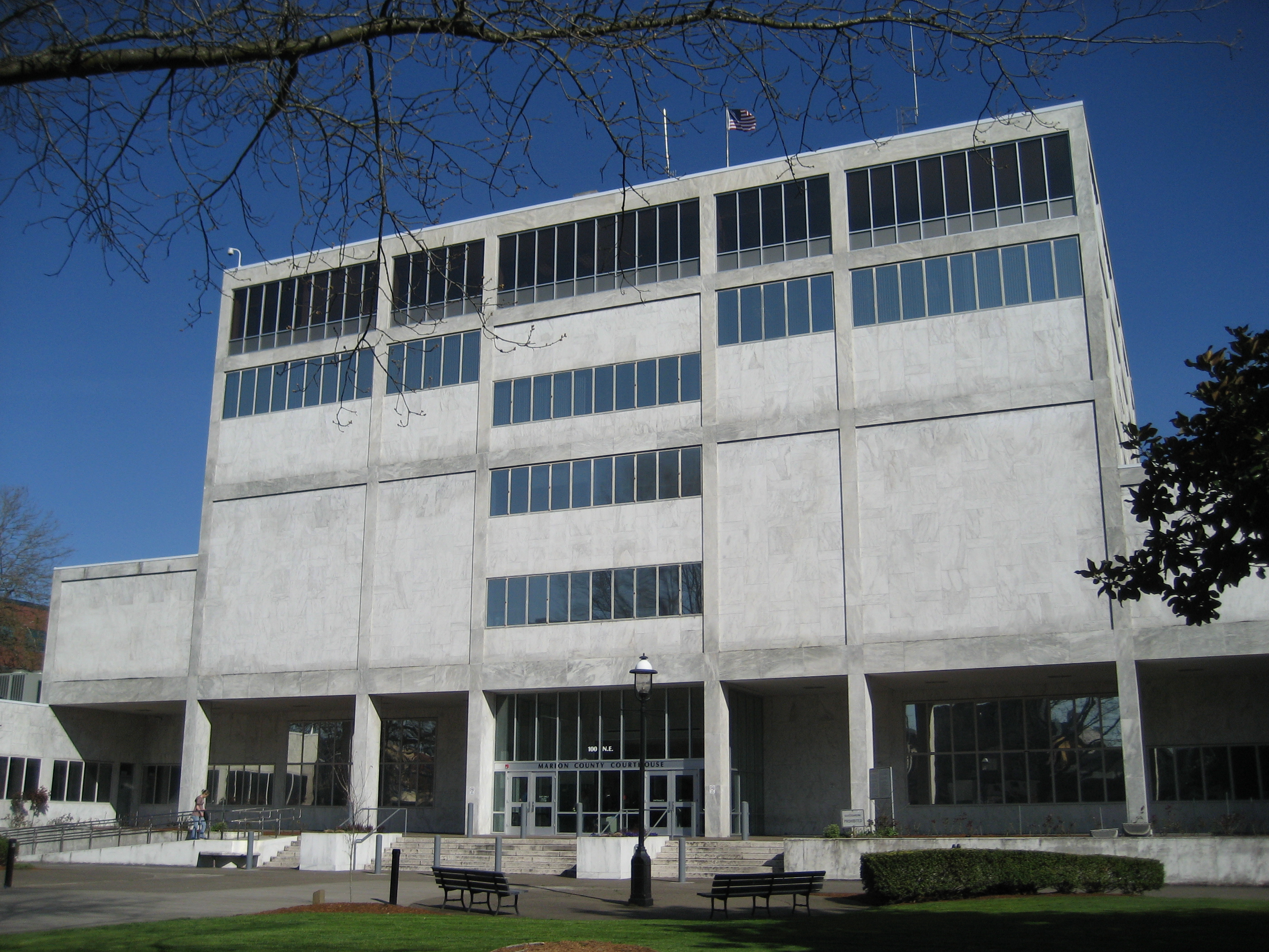
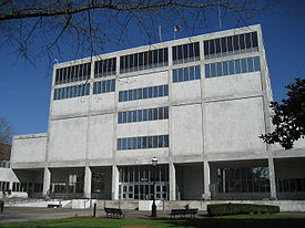 Marion County Courthouse
Historical populations Census Pop. %± 1850 2,749 — 1860 7,088 157.8% 1870 9,965 40.6% 1880 14,576 46.3% 1890 22,934 57.3% 1900 27,713 20.8% 1910 39,780 43.5% 1920 47,187 18.6% 1930 60,541 28.3% 1940 75,246 24.3% 1950 101,401 34.8% 1960 120,888 19.2% 1970 151,309 25.2% 1980 204,692 35.3% 1990 228,483 11.6% 2000 284,834 24.7% 2010 315,335 10.7% As of the census of 2000,[3] there were 284,834 people, 101,641 households, and 70,437 families residing in the county. The population density was 241 people per square mile (93/km²). There were 108,174 housing units at an average density of 91 per square mile (35/km²). The racial makeup of the county was 81.62% White, 0.89% Black or African American, 1.44% Native American, 1.75% Asian, 0.36% Pacific Islander, 10.58% from other races, and 3.35% from two or more races. 17.10% of the population were Hispanic or Latino of any race. 18.4% were of German, 9.2% English, 8.2% American and 7.4% Irish ancestry according to Census 2000. 80.8% spoke English, 14.8% Spanish and 1.4% Russian as their first language.
There were 101,641 households out of which 34.50% had children under the age of 18 living with them, 53.70% were married couples living together, 11.00% had a female householder with no husband present, and 30.70% were non-families. 24.00% of all households were made up of individuals and 9.50% had someone living alone who was 65 years of age or older. The average household size was 2.70 and the average family size was 3.19.
In the county, the population was spread out with 27.40% under the age of 18, 10.30% from 18 to 24, 28.70% from 25 to 44, 21.20% from 45 to 64, and 12.40% who were 65 years of age or older. The median age was 34 years. For every 100 females there were 101.10 males. For every 100 females age 18 and over, there were 99.50 males.
The median income for a household in the county was $40,314, and the median income for a family was $46,202. Males had a median income of $33,841 versus $26,283 for females. The per capita income for the county was $18,408. About 9.60% of families and 13.50% of the population were below the poverty line, including 18.10% of those under age 18 and 7.40% of those age 65 or over.
Economy
Agriculture and food processing are important to the county's economy, as are lumber, manufacturing, and education. Marion County is the leader in agricultural production among all other Oregon counties.[4] Marion County has 10,640 acres (43 km²) planted in orchards. Government, however, is the county's main employer and economic base.[citation needed]
Communities
Incorporated cities
- Mount Angel
- St. Paul
- Salem
- Scotts Mills
- Silverton
Unincorporated communities and CDPs
- Breitenbush
- Brooks
- Butteville
- Champoeg (a ghost town)
- Four Corners
- Hayesville
- Labish Village
- Marion
- Mehama
- Monitor
- Pratum
- Saint Benedict
- Saint Louis
- Waconda
- West Stayton
Higher education
Marion county is the home of Willamette University, Corban University, and Chemeketa Community College.[4]
See also
References
- ^ "2010 Census Data". United States Census Bureau. http://2010.census.gov/2010census/data/. Retrieved 2011-05-08.
- ^ "Find a County". National Association of Counties. http://www.naco.org/Counties/Pages/FindACounty.aspx. Retrieved 2011-06-07.
- ^ "American FactFinder". United States Census Bureau. http://factfinder.census.gov. Retrieved 2008-01-31.
- ^ a b "Marion County, Oregon". http://www.co.marion.or.us.
Municipalities and communities of Marion County, Oregon Cities 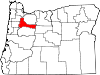
CDPs Brooks | Butteville | Four Corners | Hayesville | Labish Village | Marion | Mehama
Unincorporated
communitiesBreitenbush | Clear Lake | Macleay | McKee | Middle Grove | Monitor | Niagara | North Howell | Pratum | Saint Benedict | Saint Louis | Shaw | Talbot | Waconda | West Stayton
Ghost town Footnotes ‡This populated place also has portions in an adjacent county or counties
Categories:- Oregon counties
- Marion County, Oregon
- 1843 establishments in the United States
- Salem, Oregon metropolitan area


Wikimedia Foundation. 2010.