- Turner, Oregon
Infobox Settlement
official_name = Turner, Oregon
settlement_type =City
nickname =
motto = The Good Neighbor Town
imagesize =
image_caption =
image_
imagesize =
image_caption =
image_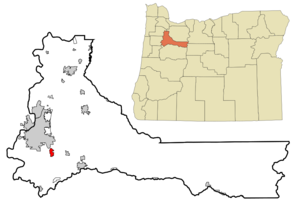
mapsize = 250px
map_caption = Location inOregon
mapsize1 =
map_caption1 =
subdivision_type = Country
subdivision_name =United States
subdivision_type1 = State
subdivision_name1 =Oregon
subdivision_type2 = County
subdivision_name2 = Marion
government_type =
leader_title =Mayor
leader_name = Carly Strauss
established_title = Incorporated
established_date = 1905
area_magnitude =
area_total_sq_mi = 1.6
area_total_km2 = 4.1
area_land_sq_mi = 1.5
area_land_km2 = 4.0
area_water_sq_mi = 0.04
area_water_km2 = 0.1
area_urban_sq_mi =
area_urban_km2 =
area_metro_sq_mi =
area_metro_km2 =
population_as_of = 2000
population_note =
population_total = 1199
population_metro =
population_urban =
population_density_km2 = 300.6
population_density_sq_mi = 778.0
timezone = Pacific
utc_offset = -8
timezone_DST = Pacific
utc_offset_DST = -7
latd = 44 |latm = 50 |lats = 45 |latNS = N
longd = 122 |longm = 57 |longs = 10 |longEW = W
elevation_m = 87.5
elevation_ft = 287
website = http://www.open.org/~turner
postal_code_type =ZIP code s
postal_code = 97359, 97392
area_code = 503
blank_name = FIPS code
blank_info = 41-75150GR|2
blank1_name = GNIS feature ID
blank1_info = 1136845GR|3
footnotes =Turner is a city in Marion County,
Oregon ,United States . The population was 1,199 at the 2000 census. It is part of the Salem Metropolitan Statistical Area.Geography
Turner is located at coor dms|44|50|45|N|122|57|10|W|city (44.845931, -122.952737)GR|1.
According to the
United States Census Bureau , the city has a total area of 1.6square mile s (4.1km² ), of which, 1.5 square miles (4.0 km²) of it is land and 0.04 square miles (0.1 km²) of it (1.27%) is water.Demographics
As of the
census GR|2 of 2000, there were 1,199 people, 491 households, and 330 families residing in the city. Thepopulation density was 778.0 people per square mile (300.6/km²). There were 522 housing units at an average density of 338.7/sq mi (130.9/km²). The racial makeup of the city was 93.83% White, 0.08% African American, 1.67% Native American, 0.25% Asian, 2.00% from other races, and 2.17% from two or more races. Hispanic or Latino of any race were 4.34% of the population.There were 491 households out of which 27.1% had children under the age of 18 living with them, 56.8% were married couples living together, 7.1% had a female householder with no husband present, and 32.6% were non-families. 27.5% of all households were made up of individuals and 20.0% had someone living alone who was 65 years of age or older. The average household size was 2.44 and the average family size was 2.99.
In the city the population was spread out with 23.8% under the age of 18, 7.4% from 18 to 24, 24.3% from 25 to 44, 22.4% from 45 to 64, and 22.1% who were 65 years of age or older. The median age was 41 years. For every 100 females there were 92.8 males. For every 100 females age 18 and over, there were 88.5 males.
The median income for a household in the city was $36,250, and the median income for a family was $43,906. Males had a median income of $38,125 versus $23,636 for females. The
per capita income for the city was $26,234. About 4.8% of families and 9.2% of the population were below thepoverty line , including 9.8% of those under age 18 and 7.3% of those age 65 or over.ee also
References
External links
* [http://www.open.org/~turner City of Turner]
Wikimedia Foundation. 2010.