- Detroit, Oregon
-
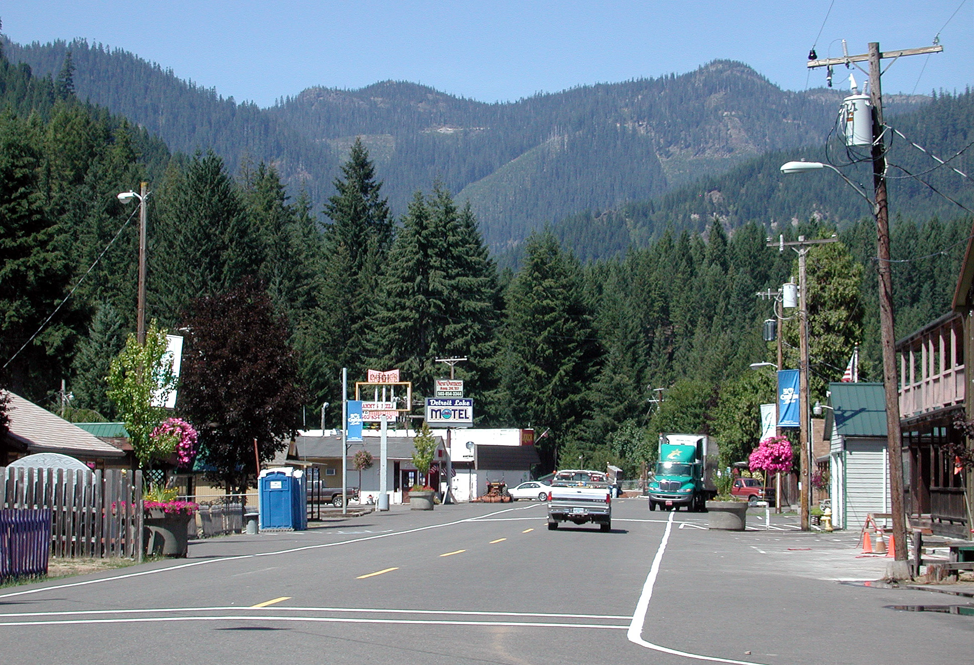
Detroit, Oregon — City — Looking west along Detroit Avenue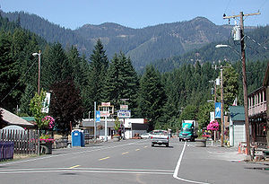 Location in Oregon
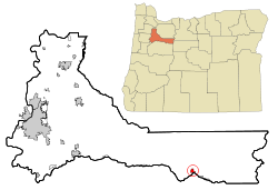
Coordinates: 44°44′8″N 122°9′5″W / 44.73556°N 122.15139°W Country United States State Oregon County Marion Incorporated 1952 Government – Mayor Jeanette Hartwell Area – Total 0.9 sq mi (2.2 km2) – Land 0.5 sq mi (1.4 km2) – Water 0.3 sq mi (0.9 km2) Elevation 1,595 ft (486.16 m) Population (2000) – Total 262 – Density 496.7/sq mi (190.9/km2) Time zone Pacific (UTC-8) – Summer (DST) Pacific (UTC-7) ZIP code 97342 Area code(s) 503 and 971 FIPS code 41-19100[1] GNIS feature ID 1140929[2] Detroit is a city in Marion County, Oregon, United States. It was named for Detroit, Michigan in the 1890s because of the large number of people from Michigan in the community. The population was 262 at the 2000 census. It is part of the Salem Metropolitan Statistical Area.
Contents
History
The original townsite of Detroit was inundated in the summer of 1952 when the Corps of Engineers finished Detroit Dam on the Santiam River.[3] The community was relocated about a half mile northwest of the original site, on State Highway 22, and was incorporated as a city the same year.
Located near Detroit Lake and Detroit Lake State Park, Detroit's economy is dependent on tourism. The community suffered from a drought in 2001, when Detroit Lake was little more than the Santiam River through the summer.[4]
In 2010, by a vote of 47-37[5] citizens in Detroit voted down a ballot measure that would have changed the city's name to Detroit Lake, the name of the neighboring reservoir and one of the most visited summer sites in Oregon. The proposal was put forth by Doug DeGeorge, a local builder and motel owner, who wanted to disassociate the town from Detroit, Michigan and its close ties to "crime, corruption, failing schools and a shaky auto industry".[6] Gary Brown, a city councilman in Detroit, Michigan, disagreed with the proposal, saying local residents would have made a big mistake because the Motor City will one day return to its previous glory.[7]
Geography
According to the United States Census Bureau, the city has a total area of 0.9 square miles (2.3 km2), of which, 0.5 square miles (1.3 km2) of it is land and 0.3 square miles (0.78 km2) of it (38.82%) is water.[8]
Demographics
As of the census[1] of 2000, there were 262 people, 119 households, and 69 families residing in the city. The population density was 496.7 people per square mile (190.9/km²). There were 383 housing units at an average density of 726.2 per square mile (279.0/km²). The racial makeup of the city was 96.56% White, 1.15% Native American, 0.38% from other races, and 1.91% from two or more races. Hispanic or Latino of any race were 3.82% of the population.
There were 119 households out of which 21.8% had children under the age of 18 living with them, 47.1% were married couples living together, 10.1% had a female householder with no husband present, and 41.2% were non-families. 33.6% of all households were made up of individuals and 16.0% had someone living alone who was 65 years of age or older. The average household size was 2.20 and the average family size was 2.77.
In the city the population was spread out with 22.1% under the age of 18, 5.0% from 18 to 24, 23.3% from 25 to 44, 33.2% from 45 to 64, and 16.4% who were 65 years of age or older. The median age was 45 years. For every 100 females there were 103.1 males. For every 100 females age 18 and over, there were 100.0 males.
The median income for a household in the city was $32,250, and the median income for a family was $35,156. Males had a median income of $41,875 versus $22,188 for females. The per capita income for the city was $19,857. About 17.9% of families and 16.1% of the population were below the poverty line, including 44.1% of those under the age of eighteen and none of those sixty five or over.
Education
Detroit public schools are part of the Santiam Canyon School District.[9]
References
- ^ a b "American FactFinder". United States Census Bureau. http://factfinder.census.gov. Retrieved 2008-01-31.
- ^ "US Board on Geographic Names". United States Geological Survey. 2007-10-25. http://geonames.usgs.gov. Retrieved 2008-01-31.
- ^ Willamette Valley Projects - Portland District - US Army Corps of Engineers
- ^ Low water picture of Detroit Lake
- ^ "Ashamed to be Detroit? Not this tiny Oregon town". Associated Press. 2010-11-03. http://news.yahoo.com/s/ap/20101103/ap_on_fe_st/us_odd_the_other_detroit_2.
- ^ "Oregon Tourist Town Considers Dumping 'Detroit'". CBS News. 2010-10-26. http://www.cbsnews.com/stories/2010/10/26/travel/main6992789.shtml. Retrieved 2010-10-27.[dead link]
- ^ "Detroit, Oregon Considers Changing Its Name To Draw More Tourists". The Huffington Post. 2010-10-26. http://www.huffingtonpost.com/2010/10/26/detroit-oregon-name-change_n_773989.html. Retrieved 2010-10-27.
- ^ "US Gazetteer files: 2010, 2000, and 1990". United States Census Bureau. 2011-02-12. http://www.census.gov/geo/www/gazetteer/gazette.html. Retrieved 2011-04-23.
- ^ http://www.santiam.k12.or.us/
External links
- Detroit Lake Recreation Area Business Association
- Listing for Detroit in the Oregon Blue Book
- Reinhardt, Bob. Detroit in the Oregon Encyclopedia
Coordinates: 44°44′08″N 122°09′05″W / 44.735676°N 122.151372°W
Municipalities and communities of Marion County, Oregon Cities 
CDPs Brooks | Butteville | Four Corners | Hayesville | Labish Village | Marion | Mehama
Unincorporated
communitiesBreitenbush | Clear Lake | Macleay | McKee | Middle Grove | Monitor | Niagara | North Howell | Pratum | Saint Benedict | Saint Louis | Shaw | Talbot | Waconda | West Stayton
Ghost town Footnotes ‡This populated place also has portions in an adjacent county or counties
Categories:- Cities in Oregon
- Populated places in Marion County, Oregon
- Salem, Oregon metropolitan area


Wikimedia Foundation. 2010.