- Burns, Oregon
Infobox Settlement
official_name = Burns, Oregon
settlement_type =City
nickname =
motto =
postal_code_type = ZIP Code
postal_code = 97720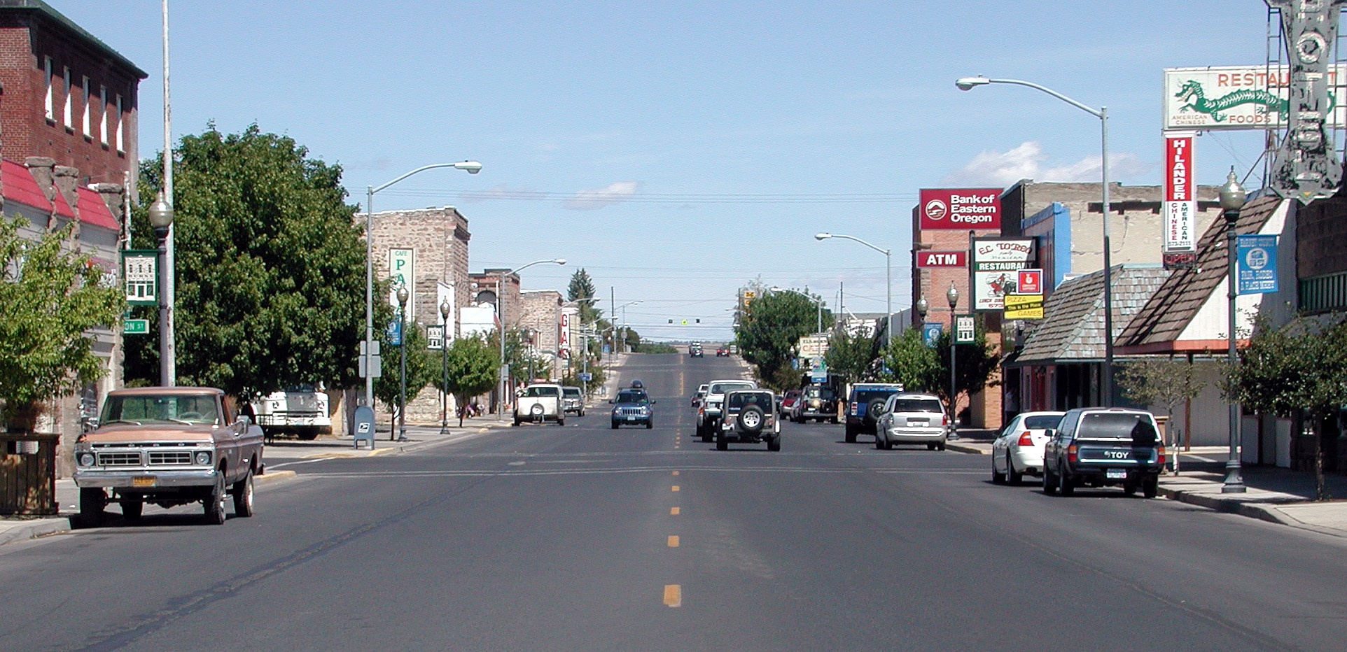
imagesize =
image_caption =
image_
image_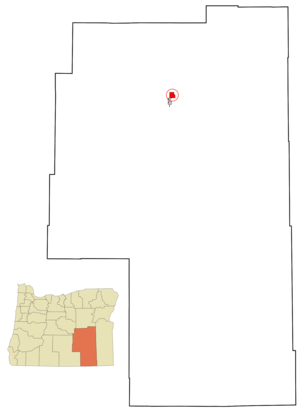
mapsize = 250x200px
map_caption = Location inOregon
mapsize1 =
map_caption1 =
subdivision_type = Country
subdivision_name =United States
subdivision_type1 = State
subdivision_name1 =Oregon
subdivision_type2 = County
subdivision_name2 = Harney
government_type =
leader_title =Mayor
leader_name = Laura Van Cleave
established_title = Incorporated
established_date =1889
area_magnitude =
area_total_sq_mi = 3.6
area_total_km2 = 9.2
area_land_sq_mi = 3.6
area_land_km2 = 9.2
area_water_sq_mi = 0.0
area_water_km2 = 0.0
area_urban_sq_mi =
area_urban_km2 =
area_metro_sq_mi =
area_metro_km2 =
population_as_of =2007
population_note =
population_total = 3020
population_metro =
population_urban =
population_density_km2 = 332.3
population_density_sq_mi = 861.5
timezone = Pacific
utc_offset = -8
timezone_DST = Pacific
utc_offset_DST = -7
area_code = 541
latd = 43 |latm = 35 |lats = 13 |latNS = N
longd = 119 |longm = 3 |longs = 36 |longEW = W
elevation_m = 1264
elevation_ft = 4147
website = [http://www.ci.burns.or.us www.ci.burns.or.us]
blank_name = FIPS code
blank_info = 41-09800GR|2
blank1_name = GNIS feature ID
blank1_info = 1118337GR|3
footnotes =Burns is a city in and county seat of Harney County,
Oregon ,United States .GR|6 The population was 3,064 at the 2000 census. The 2007 estimate is 3,020 residents. [http://www.pdx.edu/media/p/r/prcCertifiedRelease_07_web_cities.pdf PSU:Population Research Center] ]Burns was established in the early 1880s and incorporated upon Harney county's creation in 1889. It was named for the Scottish poet
Robert Burns by early settler and County Commissioner George McGowan. [cite web | title = Burns, Oregon | publisher = Harney County Chamber of Commerce | url = http://www.harneycounty.com/DowntownBurns/Burns.htm | accessdate = 2007-10-30 ]Burns and neighboring Hines form a small
metropolitan area , which has the largest population by far in Harney County.Geography and climate
Burns is located at coor dms|43|35|13|N|119|3|26|W|city (43.586827, -119.057114)GR|1 near the northern edge of the arid
Harney Basin .According to the
United States Census Bureau , the city has a total area of 3.6square mile s (9.2km² ), all of it land. It is convert|136|mi|km|0 east ofBend, Oregon , and convert|130|mi|km|0 west ofOntario, Oregon , on U.S. Route 20 at its intersection with U.S. Route 395, convert|186|mi|km|0 south ofPendleton, Oregon . A third highway,Oregon Route 78 , runs convert|92|mi|km|0 from Burns southeast past theMalheur National Wildlife Refuge andSteens Mountain to Burns Junction, Oregon.Burns has a high-desert climate that averages 115 clear days a year and only 29 rainy days. Temperatures average convert|25|°F|°C|0 in January and convert|68|°F|°C|0 in July. Annual precipitation is about convert|11|in|cm|0, and about convert|48|in|cm|0 of snow a year falls in Burns.cite web
url =http://www.weatherbase.com/weather/weather.php3?s=038627&refer= |title =Weatherbase: Historical Weather for Burns, Oregon, United States of America | publisher=Weatherbase | year=2007 | accessdate=2007-11-01 ]Demographics
As of the
census GR|2 of 2000, there were 3,064 people, 1,272 households, and 783 families residing in the city. Thepopulation density was 861.5 people per square mile (332.3/km²). There were 1,487 housing units at an average density of 418.1/sq mi (161.3/km²). The racial makeup of the city was 93.54% White, 0.20% African American, 2.48% Native American, 0.52% Asian, 0.10% Pacific Islander, 1.11% from other races, and 2.06% from two or more races. Hispanic or Latino of any race were 5.29% of the population.There were 1,272 households out of which 28.4% had children under the age of 18 living with them, 48.8% were married couples living together, 8.2% had a female householder with no husband present, and 38.4% were non-families. 31.9% of all households were made up of individuals and 12.4% had someone living alone who was 65 years of age or older. The average household size was 2.33 and the average family size was 2.94.
In the city the population was spread out with 26.0% under the age of 18, 7.4% from 18 to 24, 26.6% from 25 to 44, 23.7% from 45 to 64, and 16.3% who were 65 years of age or older. The median age was 39 years. For every 100 females there were 100.4 males. For every 100 females age 18 and over, there were 96.1 males.
The median income for a household in the city was $26,658, and the median income for a family was $31,792. Males had a median income of $24,858 versus $22,097 for females. The
per capita income for the city was $16,224. About 8.4% of families and 12.3% of the population were below thepoverty line , including 8.7% of those under age 18 and 15.1% of those age 65 or over.Notable residents
*
Kellen Clemens - New York Jets quarterback
*Norma Paulus - Oregon politicianMedia
The weekly "
Burns Times-Herald " is the only newspaper in the city. Two radio stations, KQHC-FM (92.7) and KZZR-AM (1230), broadcast from Burns. [cite web
url =http://bluebook.state.or.us/cultural/media/media03.htm |title = Oregon Blue Book: Media | publisher= Oregon State Archives | accessdate=2007-11-01 | ]Transportation
*
Burns Municipal Airport References
External links
* [http://www.ci.burns.or.us City of Burns] (official website)
* [http://bluebook.state.or.us/local/cities/ad/burns.htm Profile of Burns] from theOregon Blue Book
* [http://www.harneycounty.com/DowntownBurns/Burns.htm Profile of Burns from the Harney County Chamber of Commerce]
Wikimedia Foundation. 2010.