- Malheur Lake
-
Malheur Lake 
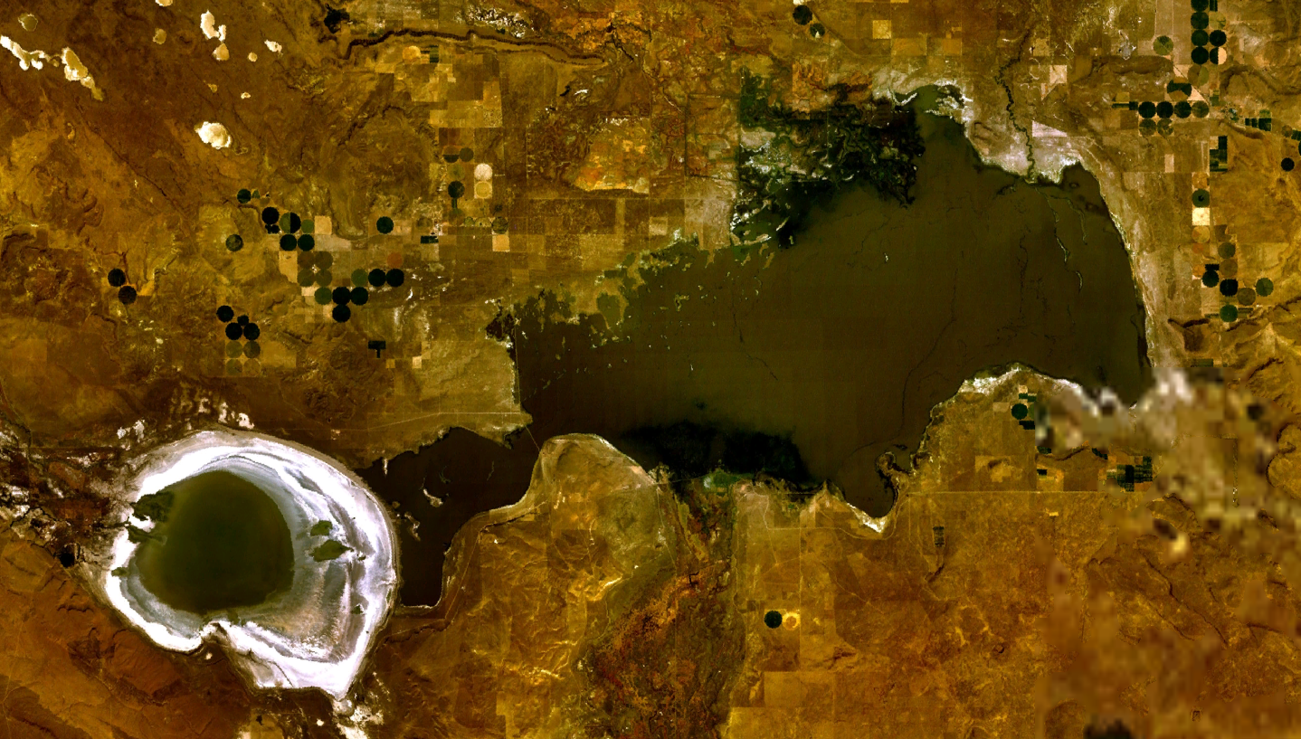
Satellite image of Harney Lake (left) and Malheur Lake (right) Location Harney County, Oregon, USA Coordinates 43°19′58″N 118°47′35″W / 43.33267°N 118.793106°WCoordinates: 43°19′58″N 118°47′35″W / 43.33267°N 118.793106°W Lake type Endorheic Primary inflows Donner und Blitzen River, Silvies River Primary outflows ground seepage, evaporation Basin countries United States 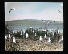 Hand painted glass slide of a colony of California Gulls at Malheur Lake, taken by Finley and Bohlman during a 1908 photograph trip to the area. Finley and Bohlman's photographs would later help Malheur become a bird refuge in 1908
Malheur Lake is a lake in an arid region of eastern Oregon, United States near Burns, Oregon. The lake is fed by Donner und Blitzen River from the south and the Silvies River from the north. Malheur Lake has no outlet, though water escapes through ground seepage and by evaporation; widespread regional irrigation may or may not have an effect. At the bottom of Harney Basin, also Harney Lake is a "twin" which, historically, merges with Malheur Lake when the water levels rise sufficiently. This last happened in the mid-1980s.
See also
- List of lakes in Oregon
- List of Oregon rivers
Categories:- Lakes of Oregon
- Landforms of Harney County, Oregon
- Oregon geography stubs

Wikimedia Foundation. 2010.