- U.S. Route 26 in Oregon
-
This article is about the section of U.S. Route 26 in Oregon. For the entire length of the highway, see U.S. Route 26.
U.S. Route 26

Route information Maintained by ODOT Length: 471.56 mi[1] (758.90 km) Major junctions West end:  US 101 near Seaside
 OR 217 in Beaverton
 I-405 in Portland
 I-5 in Portland
 I-205 in Portland
 US 97 in Madras
 OR 126 in Prineville
 US 395 in John Day
 US 20 in Vale
East end:  US-20 / US-26 at the Idaho state line
Location Counties: Clatsop, Tillamook, Washington, Multnomah, Clackamas, Wasco, Jefferson, Crook, Wheeler, Grant, Baker, & Malheur Highway system United States Numbered Highways
List • Bannered • Divided • ReplacedOregon highways
Routes • Highways←  OR 22
OR 22OR 27  →
→In the U.S. state of Oregon, U.S. Route 26 is a major cross-state state highway, connecting U.S. Route 101 on the Oregon Coast near Seaside with the Idaho state line east of Nyssa. Local highway names (see Oregon highways and routes) include the Sunset Highway No. 47, Mount Hood Highway No. 26, and John Day Highway No. 5.
Contents
Route description
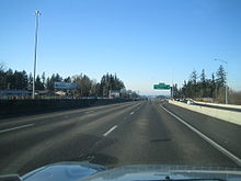
The westernmost segment, known as the Sunset Highway No. 47, heads southeast from US 101 near Seaside to Portland. (Prior to 2004, its origin was near Astoria and continued south to Seaside concurrent with US 101.) The Sunset Highway becomes a freeway near Banks, serving Washington County suburbs of Portland such as North Plains, Hillsboro, and Beaverton.
In Portland, the route overlaps Interstate 405 (Stadium Freeway No. 61) for a short distance before exiting onto city streets, including Arthur Street, to reach the Ross Island Bridge. (Prior to 2005, US 26 ran through downtown Portland on the one-way couplet of Market and Clay Streets, which carry the Sunset Highway to its end at Naito Parkway (Pacific Highway West No. 1W), turning south there to reach the bridge.) US 26 leaves the bridge, which is at the beginning of the Mount Hood Highway No. 26, and follows Powell Boulevard, a surface street, to Gresham.
There were plans to construct a freeway alignment of US 26 — the Mount Hood Freeway — to bypass Powell Boulevard; however this project was canceled as a result of the freeway revolts in the 1970s. A few ramp stubs from Interstate 5 (on the Marquam Bridge) stand as evidence of this project. Roadway connections between the Portland freeway network and Mount Hood remain a big problem, as there is no good direct highway connection. The proposed Sunrise Corridor may eventually offer a long-term solution; however construction of this route is several years off.
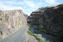
An expressway begins near Gresham and carries US 26 southeast to near Sandy. From Sandy to near Government Camp and Bennett Pass, where US 26 intersects Oregon Route 35, it closely follows the historic Barlow Road through the Mount Hood Corridor, and is part of the Mount Hood Scenic Byway. The Mount Hood Highway branches off to the north along OR 35, and the Warm Springs Highway No. 53 carried US 26 southeast through Blue Box Pass, the Warm Springs Indian Reservation, and Agency Plains to Madras. After a short overlap with US 97 (The Dalles-California Highway No. 4), the short Madras-Prineville Highway No. 360 continues southeast to a junction with OR 126 in Prineville.
At that junction, US 26 picks up the Ochoco Highway No. 41, which also follows OR 126 west to US 97 in Redmond. The Ochoco Highway ends at OR 19 near Dayville, from which US 26 follows the John Day Highway No. 5 through John Day to US 20 in Vale. The remainder of US 26 in Oregon overlaps US 20 on the Central Oregon Highway No. 7 to the Idaho state line.
History
An ancient trail passed through the section of the Warm Springs Indian Reservation as part of an extensive Indian trade network linking peoples of the northern Great Basin and Columbia Plateau to those living west of the Cascade Range. Obsidian, bear grass, and slaves were transported over these trails to major trading locations along the Columbia River in exchange for dried salmon, smelt, sturgeon, and decorative sea shells. The long established route was later used by Peter Skene Ogden's fur trapping expeditions in 1825 and 1826. Fur trader Nathaniel Wyeth was here in the 1830s. Captain John C. Frémont followed this route on his 1843 explorations for the United States and Lieutenant Henry Larcom Abbot headed a Pacific Railroad survey party along it in 1855.[2]
Major intersections
- Note: US 26 uses many different highways (see Oregon highways and routes); the milepoint column shows mileage along these highways, not adjusted for equations, with the highway number in front.
County Location Milepoint[3] # Destinations Notes Clatsop Cannon Beach Junction 47 -0.10 US 101 – Seaside, Astoria, Cannon Beach, TillamookInterchange Necanicum Junction 47 9.42  OR 53 – Wheeler, Tillamook
Jewell Junction 47 21.78  OR 103 north – Mist, Jewell
Interchange Washington Staleys Junction 47 45.51  OR 47 north – Vernonia, Clatskanie
West end of OR 47 overlap Davies Junction 47 49.47 OR 47 south – Banks, Forest GroveInterchange; east end of OR 47 overlap Tillamook Junction 47 53.33  OR 6 – Banks, Tillamook
Interchange; no westbound entrance 47 53.62 West end of freeway 47 55.19 55 Dersham Road – Mountaindale North Plains 47 57.16 57 Glencoe Road – North Plains 47 58.74 59 Jackson School Road Hillsboro 47 61.06 61 Helvetia Road, Shute Road 47 62.46 62 Cornelius Pass Road – Cornelius Pass, West Union Signed as exits 62A (south) and 62B (north) westbound 47 64.29 64 185th Avenue – PCC-Rock Creek Beaverton 47 65.67-
64.9165 Bethany Boulevard, Cornell Road 47 67.14 67 Murray Boulevard 47 68.34 68 Cedar Hills Boulevard – Beaverton 47 69.19 69A OR 217 south to I-5 south – Beaverton, Tigard, Salem47 69.21 69B Park Way, Barnes Road 47 70.83 71A  OR 8 (Canyon Road)
Westbound exit and eastbound entrance Multnomah Portland 47 71.30 71B Sylvan Signed as exit 71 eastbound 47 72.18 72 Oregon Zoo, World Forestry Center 47 73.39 73 Canyon Road – PGE Park Eastbound exit and westbound entrance 47 73.53 Vista Ridge Tunnels 47 73.75 Market Street (Sunset Highway east) – Portland City Center Eastbound exit and westbound entrance 47 74.05
61 1.41 I-405 north to I-5 north / US 30 – St. Helens, Seattle
West end of I-405 overlap 61 1.39 12th Avenue Westbound exit and eastbound entrance 61 1.29
(city street) I-405 south to I-5 south / I-84 east / US 30 – The Dalles, Salem, Portland Airport
East end of I-405 overlap; eastbound exit and westbound entrance East end of freeway Broadway Drive – Council Crest No access from US 26 west 6th Avenue, Terwilliger Boulevard – Portland City Center, Keller Auditorium, Oregon Health & Science University, University and V.A. Hospitals (city street)
26 0.01Naito Parkway (Pacific Highway West north) Interchange; westbound exit and eastbound entrance 26 0.18  OR 10 west (Barbur Boulevard)
Interchange 26 0.45  OR 43 south (Macadam Avenue) to I-5 south – Lake Oswego, Salem
Interchange 26 0.76 Ross Island Bridge over the Willamette River 26 1.01  OR 99E – Milwaukie, Oregon City
Interchange; eastbound exit to OR 99E north is via 17th Avenue south 26 1.60 17th Avenue south Interchange; eastbound exit and westbound entrance 26 1.76 17th Avenue north Westbound exit only 26 5.04  OR 213 (82nd Avenue)
26 5.74 I-205 / Division Street – Seattle, SalemGresham 26 14.18 To I-84 / Burnside Road, Powell Valley RoadClackamas County 26 19.54  OR 212 – Boring, Oregon City
Interchange Sandy 26 24.40  OR 211 – Estacada, Molalla
26 54.23 Timberline Lodge National Historic Landmark (OR 173) 26 57.45
53 57.45 OR 35 north – Hood River
Interchange Wasco 53 71.27  OR 216 – Bear Springs Ranger Station, Maupin, The Dalles
Jefferson Madras 53 117.71
4 92.08 US 97 north – The Dalles, BiggsWest end of US 97 overlap 4 92.46 D Street (OR 361) – Metolius, The Cove Palisades State Park 4 97.29
360 0.09 US 97 south – Redmond, BendEast end of US 97 overlap Crook Prineville 360 26.28
41 18.16 OR 126 west – Redmond, Bend41 18.75 OR 27 – Bowman Dam41 19.75 Prineville Reservoir, Paulina (OR 380) Wheeler Mitchell 41 65.94  OR 207 – Spray, Service Creek, Fossil
Grant 41 98.36
5 124.17 OR 19 north – Kimberly, Spray
Mount Vernon 5 154.03 US 395 north – Long Creek, PendletonWest end of US 395 overlap John Day 5 162.29 US 395 south – Canyon City, BurnsEast end of US 395 overlap Austin Junction 5 190.67  OR 7 – Sumpter, Baker City
Baker 5 210.54  OR 245 – Hereford, Baker City
Eldorado Pass 5 223.22 Malheur Vale 5 278.21
7 246.39 US 20 west – Vale City Center, Burns, AdrianWest end of US 20 overlap Cairo Junction 7 258.20  OR 201 north to I-84 – Ontario
West end of OR 201 overlap Nyssa 7 265.97 OR 201 south – Adrian, Lake OwyheeEast end of OR 201 overlap 7 266.82 Idaho state line References
- ^ "US Route 20 in Oregon". http://www.angelfire.com/or3/oroads/roads/us20/.
- ^ Oregon History sign, Indian Trails, located at 44.863983°,-121.311867°
- ^ Oregon Department of Transportation, Public Road Inventory (primarily the Digital Video Log), accessed March 2008
U.S. Route 26Previous state:
TerminusOregon Next state:
IdahoFreeways in the Portland, Oregon Metropolitan Area Radial Circumferential Bridges Categories:- U.S. Highways in Oregon
- Transportation in Washington County, Oregon
- Transportation in Tillamook County, Oregon
- Transportation in Clackamas County, Oregon
- Transportation in Multnomah County, Oregon
- Transportation in Wasco County, Oregon
- Transportation in Baker County, Oregon
- Transportation in Clatsop County, Oregon
- Transportation in Columbia County, Oregon
- Transportation in Grant County, Oregon
- Transportation in Jefferson County, Oregon
- Transportation in Malheur County, Oregon
- Transportation in Crook County, Oregon
- Transportation in Wheeler County, Oregon
- Mount Hood National Forest


Wikimedia Foundation. 2010.