- Oregon Route 47
-
For the unsigned Highway 47, see Sunset Highway (Oregon).
Oregon Route 47
Route information Maintained by ODOT Length: 78.27 mi (125.96 km) Existed: 1932 – present Major junctions South end:  OR 99W near McMinnville
 OR 240 in Yamhill
 OR 8 in Forest Grove
 OR 6 in Banks
 US 26 in Davies
US 26 in Staleys Junction
 OR 202 in Mist
North end:  US 30 in Clatskanie
Highway system Oregon highways
Routes • Highways←  OR 46
OR 46OR 51  →
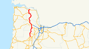
→Oregon Route 47 is an Oregon state highway that runs between the Willamette Valley, near McMinnville, and the city of Clatskanie, along the Columbia River in the northwest part of the state. The southernmost portion is part of the Tualatin Valley Highway No. 29 (see Oregon highways and routes),[1] the middle portion is part of the Nehalem Highway No. 102,[1] and the northernmost section is known as the Mist-Clatskanie Highway No. 110.[2]
Route description
Oregon Route 47 begins (at its southern terminus) at a junction with Oregon Route 99W between the cities of McMinnville and Lafayette.[1] This stretch is known as the Tualatin Valley Highway. It continues north along the western edge of the Willamette Valley, hugging the Coast Range. It passes through parts of Oregon's wine country (and some prime agricultural land), and through small towns such as Carlton,[1] Yamhill,[1] and Gaston.[1] The first large city encountered is Forest Grove.[1] A bypass around the east side of town avoids the downtown area.
In Forest Grove, OR 47 intersects Oregon Route 8,[1] and the Tualatin Valley Highway leaves Oregon Route 47, and continues east towards Hillsboro and Beaverton on Oregon Route 8. North of the intersection, OR 47 is known as the Nehalem Highway. It continues north, passing through the town of Banks.[1] North of Banks, OR 47 shares an alignment for about 4 miles (6 km) with U.S. Route 26 over the Sunset Highway, which is—a bit confusingly—Highway 47. North of Manning, OR 47 and US 26 part ways. OR 47 continues north, following the North Fork of Dairy Creek to its source and passing L.L. "Stub" Stewart Memorial State Park[3] and shortly thereafter reaching the summit called "Tophill" where the highway departs the Willamette River drainage and enters the Nehalem drainage. From Tophill, the highway quickly winds down to a tributary of the Nehalem River and finds the Nehalem River at the extinct community of Treharne.
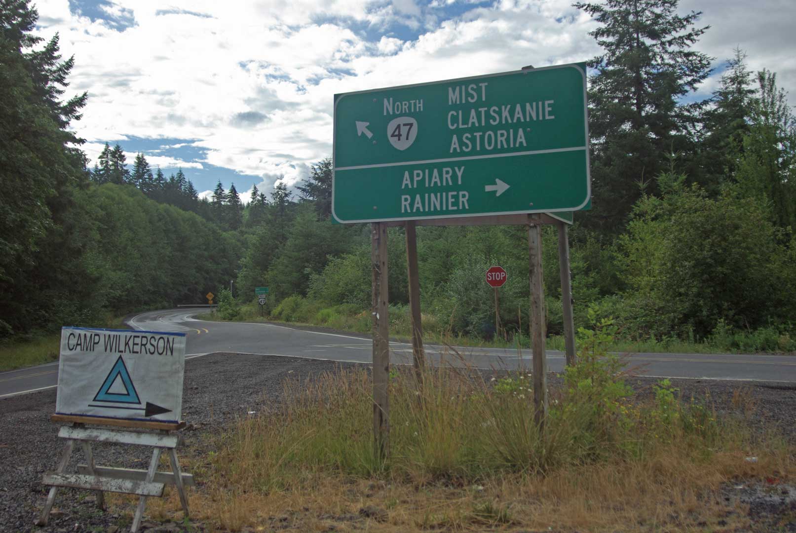
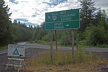 Apiary Junction
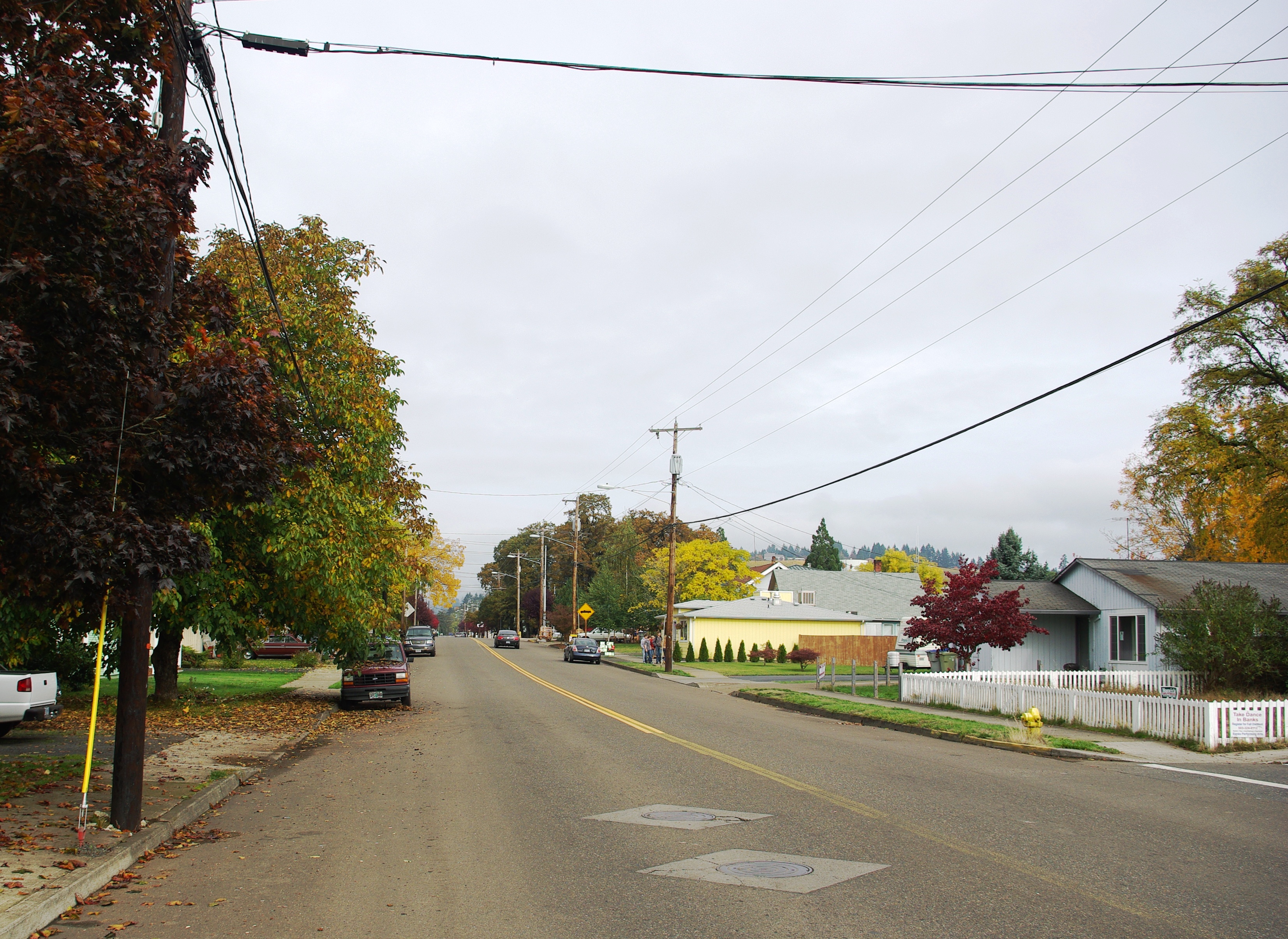
 47 in Banks
Though in the mountainous Northern Oregon Coast Range, the Nehalem Highway itself is just winding, as it follows the banks of the Nehalem River all the way to Jewell,[4] passing through Vernonia[2] and Pittsburg.[2] However, Pittsburg is little more than a road junction where the Scappoose-Vernonia Road breaks off and heads up the East Fork of the Nehalem River for Scappoose, Oregon. A few miles further north, Route 47 reaches the Apiary junction with destinations for Apiary and Rainier. The Apiary road is popular with truckers as it does not have the restrictive length limitations which are applied to OR 47 North of Mist or Oregon Route 202 west of Jewell because of numerous short turns.
After the town of Mist,[2] the Nehalem Highway continues west towards Astoria as Oregon Route 202; OR 47 continues north for 12 miles (19 km) as the Mist-Clatskanie Highway. This stretch of OR 47 is rather mountainous, with many sharp turns and steep grades. Eventually, OR 47 descends out of the mountains into the Columbia River basin, and ends in the city of Clatskanie at an intersection with U.S. Route 30.[2]
Major intersections
- Note: OR 47 uses several different highways (see Oregon highways and routes); the milepoint column shows mileage along these highways, not adjusted for equations, with the highway number in front.
County Location Milepoint[5] Destinations Notes Yamhill St. Joseph Junction 29 42.46 OR 99W – McMinnville, Newberg, PortlandYamhill 29 34.47 OR 240 / Moores Valley Road – Chehalem Valley, Newberg, FairdaleWashington Forest Grove 29 17.88
102 90.64 OR 8 – Forest Grove City Center, Hillsboro, PortlandBanks 102 83.72 OR 6 – Glenwood, Tillamook, North Plains, PortlandInterchange Davies Junction 102 80.83 US 26 east – North Plains, PortlandInterchange; south end of US 26 overlap Staleys Junction 102 76.96 US 26 west – SeasideNorth end of US 26 overlap Columbia Pittsburg 102 57.11 Scappoose, St. Helens 102 53.19 Apiary, Rainier Mist 102 46.14
110 11.89 OR 202 – Birkenfeld, AstoriaClatskanie 110 0.00 US 30 – Astoria, Rainier, PortlandReferences
- ^ a b c d e f g h i http://egov.oregon.gov/ODOT/TD/TDATA/rics/docs/NumRouteMap_enl.pdf |Portland Area Enlargement of map of State of Oregon Highway system-2006
- ^ a b c d e http://egov.oregon.gov/ODOT/TD/TDATA/rics/docs/NumRouteMap.pdf%7C State of Oregon Highway System Route Map 2006
- ^ Official State Parks Fact Sheet
- ^ The Nehalem River Highway, Jeffrey Butts
- ^ Oregon Department of Transportation, Public Road Inventory (primarily the Digital Video Log), accessed March 2008
Categories:- State routes in Oregon
- Transportation in Washington County, Oregon
- Transportation in Yamhill County, Oregon
- Transportation in Columbia County, Oregon


Wikimedia Foundation. 2010.