- Vale, Oregon
Infobox Settlement
official_name = Vale, Oregon
settlement_type =City
nickname =
motto = Born and raised on the Oregon Trail
imagesize =
image_caption =
image_
imagesize =
image_caption =
image_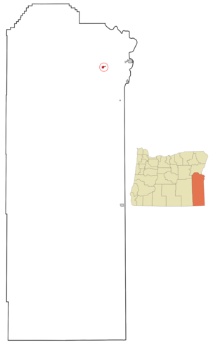
mapsize = 250x200px
map_caption = Location inOregon
mapsize1 =
map_caption1 =
subdivision_type = Country
subdivision_name =United States
subdivision_type1 = State
subdivision_name1 =Oregon
subdivision_type2 = County
subdivision_name2 = Malheur
government_type =
leader_title =Mayor
leader_name = Bill Lawrence
established_title = Incorporated
established_date =1889
area_magnitude =
area_total_sq_mi = 1.1
area_total_km2 = 2.8
area_land_sq_mi = 1.1
area_land_km2 = 2.8
area_water_sq_mi = 0
area_water_km2 = 0
area_urban_sq_mi =
area_urban_km2 =
area_metro_sq_mi =
area_metro_km2 =
population_as_of =2000
population_note =
population_total = 1976
population_metro =
population_urban =
population_density_km2 = 706.4
population_density_sq_mi = 1824.9
timezone = Mountain
utc_offset = -7
timezone_DST = Mountain
utc_offset_DST = -6
latd = 43 |latm = 58 |lats = 56 |latNS = N
longd = 117 |longm = 14 |longs = 37 |longEW = W
elevation_m = 714.2
elevation_ft = 2343
website = [http://www.ci.vale.or.us www.ci.vale.or.us]
postal_code_type =ZIP code
postal_code = 97918
area_code = 541
blank_name = FIPS code
blank_info = 41-76600GR|2
blank1_name = GNIS feature ID
blank1_info = 1136861GR|3
footnotes =Vale is a city in Malheur County,
Oregon ,United States , about 12 miles (19 km) west of theIdaho border. It is at the intersection of U.S. Routes 20 and 26, on theMalheur River .Vale was selected as Malheur's
county seat in1955 , 68 years after the county was founded. As of the 2000 census, the city had a total population of 1,976.Many of the businesses in Vale have
murals painted on their sides that depict things such as the cultural diversity of the area, and its pioneer history.Fact|date=April 2007Vale is part of the Ontario, OR–ID Micropolitan Statistical Area.
History
The community was the first stop in Oregon along the
Oregon Trail . A post office with the name of Vale was established in February 1883, and the city was incorporated in 1889.In September 2004, Oregon's first known human case of the
West Nile virus was found in a teenage boy from Vale.Fact|date=March 2008Geography
Vale is located at 43°58'56" North, 117°14'37" West (43.982237, -117.243483),GR|1 at an elevation of 2244' (684 m).
According to the
United States Census Bureau , the city has a total area of 1.1 square miles (2.8 km²), none of which is covered with water.There are a number of
hot springs andbutte s located in the area.Fact|date=March 2008Demographics
As of the
census GR|2 of2000 , there are 1,976 people in the city, organized into 658 households, and 488 families. Thepopulation density is 1,824.9 people per square mile (706.4/km²). There are 724 housing units at an average density of 668.7/sq mi (258.8/km²). The racial makeup of the city is 82.49% White, 1.37% Native American, 0.76% Asian, 0.15% African American, 0.10% Pacific Islander, 11.99% from other races, and 3.14% from two or more races. 24.85% of the population are Hispanic or Latino of any race.There are 658 households out of which 40.9% have children under the age of 18 living with them, 57.0% are married couples living together, 12.8% have a female householder with no husband present, and 25.8% are non-families. 22.6% of all households are made up of individuals and 12.3% have someone living alone who is 65 years of age or older. The average household size is 2.83 and the average family size is 3.32.
The median age within the city is 32 years:
*31.2% of the city's population is under the age of 18;
*9.7% is from 18 to 24;
*26.7% is from 25 to 44;
*18.2% is from 45 to 64; and
*14.2% are 65 years of age or older. For every 100 females there are 99.6 males. For every 100 females age 18 and over, there are 97.1 males.The median income for a household in the city is $27,065, and the median income for a family is $33,355. Males have a median income of $27,176 versus $22,500 for females. The
per capita income for the city is $11,943. 20.0% of the population and 15.6% of families are below thepoverty line . Out of the total population, 27.8% of those under the age of 18 and 12.2% of those 65 and older are living below the poverty line.Arts and culture
Annual cultural events
The Vale 4th of July Rodeo draws people from all over the United States and Canada.Fact|date=March 2008 The third day of the rodeo includes a suicide horse race, similar to an event in Washington. The route starts on Rineheart Butte and crosses the Malheur River.
Transportation
*
Miller Memorial Airpark References
External links
* [http://www.ci.vale.or.us/ City of Vale]
* [http://www.malheurco.org/vale Community profile] from the county's website
* [http://www.valeoregon.org/ Vale Chamber of Commerce]
* [http://www.vale.k12.or.us/ Vale School District]
* [http://www.blm.gov/or/districts/vale/index.php Vale District website] for theBureau of Land Management
* [http://www.valeoregonmurals.com/ Vale Heritage Reflections Mural Society]
* [http://egov.oregon.gov/ODOT/TD/TDATA/gis/docs/citymaps/vale.pdf Map of Vale] in PDF format
Wikimedia Foundation. 2010.