- Spray, Oregon
Infobox Settlement
official_name = Spray, Oregon
settlement_type =Town
nickname = The City by the River
motto =
imagesize =
image_caption =
image_
imagesize =
image_caption =
image_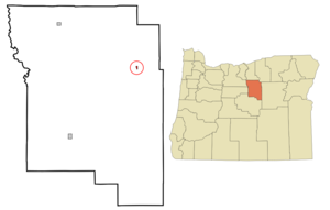
mapsize = 250px
map_caption = Location inOregon
mapsize1 =
map_caption1 =
subdivision_type = Country
subdivision_name =United States
subdivision_type1 = State
subdivision_name1 =Oregon
subdivision_type2 = County
subdivision_name2 = Wheeler
government_type =
leader_title =Mayor
leader_name = Terry Ingalls
established_title = Incorporated
established_date =1958
area_magnitude =
area_total_sq_mi = 0.2
area_total_km2 = 0.6
area_land_sq_mi = 0.2
area_land_km2 = 0.6
area_water_sq_mi = 0
area_water_km2 = 0
area_urban_sq_mi =
area_urban_km2 =
area_metro_sq_mi =
area_metro_km2 =
population_as_of =2000
population_note =
population_total = 140
population_metro =
population_urban =
population_density_km2 = 235.0
population_density_sq_mi = 388.9
timezone = Pacific
utc_offset = -8
timezone_DST = Pacific
utc_offset_DST = -7
latd = 44 |latm = 49 |lats = 59 |latNS = N
longd = 119 |longm = 47 |longs = 40 |longEW = W
elevation_m = 540.1
elevation_ft = 1772
website = http://www.sprayoregon.us
postal_code_type =ZIP code
postal_code = 97874
area_code = 541
blank_name = FIPS code
blank_info = 41-69450GR|2
blank1_name = GNIS feature ID
blank1_info = 1127403GR|3
footnotes =Spray is a city in Wheeler County,
Oregon ,United States . The population was 140 at the 2000 census.Geography
Spray is located at coor dms|44|49|59|N|119|47|40|W|city (44.833179, -119.794449)GR|1.
According to the
United States Census Bureau , the city has a total area of 0.2square mile s (0.6km² ), all of it land.Demographics
As of the
census GR|2 of 2000, there were 140 people, 67 households, and 39 families residing in the city. Thepopulation density was 618.7 people per square mile (235.0/km²). There were 88 housing units at an average density of 388.9/sq mi (147.7/km²). The racial makeup of the city was 97.86% White, 0.71% Asian, and 1.43% from two or more races.There were 67 households out of which 14.9% had children under the age of 18 living with them, 55.2% were married couples living together, 3.0% had a female householder with no husband present, and 40.3% were non-families. 34.3% of all households were made up of individuals and 11.9% had someone living alone who was 65 years of age or older. The average household size was 2.00 and the average family size was 2.55.
In the city the population was spread out with 18.6% under the age of 18, 3.6% from 18 to 24, 17.9% from 25 to 44, 27.1% from 45 to 64, and 32.9% who were 65 years of age or older. The median age was 51 years. For every 100 females there were 112.1 males. For every 100 females age 18 and over, there were 93.2 males.
The median income for a household in the city was $23,250, and the median income for a family was $24,500. Males had a median income of $19,250 versus $20,000 for females. The
per capita income for the city was $14,955. There were 11.4% of families and 21.0% of the population living below thepoverty line , including 43.5% of under eighteens and 13.2% of those over 64.Notable
Spray features an annual half marathon and rodeo on Memorial Day Weekend. The half marathon begins at Service Creek on Saturday and finishes in downtown Spray. The rodeo parade begins roughly three hours later, followed by the rodeo which continues on Sunday. High school graduation also occurs the week before, and the school year ends the week of the rodeo.
References
External links
* [http://www.sprayoregon.us City of Spray]
Wikimedia Foundation. 2010.