- Mitchell, Oregon
-
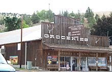
Mitchell, Oregon — City — Main Street as seen from Rosenbaum Street Location in Oregon
Coordinates: 44°34′2″N 120°9′13″W / 44.56722°N 120.15361°WCoordinates: 44°34′2″N 120°9′13″W / 44.56722°N 120.15361°W Country United States State Oregon County Wheeler Incorporated 1891 Government – Mayor Teresa Quant-Riley Area – Total 1.2 sq mi (3.1 km2) – Land 1.2 sq mi (3.1 km2) – Water 0 sq mi (0 km2) Elevation 2,777 ft (846.4 m) Population (2000) – Total 170 – Density 144.6/sq mi (55.6/km2) Time zone Pacific (UTC-8) – Summer (DST) Pacific (UTC-7) ZIP code 97750 Area code(s) 541 FIPS code 41-49150[1] GNIS feature ID 1146370[2] Website www.mitchelloregon.us Mitchell is a city in Wheeler County, Oregon, United States. The population was 170 at the 2000 census. It was founded in 1873 and was named after John H. Mitchell, a politician.
The Painted Hills unit of the John Day Fossil Beds National Monument is about 9 miles (14 km) northwest of Mitchell. Mitchell School, a public school with an enrollment of about 70 students, is in Mitchell.[3]
Contents
Geography
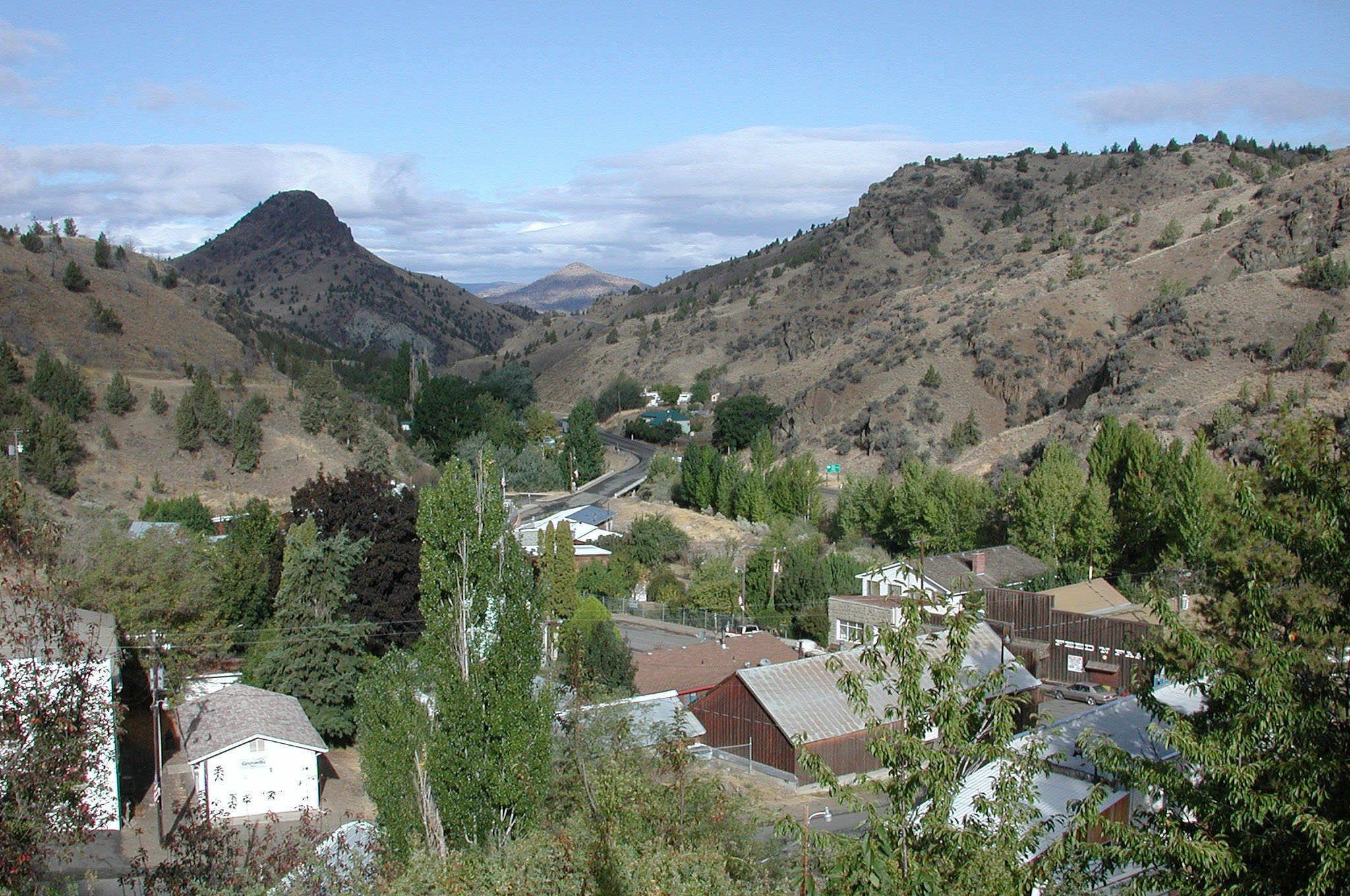
Mitchell, in southwestern Wheeler County, is on U.S. Route 26 just east of its intersection with Oregon Route 207.[4] By highway, the city is 47 miles (76 km) east of Prineville and 60 miles (97 km) west of John Day.[5] To the city's north lie the Ochoco Mountains, the source of Bridge Creek. It flows through Mitchell and then north through the Painted Hills to the John Day River.[4] Eroded remnants of ancient stratovolcanoes, once the size of Mount Hood are nearby; these include Black Butte and White Butte, visible from town.[6] According to the United States Census Bureau, the city has a total area of 1.2 square miles (3.1 km2), all of it land.[7]
History
At the request of William "Brawdie" Johnson, a blacksmith, a post office was established at Mitchell in 1873. Johnson, the first postmaster, suggested the name Mitchell after John Hippple Mitchell, a U.S. Senator from Oregon. Senator Mitchell held the office in 1873–79, 1885–97, and 1901–05. Platted in 1885, the community was incorporated in 1893.[8]
In 1872 the first school in Wheeler County was established near Mitchell, and in 1874 it was relocated to the town itself. Over the next two decades, Mitchell grew to include a store, church, hotel, livery stable, and multiple saloons. The business district, including the saloons, grew up along Bridge Creek and became known locally as "Tiger Town". The church and most of the city's homes were built at higher elevation on a bench overlooking the creek; this part of town was known locally as "Piety Hill". About half the town was destroyed by fire in 1899, but it was later rebuilt.[9]
Since its founding, Mitchell has experienced three catastrophic flash floods along Bridge Creek, which runs through the center of the city. Flooding caused great damage to the city in 1884 and 1904.[10] The third flood occurred on July 13, 1956, shortly after an intense thunderstorm in the hills to the south. The creek is usually less than 12 inches (30 cm) deep during July.[11] Minutes after the thunderstorm, a sudden surge of water destroyed or heavily damaged 20 buildings in the city and several bridges over the creek. An observer from the United States Geological Survey estimated that about 4 inches (10 cm) of rain had fallen in about 50 minutes at the storm's center.[11] Total damage from the flood, which also caused extensive damage to crops and roads in a nearby valley, was $709,000.[12]
Climate
July and August are the warmest months in Mitchell, with an average high of 86 °F (30 °C) and an average low of 52 °F (11 °C).[13] January is the coldest month, when highs average 42 °F (6 °C) and lows average 24 °F (−4 °C).[13] The highest recorded temperature in Mitchell was 107 °F (42 °C) in 1972, and the lowest was −27 °F (−33 °C) in 1983.[13] Precipitation in the region is limited by the rain shadow effect of the Cascade Range and the Ochoco Mountains to the west.[14] May is generally the wettest month, when precipitation averages 1.65 inches (42 mm).[13] In winter, much of the precipitation arrives as snow.[14]
Climate data for Mitchell, Oregon Month Jan Feb Mar Apr May Jun Jul Aug Sep Oct Nov Dec Year Average high °F (°C) 42
(6)47
(8)54
(12)60
(16)69
(21)77
(25)86
(30)86
(30)77
(25)65
(18)49
(9)42
(6)62.8
(17.1)Average low °F (°C) 24
(−4)27
(−3)31
(−1)34
(1)40
(4)47
(8)52
(11)52
(11)44
(7)36
(2)30
(−1)25
(−4)36.8
(2.7)Precipitation inches (mm) 0.87
(22.1)0.62
(15.7)1.00
(25.4)1.22
(31)1.65
(41.9)1.13
(28.7)0.61
(15.5)0.65
(16.5)0.67
(17)0.80
(20.3)1.12
(28.4)0.99
(25.1)11.33
(287.8)Source: The Weather Channel[13] Demographics
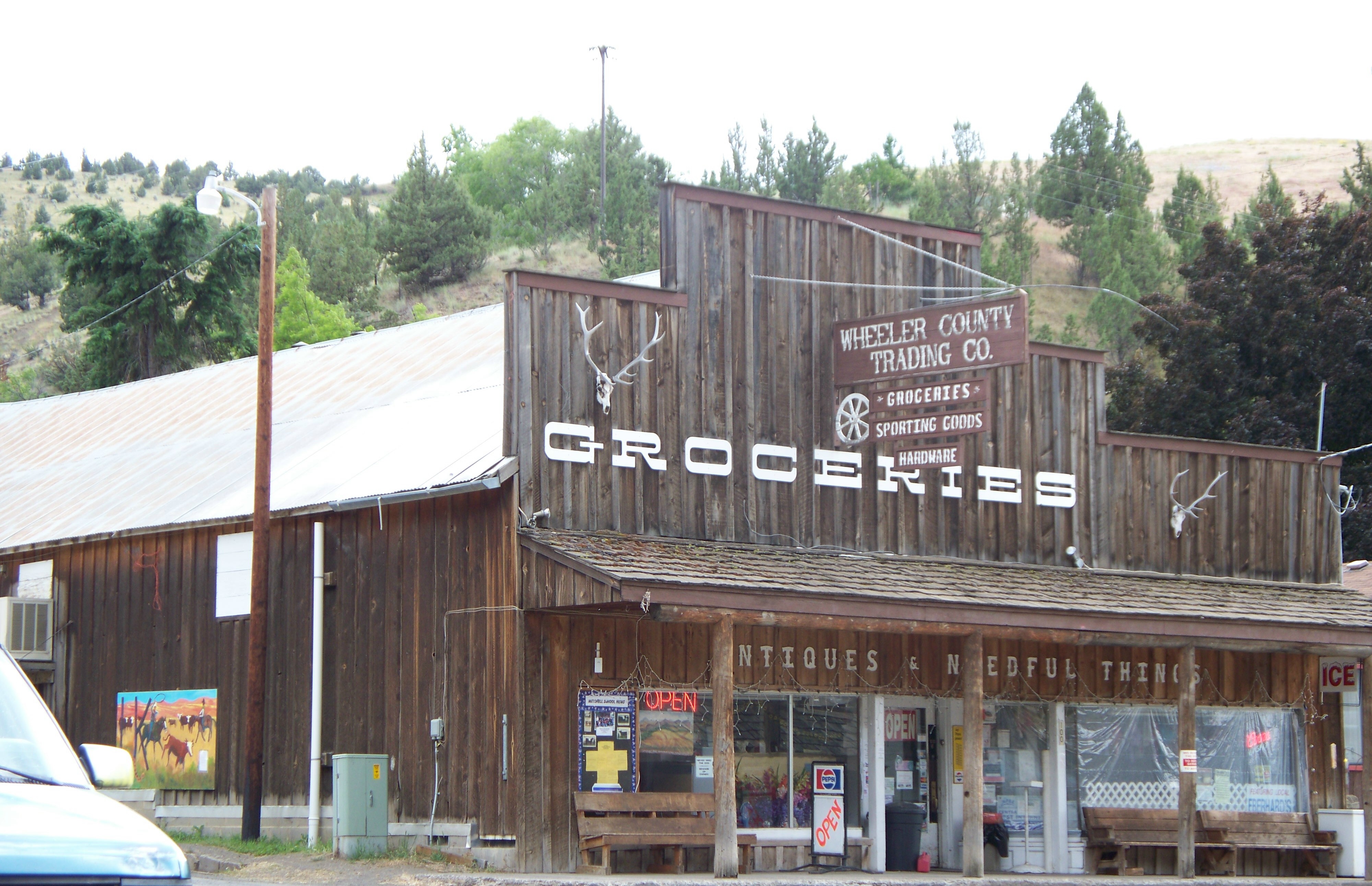
 Trading post
As of the census[1] of 2000, there were 170 people, 75 households, and 42 families residing in the city. The population density was 144.6 people per square mile (55.6/km²). There were 91 housing units at an average density of 77.4 per square mile (29.8/km²). The racial makeup of the city was 90.00% White, 2.35% Native American, 1.18% Asian, 1.18% from other races, and 5.29% from two or more races. Hispanic or Latino of any race were 7.65% of the population.
There were 75 households out of which 25.3% had children under the age of 18 living with them, 46.7% were married couples living together, 9.3% had a female householder with no husband present, and 42.7% were non-families. 38.7% of all households were made up of individuals and 22.7% had someone living alone who was 65 years of age or older. The average household size was 2.27 and the average family size was 2.79.
In the city the population was spread out with 28.8% under the age of 18, 2.9% from 18 to 24, 19.4% from 25 to 44, 28.2% from 45 to 64, and 20.6% who were 65 years of age or older. The median age was 42 years. For every 100 females there were 107.3 males. For every 100 females age 18 and over, there were 89.1 males.
The median income for a household in the city was $20,417, and the median income for a family was $20,833. Males had a median income of $21,250 versus $23,125 for females. The per capita income for the city was $13,906. About 26.9% of families and 28.7% of the population were below the poverty line, including 43.5% of those under the age of 18 and none of those 65 or over.
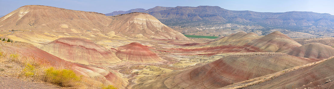 Panorama of the Painted Hills, northwest of Mitchell
References
- ^ a b "American FactFinder". United States Census Bureau. http://factfinder.census.gov. Retrieved 2008-01-31.
- ^ "US Board on Geographic Names". United States Geological Survey. 2007-10-25. http://geonames.usgs.gov. Retrieved 2008-01-31.
- ^ "About Mitchell School". Mitchell School. 2011. http://www.mitchellschool.info/?page_id=2. Retrieved 2011-08-15.
- ^ a b Oregon Atlas & Gazetteer (7th ed.). Yarmouth, Maine: DeLorme. pp. 76–77. ISBN 978-0-89933-347-2.
- ^ "Directions". City of Mitchell. http://mitchelloregon.us/?page_id=69. Retrieved 2011-08-15.
- ^ Bishop, Ellen Morris (2003). In Search of Ancient Oregon: A Geological and Natural History. Portland, Oregon: Timber Press. pp. 86–92. ISBN 978-0-88192-789-4.
- ^ "US Gazetteer files: 2010, 2000, and 1990". United States Census Bureau. 2011-02-12. http://www.census.gov/geo/www/gazetteer/gazette.html. Retrieved 2011-04-23.
- ^ McArthur, Lewis A.; Lewis L. McArthur (2003) [1928]. Oregon Geographic Names (7th ed.). Portland, Oregon: Oregon Historical Society Press. p. 652. ISBN 0-87595-277-1.
- ^ Stinchfield, Janet L.; Stinchfield, McLaren E., eds. (1983). The History of Wheeler County, Oregon. Dallas, Texas: Taylor Publishing Company. pp. 8–9. OCLC 10948544.
- ^ "Oregon Historic Photographs Collection". Salem Public Library. http://photos.salemhistory.net/cdm4/item_viewer.php?CISOROOT=/max&CISOPTR=2325&REC=20. Retrieved 2008-09-24.
- ^ a b "Some of the Area's Rainstorms". National Weather Service Forecast Office, Portland, Oregon. http://www.wrh.noaa.gov/pqr/paststorms/rain.php. Retrieved 2008-09-22.
- ^ "Flood of 1955-1956: Columbia River and Tributaries". U.S. Army Corps of Engineers. http://www.nww.usace.army.mil/dpn/fldinfo%5Cff19556.htm. Retrieved 2008-09-22.
- ^ a b c d e "Monthly Averages for Mitchell, Oregon". The Weather Channel Interactive, Inc. http://www.weather.com/outlook/health/allergies/wxclimatology/monthly/USOR0223. Retrieved 2011-07-07.
- ^ a b "John Day Fossil Beds: Nature and Science". National Park Service. 2006-09-24. http://www.nps.gov/joda/naturescience/index.htm. Retrieved 2011-07-07.
External links
Municipalities and communities of Wheeler County, Oregon Cities 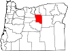
Unincorporated
communitiesAntone | Clarno | Kinzua | Richmond | Service Creek | Twickenham | Waterman
Categories:- Cities in Oregon
- Populated places in Wheeler County, Oregon


Wikimedia Foundation. 2010.