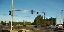
- Cornelius Pass Road
-
Cornelius Pass Road North end:  US 30 near Portland
Major
junctions: US 26 in Hillsboro
South end:  OR 8 in Hillsboro
Cornelius Pass Road is an arterial road over Cornelius Pass in the Tualatin Mountains west of Portland, Oregon, USA. Running north–south, the road stretches between U.S. Route 30 on the north and Oregon Route 8 on the south. The road passes through Washington and Multnomah counties, crossing the Tualatin Mountains at Cornelius Pass at the 577-foot (176 m) elevation.[1]
Contents
History
The road was built by Thomas R. Cornelius in the 1800s.[2] The interchange with the Sunset Highway was rebuilt and widened in 1989, and the road widened to five lanes from the freeway to Cornell Road the following year.[3][4] In 1996, the road was extended southward when 216th and 219th avenues were renamed and became the southern section of the road.[5] At that time the intersection with Baseline Road was re-aligned.[5] The intersection with U.S. 26 was revised in 2005 with new on and off ramps extending from Cornelius Pass to the east where a railroad overpass had previously been located.[6][7] In 2008, the entire Multnomah County section was changed to a no passing zone on the winding road over the Tualatin Mountains.[8] A one-mile section from Lois to Wilkins streets is scheduled to close for eight months in 2010 in order to widen the road in that area to five lanes as well as add bike lanes and sidewalks.[9]
Details
Cornelius Pass is one of only two main north–south connecting roads in Hillsboro.[10] The former country road handles 11,000 drivers each day and is an arterial route from the Tualatin Valley between Hillsboro to the Columbia River north of Portland.[8] A mountainous road at points, 1,500 of the 11,000 vehicles each day are tractor-trailers on the road designed to handle up to 10,000 vehicles per day.[11] A portion of the road, from US 26 to Cornell, is part of the National Highway System.[12]
Major intersections
County Location Destinations Notes Multnomah Near Portland (45°39′06″N 122°51′05″W / 45.651668°N 122.851524°W)  US 30 – Portland, St. Helens
Washington Hillsboro (45°33′16″N 122°54′03″W / 45.554388°N 122.90079°W)  US 26 – North Plains, Beaverton
Interchange Hillsboro (45°32′23″N 122°54′00″W / 45.53966°N 122.900104°W) Cornell Road Hillsboro (45°30′55″N 122°54′04″W / 45.515308°N 122.901048°W) Baseline Road Reedville (45°29′51″N 122°54′08″W / 45.497548°N 122.902164°W)  OR 8 – Hillsboro, Aloha
See also
References
- ^ USGS Map Name: Linnton, OR. TopoQuest. Retrieved on June 3, 2008.
- ^ Baron, Connie and Michelle Trappen. Paths linking past and present. The Oregonian, March 6, 2008.
- ^ Sunset lanes to close. The Oregonian, July 11, 1989.
- ^ Road projects prompt county to ask state aid. The Oregonian, April 2, 1989.
- ^ a b Hamilton, Don. Road work ahead. The Oregonian, June 6, 1996.
- ^ U.S. 26 Work Continues. The Oregonian, January 10, 2005.
- ^ Anderson, David R. (February 20, 2003). "Help in sight for Sunset interchange". The Oregonian.
- ^ a b Malkin, Whitney. Family hopes to keep road from claiming another life. The Oregonian, April 12, 2008.
- ^ Parks, Casey (January 19, 2010). "Hillsboro section of Cornelius Pass Road will close for eight months, $12 million in improvements". The Oregonian. http://www.oregonlive.com/washingtoncounty/index.ssf/2010/01/c.html. Retrieved 20 January 2010.
- ^ Bermudez, Esmeralda. Hillsboro seeks money for new north–south road. The Oregonian, February 23, 2006.
- ^ Starke, Amy Martinez. Family wants more than roadside marker. The Oregonian, January 26, 2008.
- ^ Oregon Transportation Map: Washington County. Oregon Department of Transportation. Retrieved on June 3, 2008.
Categories:- Roads in Oregon
- Transportation in Hillsboro, Oregon
- Transportation in Washington County, Oregon
- Transportation in Multnomah County, Oregon
Wikimedia Foundation. 2010.


