- Sumpter, Oregon
Infobox Settlement
official_name = Sumpter, Oregon
settlement_type =City
nickname =
motto =
imagesize =
image_caption =
image_
imagesize =
image_caption =
image_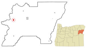
mapsize = 250px
map_caption = Location inOregon
mapsize1 =
map_caption1 =
subdivision_type = Country
subdivision_name =United States
subdivision_type1 = State
subdivision_name1 =Oregon
subdivision_type2 = County
subdivision_name2 = Baker
government_type =
leader_title =Mayor
leader_name = Richard D. Schmitz
established_title = Incorporated
established_date = 1901
area_magnitude =
area_total_sq_mi = 2.2
area_total_km2 = 5.6
area_land_sq_mi = 2.2
area_land_km2 = 5.6
area_water_sq_mi = 0
area_water_km2 = 0
area_urban_sq_mi =
area_urban_km2 =
area_metro_sq_mi =
area_metro_km2 =
population_as_of = 2000
population_note =
population_total = 171
population_metro =
population_urban =
population_density_km2 = 30.3
population_density_sq_mi = 78.4
timezone = Pacific
utc_offset = -8
timezone_DST = Pacific
utc_offset_DST = -7
latd = 44 |latm = 44 |lats = 46 |latNS = N
longd = 118 |longm = 11 |longs = 57 |longEW = W
elevation_m = 1352.4
elevation_ft = 4437
website = http://www.historicsumpter.com
postal_code_type =ZIP code
postal_code = 97877
area_code = 541
blank_name = FIPS code
blank_info = 41-71000GR|2
blank1_name = GNIS feature ID
blank1_info = 1150647GR|3
footnotes =Sumpter is a city in Baker County,
Oregon ,United States . The population was 171 at the 2000 census. Sumpter is named afterFort Sumter by its founders.History
The community was founded in 1862 by gold prospectors on their way to California gold fields, when they panned gold out of Cracker Creek. The subsequent development of Sumpter was based primarily on gold mining.
In 1917, the community was destroyed by a fire.
Geography
According to the
United States Census Bureau , the city has a total area of 2.2square mile s (5.6km² ), all of it land.Sumpter is located on
Oregon Route 410 (formerly Oregon Route 220).Demographics
As of the
census GR|2 of 2000, there were 171 people, 95 households, and 51 families residing in the city. Thepopulation density was 78.4 people per square mile (30.3/km²). There were 215 housing units at an average density of 98.6/sq mi (38.1/km²). The racial makeup of the city was 96.49% White, 1.17% Native American, and 2.34% from two or more races. Hispanic or Latino of any race were 0.58% of the population.There were 95 households out of which 6.3% had children under the age of 18 living with them, 49.5% were married couples living together, 2.1% had a female householder with no husband present, and 46.3% were non-families. 37.9% of all households were made up of individuals and 18.9% had someone living alone who was 65 years of age or older. The average household size was 1.80 and the average family size was 2.31.
In the city the population was spread out with 7.6% under the age of 18, 3.5% from 18 to 24, 17.0% from 25 to 44, 48.0% from 45 to 64, and 24.0% who were 65 years of age or older. The median age was 55 years. For every 100 females there were 125.0 males. For every 100 females age 18 and over, there were 122.5 males.
The median income for a household in the city was $27,188, and the median income for a family was $31,000. Males had a median income of $28,750 versus $35,625 for females. The
per capita income for the city was $16,518. About 6.5% of families and 10.2% of the population were below thepoverty line , including 36.4% of those under the age of eighteen and 7.0% of those sixty five or over.ites of interest
* Sumpter Valley Railway Historic District
*Sumpter Valley Gold Dredge References
External links
* [http://www.historicsumpter.com City of Sumpter]
* [http://www.westernmininghistory.com/gallery/oregon/sumpter/modern/towns/1/ Sumpter photo gallery from Western Mining History.com]
Wikimedia Foundation. 2010.