- Road
-
This article is about a route, thoroughfare or way that supports travel by a means of conveyance. For a place outside a harbor where a ship can lie at anchor, see Roadstead. For public roads, see Highway. For other routes, see thoroughfare. For other uses, see Road (disambiguation).
A road is a thoroughfare, route, or way on land between two places, which typically has been paved or otherwise improved to allow travel by some conveyance, including a horse, cart, or motor vehicle. Roads consist of one, or sometimes two, roadways (British English: carriageways) each with one or more lanes and also any associated sidewalks (British English: pavement) and road verges. Roads that are available for use by the public may be referred to as public roads or highways.
Contents
Definitions
For purposes of international statistical comparison, the OECD defines a road as "a line of communication (travelled way) using a stabilized base other than rails or air strips open to public traffic, primarily for the use of road motor vehicles running on their own wheels," which includes "bridges, tunnels, supporting structures, junctions, crossings, interchanges, and toll roads, but not cycle paths."[1] In urban areas roads may diverge through a city or village and be named as streets, serving a dual function as urban space easement and route.[2] Modern roads are normally smoothed, paved, or otherwise prepared to allow easy travel.[3] Historically many roads were simply recognizable routes without any formal construction or maintenance.[4]
United States
In the United States, laws distinguish between public roads, which are open to public use, and private roads, which are privately controlled.[5]
United Kingdom
In the United Kingdom there is some ambiguity between the terms highway and road. The Highway code details rules for "road users".[6] For the purposes of the English law, Highways Act 1980, which covers England and Wales but not Scotland or Northern Ireland, the term road is defined to be "any length of highway or of any other road to which the public has access, and includes bridges over which a road passes."[7] This includes footpaths, bridleways and cycle tracks, and also road and driveways on private land and many car parks.[8] Vehicle Excise Duty, a road use tax, is payable on some vehicles used on the public road.[8]
The definition of a road depends on the definition of a highway, however there is no formal definition for a highway in the relevant Act. A 1984 ruling said "the land over which a public right of way exists is known as a highway; and although most highways have been made up into roads, and most easements of way exist over footpaths, the presence or absence of a made road has nothing to do with the distinction.[9][10] Another legal view is that while a highway historically included footpaths, bridleways, driftways, etc., it can now be used to mean those ways that allow the movement of motor-vehicles, and the term rights of way can be used to cover the wider usage.[11]
Historical road construction
Main article: History of road transportThe assertion that the first pathways were the trails made by animals has not been universally accepted, since in many cases animals do not follow constant paths.[4] Others believe that some roads originated from following animal trails.[12][13] The Icknield Way is given as an example of this type of road origination, where man and animal both selected the same natural line.[14] By about 10,000 BC, rough pathways were used by human travelers.[4]
- Stone-paved streets are found in the city of Ur in the Middle East dating back to 4000 BC.[4]
- Corduroy roads (log roads) are found dating to 4000 BC in Glastonbury, England.[4]
- The timber trackway; Sweet Track causeway in England, is one of the oldest engineered roads discovered and the oldest timber trackway discovered in Northern Europe. Built in winter 3807 BC or spring 3806 BC, tree-ring dating (Dendrochronology) enabled very precise dating. It has been claimed to be the oldest road in the world.[15][16]
- In 500 BC, Darius I the Great started an extensive road system for Persia (Iran), including the famous Royal Road, which was one of the finest highways of its time.[17] The road remained in use after Roman times.
- In ancient times, transport by river was far easier and faster than transport by road,[16] especially considering the cost of road construction and the difference in carrying capacity between carts and river barges. A hybrid of road transport and ship transport beginning in about 1740 is the horse-drawn boat in which the horse follows a cleared path along the river bank.[18][19]
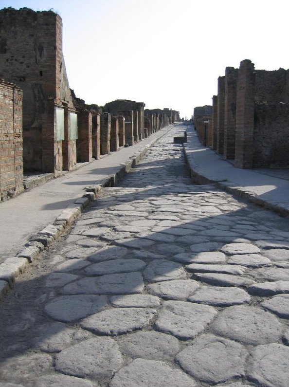
- From about 312 BC, the Roman Empire built straight[20] strong stone Roman roads throughout Europe and North Africa, in support of its military campaigns. At its peak the Roman Empire was connected by 29 major roads moving out from Rome and covering 78,000 kilometers or 52,964 Roman miles of paved roads.[16]
- In the 8th century AD, many roads were built throughout the Arab Empire. The most sophisticated roads were those in Baghdad, Iraq, which were paved with tar. Tar was derived from petroleum, accessed from oil fields in the region, through the chemical process of destructive distillation.[21]
- The Highways Act 1555 in Britain transferred responsibility for maintaining roads from government to local parishes.[16] This resulted in a poor and variable state of roads. To remedy this, the first of the "Turnpike trusts" was established around 1706, to build good roads and collect tolls from passing vehicles. Eventually there were approximately 1,100 trusts in Britain and some 36,800 km (22,870 miles) of engineered roads.[16] The Rebecca Riots in Carmarthenshire and Rhayader from 1839 to 1844 contributed to a Royal Commission that led to the demise of the system in 1844,[22] which coincided with the development of the UK railway system.
Design
Structural road design is the science of designing a road for its environment in order to extend its longevity and reduce maintenance. The Shell pavement design method is used in many countries for the design of new asphalt roads.
Construction
A road being torn up.
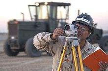 Surveyor at work with a leveling instrument.
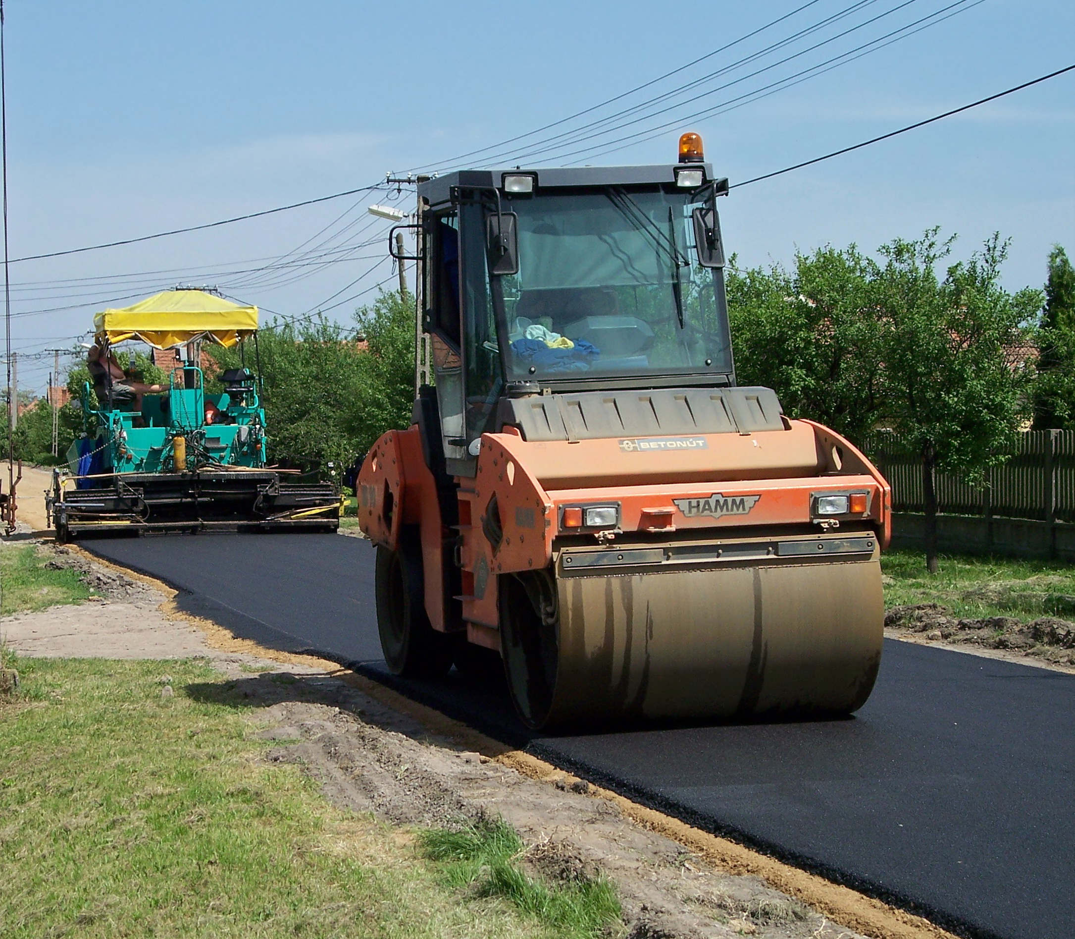
 Asphalt layer and roller
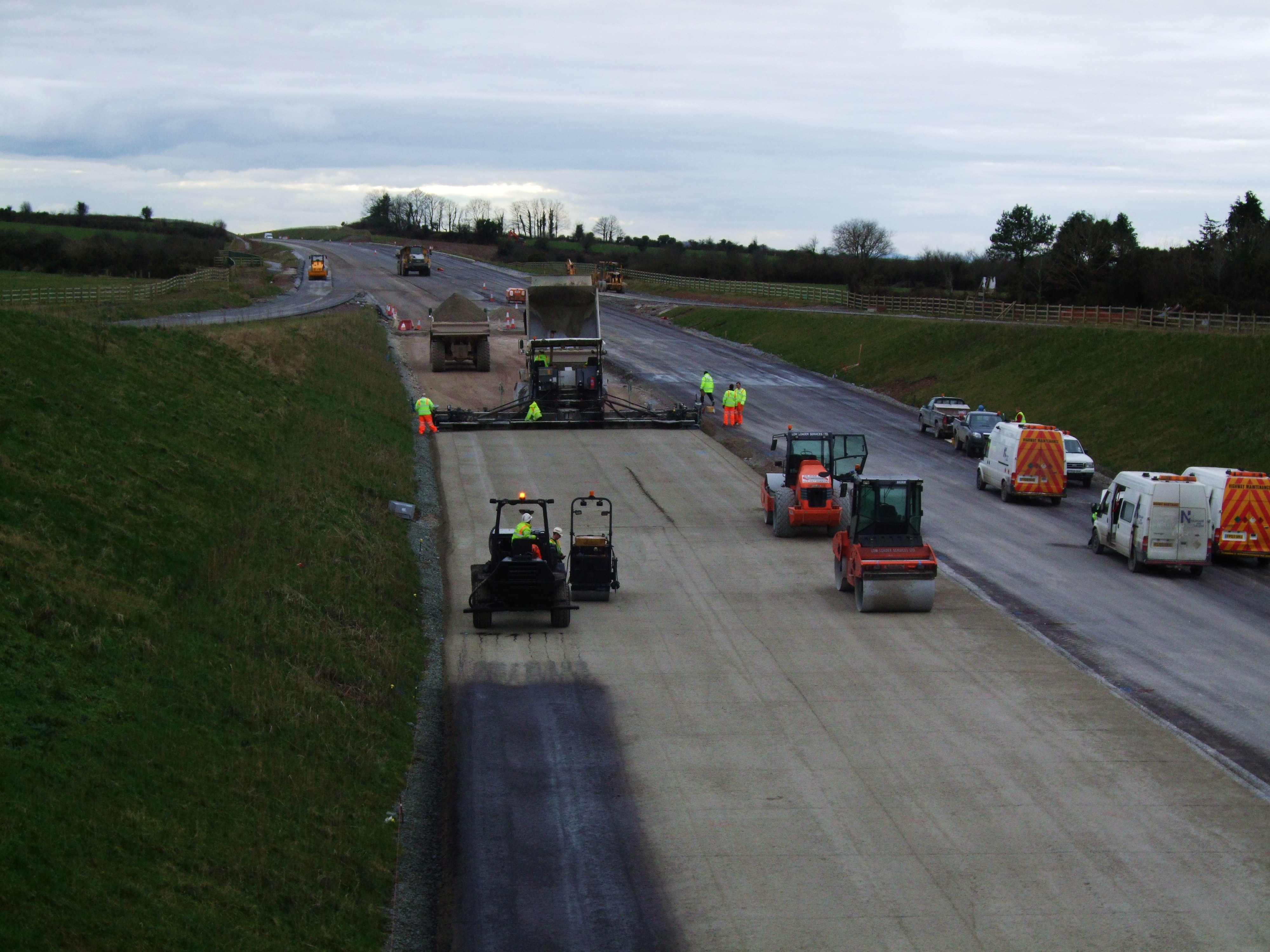
 Sub-base layer composed of cement-based material being applied during construction of the M8 motorway in Ireland.
Road construction requires the creation of a continuous right-of-way, overcoming geographic obstacles and having grades low enough to permit vehicle or foot travel.[23] (pg15) and may be required to meet standards set by law[24] or official guidelines.[25] The process is often begun with the removal of earth and rock by digging or blasting, construction of embankments, bridges and tunnels, and removal of vegetation (this may involve deforestation) and followed by the laying of pavement material. A variety of road building equipment is employed in road building.[26][27]
After design, approval, planning, legal and environmental considerations have been addressed alignment of the road is set out by a surveyor.[20] The Radii and gradient are designed and staked out to best suit the natural ground levels and minimize the amount of cut and fill.[25] (page34) Great care is taken to preserve reference Benchmarks [25] (page59)
Roads are designed and built for primary use by vehicular and pedestrian traffic. Storm drainage and environmental considerations are a major concern. Erosion and sediment controls are constructed to prevent detrimental effects. Drainage lines are laid with sealed joints in the road easement with runoff coefficients and characteristics adequate for the land zoning and storm water system. Drainage systems must be capable of carrying the ultimate design flow from the upstream catchment with approval for the outfall from the appropriate authority to a watercourse, creek, river or the sea for drainage discharge.[25] (page38 to 40)
A borrow pit (source for obtaining fill, gravel, and rock) and a water source should be located near or in reasonable distance to the road construction site. Approval from local authorities may be required to draw water or for working (crushing and screening) of materials for construction needs. The top soil and vegetation is removed from the borrow pit and stockpiled for subsequent rehabilitation of the extraction area. Side slopes in the excavation area not steeper than one vertical to two horizontal for safety reasons.[25] (page 53 to 56 )
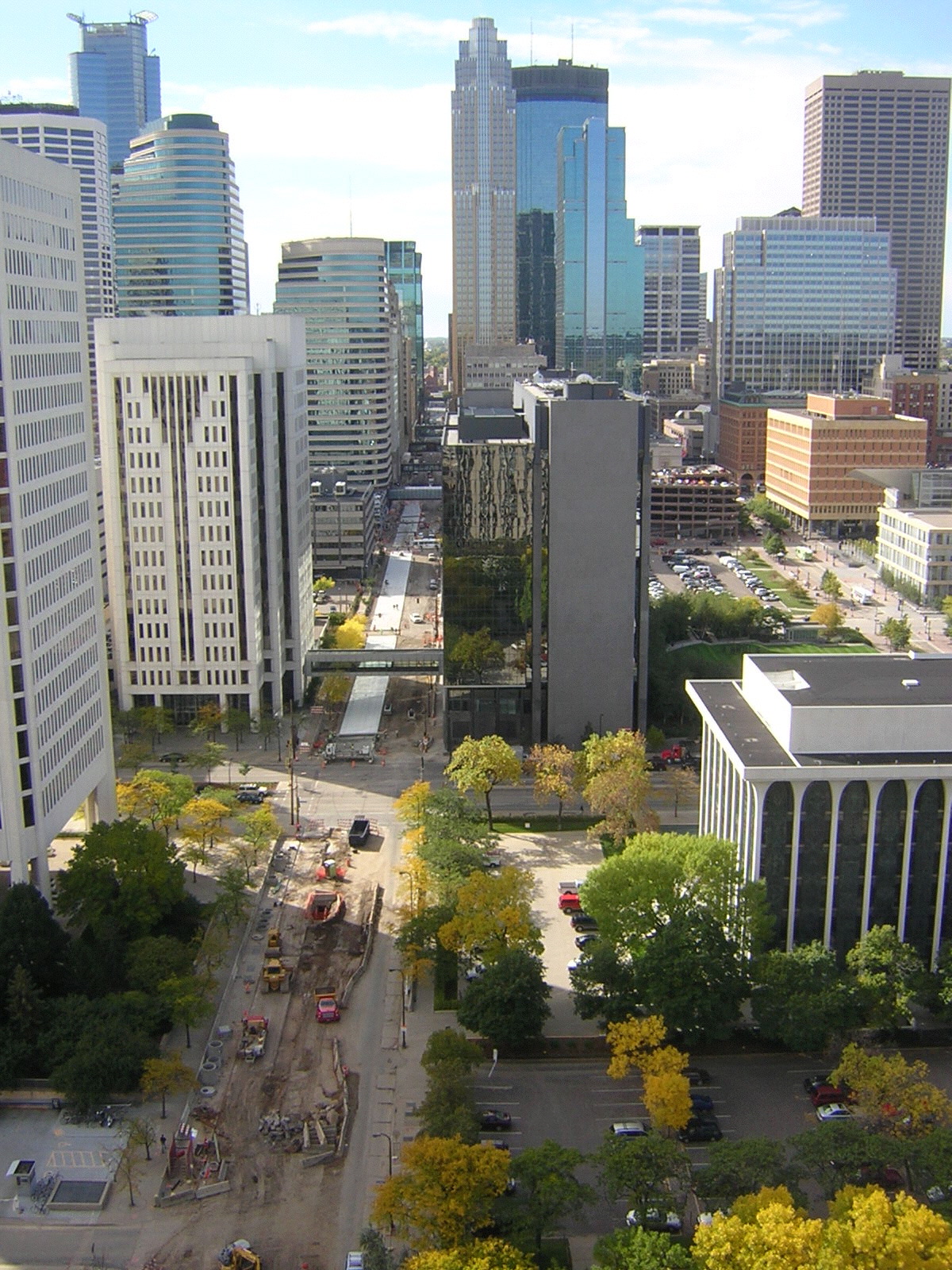
 Road construction on Marquette Avenue in Minneapolis, Minnesota, United States
Old road surfaces, fences, and buildings may need to be removed before construction can begin. Trees in the road construction area may be marked for retention. These protected trees should not have the topsoil within the area of the tree's drip line removed and the area should be kept clear of construction material and equipment. Compensation or replacement may be required if a protected tree is damaged. Much of the vegetation may be mulched and put aside for use during reinstatement. The topsoil is usually stripped and stockpiled nearby for rehabilitation of newly constructed embankments along the road. Stumps and roots are removed and holes filled as required before the earthwork begins. Final rehabilitation after road construction is completed will include seeding, planting, watering and other activities to reinstate the area to be consistent with the untouched surrounding areas.[25] (page 66 to 67 )
Processes during earthwork include excavation, removal of material to spoil, filling, compacting, construction and trimming. If rock or other unsuitable material is discovered it is removed, moisture content is managed and replaced with standard fill compacted to 90% relative compaction. Generally blasting of rock is discouraged in the road bed. When a depression must be filled to come up to the road grade the native bed is compacted after the topsoil has been removed. The fill is made by the "compacted layer method" where a layer of fill is spread then compacted to specifications, the process is repeated until the desired grade is reached.[25] (page 68 to 69 ).
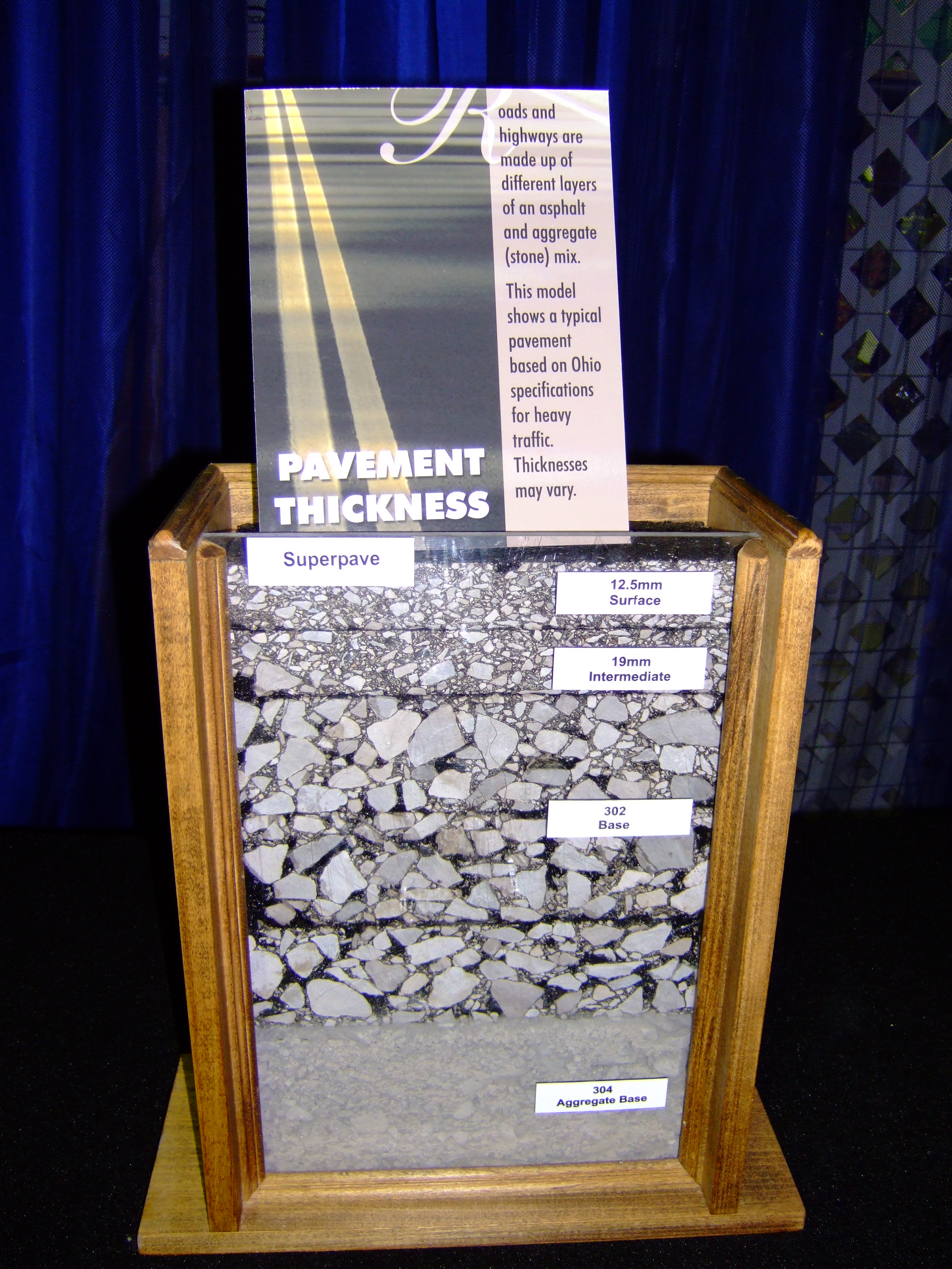
 Typical pavement strata for a heavily traveled road
General fill material should be free of organics, meet minimum California bearing ratio (CBR) results and have a low plasticity index. The lower fill generally comprises sand or a sand-rich mixture with fine gravel, which acts as an inhibitor to the growth of plants or other vegetable matter. The compacted fill also serves as lower-stratum drainage. Select second fill (sieved) should be composed of gravel, decomposed rock or broken rock below a specified Particle size and be free of large lumps of clay. Sand clay fill may also be used. The road bed must be "proof rolled" after each layer of fill is compacted. If a roller passes over an area without creating visible deformation or spring the section is deemed to comply.[25] (page 70 to 72 )
The completed road way is finished by paving or left with a gravel or other natural surface. The type of road surface is dependent on economic factors and expected usage. Safety improvements like Traffic signs, Crash barriers, Raised pavement markers, and other forms of Road surface marking are installed.
According to a May 2009 report by the American Association of State Highway and Transportation Officials (AASHTO) and TRIP—a national transportation research organization—driving on rough roads costs the average American motorist approximately $400 a year in extra vehicle operating costs. Drivers living in urban areas with populations more than 250,000 are paying upwards of $750 more annually because of accelerated vehicle deterioration, increased maintenance, additional fuel consumption, and tire wear caused by poor road conditions.
When a single carriageway road is converted into dual carriageway by building a second separate carriageway alongside the first, it is usually referred to as duplication,[28] twinning or doubling. The original carriageway is changed from two-way to become one-way, while the new carriageway is one-way in the opposite direction. In the same way as converting railway lines from single track to double track, the new carriageway is not always constructed directly alongside the existing carriageway.
Maintenance
 "Road works ahead" sign, typically used in Europe
Like all structures, roads deteriorate over time. Deterioration is primarily due to accumulated damage from vehicles, however environmental effects such as frost heaves, thermal cracking and oxidation often contribute.[29] According to a series of experiments carried out in the late 1950s, called the AASHO Road Test, it was empirically determined that the effective damage done to the road is roughly proportional to the Fourth power of axle weight.[30] A typical tractor-trailer weighing 80,000 pounds (36.287 t) with 8,000 pounds (3.629 t) on the steer axle and 36,000 pounds (16.329 t) on both of the tandem axle groups is expected to do 7,800 times more damage than a passenger vehicle with 2,000 pounds (0.907 t) on each axle. Potholes on roads are caused by rain damage and vehicle braking or related construction works.
Pavements are designed for an expected service life or design life. In some UK countries the standard design life is 40 years for new bitumen and concrete pavement. Maintenance is considered in the whole life cost of the road with service at 10, 20 and 30 year milestones.[31] Roads can be and are designed for a variety of lives (8-, 15-, 30-, and 60-year designs). When pavement lasts longer than its intended life, it may have been overbuilt, and the original costs may have been too high. When a pavement fails before its intended design life, the owner may have excessive repair and rehabilitation costs. Many concrete pavements built since the 1950s have significantly outlived their intended design lives.[32] Some roads like Chicago, Illinois's "Wacker Drive", a major two-level viaduct in downtown area are being rebuilt with a designed service life of 100 years.[33]
Virtually all roads require some form of maintenance before they come to the end of their service life. Pro-active agencies use pavement management techniques to continually monitor road conditions and schedule preventive maintenance treatments as needed to prolong the lifespan of their roads. Technically advanced agencies monitor the road network surface condition with sophisticated equipment such as laser/inertial Profilometers. These measurements include road curvature, cross slope, asperity, roughness, rutting and texture (roads). This data is fed into a pavement management system, which recommends the best maintenance or construction treatment to correct the damage that has occurred.
Maintenance treatments for asphalt concrete generally include crack sealing, surface rejuvenating, fog sealing, micro-milling and surface treatments. Thin surfacing preserves, protects and improves the functional condition of the road while reducing the need for routing maintenance, leading to extended service life without increasing structural capacity.[34]
Failure to maintain roads properly can create significant costs to society, in a 2009 report released by the American Association of State Highway and Transportation Officials (USA) about 50% of the roads in the USA are in bad condition with urban areas worse. The report estimates that urban drivers pay an average of $746/year on vehicle repairs while the average US motorist pays about $335/year. In contrast, the average motorist pays about $171/year in road maintenance taxes (based on 600 gallons/year and $0.285/gallon tax).
Slab Stabilization
Distress and serviceability loss on concrete roads can be caused by loss of support due to voids beneath the concrete pavement slabs. The voids usually occur near cracks or joints due to surface water infiltration. The most common causes of voids are pumping, consolidation, subgrade failure and bridge approach failure. Slab stabilization is a non-destructive method of solving this problem and is usually employed with other Concrete Pavement Restoration (CPR) methods including patching and diamond grinding. The technique restores support to concrete slabs by filing small voids that develop underneath the concrete slab at joints, cracks or the pavement edge. The process consists of pumping a cementitous grout or polyurethane mixture through holes drilled through the slab. The grout can fill small voids beneath the slab and/or sub-base. The grout also displaces free water and helps keep water from saturating and weakening support under the joints and slab edge after stabilization is complete. The three steps for this method after finding the voids are locating and drilling holes, grout injection and post-testing the stabilized slabs.
Slab stabilization does not correct depressions, increase the design structural capacity, stop erosion or eliminate faulting. It does, however, restore the slab support, therefore, decreasing deflections under the load. Stabilization should only be performed at joints and cracks where loss of support exists. Visual inspection is the simplest manner to find voids. Signs that repair is needed are transverse joint faulting, corner breaks and shoulder drop off and lines at or near joints and cracks. Deflection testing is another common procedure utilized to locate voids. It is recommended to do this testing at night as during cooler temperatures, joints open, aggregate interlock diminishes and load deflections are at their highest.
Testing
Ground penetrating radar pulses electromagnetic waves into the pavement and measures and graphically displays the reflected signal. This can reveal voids and other defects.
The epoxy/core test, detects voids by visual and mechanical methods. It consists of drilling a 25 to 50 millimeter hole through the pavement into the sub-base with a dry-bit roto-hammer. Next, a two-part epoxy is poured into the hole—dyed for visual clarity. Once the epoxy hardens, technicians drill through the hole. If a void is present, the epoxy will stick to the core and provide physical evidence.
Common stabilization materials include pozzolan-cement grout and polyurethane. The requirements for slab stabilization are strength and the ability to flow into or expand to fill small voids. Colloidal mixing equipment is necessary to use the pozzolan-cement grouts. The contractor must place the grout using a positive-displacement injection pump or a non-pulsing progressive cavity pump. A drill is also necessary but it must produce a clean hole with no surface spalling or breakouts. The injection devices must include a grout packer capable of sealing the hole. The injection device must also have a return hose or a fast-control reverse switch, in case workers detect slab movement on the uplift gauge. The uplift beam helps to monitor the slab deflection and has to have sensitive dial gauges.[35][36]
Joint Sealing
Also called joint and crack repair, this method’s purpose is to minimize infiltration of surface water and incompressible material into the joint system. Joint sealants are also used to reduce dowel bar corrosion in Concrete Pavement Restoration (CPR) techniques. Successful resealing consists of old sealant removal, shaping and cleaning the reservoir, installing the backer rod and installing the sealant. Sawing, manual removal, plowing and cutting are methods used to remove the old sealant. Saws are used to shape the reservoir. When cleaning the reservoir, no dust, dirt or traces of old sealant should remain. Thus, it is recommended to water wash, sand-blast and then air blow to remove any sand, dirt or dust. The backer rod installation requires a double-wheeled, steel roller to insert the rod to the desired depth. After inserting the backer rod, the sealant is placed into the joint. There are various materials to choose for this method including hot pour bituminous liquid, silicone and preformed compression seals.
Safety considerations
 See also: Road traffic safety
Careful design and construction of roads can increase Road traffic safety and reduce the harm (deaths, injuries, and property damage) on the highway system from traffic collisions.
On neighborhood roads traffic calming, safety barriers, pedestrian crossings and cycle lanes can all protect pedestrians and cyclists.
Lane markers in some countries and states are marked with Cat's eyes or Botts dots, bright reflectors that do not fade like paint. Botts dots are not used where it is icy in the winter, because frost and snowplows can break the glue that holds them to the road, although they can be embedded in short, shallow trenches carved in the roadway, as is done in the mountainous regions of California.
For major roads risk can be reduced by providing limited access from properties and local roads, grade separated junctions and median dividers between opposite-direction traffic to reduce likelihood of head-on collisions.
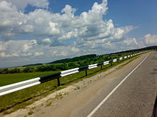
The placement of energy attenuation devices (e.g. guardrails, wide grassy areas, sand barrels) is also common. Some road fixtures such as road signs and fire hydrants are designed to collapse on impact. Light poles are designed to break at the base rather than violently stop a car that hits them. Highway authorities may also remove larger trees from the immediate vicinity of the road.
Environmental performance
Main article: Environmental impacts of roads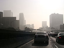
Careful design and construction of a road can reduce any negative environmental impacts.
Water management systems can be used to reduce the effect of pollutants from roads.[citation needed] Rainwater and snowmelt running off of roads tends to pick up gasoline, motor oil, heavy metals, trash and other pollutants and result in Water pollution. Road runoff is a major source of nickel, copper, zinc, cadmium, lead and polycyclic aromatic hydrocarbons (PAHs), which are created as combustion byproducts of gasoline and other fossil fuels.[40] De-icing chemicals and sand can run off into roadsides, contaminate groundwater and pollute surface waters;[41] and road salts can be toxic to sensitive plants and animals.[42] Sand applied to icy roads can be ground up by traffic into fine particulates and contribute to air pollution. Sand can alter stream bed environments, causing stress for the plants and animals that live there.[citation needed]
Roads are a chief source of environmental noise generation. In the early 1970s it was recognized that design of roads can be conducted to influence and minimize noise generation.[43] Noise barriers are used to reduce Noise pollution, in particular where roads are located close to built-up areas. Regulations can restrict the use of Engine braking.
Motor vehicle emissionss contribute air pollution. Concentrations of air pollutants and adverse respiratory health effects are greater near the road than at some distance away from the road.[44] Road dust kicked up by vehicles may trigger allergic reactions.[45]
Terminology


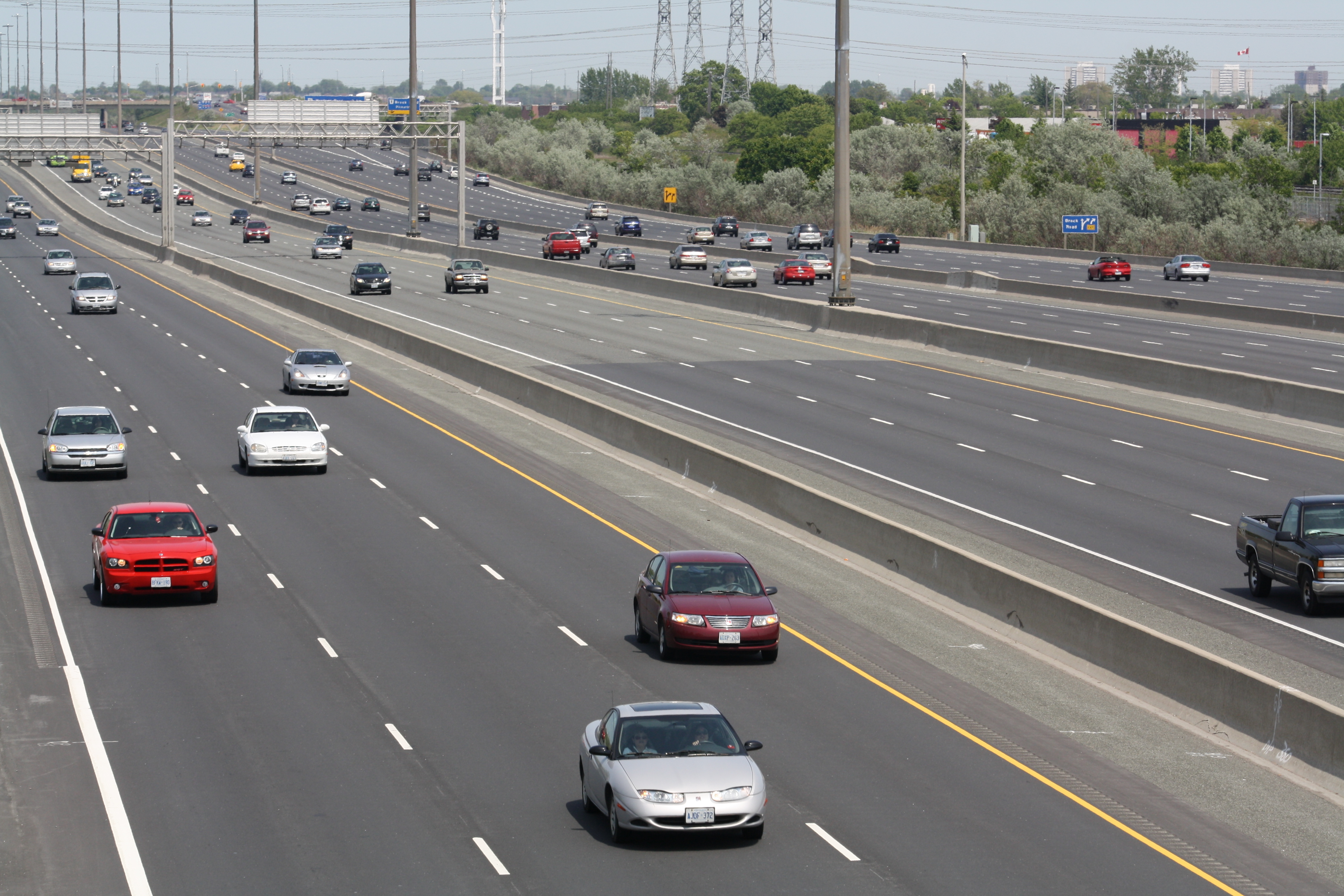
 Highway 401, a route with a collector / express setup.
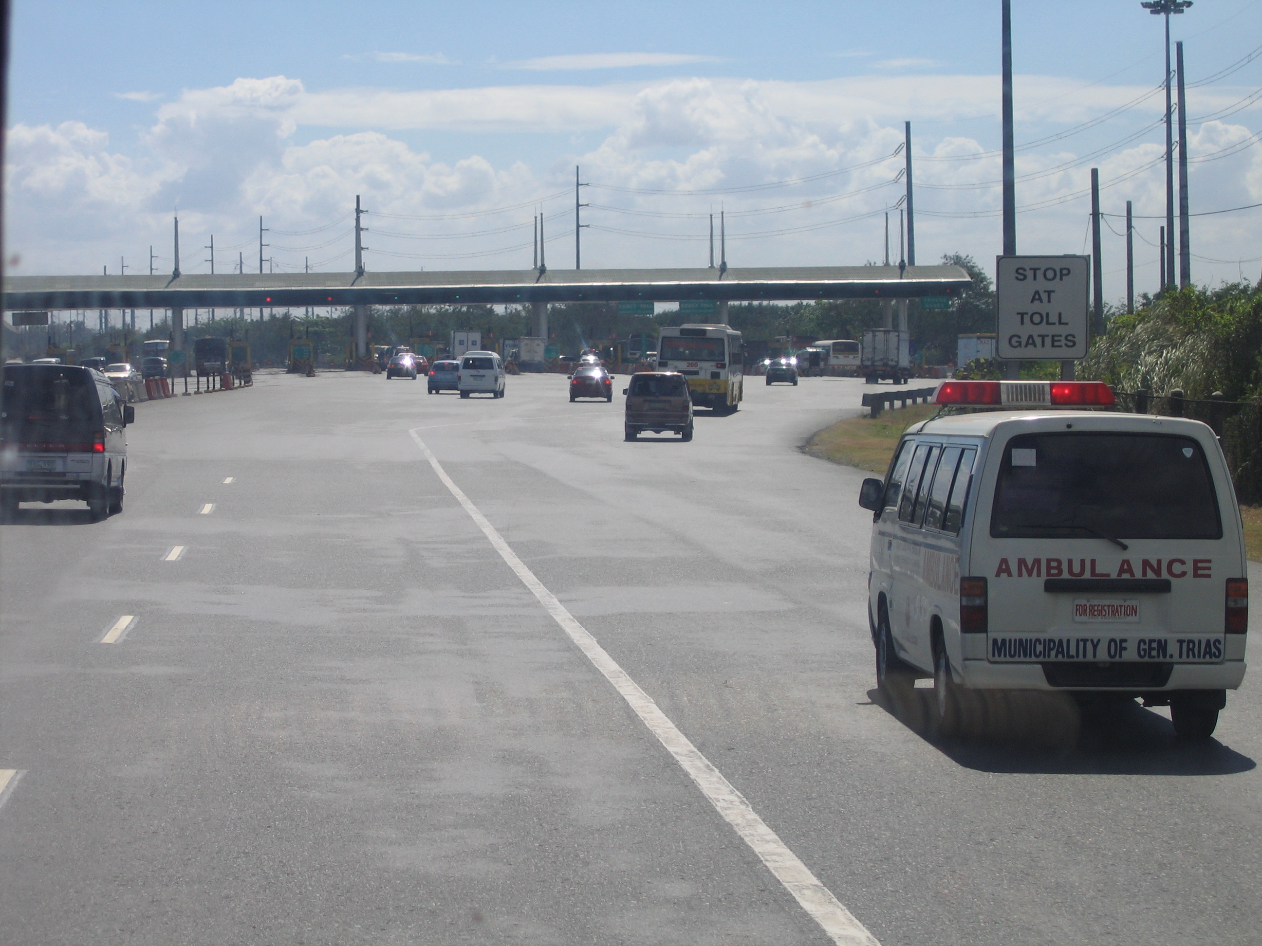
 The wide Coastal Road in the Philippines now called the Manila Cavite Expressway
 Road in the Jujuy Province Argentina
- Alignment (road) - horizontal and vertical curvature of a road.
- Adverse camber - where a road slopes towards the outside of a bend, increasing the likelihood that vehicles travelling at speed will skid or topple. Usually only a temporary situation during road maintenance.
- All-weather road - Unpaved road that is constructed of a material that does not create mud during rainfall.
- Banked turn
- Camber - the curvature of the road surface that encourages surface water to flow freely from the carriageway, or on bends angling of the surface to lean traffic 'into the bend' reducing the chance of a skid.
- Cant - superelevation
- Cross slope
- Grade - longitudinal slope
- Belisha Beacon - an orange globe, lit at night, used to highlight a pedestrian crossing.
- Bollard - Rigid posts that can be arranged in a line to close a road or path to vehicles above a certain width
- Byway - Highway over which the public have a right to travel for vehicular and other kinds of traffic, but is used mainly as a footpath or bridleway
- Bypass Road that avoids or "bypasses" a built-up area, town, or village
- Bottleneck - Section of a road with a carrying capacity substantially below that of other sections of the same road
- Botts' dots - Non-reflective raised pavement marker used on roads
- Cat's eye - reflective raised pavement marker used on roads
- Central reservation - On dual carriageway roads, including controlled-access highways, divided highways and many limited-access highways, the central reservation (British English), median (North American English), median strip (North American English and Australian English), neutral ground [Louisiana English] or central nature strip (Australian English) - Area that separates opposing lanes of traffic
- Chicane - Sequence of tight serpentine curves (usually an S-shape curve or a bus stop)
- Chipseal - Road surface composed of a thin layer of crushed stone 'chips' and asphalt emulsion. It seals the surface and protects it from weather, but provides no structural strength. It is cheaper than asphalt concrete or a concrete, in the U.S. it is usually only used on low volume rural roads
- Corniche - Road on the side of a cliff or mountain, with the ground rising on one side and falling away on the other
- Curb (kerb) - A raised edge at the side of the roadway.
- Curb extension - (also kerb extension, bulb-out, nib, elephant ear, curb bulge and blister) Traffic calming measure, intended to slow the speed of traffic and increase driver awareness, particularly in built-up and residential neighborhoods.
- Drainage gradient
- Farm-to-market road - a state road or county road that connects rural or agricultural areas to market towns.
- Fork - (literally "fork in the road") Type of intersection where a road splits
- Green lane - (UK) Unsurfaced road, may be so infrequently used that vegetation colonises freely, hence 'green'. Many green lanes are ancient routes that have existed for millennium, similar to a Byway
- Guard rail - Prevents vehicles from veering off the road into oncoming traffic, crashing against solid objects or falling from a road
- Gutter - UK a drainage channel between the main carriageway and the edge of the road.
- Interstate Highway System - United States System of Interstate and Defense Highways
- Layby (Pullout, pull-off) - A paved area beside a main road where cars can stop temporarily to let another car pass.
- Loose chippings - the hazard of stone chippings that have come loose
- Median - On dual carriageway roads, including controlled-access highways, divided highways and many limited-access highways, the central reservation (British English), median (North American English), median strip (North American English and Australian English), neutral ground [Louisiana English] or central nature strip (Australian English) - Area that separates opposing lanes of traffic
- Mountain pass - Lower point that allows easier access through a range of mountains
- Milestone - One of a series of numbered markers placed along a road at regular intervals, showing the distance to destinations.
- National Highway - Road built and maintained by a national authority.
- Pavement - The road regarded as a geoconstruction. In the UK the term is road surface and the pavement is a pedestrian walkway alongside the road.
- Pedestrian crossing - Designated point on a road where road marking or other means helps pedestrians cross safely
- Pelican crossing - (officially Pelicon crossing) UK a PEdestrian LIght CONtrolled crossing.
- Private highway - Highway owned and operated for profit by private industry
- Private road - Road owned and maintained by a private individual, organization, or company rather than by a government
- Public space - Place where anyone has a right to come without being excluded because of economic or social conditions
- Ranch road - U.S. road that connects rural and agricultural areas to market towns
- Road number - Often assigned to identify a stretch of public roads—often dependent on the type of road, with numbers differentiating between interstates, motorways, arterial thoroughfares, etc.
- Road-traffic safety - Process to reduce the harm (deaths, injuries, and property damage) that result from vehicle crashes on public roads
- Roadworks - Part or all of the road is occupied for work or maintenance
- Roughness - Deviations from a true planar pavement surface, which affects vehicle suspension deflection, dynamic loading, ride quality, surface drainage and winter operations. Roughness have wavelengths ranging from 500 mm up to some 40 m. The upper limit may be as high as 350 m when considering motion sickness aspects; motion sickness is generated by motion with down to 0.1 Hz frequency; in an ambulance car driving 35 m/s (126 km/h), waves with up to 350 m will excite motion sickness.
- Roundabout UK a road junction where typically three or more roads are joined by a circular section of road. Traffic 'on the roundabout' has priority over traffic on approach roads, unless indicated otherwise. In countrys where traffic drives on the left the roundabout is travelled in a clockwise direction. Also known as an island in parts of the UK.
- Shoulder (also hand-shoulder) - A clear, level paved area to the side of the roadway available for stopping if required.
- State highway - Road numbered by the state, falling below numbered national highways (like U.S. Routes) in the hierarchy or a road maintained by the state, including nationally-numbered highways
- Texture (roads) - Deviations from a true planar pavement surface, which affects the interaction between road and tire. Microtexture have wavelengths below 0.5 mm, Macrotexture below 50 mm and Megatexture below 500 mm.
- Traffic calming - Set of strategies used by urban planners and traffic engineers to slow down or reduce traffic, thereby improving safety for pedestrians and bicyclists and improving the environment for residents
- Traffic island - UK a small raised area used to help define the traffic flow, which may also act as a refuge for pedestrians crossing the carriageway or a location for signs, barriers or lights—a synonym for roundabout in some parts of the UK
- Traffic light - Also known as a traffic signal, stop light, stop-and-go lights—a signaling device at a road intersection, pedestrian crossing, or other location that assigns right of way to different approaches to an intersection
- Zebra Crossing - UK a pedestrian crossing marked by black and white stripes on the carriageway
Regulation
Right- and left-hand traffic
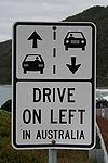
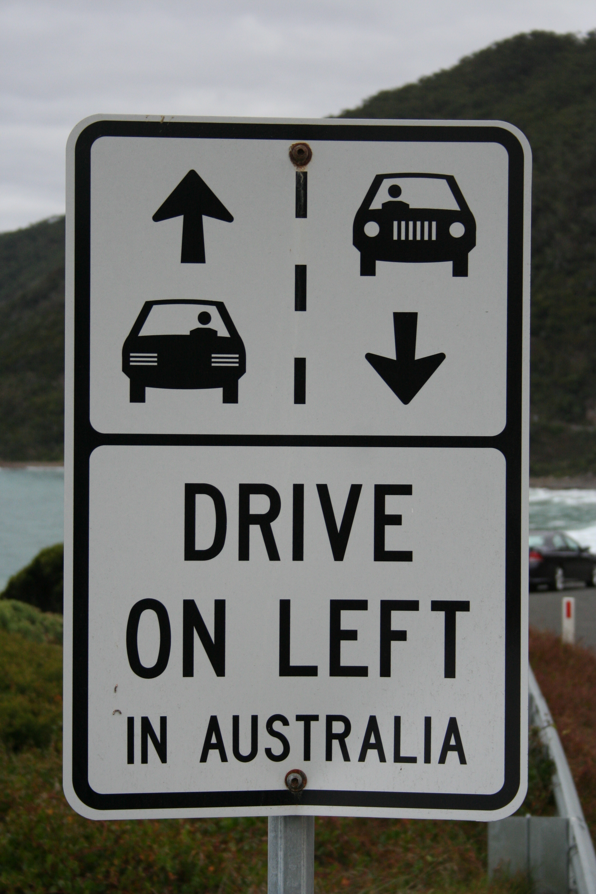
Main article: Right- and left-hand trafficTraffic flows on the right or on the left side of the road depending on the country.[46] In countries where traffic flows on the right, traffic signs are mostly on the right side of the road, roundabouts and traffic circles go counter-clockwise/anti-clockwise, and pedestrians crossing a two-way road should watch out for traffic from the left first.[47] In countries where traffic flows on the left, the reverse is true.
About 33% of the world by population drive on the left, and 67% keep right. By road distances, about 28% drive on the left, and 72% on the right,[48] even though originally most traffic drove on the left worldwide.[49]
Economics
Main article: Transport economicsTransport economics is used to understand both the relationship between the transport system and the wider economy and the complex network effects when there are multiple paths and competing modes for both personal and freight (road/rail/air/ferry) and where Induced demand can result in increased on decreased transport levels when road provision is increased by building new roads or decreased (for example California State Route 480). Roads are generally built and maintained by the public sector using taxation although implementation may be through private contractors).[50][51] or occasionally using road tolls.[52]
Economics and society depend heavily on efficient roads. In the European Union (EU) 44% of all goods are moved by trucks over roads and 85% of all persons are transported by cars, buses or coaches on roads.[53] The term was also commonly used to refer to roadsteads, waterways that lent themselves to use by shipping.
Construction costs
According to the New York State Thruway Authority,[54] some sample per-mile costs to construct multi-lane roads in several US northeastern states were:
- Connecticut Turnpike — $3,449,000 per mile
- New Jersey Turnpike — $2,200,000 per mile
- Pennsylvania Turnpike (Delaware Extension) — $1,970,000 per mile
- Northern Indiana Toll Road — $1,790,000 per mile
- Garden State Parkway — $1,720,000 per mile
- Massachusetts Turnpike — $1,600,000 per mile
- Thruway, New York to Pennsylvania Line — $1,547,000 per mile
- Ohio Turnpike — $1,352,000 per mile
- Pennsylvania Turnpike (early construction) — $736,000 per mile
Statistics
The United States has the largest network of roads of any country with 6,430,366 kilometres (3,995,644 mi) (2005). The People's Republic of China is second with 3,583,715 kilometres (2,226,817 mi) of road (2007) See List of countries by road network size. The Republic of India has the third largest road system in the world with 3,383,344 kilometres (2,102,312 mi) (2002). When looking only at expressways the National Trunk Highway System (NTHS) in People's Republic of China has a total length of 45,000 kilometres (28,000 mi) at the end of 2006, and 60,300 km at the end of 2008, second only to the United States with 90,000 kilometres (56,000 mi) in 2005.[55][56]
See also
References
- ^ OECD (2004-02-26). "Glossary of Statistical Terms". http://stats.oecd.org/glossary/detail.asp?ID=4005. Retrieved 2007-07-17.
- ^ "What is the difference between a road and a street?". Word FAQ. Dictionary.com (Lexico Publishing Group, LLC). 2007. http://dictionary.reference.com/help/faq/language/d01.html. Retrieved 2007-03-24.
- ^ "Road Infrastructure Strategic Framework for South Africa". A Discussion Document. National Department of Transport (South Africa). http://www.transport.gov.za/library/docs/rifsa/infor.html. Retrieved 2007-03-24.
- ^ a b c d e f Lay, Maxwell G (1992). Ways of the World: A History of the World's Roads and of the Vehicles that Used Them. Rutgers University Press. ISBN 0813526914. http://books.google.com/?id=flvS-nJga8QC&pg=PR3&lpg=PR3&dq=%22Ways+of+the+world%22+Rutgers+University+Press,+New+Brunswick.
- ^ "road". The Free Dictionary. http://legal-dictionary.thefreedictionary.com/road. "ROAD. A passage through the country for the use of the people. 3 Yeates, 421. 2. Roads are public or private. Public roads are laid out by public authority, or dedicated by individuals to public use. The public have the use of such roads, but the owner of the land over which they are made and the owners of land bounded on the highway, have, prima facie, a fee in such highway, ad medium filum viae, subject to the easement in favor of the public... Private roads are, such as are used for private individuals only, and are not wanted for the public generally."
- ^ "The road user and the law". http://www.direct.gov.uk/en/TravelAndTransport/Highwaycode/DG_069869.
- ^ "Road Traffic Regulation Act 1984 - 142 General interpretation of Act". Legislation. http://www.legislation.gov.uk/ukpga/1984/27/section/142. "“road”— (a) in England and Wales, means any length of highway or of any other road to which the public has access, and includes bridges over which a road passes, and (b) in Scotland, has the same meaning as in the Roads (Scotland) Act 1984"
- ^ a b "The road user and the law". http://www.direct.gov.uk/en/TravelAndTransport/Highwaycode/DG_069869. "Most of the provisions apply on all roads throughout Great Britain, although there are some exceptions."
- ^ Reference listed says 1984, This description is used in several rules going back to at least 1975, The law of real property; Stevens, 1975; Authors - Robert Megarry, Sir Robert Edgar Megarry, Sir William Wade
- ^ "Judgment - Director of Public Prosecutions v. Jones and Another (On Appeal from a Divisional Court of the Queen's Bench Division)". http://www.hrothgar.co.uk/WebCases/hol/reports/07/44.htm. "The land over which a public right of way exists is known as a highway; and although most highways have been made up into roads, and most easements of way exist over footpaths, the presence or absence of a made road has nothing to do with the distinction. There may be a highway over a footpath, while a well-made road may be subject only to an easement of way, or may exist only for the landowner's benefit and be subject to no easement at all"
- ^ "Local government law - Highway law". http://www.4-5.co.uk/practiceareas/index.cfm?id=486. "Historically, a highway comprehended any path in which members of the public had the right to pass and re-pass without let or hindrance. The term embraced footpaths, bridleways, driftways and so forth. The advent of the motor vehicle and its peculiar requirements has seen increasing distinctions between paths over which walkers and riders have a right of way and those ways that are predominantly used by motor vehicles. The former may be usefully termed "rights of way" (and are the subject of a separate entry in this web) and the latter may be termed "highways.""
- ^ (PDF) Environment and Planning B: Planning and Design 2001, volume 28 (Self-organizing pedestrian movement). pp. 376. doi:10.1068/b2697. http://pedsim.elte.hu/pdf/envplanb.pdf.
- ^ "Marshalls Heath Nature Reserve". History. wheathampstead.net. 24 February 2003. http://www.wheathampstead.net/mh/history.htm. Retrieved 2007-04-28.
- ^ "The Icknield Way Path". Icknield Way Association. 2004. http://www.icknieldwaypath.co.uk/. Retrieved 2007-04-29.
- ^ "The Somerset Levels (the oldest timber trackway discovered in Northern Europe)". Current Archaeology 172. Current Archaeology. February 2001. Archived from the original on 2007-03-11. http://web.archive.org/web/20070311003620/http://www.archaeology.co.uk/ca/issues/ca172/ca172.htm. Retrieved 2007-03-25.
- ^ a b c d e O'Flaherty, Coleman A. (2002). Highways: The Location, Design, Construction & Maintenance of Road Pavements. Elsevier. ISBN 0750650907. http://books.google.com/?id=Ren4sWQ3jKkC&pg=PA1&lpg=PA1&dq=ancient+Egyptians+stone+paved+road++Great+Pyramid+in+about+3000+BC.
- ^ Lendering, Jona. "Royal Road". History of Iran. Iran Chamber of Society. http://www.iranchamber.com/history/achaemenids/royal_road.php. Retrieved 2007-04-09.
- ^ "Horseboating" (Web). The Horseboating Society. http://www.horseboating.org.uk/. Retrieved 2007-04-09.
- ^ "Horses and Canals 1760 - 1960 The people & the horses". Horse Drawn Boats. Canal Junction Ltd. http://www.canaljunction.com/craft/horsedrawn1.htm. Retrieved 2007-04-09.
- ^ a b Hart-Davis, Adam (2001-06-01). "Roads and surveying". Discovering Roman Technology. BBC.CO.UK. http://www.bbc.co.uk/history/ancient/romans/tech_02.shtml. Retrieved 2007-04-22.
- ^ Dr. Kasem Ajram (1992). The Miracle of Islam Science (2nd ed.). Knowledge House Publishers. ISBN 0-911119-43-4.
- ^ "The Rebecca Riots". Rebecca and her daughters come to Rhayader. Victorian Powys for Schools. March 2002. http://history.powys.org.uk/school1/rhayader/rebcmenu.shtml. Retrieved 2007-04-28.
- ^ "Kitsap County Road Standards 2006" (Doc). Kitsap County, Washington. 2006. http://www.kitsapgov.com/PW/pdf/Revised%20Road%20Standards.doc. Retrieved 2007-04-20.[dead link]
- ^ "Washington State County Road Standards". Chapter 35.78 RCW requires cities and counties to adopt uniform definitions and design standards for municipal streets and roads. Municipal Research & Services Center of Washington. 2005. http://www.mrsc.org/subjects/Transpo/stand/CoRdStand.aspx. Retrieved 2007-04-20.
- ^ a b c d e f g h Shire of Wyndham East Kimberly (October 2006). "Guidelines for rural road design and construction technical specifications" (PDF). Western Australia (The Last Frontier). Archived from the original on 2007-07-10. http://web.archive.org/web/20070710022035/http://www.thelastfrontier.com.au/Publications/06K027005-061019-Rural+Road+Technical+Specification+complete+(3).pdf. Retrieved 2007-04-24.
- ^ "Road Building Equipment". Constructing roads into forestry work areas. Caterpillar. 2007. http://www.cat.com/cda/layout?m=62323&x=7. Retrieved 2007-04-20.
- ^ "Volvo Construction Equipment (Europe)". Building the cities, towns, streets, highways and bridges in your neighborhood and in communities around the globe. Volvo. 2007. Archived from the original on 2006-10-27. http://web.archive.org/web/20061027082405/http://www.volvo.com/constructionequipment/europe/en-gb/work+solutions/government/introduction.htm. Retrieved 2007-04-20.
- ^ Glossary: Princes Highway, Traralgon Bypass - Planning Assessment Report at The State of Victoria
- ^ "ISAP 9th Conference Titles & Abstracts (#09044)". Effects of Frost Heave on the Longitudinal Profile of Asphalt Pavements in Cold Regions. International Society for Asphalt Pavements. August 2002. http://www.asphalt.org/Pubs/9th_conf_abst.html. Retrieved 2007-05-13.
- ^ The Motorway Achievement: Frontiers of Knowledge and Practice. Thomas Telford. 2002. pp. 252. ISBN 0727731971. http://books.google.com/?id=7Yqxyefv-VAC&pg=PA252&dq=4th+power+of+axle+weight.
- ^ O'Flaherty, Coleman A. (2002). Highways: The Location, Design, Construction & Maintenance of Road Pavements. Elsevier. pp. 252. ISBN 0750650907. http://books.google.com/?id=Ren4sWQ3jKkC&pg=PA252&dq=Pavements+are+designed+for+an+expected+service+life.
- ^ "Road Map to the Future". United States Department of Transportation - Federal Highway Administration. July/August 2002. http://www.tfhrc.gov/pubrds/02jul/10.htm. Retrieved 2007-05-13.
- ^ ISG Resources, Inc (December 2003). "Fly Ash Concrete Design for Chicago's 100-Year Road Structure" (PDF). Case Study. U.S. Environmental Protection Agency. http://www.epa.gov/epaoswer/osw/conserve/c2p2/cases/wacker-dr.pdf. Retrieved 2007-05-13.
- ^ "Thin Surfacing - Effective Way of Improving Road Safety within Scarce Road Maintenance Budget" (PDF). Paper for presentation at the 2005 Annual Conference of the Transportation Association of Canada in Calgary, Alberta. Transportation Association of Canada. 2005. Archived from the original on 2008-04-07. http://web.archive.org/web/20080407011631/http://www.tac-atc.ca/english/pdf/conf2005/s16/uzarowski2.pdf. Retrieved 2007-05-14.
- ^ a b [1] Minnesota DOT
- ^ Practical guidelines for CPR of Urban Roads: A compelling need for preserving city concrete streets led to the development of a methodology for scoping repairs and the undertaking of a comprehensive concrete pavement repair program in Grand Rapids, Michigan. June 2005. Better Roads.
- ^ [2] IGGA
- ^ How States Preserve Concrete Pavements: CPR pays off in extra pavement life. Better Roads. August 2005.
- ^ CPR brings dying pavement back to life: Georgia continues to be the leader in concrete pavement restoration, but as the word spreads other states are beginning to use this system to restore deteriorating pavements. April 1997, Roads & Bridges Magazine
- ^ G. Allen Burton, Jr., Robert Pitt (2001). Stormwater Effects Handbook: A Toolbox for Watershed Managers, Scientists, and Engineers. New York: CRC/Lewis Publishers. ISBN 0-87371-924-7. http://unix.eng.ua.edu/~rpitt/Publications/BooksandReports/Stormwater%20Effects%20Handbook%20by%20%20Burton%20and%20Pitt%20book/MainEDFS_Book.html. Chapter 2.
- ^ Charles Seawell and Newland Agbenowosi (1998)."Effects of Road Deicing Salts on Groundwater Systems." Virginia Polytechnic Institute, Department of Civil Engineering.
- ^ University of Minnesota (2009). "U of M research finds most road salt is making it into the state's lakes and rivers." 2009-02-10.
- ^ C.Michael Hogan, Analysis of highway noise, Journal of Water, Air, & Soil Pollution, Volume 2, Number 3, Biomedical and Life Sciences and Earth and Environmental Science Issue, Pages 387-392, September, 1973, Springer Verlag, Netherlands ISSN 0049-6979
- ^ "Traffic-related Air Pollution near Busy Roads". American Journal of Respiratory and Critical Care Medicine Vol 170. pp. 520-526. 2004. http://ajrccm.atsjournals.org/cgi/content/full/170/5/520.
- ^ "Road Dust - Something To Sneeze About." Science Daily, 1999-11-30.
- ^ "Why In Britain Do We Drive On The Left?". 2Pass.co.uk. © 1996-2007. http://www.2pass.co.uk/goodluck.htm. Retrieved 2007-03-24.
- ^ Kincaid, Peter (1986). The Rule of the Road: An International Guide to History and Practice. Greenwood Press. ISBN 0-313-25249-1. http://www.amazon.com/Rule-Road-International-History-Practice/dp/0313252491.
- ^ Lucas, Brian (2005). "Which side of the road do they drive on?". http://www.brianlucas.ca/roadside/. Retrieved 2006-08-03.
- ^ "Why do some countries drive on the right and others on the left?". http://users.pandora.be/worldstandards/driving%20on%20the%20left.htm.
- ^ "International Market Research Reports". Australia CCG 2004 Update: Economic Trends and Outlook (E. INFRASTRUCTURE ). Industry Canada. 2006-02-28. Archived from the original on 2007-11-14. http://web.archive.org/web/20071114181049/http://strategis.ic.gc.ca/epic/site/imr-ri.nsf/en/gr126748e.html. Retrieved 2007-04-17.
- ^ "State and Federal Gasoline Taxes". Maps, Reports and history of gas tax in the United States. American Road & Transportation Builders Association ("ARTBA"). Archived from the original on 2007-04-08. http://web.archive.org/web/20070408082904/http://www.artba.org/economics_research/current_issues/state_fed_gas_taxes.htm. Retrieved 2007-05-02.
- ^ "International Bridge, Tunnel and Turnpike Association". April 16, 2007. http://ibtta.org/. Retrieved 2007-04-17.
- ^ "Road Transport (Europe)". Overview. European Communities, Transportation. 2007-02-15. http://ec.europa.eu/transport/road/index_en.htm. Retrieved 2007-03-24.
- ^ "Thruway Fact Book". New York State Thruway Authority. http://www.thruway.ny.gov/about/factbook/. Retrieved 2011-05-05.
- ^ China to build more highways in 2007
- ^ Expressways Being Built at Frenetic Pace
External links
- The Post-Roads of Europe 1781 Map
- National Alliance Against Tolls
- The Roadex project
- The Greenroads Rating System
- The Asphalt Maintenance Manual
Roads and junctions Types of road By countryGermany · Croatia · Spain · Italy · Portugal · Czech Republic · Ireland · United States (U.S. Routes · Interstates)Main roadsArterial road · Collector road · Express-collector setup · Farm-to-market road · Highway · Link road · Two-lane expressway · 2+1 road (Parkway · Super two · 2+2 road) · Trunk road · Highway systems by countryLocal roadsBoulevard · Frontage road · Road · Single carriageway · Street · Alley · Backroad · Cul-de-sac · Driveway · Lane · Primitive road · Side roadOther termsSurfaces Asphalt concrete · Brick · Chipseal · Cobblestone · Concrete · Corduroy · Dirt · Gravel · Ice · Macadam · Oiled (bitumen) · Plank · Sett · TarmacRoad junctions Cloverleaf · Diamond · Directional T · Diverging diamond · Parclo · Trumpet · SPUI · Stack · Three-level diamond · Raindrop · Roundabout interchangeCategories:- Roads


Wikimedia Foundation. 2010.