- Brooklyn Bridge
-
Brooklyn Bridge – City Hall / Chambers Street


New York City Subway rapid transit station complex 
Street stairStation statistics Borough Manhattan Locale Civic Center Coordinates 40°42′46″N 74°0′17″W / 40.71278°N 74.00472°WCoordinates: 40°42′46″N 74°0′17″W / 40.71278°N 74.00472°W Division A (IRT), B (BMT) Line IRT Lexington Avenue Line
BMT Nassau Street LineServices 4  (all times)
5 (all except late nights)
6 (all times) <6> (weekdays until 8:45 p.m., peak direction)
J (all times)
Z (rush hours, peak direction)Connection - New York City Bus: M9, M22, M103
Structure Underground Other information Opened August 4, 1913[1] (BMT station) October 27, 1904 (IRT station)[2] Traffic Passengers (2010) 10,783,128 (station complex)[3]  1.1%
1.1%Rank 27 out of 422 Station service legend Symbol Description 
Stops in station at all times 
Stops all times except late nights 
Stops late nights only 
Stops late nights and weekends only 
Stops weekdays only 
Stops all times except rush hours in the peak direction Stops all times except weekdays 
Stops rush hours only 
Stops rush hours in the peak direction only 
Station is closed (Details about time periods) Brooklyn Bridge – City Hall / Chambers Street is a New York City Subway station complex in Lower Manhattan. The complex is served by trains of the IRT Lexington Avenue Line and the BMT Nassau Street Line. The following services stop at this station:
- J, 4, and 6 trains at all times
- 5 train at all times except late nights
- Z skip-stop train during rush hours in peak direction
- <6> train on weekdays in peak direction
Contents
IRT Lexington Avenue Line platforms
Brooklyn Bridge – City Hall
New York City Subway rapid transit station 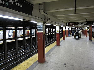
Downtown island platformStation statistics Address Park Row & Centre Street
New York, NY 10007Division A (IRT) Line IRT Lexington Avenue Line Services 4 (all times)
5 (all except late nights)
6 (all times) <6>(weekdays until 8:45 p.m., peak direction)System transfers J Z at Chambers Street (BMT Nassau Street Line)Structure Underground Platforms 2 island platforms, 2 closed side platforms (partially visible) Tracks 4 Other information Opened October 27, 1904[2] Accessible  (transfer to Chambers Street is not accessible)
Former/other names Brooklyn Bridge
Brooklyn Bridge - Worth StreetStation succession Next north Canal Street (local): 4  6 <6>
6 <6>
14th Street – Union Square (express): 4 5
Worth Street (local; closed)Next south Fulton Street: 4 5
(Terminal): 6 <6>
City Hall (closed)Next northCanal Street (local): 4 6 <6>
Grand Central – 42nd Street (express): 4 5 Next southBowling Green: 4 5 Station service legend Symbol Description Stops in station at all times Stops all times except late nights Stops late nights only Stops late nights and weekends only Stops weekdays only Stops all times except rush hours in the peak direction Stops all times except weekdays Stops rush hours only Stops rush hours in the peak direction only Station is closed (Details about time periods) Brooklyn Bridge – City Hall is an express station on the IRT Lexington Avenue Line which is located on Park Row at the Manhattan end of the Brooklyn Bridge. It is served by the 4 and 6 trains at all times, the 5 train at all times except late nights, and the <6> train during weekdays in the peak direction.
Description
This is the south terminal for the 6 train, which turns via the City Hall Loop to head back uptown. During weekdays from approximately 6:30 AM to 8:45 PM, some 6 trains change designation here. At those times the Pelham Bay Park terminal can't handle the large number of 6 trains in service. The solution is to operate 6 trains local on the IRT Pelham Line south of Parkchester and terminate them there. The <6> trains run express using the center track from Third Avenue to Parkchester in the peak direction and local north of Parkchester, terminating at Pelham Bay Park. In the morning, terminating <6> trains become 6 trains for the return trip to the Bronx; in the afternoon and early evening some terminating 6 trains become <6> trains.
Just north of the station are crossovers that allow trains to switch between the local and express tracks, which allow Lexington Avenue local trains to continue south via the express tracks if necessary (rather than using the City Hall loop). Due to the closure of City Hall station in 1945, Brooklyn Bridge – City Hall (which had simply been Brooklyn Bridge) became the southernmost station on normal Lexington Avenue local service.
South of the station, the downtown local track splits into three tracks. The westernmost track loops around to the northbound local track through City Hall station. The other two are layup tracks parallel to the downtown express track. Until the 1960s, they merged into the downtown express track north of Fulton Street, but now they are spurs ending a little north of Fulton Street, occasionally used for train storage. Plans are on the books to rejoin the layup tracks to the express track.
The station has been renovated, with new tile and ADA-accessible elevator access. It is the zero point for the IRT East Side chain; mile 0 is at the south end of the station.
Station and platform layout
The Brooklyn Bridge station has a number of closed off areas as construction and service patterns have required changes to be made to the station. In addition to the two island platforms, there are two short side platforms on the outer edges of the station. Like those on the IRT Lexington Avenue Line at 14th Street – Union Square and on the IRT Broadway – Seventh Avenue Line at 96th Street, these side platforms were built to accommodate extra passenger volume and were built to the five-car length of the original IRT local trains. These platforms did not see much use as they were located at express stations, which allows cross-platform interchanges via the island platforms. When trains were lengthened to their current ten-car length, it was impractical to lengthen both these side platforms and the island platforms. They were closed in 1910 after only six years in operation and walled off along the platform edges.
The side platform on the southbound side is now home to some electrical equipment and a backup control tower for the Brooklyn Bridge interlocking, just north of the station. The tower is functional but not normally used, because the Grand Central – 42nd Street tower is the primary control point for the whole line. The interlocking board can be seen through a window along the wall along the southbound local trackway. The south end of the downtown side platform is still visible near the dispatcher's booth on the downtown island platform.
There are also some closed portions at the south ends of the existing express platforms. During the station lengthening projects it was easier to lengthen the express platform to the north. The curves at the south end proved impossible to rework so the station was lengthened northward (allowing Worth Street to be closed), and the curved southern ends of the express platform closed. Gap fillers and original mosaic tiles remain in the closed ends.
Artwork includes a 1996 work by Mark Gibian titled Cable Crossing.
After Worth Street station closed, the Brooklyn Bridge - City Hall station was known as Brooklyn Bridge - Worth Street. The name was reverted to Brooklyn Bridge - City Hall in 1995.
Image gallery
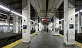
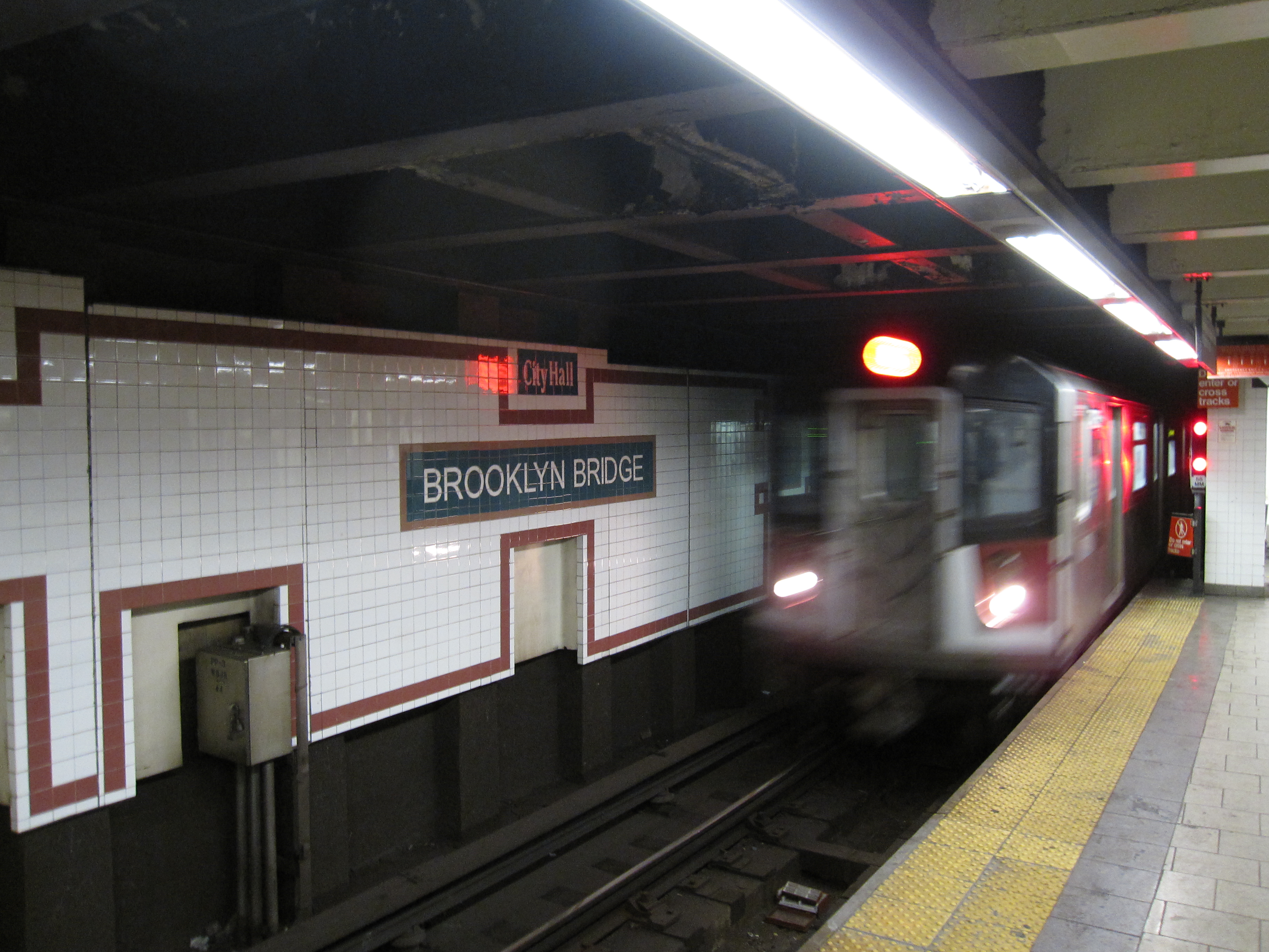
-

Downtown Local 6 train arriving
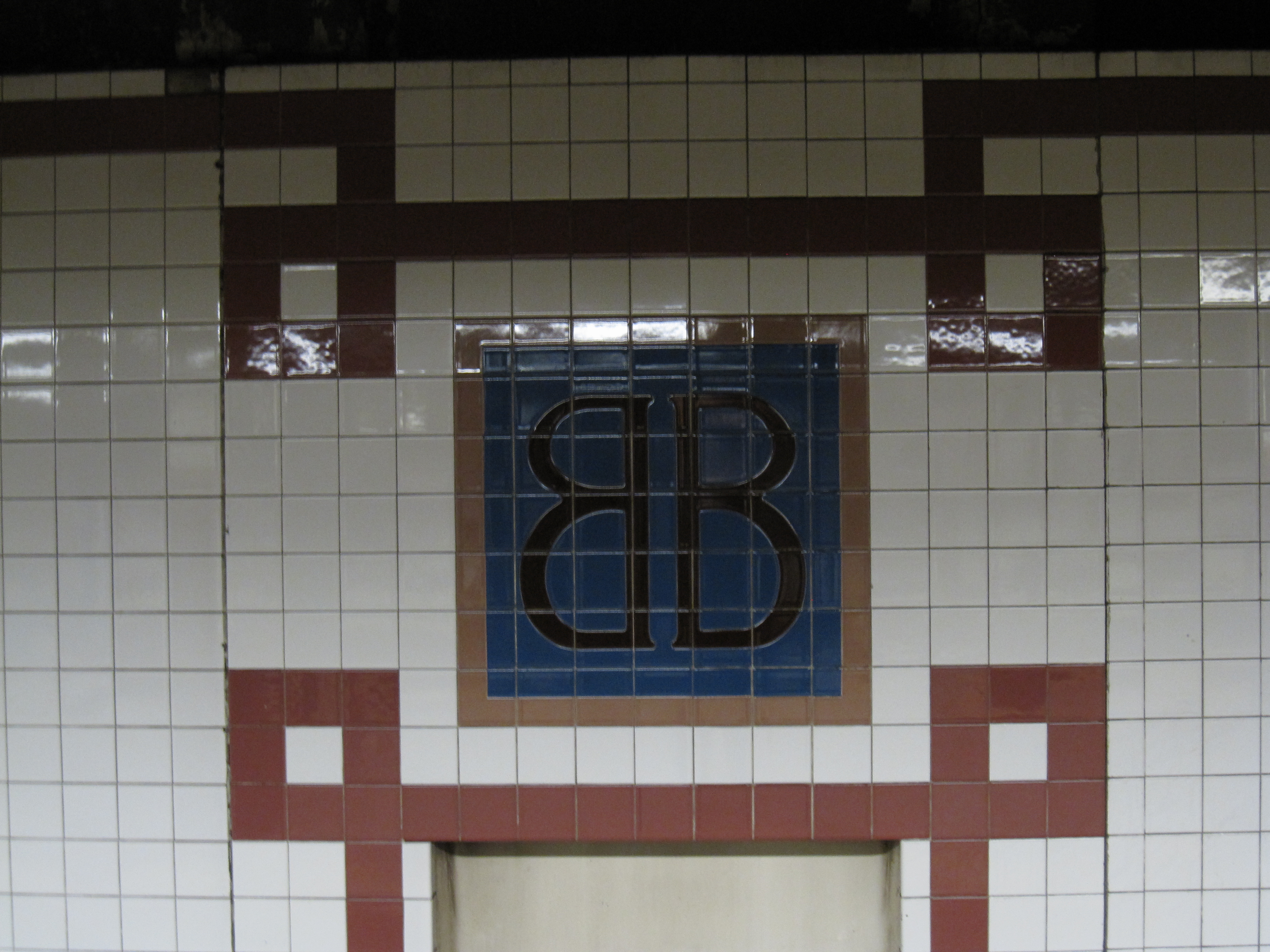
-

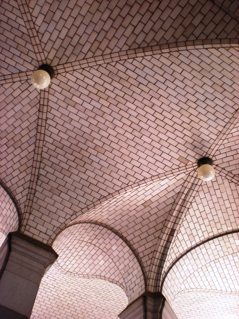
Tiles
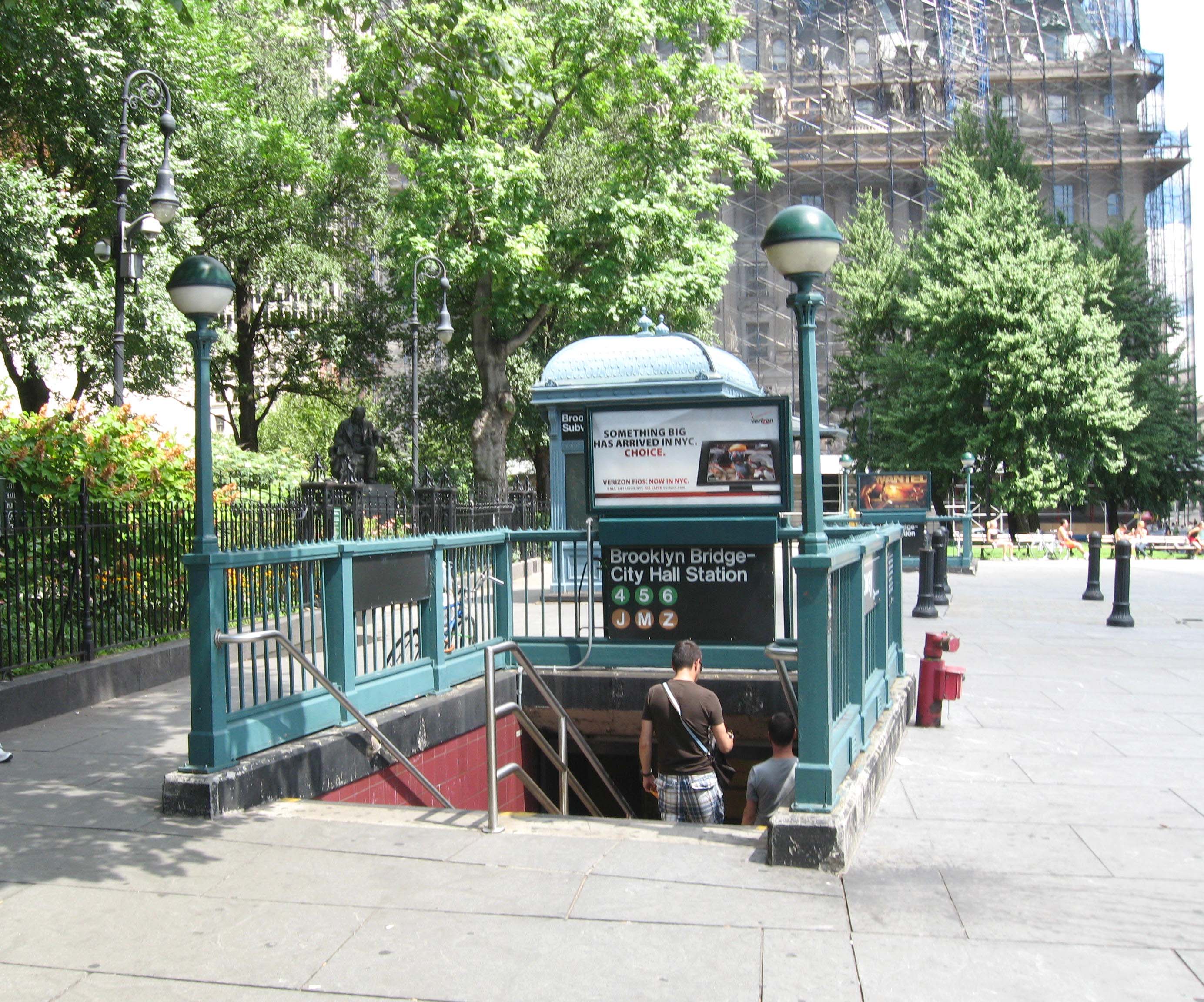
-

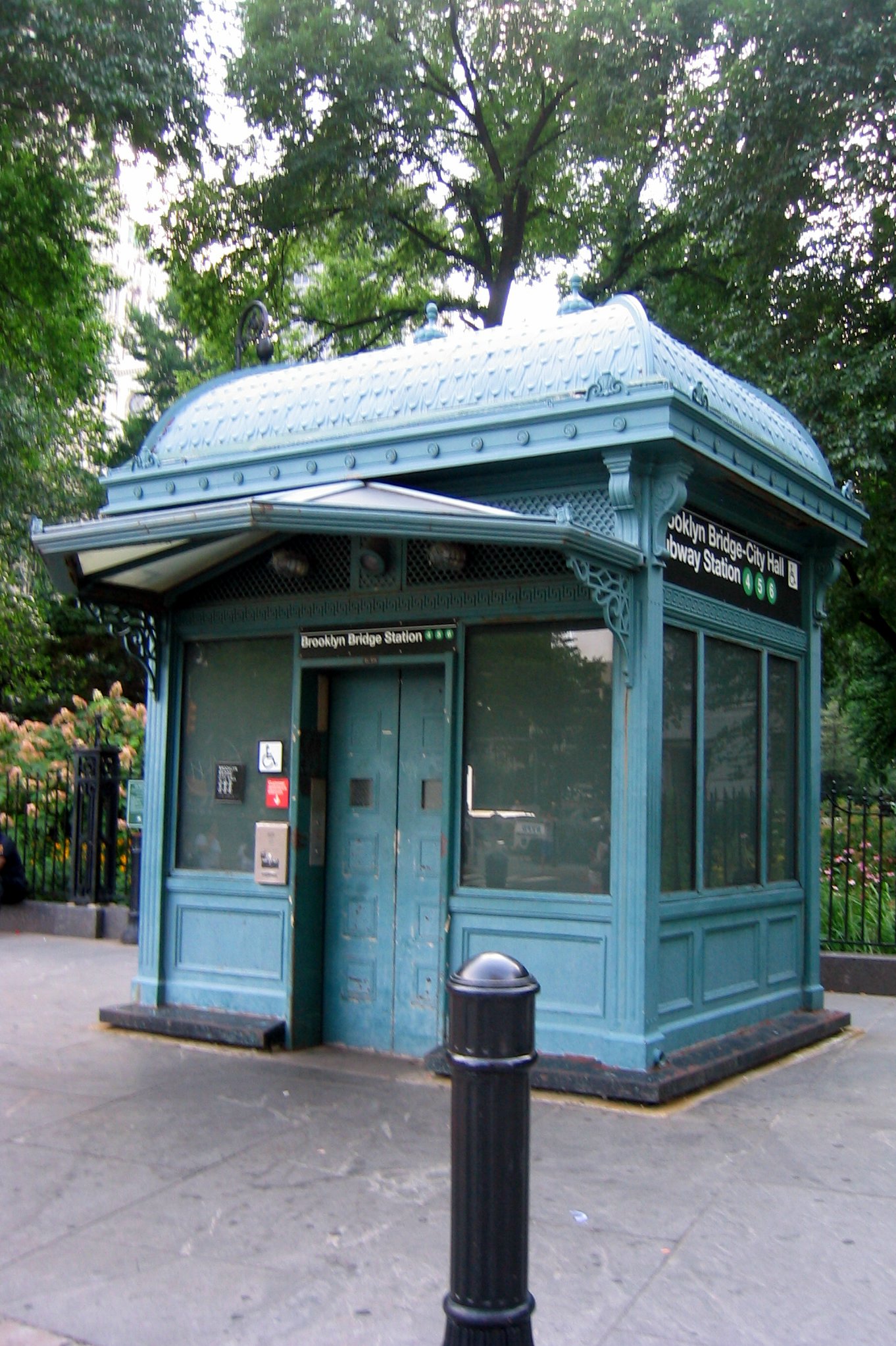
Replica of an original IRT subway entrance kiosk
-
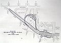
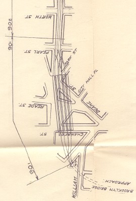
Plan of the station (lower-right corner)
Further reading
- Lee Stokey. Subway Ceramics : A History and Iconography. 1994. ISBN 978-0-9635486-1-0
BMT Nassau Street Line platforms
Chambers Street
New York City Subway rapid transit station 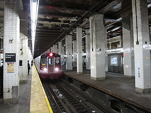
train arriving at the northbound platform, on the right is the unused middle platformStation statistics Division B (BMT) Line BMT Nassau Street Line Services J (all times)
Z (rush hours, peak direction)System transfers 4 5 6 <6> at Brooklyn Bridge – City Hall (IRT Lexington Avenue Line)Connection - New York City Bus: M22
Structure Underground Platforms 3 island platforms (2 active), 2 side platforms (1 walled up; 1 disused) Tracks 4 Other information Opened August 4, 1913[1] Station succession Next north Canal Street: J Z Next south Fulton Street: J  Z
Z
(Terminal): J
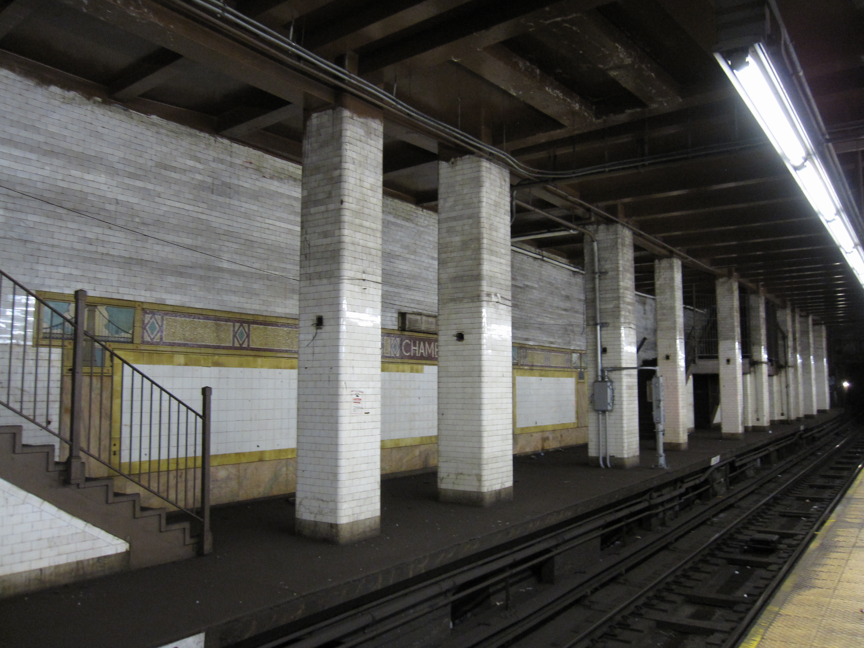
Station service legend Symbol Description Stops in station at all times Stops all times except late nights Stops late nights only Stops late nights and weekends only Stops weekdays only Stops all times except rush hours in the peak direction Stops all times except weekdays Stops rush hours only Stops rush hours in the peak direction only Station is closed (Details about time periods) Chambers Street on the BMT Nassau Street Line is located at the intersection of Centre and Chambers Streets beneath the Manhattan Municipal Building. The station has four tracks, three island platforms, and one side platform (originally two).
Layout
This station is the southern terminal for J trains on weekends (from approximately 1 a.m. on Saturday to 5 a.m. on Monday) and during this time, they use the inner tracks to begin their return trip to Brooklyn and Queens.
The south platform is slightly higher at the southern end of the station because the next stop south, Fulton Street, is bi-level with the southbound platform being above the northern one.
The two "express" tracks at this station merge into a single tail track south of the station. The tail track is 620 feet long from the switch points to the bumper block, where an emergency exit is available.
North of this station, there are provisions for two tracks, which end behind the now-closed Queens-bound side platform.[4] These tracks were formerly connected to the Manhattan Bridge, until they were disconnected in 1967 as part of the Chrystie Street Connection.
History
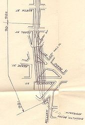 Original plan of Chambers Street station (1908)
This was one of the earliest BMT subway stations opened in New York City, built at a time when Lower Manhattan was the city's principal business district. It was designed to be the BMT's Manhattan hub, with trains arriving from Brooklyn in both directions, and terminating here. Originally, trains arrived from the north via either the Williamsburg Bridge or the Manhattan Bridge.
The Nassau Street Loop was completed in 1931, making Chambers Street a through station south to the Montague Street Tunnel to Brooklyn. At this point, the center island platform and two side platforms were closed. The west side platform was walled up and partly demolished when Brooklyn Bridge – City Hall on the IRT Lexington Avenue Line was rebuilt on the other side of the wall in 1960–62.
The loop configuration permitted trains arriving in either direction from the BMT Fourth Avenue Line in Brooklyn to pass through Chambers Street and return to Fourth Avenue without turning around. A track connection to the Brooklyn Bridge, which would have made a similar loop through the Williamsburg Bridge, was planned in the station's design, but never built. (See BMT Brooklyn Loops.)
Although altered over the years to account for changing ridership patterns, the station has not been renovated. In one poll, it was voted the ugliest station in the system:
When it was being built before World War I, Chambers Street was envisioned as a City Hall terminal, a kind of downtown Grand Central at a time when the business and population center of the city was still closer to the southern end of the island. Three years after it opened, its four wide platforms were so overcrowded that one newspaper article described them as more dangerous during the rush hours than at the Grand Central or the Fourteenth Street Stations.
But by the mid-1920s, the subway itself was pushing the city's population north and leaving Chambers Street behind. By as early as the 1930s, in fact, the station's ridership had dropped off so steeply that half of it was closed.
By the 1950s, many of the city's business interests had shifted to Midtown. The Chrystie Street Connection, completed in 1967, severed the Nassau line's connection to the Manhattan Bridge, so that the bridge tracks could connect instead to the uptown IND Sixth Avenue Line. The tracks heading towards the Manhattan Bridge (now used for train storage) are visible from northbound trains leaving Chambers Street.
The station was the site of the R42 crash into the bumper block on the lower level relay track on November 6, 2007 on the M service.[5]
In Film
This station was used in the 1998 adaptation of Great Expectations, in a climactic scene featuring Ethan Hawke and Robert DeNiro. Subway scenes from the 1956 film Somebody Up There Likes Me were filmed at this station. The station was used to film a scene in the 1980 film Fame.
Tile Work
The tile work on this station includes a depiction of the nearby Brooklyn Bridge that suffers from an interesting gaffe: it features the parallel up-down cables between the main cable and the roadway (as seen alone on most suspension bridges) but misses the second set of diagonal cables that radiate from the bridge to the roadway (as seen on cable-stayed bridges).
Image Gallery
-

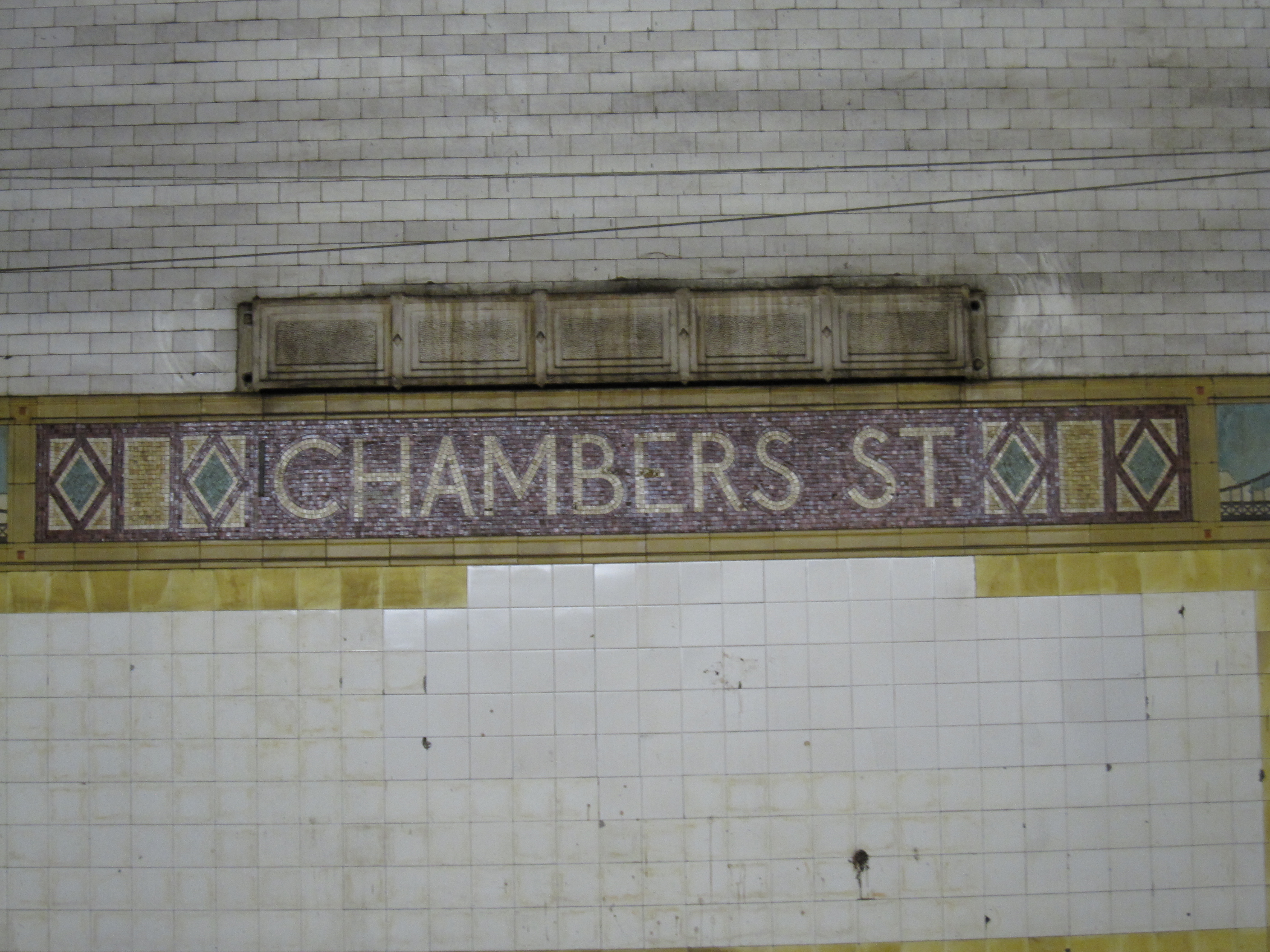
Name of station in mosaics
-

Ceramic tile with Brooklyn Bridge
-

Early postcard depiction of station
-

Entrance to the station
-

Disused northbound side platform
-
Northbound platform used by J train
-

Former tickets booths at Chambers Street
-

Unused center platform
References
- ^ a b New York Times, Passenger Killed on Loop's First Day, August 5, 1913, page 2
- ^ a b New York Times, Our Subway Open: 150,000 Try It, October 28, 1904
- ^ "Facts and Figures: 2010 Annual Subway Ridership". New York City Metropolitan Transportation Authority. http://mta.info/nyct/facts/ridership/ridership_sub_annual.htm. Retrieved 2011-05-18.
- ^ http://www.youtube.com/watch?v=V69X72HAZ1g The provisions for 2 tracks are clearly visible towards the right at the 3:11 mark, just after the train leaves the Chambers Street station.
- ^ Metropolitan Transportation Authority (New York), M Train Incident at Chambers Street, November 6, 2007
External links
- nycsubway.org — BMT Nassau Street/Jamaica Line: Chambers Street
- nycsubway.org — IRT East Side Line: Brooklyn Bridge/City Hall
- Station Reporter — Brooklyn Bridge/Chambers Street Complex
- MTA's Arts For Transit — Brooklyn Bridge – City Hall/Chambers Street
- entrance near City Hall Park from Google Maps Street View
- entrance north of Brooklyn Bridge from Google Maps Street View
- entrance south of Brooklyn Bridge from Google Maps Street View
- Reade Street and Centre Street entrance from Google Maps Street View
- Foley Square entrance from Google Maps Street View
- Abandoned Stations - Brooklyn Bridge – City Hall platforms
- Abandoned Stations - Chambers Street platforms
Categories:- BMT Nassau Street Line stations
- Railway and subway stations on the National Register of Historic Places in Manhattan
- New York City Subway stations in Manhattan
- Beaux-Arts buildings
- Buildings and structures completed in 1913
- Railway stations opened in 1913
- New York City Subway transfer stations
- IRT Lexington Avenue Line stations
- Railway stations opened in 1904


Wikimedia Foundation. 2010.