- National Register of Historic Places listings in Allegany County, New York
-
 Location of Allegany County in New York
This is intended to be a complete list of properties and districts listed on the National Register of Historic Places in Allegany County, New York. The locations of National Register properties and districts for which the latitude and longitude coordinates are included below, may be seen in a Google map.[1]
-
- This National Park Service list is complete through NPS recent listings posted November 18, 2011.[2]
Contents: Counties in New York Albany (Albany) – Allegany – Bronx – Broome – Cattaraugus – Cayuga – Chautauqua – Chemung – Chenango – Clinton – Columbia – Cortland – Delaware – Dutchess – Erie (Buffalo) – Essex – Franklin – Fulton – Genesee – Greene – Hamilton – Herkimer – Jefferson – Kings (Brooklyn) – Lewis – Livingston – Madison – Monroe (Rochester) – Montgomery – Nassau – New York (Manhattan – Below 14th Street, 14th to 59th Streets, 59th to 110th Streets, Above 110th Street, Islands) – Niagara – Oneida – Onondaga (Syracuse) – Ontario – Orange – Orleans – Oswego – Otsego – Putnam – Queens – Rensselaer – Richmond (Staten Island) – Rockland – Saratoga – Schenectady – Schoharie – Schuyler – Seneca – St. Lawrence – Steuben – Suffolk – Sullivan – Tioga – Tompkins – Ulster – Warren – Washington – Wayne – Westchester (New Rochelle, Peekskill, Yonkers) – Wyoming – Yates Current listings
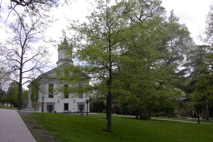
[3] Landmark name Image Date listed Location City or town Summary 1 Alfred Village Historic District September 11, 1985 Sections of N. & S. Main, Church, Ford, Glenn, Park, Sayles, Terrace & W. University Sts.
42°15′13″N 77°47′19″W / 42.253611°N 77.788611°WAlfred 2 Alumni Hall 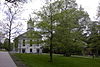
September 12, 1985 Alfred University
42°15′11″N 77°47′16″W / 42.253056°N 77.787778°WAlfred 3 Angelica Park Circle Historic District January 31, 1978 Main and White Sts. and Allegany County Fairgrounds
42°18′21″N 78°00′56″W / 42.305833°N 78.015556°WAngelica 4 Belmont Grange No. 1243 January 18, 2006 32 Willets Ave.
42°13′30″N 78°02′25″W / 42.225°N 78.040278°WBelmont 5 Belmont Hotel December 3, 2001 40-48 Schuyler St.
42°13′24″N 78°02′00″W / 42.223333°N 78.033333°WBelmont 6 Belmont Literary and Historical Society Free Library July 5, 2003 2 Willets Ave.
42°13′24″N 78°02′09″W / 42.223333°N 78.035833°WBelmont 7 Belvidere 
March 16, 1972 3 mi. N of Belmont on SR 408
42°15′54″N 78°01′50″W / 42.265°N 78.030556°WBelmont 8 Bolivar Free Library July 5, 2003 390 Main Street
42°03′55″N 78°03′44″W / 42.065278°N 78.062222°WBolivar 9 Canaseraga Four Corners Historic District March 6, 2002 42-64 and 43-69 Main St., 9 S. Church St.
42°27′41″N 77°46′39″W / 42.461389°N 77.7775°WCanaseraga 10 Caneadea Bridge November 19, 1998 Cty. Rd. over Genesee R.
42°23′06″N 78°08′59″W / 42.385°N 78.149722°WCaneadea 11 Centerville Town Hall March 25, 2009 Fairview Road
42°28′44″N 78°14′58″W / 42.478989°N 78.249539°WCenterville 12 Ceres School December 7, 2010 School St.
41°59′58″N 78°16′22″W / 41.999444°N 78.272778°WCeres 13 Christ Episcopal Church May 17, 1974 Gibson Hill Rd., SW of Rtes. 19 and 408
42°15′10″N 78°04′31″W / 42.252778°N 78.075278°WBelvidere 14 Fireman's Hall March 18, 1980 7 W. University St.
42°15′13″N 77°47′29″W / 42.253611°N 77.791389°WAlfred 15 Friendship Free Library August 15, 2008 40 West Main Street
42°12′25″N 78°08′08″W / 42.206944°N 78.135417°WFriendship New listing; refnum#08000769 16 Main Street Historic District February 5, 1999 Roughly along Main St., from Orchard St. to Green St.
42°13′01″N 78°16′33″W / 42.216944°N 78.275833°WCuba 17 McKinney Stables of Empire City Farms August 12, 1999 105 South St.
42°12′35″N 78°16′16″W / 42.209722°N 78.271111°WCuba 18 Old Allegany County Courthouse August 21, 1972 Park Circle
42°18′19″N 78°00′58″W / 42.305278°N 78.016111°WAngelica 19 Rail and Titsworth Canal Warehouse August 16, 2000 Hughes Rd.
42°20′33″N 78°07′33″W / 42.3425°N 78.125833°WBelfast 20 South Street Historic District May 26, 1988 17, 19-89 South St.
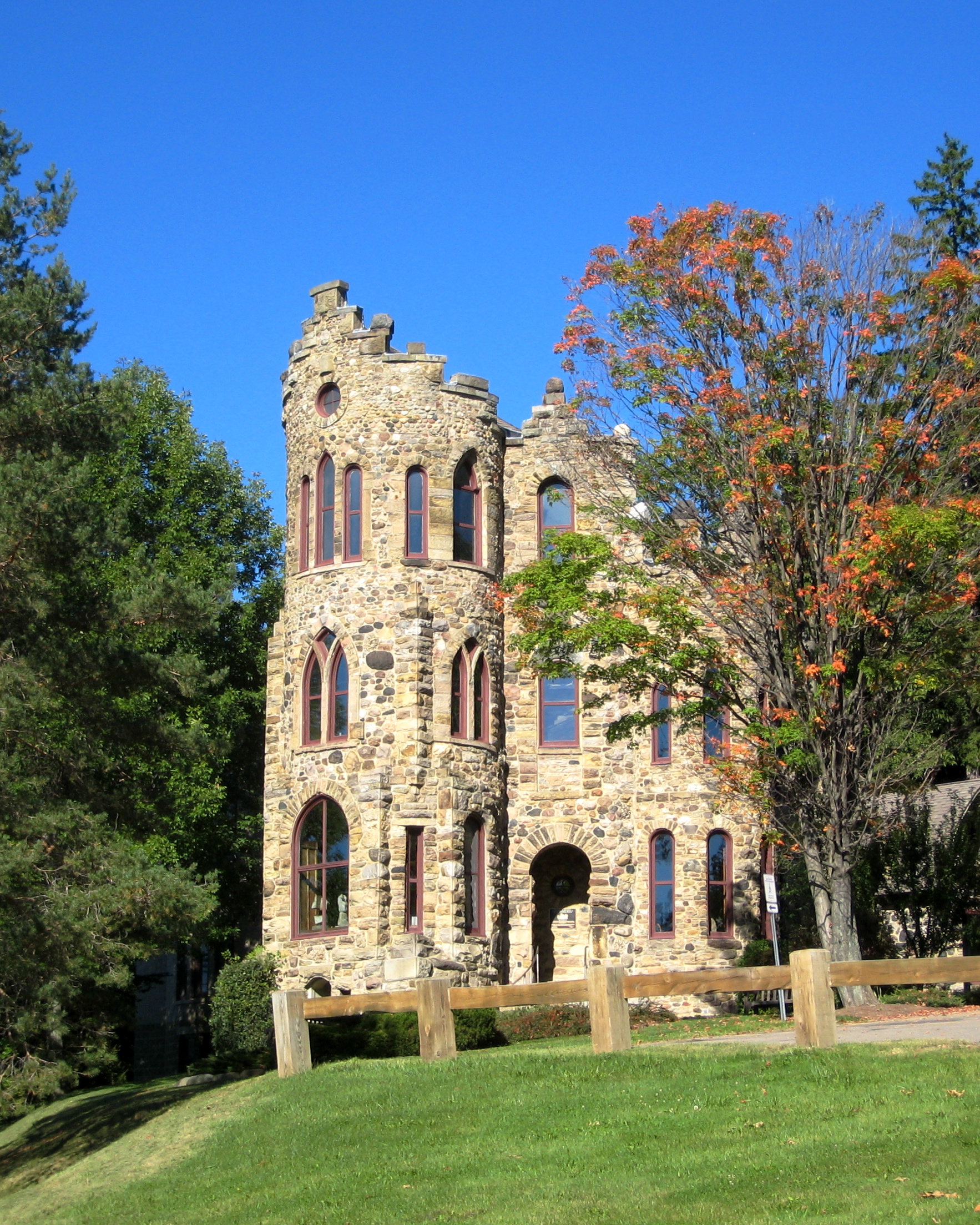
42°12′50″N 78°16′31″W / 42.213889°N 78.275278°WCuba 21 Allen Steinheim Museum 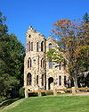
June 4, 1973 Alfred University Campus
42°15′16″N 77°47′13″W / 42.254444°N 77.786944°WAlfred 22 Terra Cotta Building March 16, 1972 Main St.
42°15′27″N 77°47′19″W / 42.2575°N 77.788611°WAlfred 23 US Post Office-Wellsville May 11, 1989 40 E. Pearl St.
42°07′24″N 77°56′56″W / 42.123333°N 77.948889°WWellsville 24 Moses Van Campen House April 16, 2004 4690 Birdsall Rd.
42°18′07″N 77°59′55″W / 42.301944°N 77.998611°WAngelica 25 Wellman House June 20, 1974 Main St.
42°12′22″N 78°08′13″W / 42.206111°N 78.136944°WFriendship 26 Wellsville Erie Depot August 27, 1987 Depot St.
42°07′24″N 77°56′54″W / 42.123333°N 77.948333°WWellsville 27 West Almond Churches August 2, 2000 Cty. Rte. 2
42°17′59″N 77°53′07″W / 42.299722°N 77.885278°WWest Almond References
- ^ The latitude and longitude information provided is primarily from the National Register Information System, and has been found to be fairly accurate for about 99% of listings. For 1%, the location info may be way off. We seek to correct the coordinate information wherever it is found to be erroneous. Please leave a note in the Discussion page for this article if you believe any specific location is incorrect.
- ^ "National Register of Historic Places: Weekly List Actions". National Park Service, United States Department of the Interior. Retrieved on November 18, 2011.
- ^ Numbers represent an ordering by significant words. Various colorings, defined here, differentiate National Historic Landmark sites and National Register of Historic Places Districts from other NRHP buildings, structures, sites or objects.
External links
A useful list of the above sites, with street addresses and other information, is available at National Register of Historic Places.Com, a private site serving up public domain information on NRHPs.
Municipalities and communities of Allegany County, New York Towns Alfred | Allen | Alma | Almond | Amity | Andover | Angelica | Belfast | Birdsall | Bolivar | Burns | Caneadea | Centerville | Clarksville | Cuba | Friendship | Genesee | Granger | Grove | Hume | Independence | New Hudson | Rushford | Scio | Ward | Wellsville | West Almond | Willing | Wirt
Villages Alfred | Almond‡ | Andover | Angelica | Belmont | Bolivar | Canaseraga | Cuba | Richburg | Wellsville
CDPs Hamlets Indian
reservationFootnotes ‡This populated place also has portions in an adjacent county or counties
Categories:- Allegany County, New York
- National Register of Historic Places in New York by county
-


Wikimedia Foundation. 2010.