- National Register of Historic Places listings in Broome County, New York
-
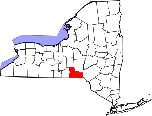 Location of Broome County in New York
This is a list of the National Register of Historic Places listings in Broome County, New York, taken from the National Register of Historic Places for Broome County.
This is intended to be a complete list of properties and districts listed on the National Register of Historic Places in Broome County, New York. The locations of National Register properties and districts for which the latitude and longitude coordinates are included below, may be seen in a Google map.[1]
-
- This National Park Service list is complete through NPS recent listings posted November 18, 2011.[2]
Contents: Counties in New York Albany (Albany) – Allegany – Bronx – Broome – Cattaraugus – Cayuga – Chautauqua – Chemung – Chenango – Clinton – Columbia – Cortland – Delaware – Dutchess – Erie (Buffalo) – Essex – Franklin – Fulton – Genesee – Greene – Hamilton – Herkimer – Jefferson – Kings (Brooklyn) – Lewis – Livingston – Madison – Monroe (Rochester) – Montgomery – Nassau – New York (Manhattan – Below 14th Street, 14th to 59th Streets, 59th to 110th Streets, Above 110th Street, Islands) – Niagara – Oneida – Onondaga (Syracuse) – Ontario – Orange – Orleans – Oswego – Otsego – Putnam – Queens – Rensselaer – Richmond (Staten Island) – Rockland – Saratoga – Schenectady – Schoharie – Schuyler – Seneca – St. Lawrence – Steuben – Suffolk – Sullivan – Tioga – Tompkins – Ulster – Warren – Washington – Wayne – Westchester (New Rochelle, Peekskill, Yonkers) – Wyoming – Yates Current listings
[3] Landmark name Image Date listed Location City or town Summary 1 Abel Bennett Tract Historic District February 19, 2008 Bounded by Riverside Dr., Seminary & St. John Aves., & Beethoven St.
42°05′42″N 75°55′48″W / 42.095086°N 75.929867°WBinghamton 2 Bevier-Wright House May 21, 2008 776 Chenango St.
42°08′15″N 75°53′41″W / 42.13745°N 75.894811°WPort Dickinson 3 Binghamton City Hall 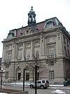
March 18, 1971 Collier St. between Court and Academy Sts.
42°05′53″N 75°54′45″W / 42.098056°N 75.9125°WBinghamton 4 Binghamton Railway Company Complex November 29, 2006 375 State St.
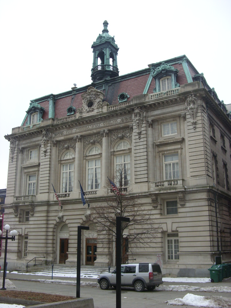
42°06′25″N 75°54′33″W / 42.106944°N 75.909167°WBinghamton 5 Binghamton Theatre January 23, 2008 236 Washington St.
42°06′14″N 75°54′44″W / 42.103889°N 75.912222°WBinghamton 6 Broome County Courthouse 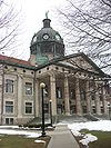
May 22, 1973 Court St.
42°05′53″N 75°54′42″W / 42.098056°N 75.911667°WBinghamton 7 Building at 171-177 Clinton Street December 31, 2002 171-177 Clinton St.
42°06′20″N 75°55′36″W / 42.105556°N 75.926667°WBinghamton 8 Harlow E. Bundy House May 11, 2011 129 Main St.
42°06′06″N 75°55′41″W / 42.101667°N 75.928056°WBinghamton 9 Chenango Canal Prism and Lock 107 June 18, 2010 River Rd.
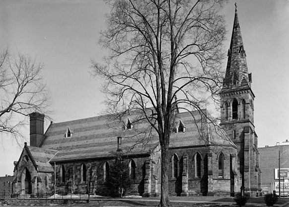
42°14′N 75°50′W / 42.24°N 75.84°WChenango Forks 10 Christ Church 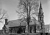
December 2, 1974 Corner of Washington and Henry Sts.
42°06′01″N 75°54′50″W / 42.100278°N 75.913889°WBinghamton 11 Conklin Town Hall December 20, 2006 1271 Conklin Rd.
42°02′58″N 75°48′22″W / 42.049444°N 75.806111°WConklin 12 Court Street Historic District 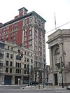
September 7, 1984 Roughly bounded by the Chenango River, Carroll, Henry, and Hawley Sts.
42°05′55″N 75°54′42″W / 42.098611°N 75.911667°WBinghamton 13 Drovers Inn and Round Family Residence April 26, 2010 2 Pumphouse Rd.
42°5′22.78″N 76°3′15.87″W / 42.0896611°N 76.0544083°W
and 301 Main St.
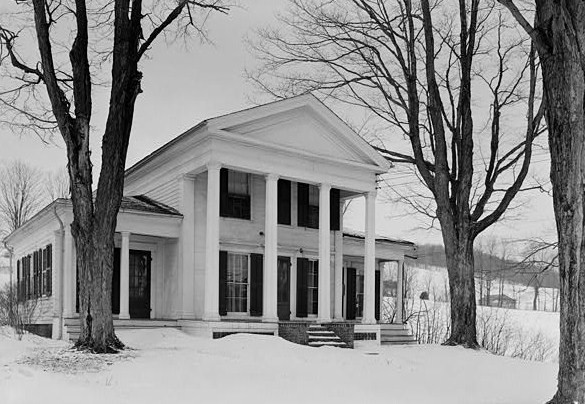
42°05′00″N 76°03′11″W / 42.083244°N 76.052917°WVestal 14 Alfred Dunk House 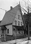
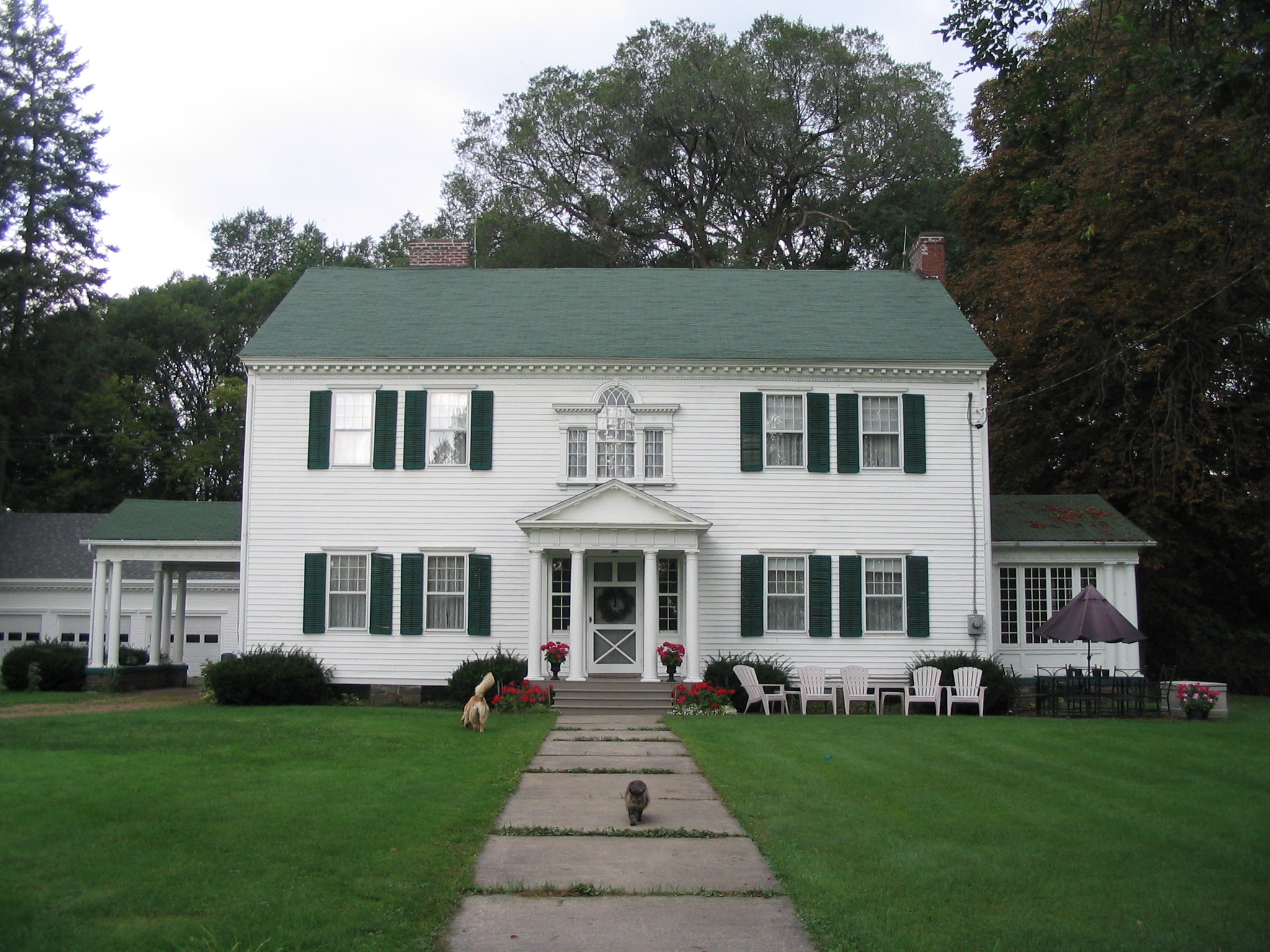
March 21, 1985 4 Pine St.
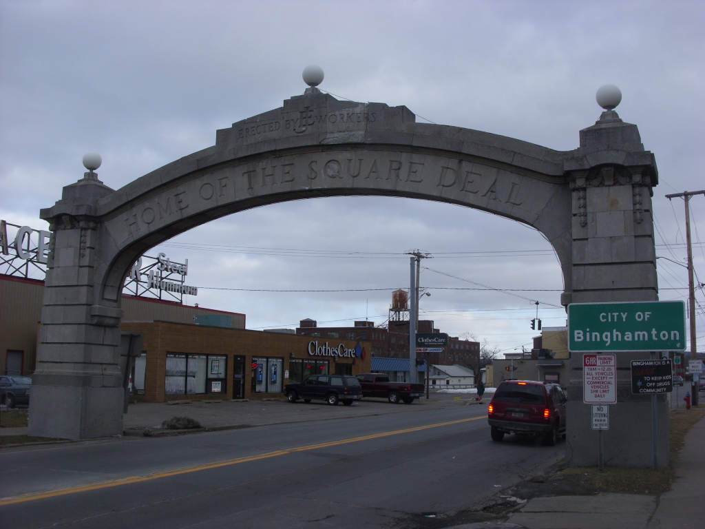
42°06′01″N 75°53′45″W / 42.100278°N 75.895833°WBinghamton 15 Endicott Square Deal Arch 
February 23, 2001 Main St., E of Vestal Ave.
42°06′41″N 75°56′46″W / 42.111389°N 75.946111°WEndicott 16 Emmanuel Church of the Evangelical Association of Binghamton 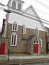
November 20, 2009 80 Front St.
42°05′45″N 75°55′07″W / 42.095733°N 75.918519°WBinghamton 17 Cyrus Gates Farmstead 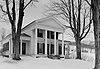
January 11, 1999 10-17 Old Nanticoke Rd.
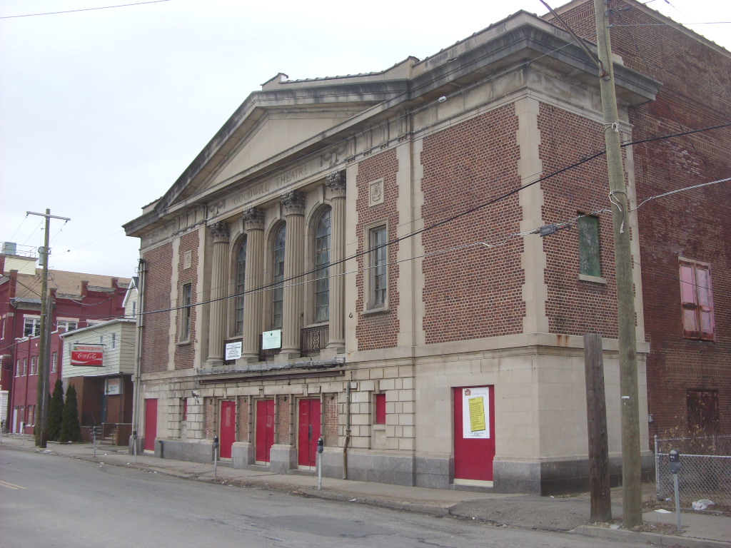
42°14′50″N 76°02′19″W / 42.247222°N 76.038611°WMaine Farm of mapmaker and abolitionist 18 Goodwill Theatre 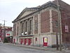
January 7, 2000 36 Willow St.
42°06′50″N 75°57′20″W / 42.113889°N 75.955556°WJohnson City 19 Grace Episcopal Church 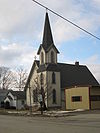
August 28, 1998 2624 Main St.
42°19′45″N 75°58′07″W / 42.329167°N 75.968611°WWhitney Point 20 Harpursville United Methodist Church January 18, 2006 NY 79
42°10′41″N 75°37′28″W / 42.178056°N 75.624444°WHarpursville 21 Old Hawleyton Methodist Episcopal Church September 28, 2006 923 Hawleyton Rd.
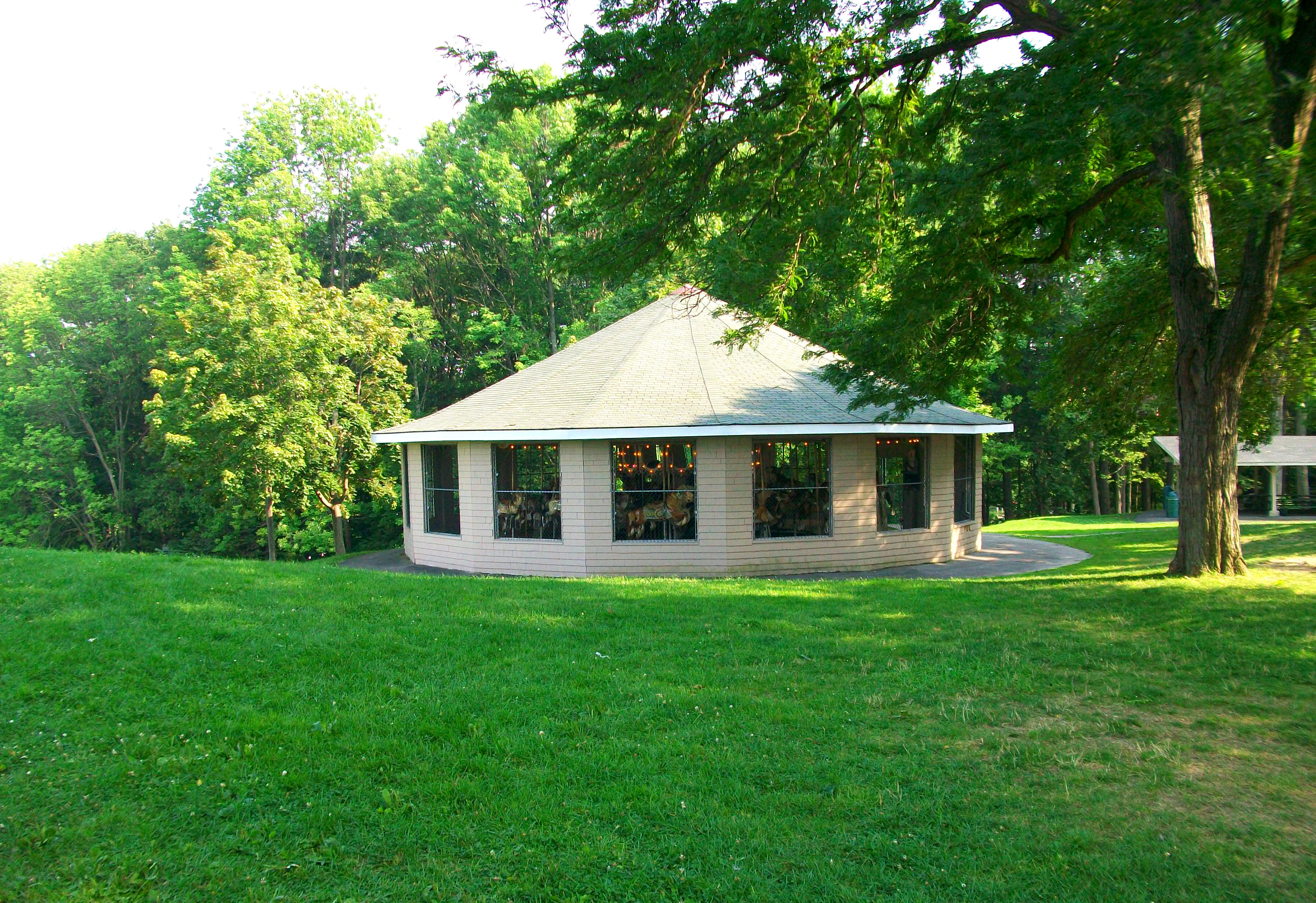
42°01′08″N 75°55′00″W / 42.018889°N 75.916667°WHawleyton 22 Highland Park Carousel 
January 25, 1992 Highland Park, Cooper Rd.
42°07′30″N 76°01′46″W / 42.125°N 76.029444°WEndwell 23 Jedediah Hotchkiss House June 3, 1982 10 Chestnut St.
42°04′15″N 75°37′58″W / 42.070833°N 75.632778°WWindsor 24 Johnson City Historic District August 30, 2011 Generally Corless Ave., Arch St., Main St., Lester Ave. & Helen Dr.
42°06′51″N 75°57′14″W / 42.114167°N 75.953889°WJohnson City 25 Johnson City Square Deal Arch 
February 16, 2001 Main St., W of Floral Ave.
42°05′41″N 76°03′27″W / 42.094722°N 76.0575°WJohnson City 26 C. Fred Johnson Park Carousel January 25, 1992 C. Fred Johnson Park
42°07′02″N 75°57′01″W / 42.117222°N 75.950278°WJohnson City 27 George F. Johnson Recreation Park Carousel January 25, 1992 George F. Johnson Recreation Park
42°05′57″N 75°56′02″W / 42.099167°N 75.933889°WBinghamton 28 George W. Johnson Park Carousel 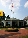
January 25, 1992 George W. Johnson Park
42°06′40″N 76°03′03″W / 42.111111°N 76.050833°WEndicott 29 Gen. Edward F. Jones House February 9, 2005 9 Asbury Court
42°05′58″N 75°55′37″W / 42.099444°N 75.926944°WBinghamton 30 Jonas M. Kilmer House September 29, 2006 9 Riverside Dr.
42°05′32″N 75°55′19″W / 42.092222°N 75.921944°WBinghamton 31 Maine Central School January 7, 1998 Church St.
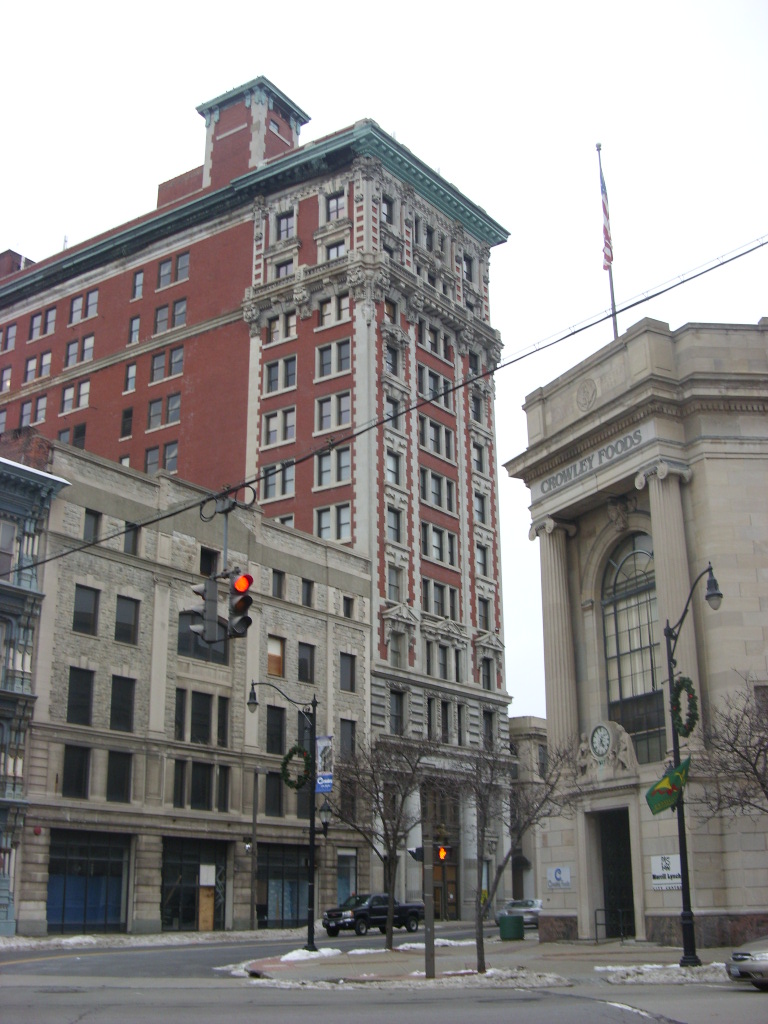
42°11′38″N 76°03′51″W / 42.193889°N 76.064167°WMaine 32 Marlborough Building February 19, 2008 81 Clinton St.
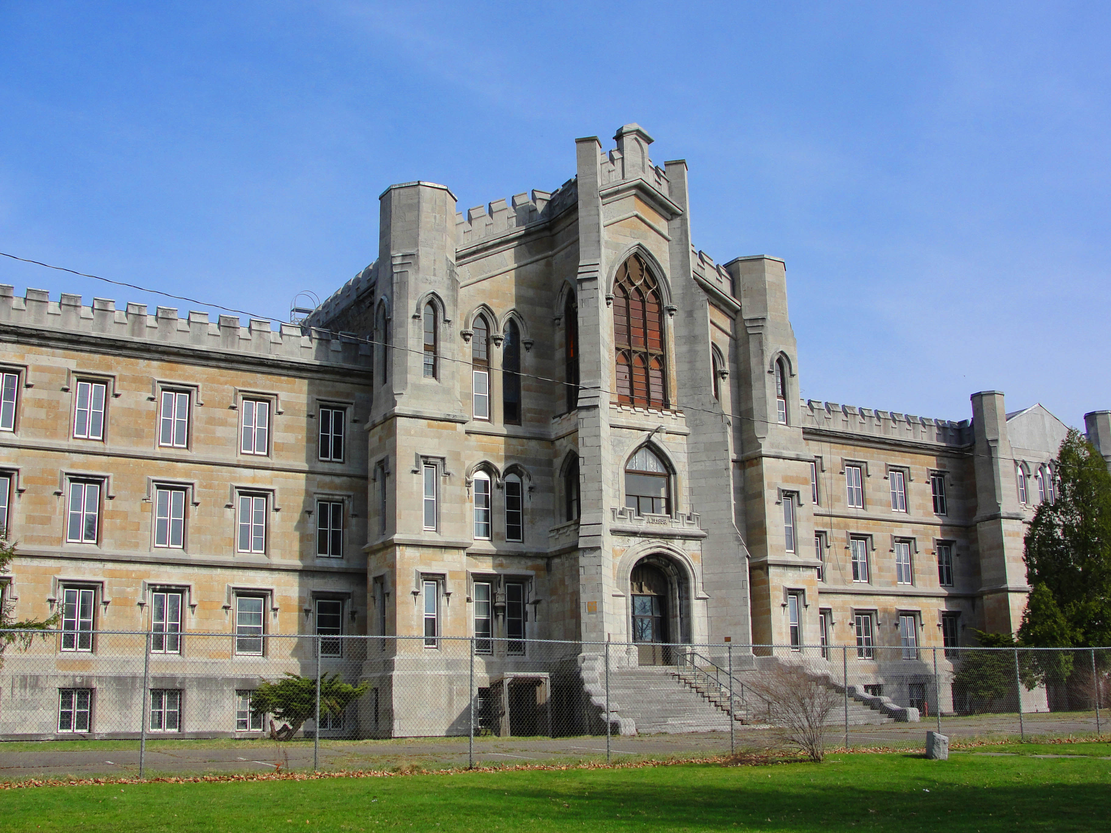
42°06′25″N 75°55′20″W / 42.106944°N 75.922222°WBinghamton 33 New York State Inebriate Asylum 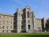
July 24, 1996 425 Robinson St.
42°06′22″N 75°51′59″W / 42.106111°N 75.866389°WBinghamton 34 Ouaquaga Lenticular Truss Bridge 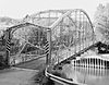
February 20, 2003 Dutchman Rd. over Susquehanna R
42°07′24″N 75°38′52″W / 42.123333°N 75.647778°WOuaquaga 35 Patterson-Hooper Family Cemetery May 21, 2008 River Rd.
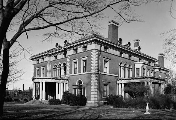
42°06′23″N 76°01′07″W / 42.106458°N 76.018614°WEndwell 36 Phelps Mansion June 4, 1973 191 Court St.
42°06′03″N 75°54′20″W / 42.100833°N 75.905556°WBinghamton 37 Railroad Terminal Historic District 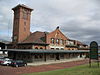
March 20, 1986 Intersection of Chenango St. and Erie-Lackawanna RR tracks
42°06′15″N 75°54′29″W / 42.104167°N 75.908056°WBinghamton 38 Riverside Cemetery August 11, 2004 400 Vestal Ave.
42°05′37″N 76°03′31″W / 42.093611°N 76.058611°WEndicott 39 Roberson Mansion 
March 25, 1980 30 Front St.
42°05′39″N 75°55′08″W / 42.094167°N 75.918889°WBinghamton 40 Robert H. Rose House August 26, 1980 3 Riverside Dr.
42°05′33″N 75°55′13″W / 42.0925°N 75.920278°WBinghamton 41 Ross Park Carousel January 25, 1992 Ross Park
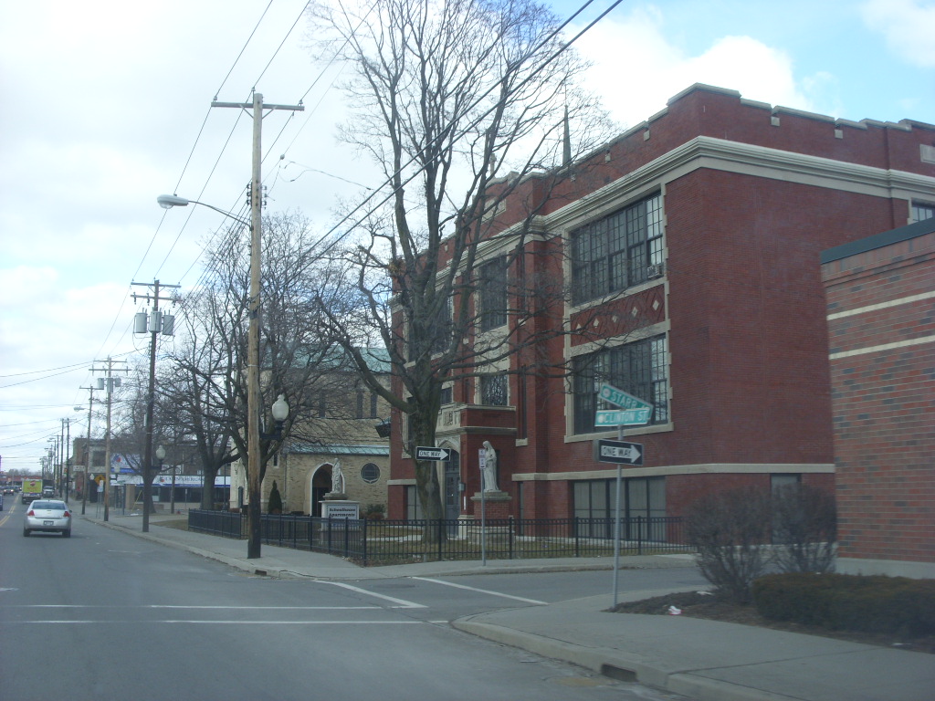
42°04′31″N 75°54′28″W / 42.075278°N 75.907778°WBinghamton 42 Saints Cyril and Methodius Slovak Roman Catholic School 
March 1, 2007 144-146 Clinton St.
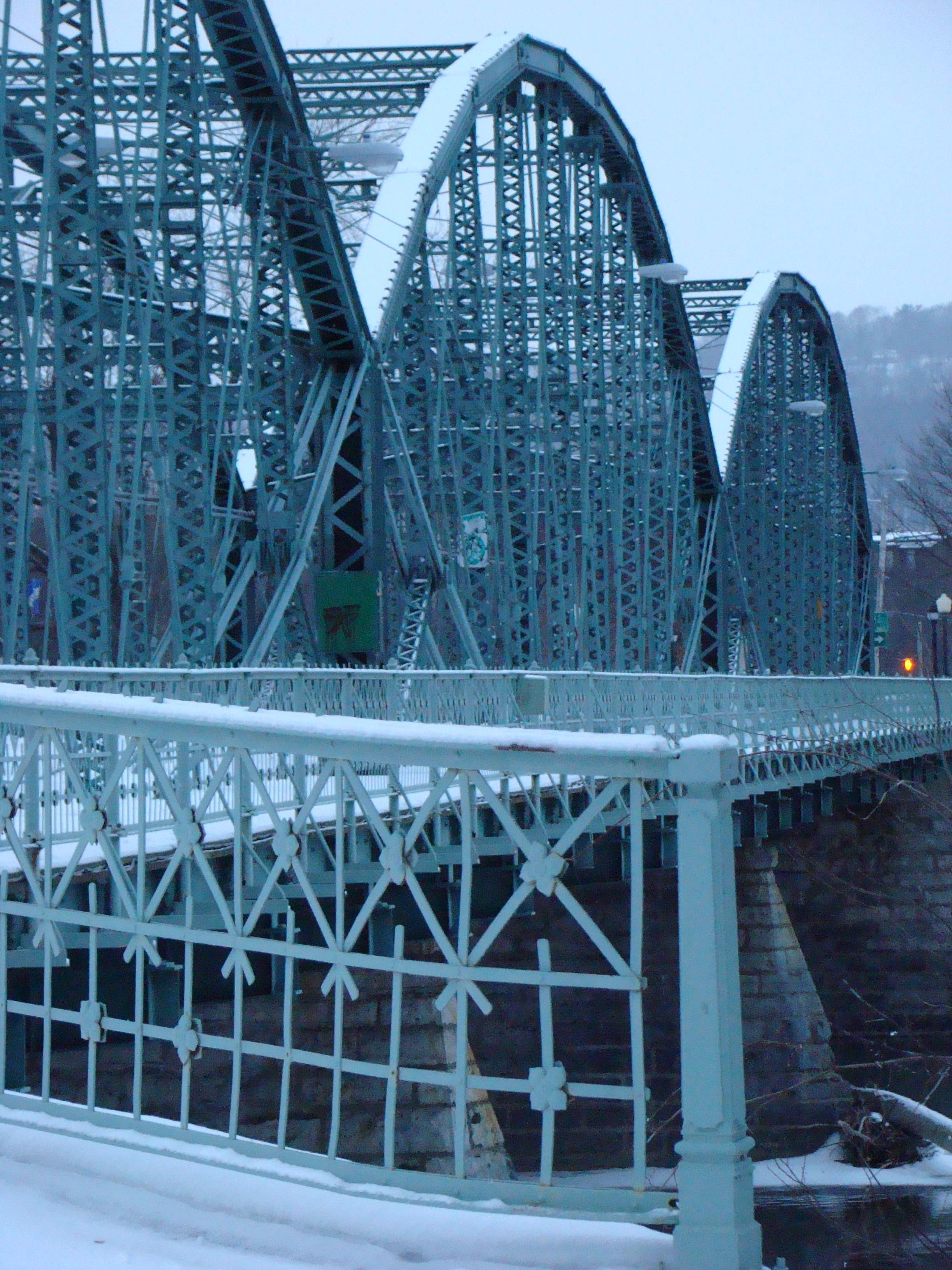
42°06′21″N 75°55′30″W / 42.105833°N 75.925°WBinghamton 43 South Washington Street Parabolic Bridge 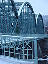
January 30, 1978 S. Washington St.
42°05′33″N 75°54′54″W / 42.0925°N 75.915°WBinghamton 44 State Street-Henry Street Historic District June 25, 1986 Roughly bounded by Lewis St., Prospect Ave., Henry St., and Water and Washington Sts.
42°06′05″N 75°54′44″W / 42.101389°N 75.912222°WBinghamton 45 Stone Spillway, National Defense Stockpile Center April 20, 2004 N of Gilmore Ave.
42°09′18″N 75°52′34″W / 42.155°N 75.876111°WHillcrest 46 Trinity Memorial Church 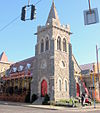
November 19, 1998 44 Main St.
42°05′59″N 75°53′01″W / 42.099722°N 75.883611°WBinghamton 47 US Post Office-Endicott November 17, 1988 200 Washington Ave.
42°06′02″N 76°02′55″W / 42.100556°N 76.048611°WEndicott 48 US Post Office-Johnson City May 11, 1989 307 Main St.
42°06′57″N 75°57′31″W / 42.115833°N 75.958611°WJohnson City 49 Vestal Central School February 22, 2010 201 Main St.
42°05′05″N 76°03′05″W / 42.084794°N 76.051347°WVestal 50 Washingtonian Hall 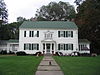
February 23, 1996 3725 River Rd.
42°06′39″N 76°00′16″W / 42.110833°N 76.004444°WEndwell 51 J. Stuart Wells House August 21, 2009 71 Main St.
42°05′59″N 75°55′21″W / 42.099703°N 75.922442°WBinghamton 52 West Endicott Park Carousel 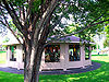
January 25, 1992 West Endicott Park
42°05′53″N 76°04′24″W / 42.098056°N 76.073333°WEndicott 53 John T. Whitmore House August 14, 1986 111 Murray St.
42°05′57″N 75°55′19″W / 42.099167°N 75.921944°WBinghamton 54 Windsor Village Historic District 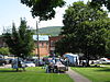
July 30, 1980 College Ave., Academy, Chapel, Church, Dewey, Elm and Main Sts.
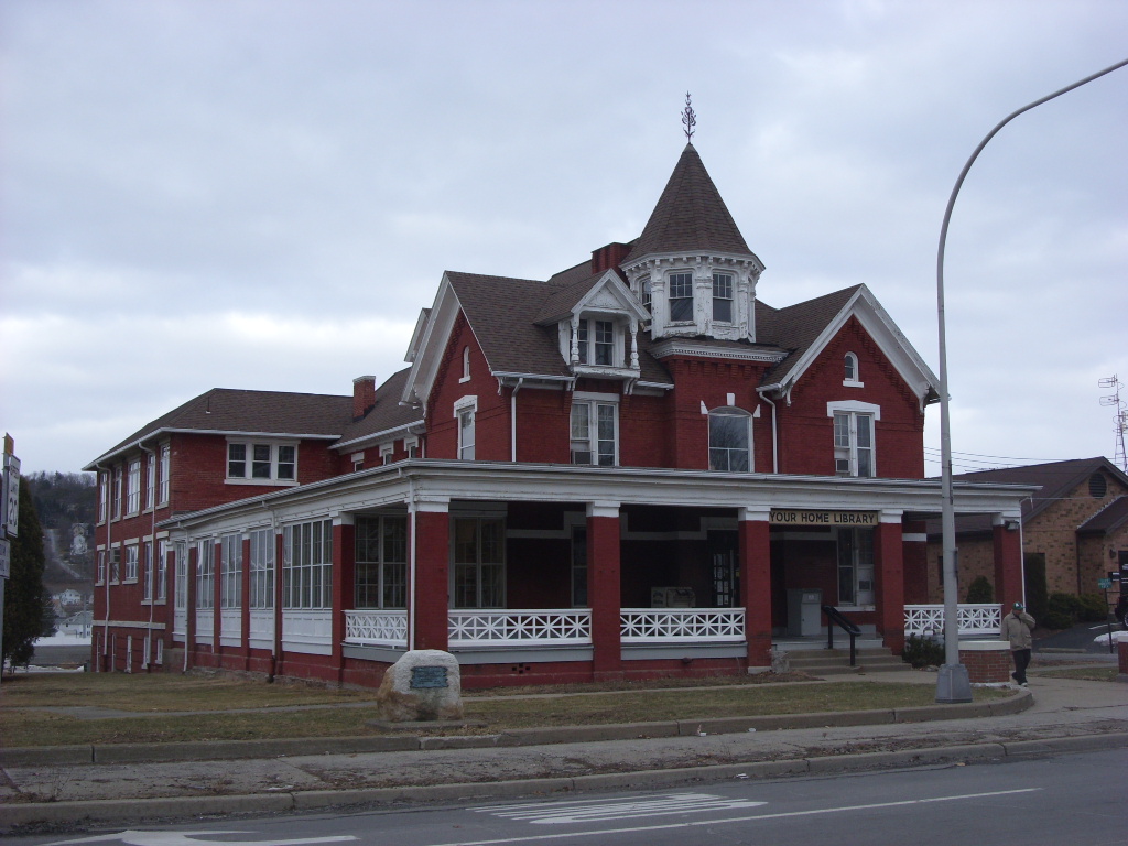
42°04′39″N 75°38′39″W / 42.0775°N 75.644167°WWindsor 55 Your Home Library 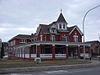
October 5, 2005 107 Main St.
42°06′47″N 75°56′59″W / 42.113056°N 75.949722°WJohnson City See also
References
- ^ The latitude and longitude information provided is primarily from the National Register Information System, and has been found to be fairly accurate for about 99% of listings. For 1%, the location info may be way off. We seek to correct the coordinate information wherever it is found to be erroneous. Please leave a note in the Discussion page for this article if you believe any specific location is incorrect.
- ^ "National Register of Historic Places: Weekly List Actions". National Park Service, United States Department of the Interior. Retrieved on November 18, 2011.
- ^ Numbers represent an ordering by significant words. Various colorings, defined here, differentiate National Historic Landmark sites and National Register of Historic Places Districts from other NRHP buildings, structures, sites or objects.
External links
- A useful list of the above sites, with street addresses and other information, is available at Broome County listing, at National Register of Historic Places.Com, a private site serving up public domain information on NRHPs.
Categories:- Broome County, New York
- National Register of Historic Places in New York by county
-


Wikimedia Foundation. 2010.