- Conklin, New York
-
Conklin, New York — Town — Location within the state of New York
 Conklin, New York
Coordinates: 42°3′11″N 75°49′39″W / 42.05306°N 75.8275°W Country United States State New York County Broome Government – Type Town Council – Town Supervisor Debra A. Preston – Town Council Members' ListArea – Total 24.9 sq mi (64.6 km2) – Land 24.5 sq mi (63.5 km2) – Water 0.4 sq mi (1.1 km2) Elevation 1,165 ft (355 m) Population (2000) – Total 5,940 – Density 242.3/sq mi (93.6/km2) Time zone Eastern (EST) (UTC-5) – Summer (DST) EDT (UTC-4) ZIP code 13748 Area code(s) 607 FIPS code 36-17772 GNIS feature ID 0978861 Conklin is a town in Broome County, New York, United States. The population was 5,940 at the 2000 census.
The Town of Conklin is on the south border of the county, southeast of Binghamton, New York.
Contents
History
The area was first settled around 1788. The Town of Conklin was established in 1824 from the Town of Chenango by Nicholas Conklin (1782–1858). The town exchanged territories with adjacent towns before establishing its modern boundaries. In 1831, part of Conklin was used to form the Town of Windsor, but Conklin received territory from Windsor in 1851. Another part of Conklin was used in 1859 to form the Town of Kirkwood.
Alpheus Corby, a Conklin resident, built a castle-like structure as his home in 1900. The building is the current community center of the town.
In June 2006, the town was devastated by a massive flood that isolated the center of the town and required hundreds of people to be airlifted to safety. The flood destroyed hundreds of homes and businesses and caused tens of millions of dollars in damage.
The Conklin Town Hall was listed on the National Register of Historic Places in 2006.[1]
It has once again been flooded in September 2011. All roads into town are currently closed so the full extent of the damage is not yet known, but it is thought to be as massive as 2006.
Notable people
- Jerome Anthony Watrous, writer, military officer, legislator
Geography
According to the United States Census Bureau, the town has a total area of 24.9 square miles (64 km2), of which, 24.5 square miles (63 km2) of it is land and 0.4 square miles (1.0 km2) of it (1.68%) is water.
The south town line is the border of Susquehanna County in Pennsylvania. The eastern town line is marked by the Susquehanna River. Snake Creek, a tributary of the Susquehanna, was the site of early town settlement.
New York State Route 7 splits off New York State Route 7A in the southeast corner of the town by Corbettsville.
Demographics
As of the census[2] of 2000, there were 5,940 people, 2,249 households, and 1,671 families residing in the town. The population density was 242.3 people per square mile (93.6/km²). There were 2,435 housing units at an average density of 99.3 per square mile (38.4/km²). The racial makeup of the town was 97.71% White, 0.84% African American, 0.13% Native American, 0.22% Asian, 0.29% from other races, and 0.81% from two or more races. Hispanic or Latino of any race were 0.86% of the population.
There were 2,249 households out of which 35.2% had children under the age of 18 living with them, 59.5% were married couples living together, 10.6% had a female householder with no husband present, and 25.7% were non-families. 20.9% of all households were made up of individuals and 8.1% had someone living alone who was 65 years of age or older. The average household size was 2.64 and the average family size was 3.06.
In the town the population was spread out with 27.1% under the age of 18, 6.5% from 18 to 24, 29.1% from 25 to 44, 25.1% from 45 to 64, and 12.2% who were 65 years of age or older. The median age was 38 years. For every 100 females there were 97.1 males. For every 100 females age 18 and over, there were 93.7 males.
The median income for a household in the town was $37,445, and the median income for a family was $43,309. Males had a median income of $35,456 versus $23,856 for females. The per capita income for the town was $16,720. About 9.7% of families and 10.5% of the population were below the poverty line, including 14.3% of those under age 18 and 13.9% of those age 65 or over.
Communities and locations in Conklin
- Corbettsville – A hamlet on NY-7 in the south part of the town.
- Conklin – The hamlet of Conklin by the Susquehanna River on NY-7.
- Conklin Forks – A hamlet in the western part of the town at the junction of County Roads 8 and 141.
- Conklin Station – A hamlet north of Corbettsville on NY-7. It was previously called "Milburn."
- Conklin Center – A hamlet north of Conklin village on NY-7.
References
- ^ "National Register Information System". National Register of Historic Places. National Park Service. 2009-03-13. http://nrhp.focus.nps.gov/natreg/docs/All_Data.html.
- ^ "American FactFinder". United States Census Bureau. http://factfinder.census.gov. Retrieved 2008-01-31.
External links
Coordinates: 42°02′03″N 75°48′14″W / 42.03417°N 75.80389°W
Municipalities and communities of Broome County, New York City 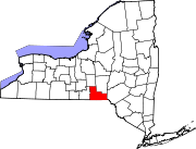
Towns Villages Deposit‡ | Endicott | Johnson City | Lisle | Port Dickinson | Whitney Point | Windsor
CDP Other
hamletsChenango Bridge | Chenango Forks | Hillcrest | Nineveh
Footnotes ‡This populated place also has portions in an adjacent county or counties
Categories:- Towns in New York
- Binghamton metropolitan area
- Populated places in Broome County, New York


Wikimedia Foundation. 2010.