- Nanticoke, New York
-
Nanticoke, New York — Town — Location within the state of New York
 Nanticoke, New York
Coordinates: 42°17′5″N 76°1′29″W / 42.28472°N 76.02472°W Country United States State New York County Broome Government - Type Town Council - Town Supervisor Donald Benjamin - Town Council Members' ListArea - Total 24.3 sq mi (63.1 km2) - Land 24.3 sq mi (63.0 km2) - Water 0.0 sq mi (0.1 km2) Elevation 1,391 ft (424 m) Population (2000) - Total 1,790 - Density 73.6/sq mi (28.4/km2) Time zone Eastern (EST) (UTC-5) - Summer (DST) EDT (UTC-4) FIPS code 36-49396 GNIS feature ID 0979247 Nanticoke is a town in Broome County, New York, United States. The population was 1,790 at the 2000 census. The name is an Native American word.
The Town of Nanticoke is on the western border of the county and is northwest of Binghamton.
Contents
History
The town was first settled around 1793. The Town of Nanticoke was formed from the Town of Lisle in 1831. The two villages, Glen Aubrey and Nanticoke, grew up around flour and lumber mills.
Geography
According to the United States Census Bureau, the town has a total area of 24.4 square miles (63 km2), of which, 24.3 square miles (63 km2) of it is land and 0.04 square miles (0.10 km2) of it (0.16%) is water.
The west town line is the border of Tioga County.
New York State Route 26 is a north-south highway in the town.
The Nanticoke Creek flows southward from the town to the Susquehanna River.
Demographics
As of the census[1] of 2000, there were 1,790 people, 629 households, and 481 families residing in the town. The population density was 73.6 people per square mile (28.4/km²). There were 717 housing units at an average density of 29.5 per square mile (11.4/km²). The racial makeup of the town was 97.71% White, 0.28% African American, 0.39% Native American, 0.22% Asian, 0.22% from other races, and 1.17% from two or more races. Hispanic or Latino of any race were 0.84% of the population.
There were 629 households out of which 39.9% had children under the age of 18 living with them, 62.5% were married couples living together, 7.9% had a female householder with no husband present, and 23.4% were non-families. 17.6% of all households were made up of individuals and 7.0% had someone living alone who was 65 years of age or older. The average household size was 2.85 and the average family size was 3.20.
In the town the population was spread out with 30.4% under the age of 18, 7.8% from 18 to 24, 30.9% from 25 to 44, 21.9% from 45 to 64, and 8.9% who were 65 years of age or older. The median age was 35 years. For every 100 females there were 99.1 males. For every 100 females age 18 and over, there were 97.9 males.
The median income for a household in the town was $36,761, and the median income for a family was $39,545. Males had a median income of $30,469 versus $21,739 for females. The per capita income for the town was $15,683. About 9.2% of families and 11.2% of the population were below the poverty line, including 13.8% of those under age 18 and 6.7% of those age 65 or over.
Communities and locations in Nanticoke
- Glen Aubrey – A hamlet in the south part of the town on NY-26. It was formerly known as the "Councilman Settlement."
- Greenwood Park – A county park near the west town line.
- Nanticoke – The hamlet of Nanticoke is in the western part of the town. It was previously called "Lambs Corners." The community is at the junction of County Roads 21 and 136.
- Nanticoke Springs – A former community lying southeast of Nanticoke village.
References
- ^ "American FactFinder". United States Census Bureau. http://factfinder.census.gov. Retrieved 2008-01-31.
External links
Coordinates: 42°16′29″N 76°03′15″W / 42.27472°N 76.05417°W
Municipalities and communities of Broome County, New York City 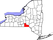
Towns Villages Deposit‡ | Endicott | Johnson City | Lisle | Port Dickinson | Whitney Point | Windsor
CDP Other
hamletsChenango Bridge | Chenango Forks | Hillcrest | Nineveh
Footnotes ‡This populated place also has portions in an adjacent county or counties
Categories:- Towns in New York
- Binghamton metropolitan area
- Populated places in Broome County, New York


Wikimedia Foundation. 2010.